Haltcliff Bridge

Settlement in Cumberland Allerdale

England

Haltcliff Bridge

Carrock Beck ford On the minor road that skirts the eastern edge of the fells south of Hesket Newmarket.
Carrock Beck ford Credit: Gordon Hatton

Haltcliff Bridge is a historically significant structure located in the county of Cumberland, England. Situated near the village of Haltcliff, it spans the River Eden and serves as a vital transportation link for the local community.

The bridge is known for its architectural beauty and has been a landmark in the area for centuries. It was originally constructed in the 14th century and has undergone several renovations and repairs over the years to maintain its integrity. The current bridge is a stone structure with multiple arches, providing a picturesque view for passersby.

Haltcliff Bridge holds great historical importance as it was a key route for traders and travelers during the medieval period. Its strategic location allowed for easy access to neighboring towns and villages, contributing to the economic development of the region. Today, it continues to serve as a vital link for both vehicular and pedestrian traffic, connecting various parts of Cumberland.

The bridge's location also offers visitors and locals the opportunity to enjoy the natural beauty of the surrounding area. The River Eden, with its crystal-clear waters, flows peacefully beneath the bridge, providing a tranquil setting for nature enthusiasts and photographers alike.

Whether admired for its architectural grandeur, historical significance, or natural splendor, Haltcliff Bridge remains a beloved landmark in Cumberland. Its presence is a testament to the rich heritage and enduring legacy of the region, attracting visitors from far and wide to witness its charm and immerse themselves in its history.

If you have any feedback on the listing, please let us know in the comments section below.

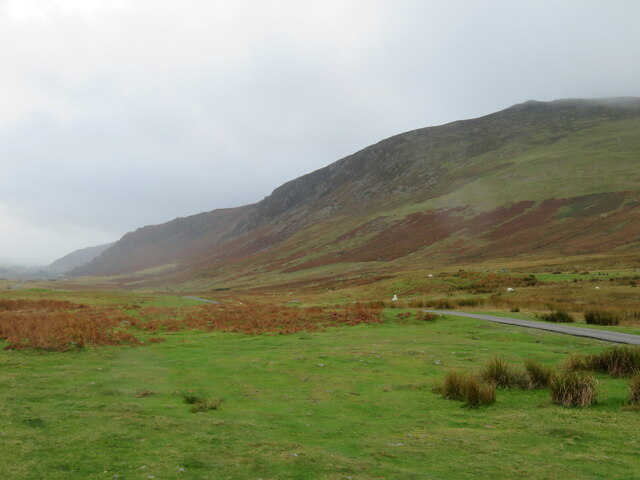
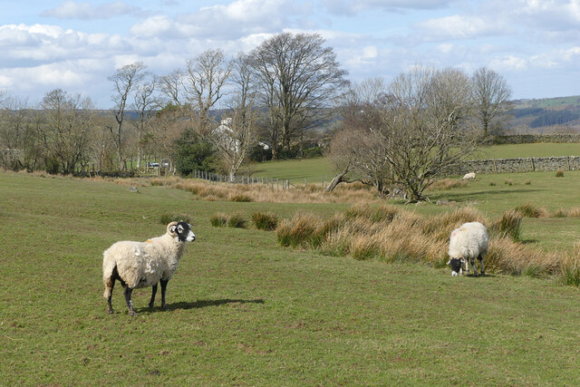
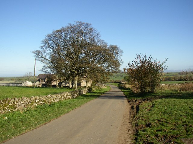
Haltcliff Bridge Images

Images are sourced within 2km of 54.718927/-3.001295 or Grid Reference NY3536. Thanks to Geograph Open Source API. All images are credited.

Carrock Beck ford On the minor road that skirts the eastern edge of the fells south of Hesket Newmarket.
Carrock Beck ford
On the minor road that skirts the eastern edge of the fells south of Hesket Newmarket.
Moorland road below Carrock Fell One of those Lake District days when the fells are cloaked in cloud and drizzle fills the air, whilst to the east the sun shines over the Vale of Eden. Here the minor road heading south towards Mosedale runs along under the steep slopes of Carrock Fell.
Moorland road below Carrock Fell
One of those Lake District days when the fells are cloaked in cloud and drizzle fills the air, whilst to the east the sun shines over the Vale of Eden. Here the minor road heading south towards Mosedale runs along under the steep slopes of Carrock Fell.
Pasture, Mungrisdale Looking along the line of a footpath climbing obliquely from the River Caldew.
Pasture, Mungrisdale
Looking along the line of a footpath climbing obliquely from the River Caldew.
Pasture, Mungrisdale Sheep and a small valley with quarries to the west of Bishopspot.
Pasture, Mungrisdale
Sheep and a small valley with quarries to the west of Bishopspot.
Pasture, Mungrisdale Looking up from the footpath between Haltcliff Bridge and Deer Rudding.
Pasture, Mungrisdale
Looking up from the footpath between Haltcliff Bridge and Deer Rudding.
Pasture, Mungrisdale The footpath approaching Millhouse from Deer Rudding.
Pasture, Mungrisdale
The footpath approaching Millhouse from Deer Rudding.
Pasture, Caldbeck Sheep and a line of beeches to the south-east of Hutton Sceugh.
Pasture, Caldbeck
Sheep and a line of beeches to the south-east of Hutton Sceugh.
Pasture, Caldbeck Seen from the bridleway between Calebrack and Lonning Head.
Pasture, Caldbeck
Seen from the bridleway between Calebrack and Lonning Head.
Pasture, Caldbeck Looking towards Pasture Lane House from the footpath to its east.
Pasture, Caldbeck
Looking towards Pasture Lane House from the footpath to its east.
Pasture, Caldbeck Sheep grazing to the north of Wood Hall.
Pasture, Caldbeck
Sheep grazing to the north of Wood Hall.
Boulder under Carrock Fell One of many on the Common by Carrock Beck
Boulder under Carrock Fell
One of many on the Common by Carrock Beck
Carrock Beck At Rospow Hills
Carrock Beck
At Rospow Hills
Carrock Beck Near Rospow Hills
Carrock Beck
Near Rospow Hills
Hillside above Calebreck Farm The lower slopes of West Fell, which lead ultimately to High Pike <a href="https://www.geograph.org.uk/gridref/NY3135">NY3135</a>.
Hillside above Calebreck Farm
The lower slopes of West Fell, which lead ultimately to High Pike NY3135.
A minor road junction north of Mosedale
Houses at High Row The little bridge crosses the Carrock Beck.
Houses at High Row
The little bridge crosses the Carrock Beck.
Lonning Head A quick shot during a break in the rain!
Lonning Head
A quick shot during a break in the rain!
Moorland west of Bannest Hill Bannest Hill, presumably a farm, lies hidden among the trees. The moorland is largely grassy with some bracken but also an amount of gorse. The view is from near to a minor road passing Carrock Fell.
Moorland west of Bannest Hill
Bannest Hill, presumably a farm, lies hidden among the trees. The moorland is largely grassy with some bracken but also an amount of gorse. The view is from near to a minor road passing Carrock Fell.
Show me another place!

Haltcliff Bridge is located at Grid Ref: NY3536 (Lat: 54.718927, Lng: -3.001295)

Administrative County: Cumbria

District: Allerdale

Police Authority: Cumbria

What 3 Words

///pills.hedge.insisting. Near Dalston, Cumbria

Nearby Locations

Haltcliff Bridge

Related Wikis

Haltcliff Bridge

Haltcliff Bridge or Haltcliffe Bridge is a hamlet on the River Caldew, in the civil parish of Mungrisdale in the county of Cumbria, England. The spelling...

Hesket Newmarket

Hesket Newmarket is a small village in Cumbria, England, historically within Cumberland. It is on the opposite side of Skiddaw to Keswick within the Lake...

Hutton Roof, Eden

Hutton Roof is a hamlet and former civil parish, now in the parish of Mungrisdale, in the Westmorland and Furness district, in the ceremonial county of...

Carrock Fell

Carrock Fell is a fell in the English Lake District, situated in the northern region of the national park, 8 miles (13 kilometres) north-east of Keswick...

Nearby Amenities

Located within 500m of 54.718927,-3.001295
Haltcliff House (N bound)
Naptan AtcoCode: 090002104042
Naptan Bearing: N
Naptan BusStopType: CUS
Naptan CommonName: Haltcliff House (N bound)
Naptan Indicator: near
Naptan Landmark: School Cottage
Naptan NaptanCode: cumdpgtw
Naptan Street: No Name
Naptan Verified: no
Source: naptan_import
Lat/Long: 54.7181071/-2.9975903
Haltcliff House (S bound)
Naptan AtcoCode: 090002104043
Naptan Bearing: S
Naptan BusStopType: CUS
Naptan CommonName: Haltcliff House (S bound)
Naptan Indicator: near
Naptan Landmark: School Cottage
Naptan NaptanCode: cumdpgwa
Naptan Street: No Name
Naptan Verified: no
Source: naptan_import
Lat/Long: 54.7183153/-2.9974091
Harrison house
Place: locality
Lat/Long: 54.7184464/-3.0015835
Power: pole
Lat/Long: 54.7181058/-2.9976978
Power: pole
Lat/Long: 54.7185362/-2.9961388
Power: pole
Lat/Long: 54.7189765/-2.9945797
Power: pole
Lat/Long: 54.7177919/-2.9988266
Power: pole
Lat/Long: 54.7166357/-3.0001791
Power: pole
Lat/Long: 54.7160065/-3.001266
Power: pole
Lat/Long: 54.7153772/-3.0023455
The data included in this document is from www.openstreetmap.org. The data is made available under ODbL.

Have you been to Haltcliff Bridge?

Leave your review of Haltcliff Bridge below (or comments, questions and feedback).