Bryan Houses Plantation

Downs, Moorland in Westmorland South Lakeland

England

Bryan Houses Plantation

Hubbersty Head Lane
Hubbersty Head Lane Credit: Anthony Parkes

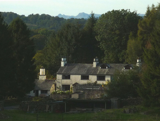
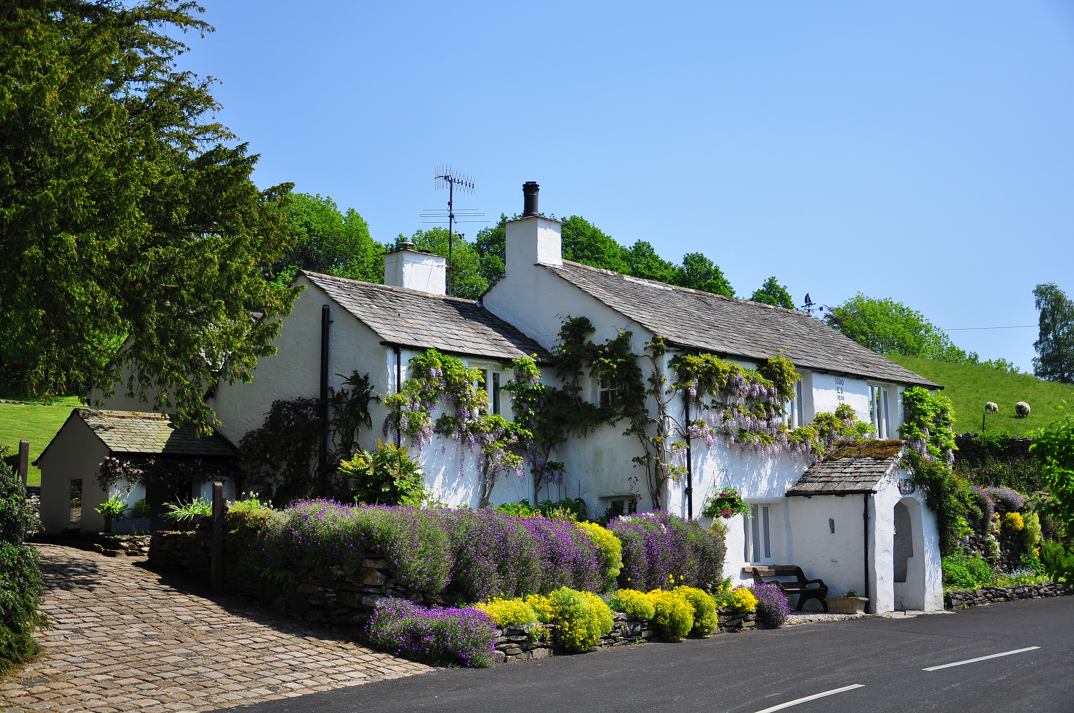
Bryan Houses Plantation, located in Westmorland, England, is a historic estate situated in the picturesque Downs and Moorland region. This sprawling plantation spans over several acres of lush greenery and offers visitors a glimpse into the area's rich cultural and agricultural heritage.

Originally established in the 17th century, Bryan Houses Plantation has witnessed significant transformations over the years. The plantation is known for its meticulously maintained gardens and farmlands, showcasing a diverse range of plant species and crops. The estate is home to a variety of trees including oak, ash, and beech, creating a scenic and serene atmosphere.

The plantation has long been associated with the production of crops such as wheat, barley, and potatoes. The fertile soil and favorable climate in the region contribute to the success of these agricultural endeavors. Visitors can witness the traditional farming practices that have been passed down through generations, gaining insight into the historical significance of the estate.

Bryan Houses Plantation also boasts several historic buildings, including a beautifully preserved manor house that dates back to the 18th century. The manor house provides a captivating example of Georgian architecture and serves as a testament to the region's past wealth and influence.

Today, the plantation is open to the public, allowing visitors to explore its grounds, gardens, and historic buildings. It offers a unique opportunity to experience the beauty of the Downs and Moorland region while learning about its agricultural heritage. Bryan Houses Plantation continues to be a cherished landmark, attracting tourists and locals alike with its natural beauty and historical significance.

If you have any feedback on the listing, please let us know in the comments section below.

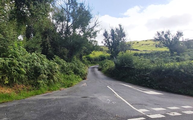
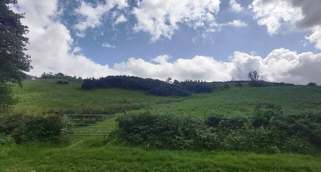
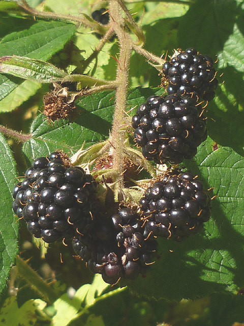
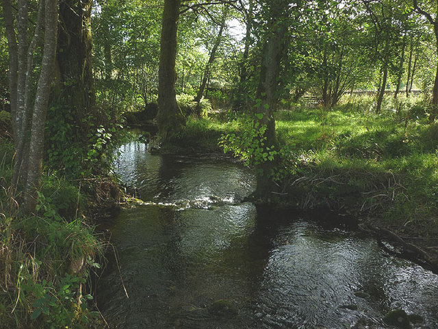
Bryan Houses Plantation Images

Images are sourced within 2km of 54.330102/-2.8860055 or Grid Reference SD4293. Thanks to Geograph Open Source API. All images are credited.

Hubbersty Head Lane
Hubbersty Head Lane
Track up Windyhowe Hill
Footpath towards Bryan Houses Plantation
The Brown Horse Public House at Winster
House at Broom Hill
House at Broom Hill
2015 - a great year for blackberries The hedgerows this autumn have been full of juicy blackberries, the best I can recall for some time. This particular bunch near Crosthwaite did not long survive the photograph!
2015 - a great year for blackberries
The hedgerows this autumn have been full of juicy blackberries, the best I can recall for some time. This particular bunch near Crosthwaite did not long survive the photograph!
Outbuildings at Hardriggs, Crosthwaite Former farm buildings, they look too clean and tidied-up to be still used as such. A planning application has been passed for its conversion to a dwelling <span class="nowrap"><a title="http://www.lakedistrict.gov.uk/swiftlg/apas/run/WPHAPPDETAIL.DisplayUrl?theApnID=7/2015/5225&theTabNo=3&backURL=%3Ca%20href=wphappcriteria.display%3ESearch%20Criteria%3C/a%3E%20%3E%20%3Ca%20href=%27wphappsearchres.displayResultsURL?ResultID=1044769%26StartIndex=41%26SortOrder=apnkey%20desc%26DispResultsAs=WPHAPPSEARCHRES%26BackURL=%3Ca%20href=wphappcriteria.display%3ESearch%20Criteria%3C/a%3E%27%3ESearch%20Results%3C/a%3E" rel="nofollow ugc noopener" href="http://www.lakedistrict.gov.uk/swiftlg/apas/run/WPHAPPDETAIL.DisplayUrl?theApnID=7/2015/5225&theTabNo=3&backURL=%3Ca%20href=wphappcriteria.display%3ESearch%20Criteria%3C/a%3E%20%3E%20%3Ca%20href=%27wphappsearchres.displayResultsURL?ResultID=1044769%26StartIndex=41%26SortOrder=apnkey%20desc%26DispResultsAs=WPHAPPSEARCHRES%26BackURL=%3Ca%20href=wphappcriteria.display%3ESearch%20Criteria%3C/a%3E%27%3ESearch%20Results%3C/a%3E">Link</a><img style="margin-left:2px;" alt="External link" title="External link - shift click to open in new window" src="https://s1.geograph.org.uk/img/external.png" width="10" height="10"/></span>
Outbuildings at Hardriggs, Crosthwaite
Former farm buildings, they look too clean and tidied-up to be still used as such. A planning application has been passed for its conversion to a dwelling LinkExternal link
Birk Moss A zoom shot of the cattle and sheep farm from high ground to the south east. The shot shows the contrast between the rolling Silurian slate country near Windermere and the more rugged volcanic rocks of the higher central fells. The Langdale Pikes, particularly, stand out on the skyline.
Birk Moss
A zoom shot of the cattle and sheep farm from high ground to the south east. The shot shows the contrast between the rolling Silurian slate country near Windermere and the more rugged volcanic rocks of the higher central fells. The Langdale Pikes, particularly, stand out on the skyline.
The River Gilpin below Foxhole Bank Viewed from the bridge that carries the access track/footpath.
The River Gilpin below Foxhole Bank
Viewed from the bridge that carries the access track/footpath.
Thornyfields in the Gilpin Valley Typical Lakeland cottages below the steep, wooded bank of Bowmabble Breast. From the heights of Hart Howe it is possible to see the distant Coniston fells beyond.
Thornyfields in the Gilpin Valley
Typical Lakeland cottages below the steep, wooded bank of Bowmabble Breast. From the heights of Hart Howe it is possible to see the distant Coniston fells beyond.
Footbridge over the Gilpin at Dodds Howe, Crosthwaite This simple stone slab bridge is possibly 18th or 19th century and is a Grade II listed structure <span class="nowrap"><a title="http://www.britishlistedbuildings.co.uk/en-77098-footbridge-approximately-70-metres-to-wes#.VglcRH06tI4" rel="nofollow ugc noopener" href="http://www.britishlistedbuildings.co.uk/en-77098-footbridge-approximately-70-metres-to-wes#.VglcRH06tI4">Link</a><img style="margin-left:2px;" alt="External link" title="External link - shift click to open in new window" src="https://s1.geograph.org.uk/img/external.png" width="10" height="10"/></span>
Footbridge over the Gilpin at Dodds Howe, Crosthwaite
This simple stone slab bridge is possibly 18th or 19th century and is a Grade II listed structure LinkExternal link
Mirk Howe Large house above the River Gilpin near Crosthwaite.
Mirk Howe
Large house above the River Gilpin near Crosthwaite.
Heading for the Gilpin A pleasant route descends through pastureland from Head Lane down towards the River Gilpin.
Heading for the Gilpin
A pleasant route descends through pastureland from Head Lane down towards the River Gilpin.
Mossy drystone wall An indicator of the often damp climate up here.
Mossy drystone wall
An indicator of the often damp climate up here.
Birk Moss (2) A zoom shot of the cattle and sheep farm from high ground to the south east. The shot shows the contrast between the rolling Silurian slate country near Windermere and the more rugged volcanic rocks of the higher fells (left to right: Wetherlam, Crinkle Crags, Bow Fell and Great Gable).
Birk Moss (2)
A zoom shot of the cattle and sheep farm from high ground to the south east. The shot shows the contrast between the rolling Silurian slate country near Windermere and the more rugged volcanic rocks of the higher fells (left to right: Wetherlam, Crinkle Crags, Bow Fell and Great Gable).
Greenbank Farm The distinctive outline of the Langdale Pikes on the skyline.
Greenbank Farm
The distinctive outline of the Langdale Pikes on the skyline.
Sheep on Windyhowe Hill On the footpath south of Greenbank Farm.
Sheep on Windyhowe Hill
On the footpath south of Greenbank Farm.
Winter dusk, Winster Valley Watching the colours in the sky as the sun sets behind Gummer's How.
Winter dusk, Winster Valley
Watching the colours in the sky as the sun sets behind Gummer's How.
Show me another place!

Bryan Houses Plantation is located at Grid Ref: SD4293 (Lat: 54.330102, Lng: -2.8860055)

Administrative County: Cumbria

District: South Lakeland

Police Authority: Cumbria

What 3 Words

///folks.diverged.chopper. Near Windermere, Cumbria

Related Wikis

Winster, Cumbria

Winster is a village in the South Lakeland District of Cumbria, in North West England. Historically within the county of Westmorland, it is situated less...

South Lakeland

South Lakeland was a local government district in Cumbria, England, from 1974 to 2023. Its council was based in Kendal. The district covered the southern...

Westmorland and Lonsdale (UK Parliament constituency)

Westmorland and Lonsdale is a constituency in the south of Cumbria, represented in the House of Commons of the UK Parliament since 2005 by Tim Farron,...

Sedbergh Rural District

Sedbergh Rural District was a rural district in the West Riding of Yorkshire in England from 1894 to its abolition in 1974. The district consisted of the...

Nearby Amenities

Located within 500m of 54.330102,-2.8860055
Parking
Access: yes
Capacity: 3
Fee: no
Park Ride: no
Parking: surface
Supervised: no
Surface: asphalt
Lat/Long: 54.3314598/-2.8922223
Information: guidepost
Tourism: information
Lat/Long: 54.3302451/-2.8911778
Bryan House Plantation
Place: locality
Lat/Long: 54.330464/-2.8843477
Information: guidepost
Tourism: information
Lat/Long: 54.3302353/-2.8910019
Give Way
Direction: forward
Lat/Long: 54.3267408/-2.8892012
Scott Howe
Place: locality
Lat/Long: 54.3294553/-2.8805302
Bicycle: yes
Foot: yes
Ford: yes
Horse: yes
Lat/Long: 54.3320539/-2.8868788
Power: pole
Lat/Long: 54.3286706/-2.8912859
Power: pole
Lat/Long: 54.3280499/-2.8898589
Power: pole
Lat/Long: 54.3278658/-2.8894493
The data included in this document is from www.openstreetmap.org. The data is made available under ODbL.

Have you been to Bryan Houses Plantation?

Leave your review of Bryan Houses Plantation below (or comments, questions and feedback).