Caudale Moor

Downs, Moorland in Westmorland Eden

England

Caudale Moor

Cairn on Stony Cove Pike The summit of Caudale Moor.
Cairn on Stony Cove Pike Credit: steven ruffles

Caudale Moor, located in Westmorland, England, is a vast expanse of rugged and picturesque moorland. Situated within the Lake District National Park, it covers an area of approximately 3,000 hectares and reaches an elevation of 732 meters at its highest point.

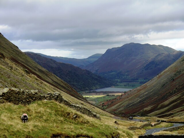
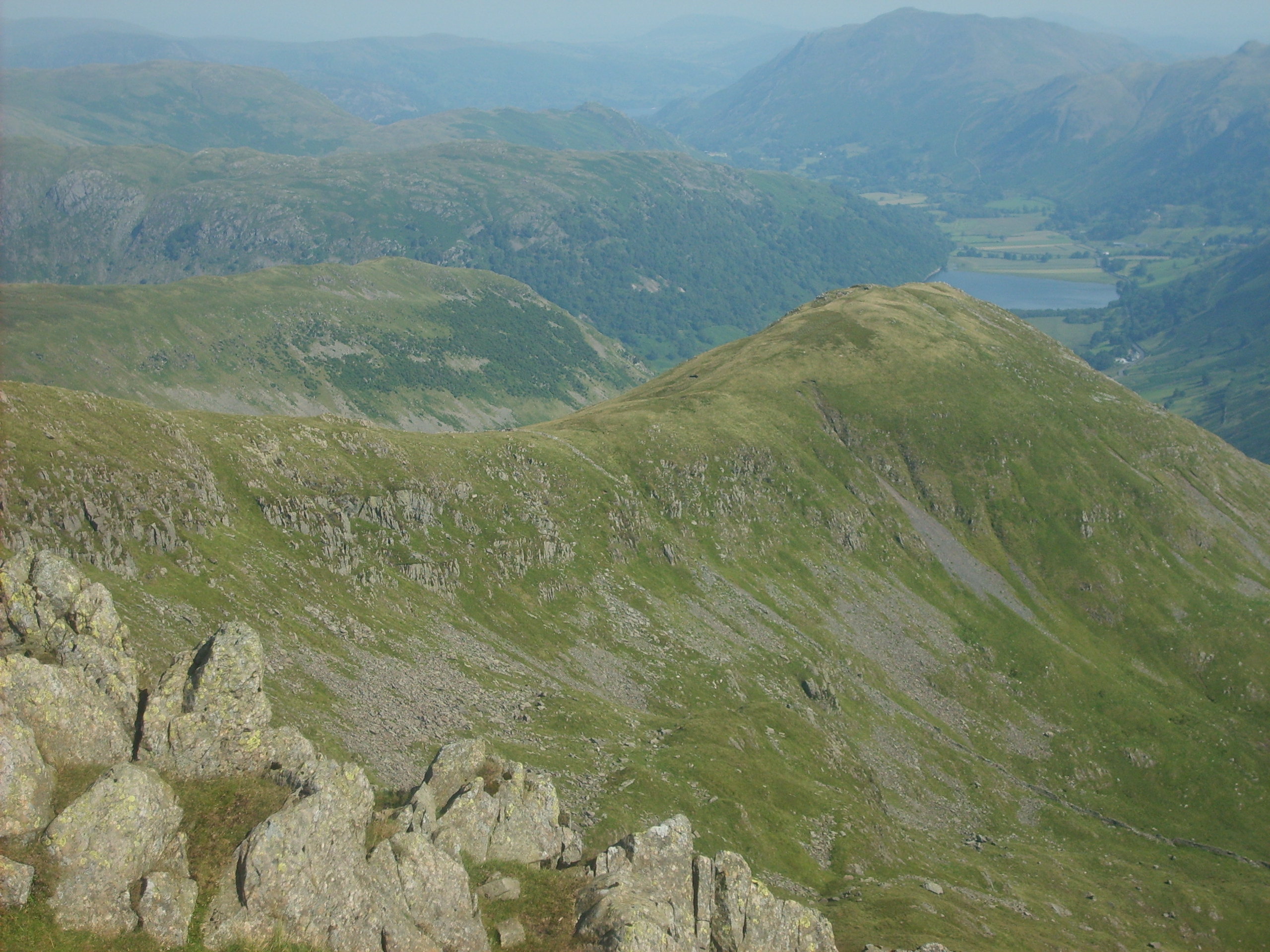
The moorland is characterized by its rolling hills, heather-covered slopes, and scattered rocky outcrops, creating a unique and beautiful landscape. The terrain is diverse, featuring both open expanses and more enclosed valleys. Visitors to Caudale Moor can enjoy breathtaking panoramic views of the surrounding fells, including the iconic Helvellyn and High Street.

The moorland is home to a rich variety of flora and fauna. Heather dominates the landscape, painting the hillsides with vibrant purple hues during the summer months. Rare bird species such as curlews and golden plovers can be spotted here, making it a popular destination for birdwatchers. Additionally, the moorland provides a habitat for a variety of mammals, including red deer and mountain hares.

Caudale Moor offers numerous opportunities for outdoor activities. Hiking and walking enthusiasts can explore the network of footpaths and trails that crisscross the area, providing access to the captivating scenery. For those seeking a more challenging adventure, the nearby Fairfield Horseshoe offers a demanding circular hike that takes in Caudale Moor along the way.

Overall, Caudale Moor in Westmorland is a captivating and diverse moorland, offering visitors the chance to immerse themselves in the natural beauty of the Lake District National Park.

If you have any feedback on the listing, please let us know in the comments section below.
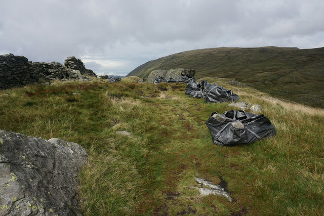
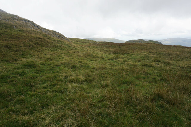
Caudale Moor Images

Images are sourced within 2km of 54.484443/-2.9064426 or Grid Reference NY4110. Thanks to Geograph Open Source API. All images are credited.

Cairn on Stony Cove Pike The summit of Caudale Moor.
Cairn on Stony Cove Pike
The summit of Caudale Moor.
Kirkstone Pass
Kirkstone Pass
Red Pit car park on Kirkstone Pass
Bags of stones on St Raven's Edge Stones are being laid in sections to aid the crossing of boggy bits, and they are very welcome. Caudale Moor is in the background.
Bags of stones on St Raven's Edge
Stones are being laid in sections to aid the crossing of boggy bits, and they are very welcome. Caudale Moor is in the background.
Hillside below Pike How The beginning of a long slope down towards Trout Beck. It was necessary to wander off the main path to get here.
Hillside below Pike How
The beginning of a long slope down towards Trout Beck. It was necessary to wander off the main path to get here.
Stony Cove Pike A large summit plateau where it is difficult to work out where the highest point is. This view is east from a cairn which could well mark the summit. Thornthwaite Crag is the next fell, while High Street is behind in shadow.
Stony Cove Pike
A large summit plateau where it is difficult to work out where the highest point is. This view is east from a cairn which could well mark the summit. Thornthwaite Crag is the next fell, while High Street is behind in shadow.
Path on Stony Cove Pike The eastern end of the summit plateau before a steep descent to Threshthwaite Mouth. Straight ahead is Thornthwaite Crag, on the other side of the pass.
Path on Stony Cove Pike
The eastern end of the summit plateau before a steep descent to Threshthwaite Mouth. Straight ahead is Thornthwaite Crag, on the other side of the pass.
Stony Cove Pike Having climbed up from Threshthwaite Mouth, there is still a further gentle slog to get to the summit of Stony Cove Pike, though the summit is a large plateau.
Stony Cove Pike
Having climbed up from Threshthwaite Mouth, there is still a further gentle slog to get to the summit of Stony Cove Pike, though the summit is a large plateau.
The eastern end of Stony Cove Pike The eastern end of the summit plateau where it tapers away to the sudden drop down to Threshthwaite Mouth. In the background are some of the fells of the Kentmere Round.
The eastern end of Stony Cove Pike
The eastern end of the summit plateau where it tapers away to the sudden drop down to Threshthwaite Mouth. In the background are some of the fells of the Kentmere Round.
The Atkinson Memorial On Caudale Moor, commemorating the family which used to own the Kirkstone Pass Inn. The Helvellyn range is in the background.
The Atkinson Memorial
On Caudale Moor, commemorating the family which used to own the Kirkstone Pass Inn. The Helvellyn range is in the background.
Kirkstone Pass, Cumbria Looking down Kirkstone Pass towards Brothers water
Kirkstone Pass, Cumbria
Looking down Kirkstone Pass towards Brothers water
The approach from the south towards Thornthwaite Crag
Mark and William Atkinson's monument On John Bell's Banner, near Stony Cove Pike.
Mark and William Atkinson's monument
On John Bell's Banner, near Stony Cove Pike.
Descending from Caudale Moor In the distance, centre, is Windermere.
Descending from Caudale Moor
In the distance, centre, is Windermere.
Hart Crag The crags are out of sight here, below the summit and mainly on the right.
Hart Crag
The crags are out of sight here, below the summit and mainly on the right.
St Raven's Edge High ground east of the Kirkstone Pass.  In the far distance can be seen a small part of Ullswater.
St Raven's Edge
High ground east of the Kirkstone Pass. In the far distance can be seen a small part of Ullswater.
St Raven's Edge High ground east of the Kirkstone Pass.
St Raven's Edge
High ground east of the Kirkstone Pass.
St Raven's Edge High ground east of the Kirkstone Pass.
St Raven's Edge
High ground east of the Kirkstone Pass.
Show me another place!

Caudale Moor is located at Grid Ref: NY4110 (Lat: 54.484443, Lng: -2.9064426)

Administrative County: Cumbria

District: Eden

Police Authority: Cumbria

What 3 Words

///truly.cello.onto. Near Ambleside, Cumbria

Related Wikis

Nearby Amenities

Located within 500m of 54.484443,-2.9064426
Caudale Moor
Ele: 755
Place: locality
Wikidata: Q2351670
Wikipedia: en:Stony Cove Pike
Lat/Long: 54.4826334/-2.9078449
Caudale
Is In: Cumbria
Place: locality
Lat/Long: 54.4875373/-2.9093011
Stony Cove Pike
Ele: 763
Natural: peak
Wikidata: Q2351670
Wikipedia: en:Stony Cove Pike
Lat/Long: 54.4821128/-2.8999397
Stony Cove
Place: locality
Lat/Long: 54.4821789/-2.9034455
Caudale Head
Place: locality
Lat/Long: 54.4841436/-2.9086607
Mark Atkinson's Monument
Historic: memorial
Inscription: Hic Jacet Mark Atkinson of Kirkstone Pass Inn, died 14 June 1930 aged 69 years. Also his son William Ion Atkinson, died 2nd April 1987 aged 83 years.
Memorial: memorial
Lat/Long: 54.4809138/-2.9089347
The data included in this document is from www.openstreetmap.org. The data is made available under ODbL.

Have you been to Caudale Moor?

Leave your review of Caudale Moor below (or comments, questions and feedback).