Old Lands Wood

Downs, Moorland in Shropshire

England

Old Lands Wood

Bridges (Youth) Hostel Bridges Hostel is close to the small Shropshire settlement of Ratlinghope - 'Rachup' in pronunciation.
Bridges was once part of the YHA operation but was sold on some time ago to owners (or an owner) who still operate(s) the building as a hostel; it remains bookable through the YHA.
Bridges (Youth) Hostel Credit: Trevor Littlewood

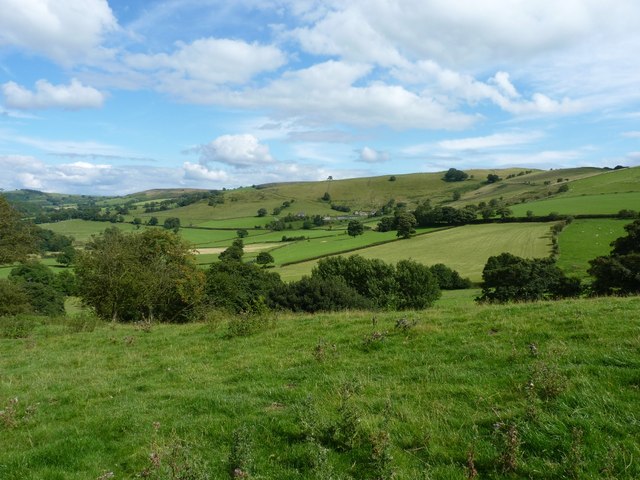
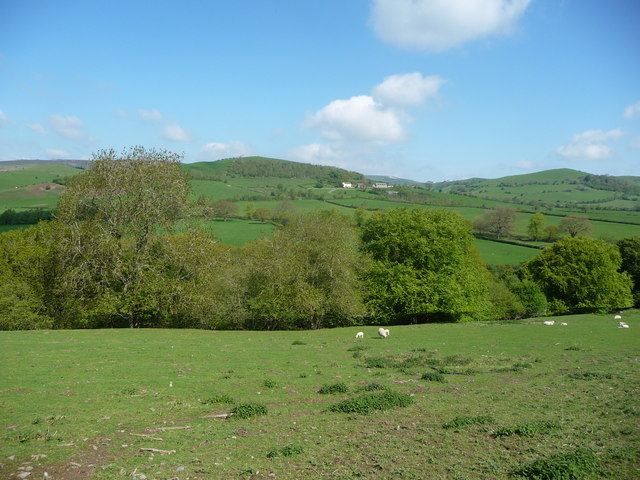
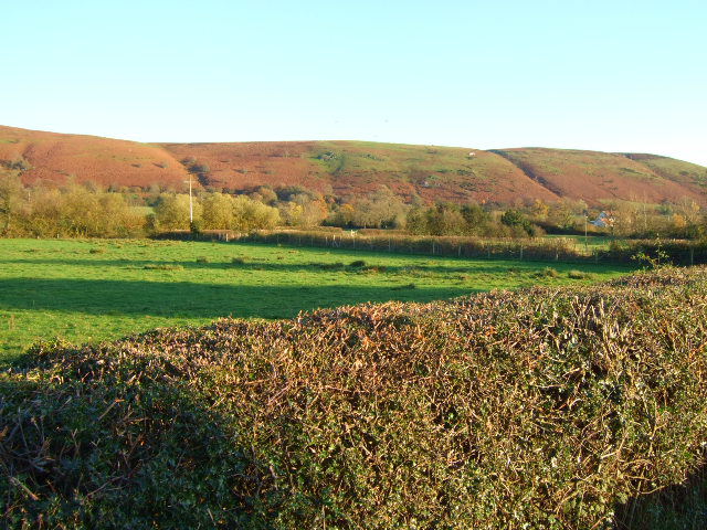
Old Lands Wood is a picturesque and diverse natural reserve located in Shropshire, England. Spanning over a vast area, it encompasses a combination of downs and moorland landscapes, offering visitors a unique and captivating experience. The wood is situated within the larger Clun Forest, nestled in the heart of the beautiful Shropshire Hills Area of Outstanding Natural Beauty.

The wood boasts a rich history, dating back centuries, and is home to a wide range of flora and fauna. Ancient oak and beech trees dominate the landscape, providing a dense canopy that creates a peaceful and serene atmosphere. These trees are interspersed with vibrant heather and gorse, which add a splash of color to the surrounding moorland.

The diverse ecosystem of Old Lands Wood supports a variety of wildlife. Visitors may be fortunate enough to spot red deer, foxes, and badgers roaming freely, while numerous species of birds, such as woodpeckers and owls, can be observed and heard throughout the day.

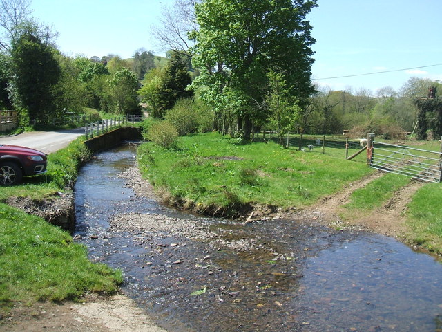
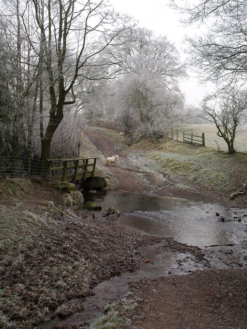
For nature enthusiasts, Old Lands Wood offers a network of walking trails, allowing visitors to explore the area at their own pace. These trails meander through the wood, revealing breathtaking vistas of the surrounding countryside. Additionally, there are designated picnic spots and seating areas where visitors can relax and immerse themselves in the tranquil ambiance.

Old Lands Wood, with its enchanting landscapes and abundant wildlife, provides a haven for nature lovers seeking a peaceful retreat. Its combination of downs and moorland, along with its rich biodiversity, make it a truly special and captivating destination within Shropshire.

If you have any feedback on the listing, please let us know in the comments section below.

Old Lands Wood Images

Images are sourced within 2km of 52.556079/-2.8764429 or Grid Reference SO4095. Thanks to Geograph Open Source API. All images are credited.

Bridges (Youth) Hostel Bridges Hostel is close to the small Shropshire settlement of Ratlinghope - 'Rachup' in pronunciation.
Bridges was once part of the YHA operation but was sold on some time ago to owners (or an owner) who still operate(s) the building as a hostel; it remains bookable through the YHA.
Bridges (Youth) Hostel
Bridges Hostel is close to the small Shropshire settlement of Ratlinghope - 'Rachup' in pronunciation. Bridges was once part of the YHA operation but was sold on some time ago to owners (or an owner) who still operate(s) the building as a hostel; it remains bookable through the YHA.
Riders on the lane into Coates Participants in the 2012 MTB Marathon Event around the Long Mynd area, heading along the track from Asterton into Coates, through a gateway that is normally kept closed.
Riders on the lane into Coates
Participants in the 2012 MTB Marathon Event around the Long Mynd area, heading along the track from Asterton into Coates, through a gateway that is normally kept closed.
Coates Farm Participants in the 2012 MTB Marathon Event heading through Coates Farm, from where the route went rapidly (VERY rapidly...) downhill to Bridge, and then slowly (VERY slowly...) back up the Stiperstones road past Squilver.
Coates Farm
Participants in the 2012 MTB Marathon Event heading through Coates Farm, from where the route went rapidly (VERY rapidly...) downhill to Bridge, and then slowly (VERY slowly...) back up the Stiperstones road past Squilver.
Harebells at Medlicott A large clump of Harebells (Campanula rotundifolia) at the roadside. This was the largest of several we saw today, the Long Mynd being quite well known for this plant.
Harebells at Medlicott
A large clump of Harebells (Campanula rotundifolia) at the roadside. This was the largest of several we saw today, the Long Mynd being quite well known for this plant.
Across the valley towards Coppice Farm From the northern end of Adstone Hill, looking eastwards(ish) to the slopes of the Long Mynd and Coppice Farm.
Across the valley towards Coppice Farm
From the northern end of Adstone Hill, looking eastwards(ish) to the slopes of the Long Mynd and Coppice Farm.
On Adstone Hill The Shropshire Way climbs (or descends) this northern end of Adstone Hill, with views up the East Onny valley towards Westcott.
On Adstone Hill
The Shropshire Way climbs (or descends) this northern end of Adstone Hill, with views up the East Onny valley towards Westcott.
Stile and tree on Adstone Hill Actually a double-stile, as there are two rows of wire protecting a new hedge from the marauding sheep.
Stile and tree on Adstone Hill
Actually a double-stile, as there are two rows of wire protecting a new hedge from the marauding sheep.
Adstone Hill This Unclassified County Road is marked on the maps as a double-track, runs the length of Adstone Hill, and provides good views all around.
Adstone Hill
This Unclassified County Road is marked on the maps as a double-track, runs the length of Adstone Hill, and provides good views all around.
Land around Kinnerton Chapel The small white patches along the hedge lines are the last remains from a week of heavy snowfall
Land around Kinnerton Chapel
The small white patches along the hedge lines are the last remains from a week of heavy snowfall
Field beside Kinnerton Chapel
River East Onny
River East Onny
The Horseshoe Inn An unusual means of transport favoured by one of the locals. Handling the Marshalls traction engine was a challenge on the narrow country lanes from Ratlinghope.
The Horseshoe Inn
An unusual means of transport favoured by one of the locals. Handling the Marshalls traction engine was a challenge on the narrow country lanes from Ratlinghope.
Walkers pass by the pub at Bridges, Shropshire Early on a May morning and these walkers are eager to be up in the hills but are anticipating the Horseshoe Inn's hospitality after their walk.
Walkers pass by the pub at Bridges, Shropshire
Early on a May morning and these walkers are eager to be up in the hills but are anticipating the Horseshoe Inn's hospitality after their walk.
Rural cottage near Bridges, Shropshire A quiet little traditional rural cottage.
Rural cottage near Bridges, Shropshire
A quiet little traditional rural cottage.
In the Shropshire Hills in May Who would want to be anywhere else? 

The farm is Stedment farm and lies between the glorious Long Mynd and the lovely Stiperstones ridge. Not a bad spot.
In the Shropshire Hills in May
Who would want to be anywhere else? The farm is Stedment farm and lies between the glorious Long Mynd and the lovely Stiperstones ridge. Not a bad spot.
In some of the Shropshire Hills in May From this field corner a distant aspect of the lovely Stiperstones ridge can be appreciated as well as the rolling minor hills in between.
In some of the Shropshire Hills in May
From this field corner a distant aspect of the lovely Stiperstones ridge can be appreciated as well as the rolling minor hills in between.
On Adstone Hill, Shropshire in May Walkers follow this delightful ridge walk in sublime May weather - hot sun, cooling breeze.
On Adstone Hill, Shropshire in May
Walkers follow this delightful ridge walk in sublime May weather - hot sun, cooling breeze.
Waymarker post on Adstone Hill, Shropshire A Ride UK bridleway disc, a local waymarked walk disc and of course the old style Shropshire Way disc (much preferable to the new style ones!) set off this weathered old fence post.
Waymarker post on Adstone Hill, Shropshire
A Ride UK bridleway disc, a local waymarked walk disc and of course the old style Shropshire Way disc (much preferable to the new style ones!) set off this weathered old fence post.
Show me another place!

Old Lands Wood is located at Grid Ref: SO4095 (Lat: 52.556079, Lng: -2.8764429)

Unitary Authority: Shropshire

Police Authority: West Mercia

What 3 Words

///gateway.times.songbirds. Near Church Stretton, Shropshire

Nearby Locations

Old Lands Wood

Related Wikis

Ratlinghope

Ratlinghope (, locally also RAT-chəp) is a hamlet and civil parish in Shropshire, England. The population of the civil parish at the 2011 census was 138...

Long Mynd

The Long Mynd (Welsh: Cefn Hirfynydd) is a heath and moorland plateau that forms part of the Shropshire Hills in Shropshire, England. The high ground,...

Prolley Moor

Prolley Moor (also known as Prolly Moor) is a small dispersed settlement in Shropshire, England, based around a cross roads. The settlement is located...

Wentnor

Wentnor is a village and civil parish in Shropshire, England. It lies to the west of the Long Mynd and between the village and the hill range is the dispersed...

Nearby Amenities

Located within 500m of 52.556079,-2.8764429
Barrier: cattle_grid
Bicycle: yes
Lat/Long: 52.5598885/-2.875658
The data included in this document is from www.openstreetmap.org. The data is made available under ODbL.

Have you been to Old Lands Wood?

Leave your review of Old Lands Wood below (or comments, questions and feedback).