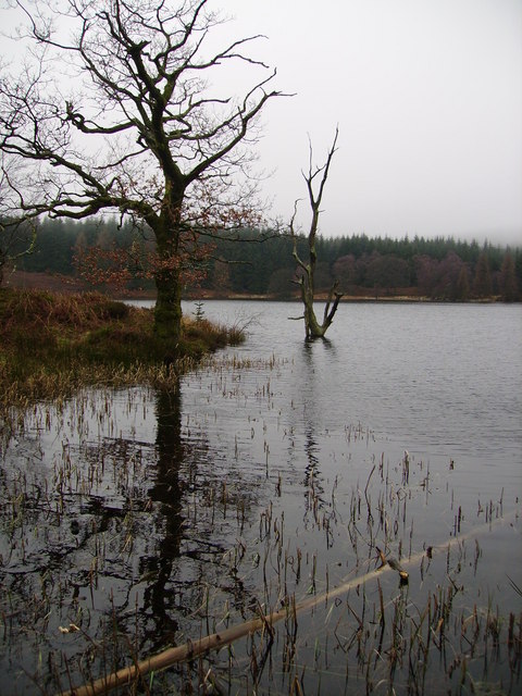
Bog End Moss
Downs, Moorland in Lancashire South Lakeland
England
Bog End Moss

Bog End Moss, located in Lancashire, England, is a vast expanse of downs and moorland that encompasses an area of approximately 500 acres. Situated in the western part of the county, it is surrounded by a diverse range of landscapes, including woodlands, rivers, and farmland.
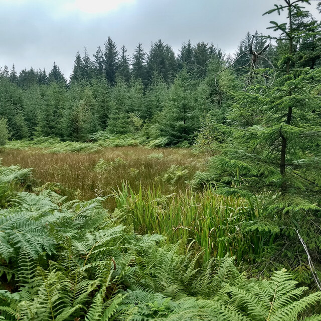
The terrain of Bog End Moss is characterized by undulating hills, heather-covered moorland, and patches of boggy ground, which gives it its name. The area is rich in biodiversity, harboring a variety of plant and animal species. The heather, gorse, and grasses that dominate the landscape provide a habitat for numerous bird species, including the curlew, lapwing, and skylark.
The moss is also home to a range of mammals, such as rabbits, hares, and foxes, which are often spotted darting across the open moorland. Additionally, the area is known for its reptile population, with common lizards and adders occasionally seen basking in the sun.
Bog End Moss is popular among outdoor enthusiasts, attracting walkers, hikers, and nature lovers who appreciate the tranquility and natural beauty of the surroundings. The moss offers several walking trails that allow visitors to explore its diverse habitats and enjoy panoramic views of the Lancashire countryside.
The area is also of historical significance, with evidence of human activity dating back to prehistoric times. Archaeological surveys have identified several ancient burial mounds and stone circles, hinting at the moss's long-standing association with human settlement.
Overall, Bog End Moss is a captivating natural landscape that offers visitors a chance to immerse themselves in the beauty of Lancashire's downs and moorland while providing a haven for a diverse range of flora and fauna.
If you have any feedback on the listing, please let us know in the comments section below.
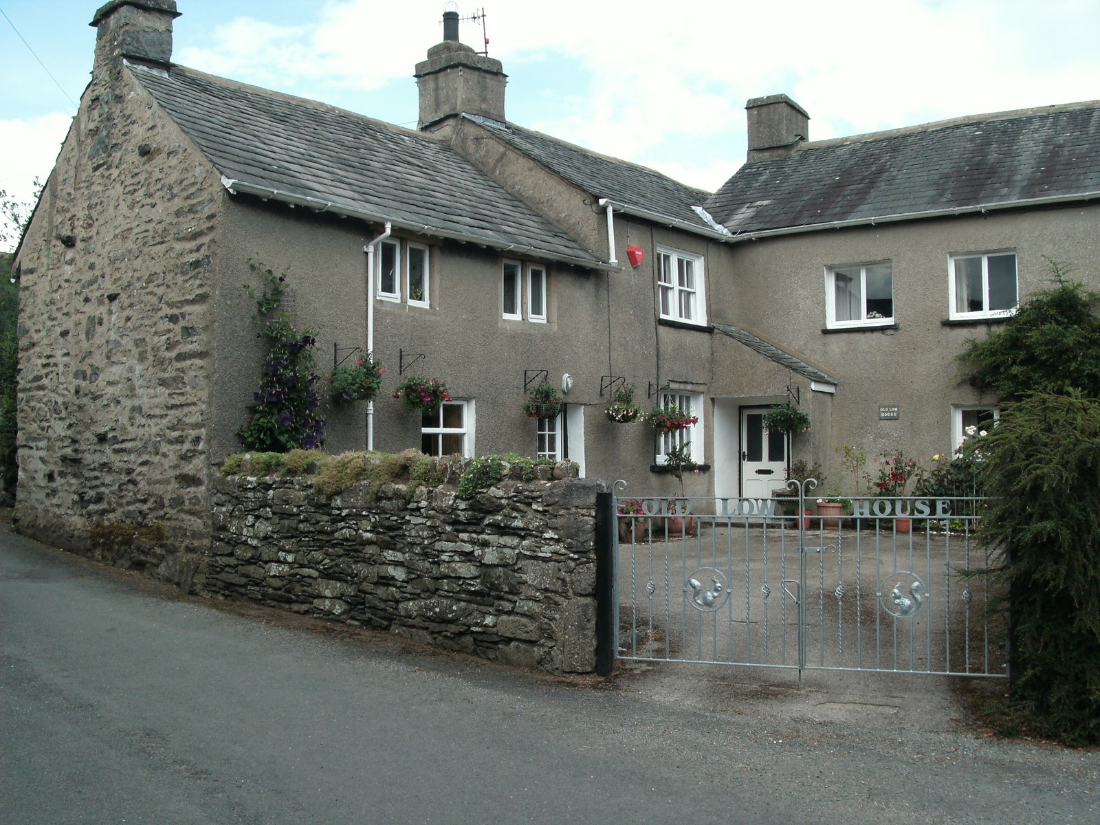
Bog End Moss Images
Images are sourced within 2km of 54.262792/-2.929268 or Grid Reference SD3985. Thanks to Geograph Open Source API. All images are credited.


Bog End Moss is located at Grid Ref: SD3985 (Lat: 54.262792, Lng: -2.929268)
Administrative County: Cumbria
District: South Lakeland
Police Authority: Cumbria
What 3 Words
///daring.domain.monday. Near Grange-over-Sands, Cumbria
Nearby Locations
Related Wikis
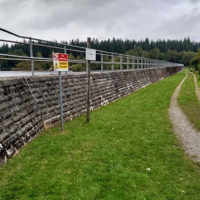
Simpson Ground Reservoir
Simpson Ground Reservoir is a reservoir in Cumbria, England, near the southeastern end of Windermere. It is located within a Forestry Commission conifer...
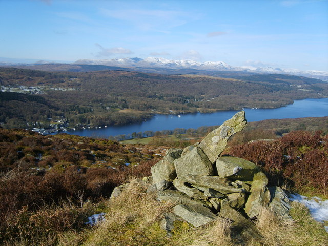
Staveley Fell
Staveley Fell is an upland area in the English Lake District, near (and named for) Staveley-in-Cartmel (not to be confused with Staveley-in-Westmorland...

Staveley-in-Cartmel
Staveley-in-Cartmel is a small village and civil parish in South Lakeland district, Cumbria, England. It lies east of Newby Bridge, near the south end...
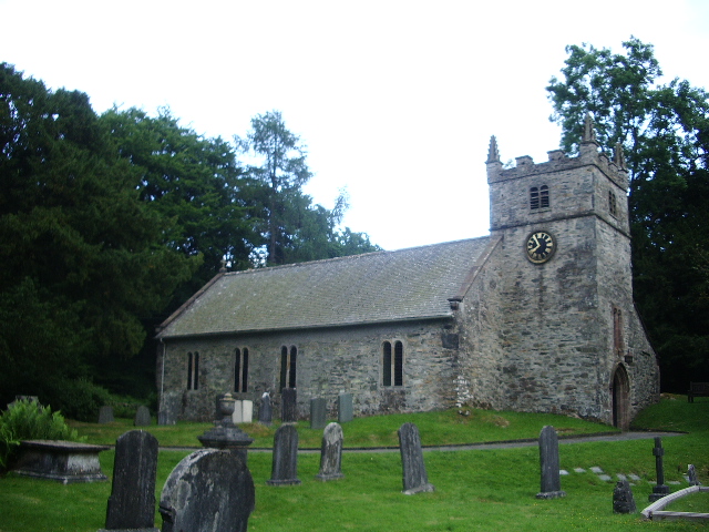
St Mary's Church, Staveley
St Mary's Church is in the village of Staveley-in-Cartmel, Cumbria, England. It is an active Anglican parish church in the deanery of Windermere, the archdeaconry...
Fell Foot Park
Fell Foot Park is a country park situated at the southern end of Windermere in Cumbria, the largest lake in England. It is north of Newby Bridge in the...
Ayside
Ayside is a hamlet on the A590 road, in the South Lakeland district, in the county of Cumbria, England. == References == Philip's Street Atlas Cumbria...
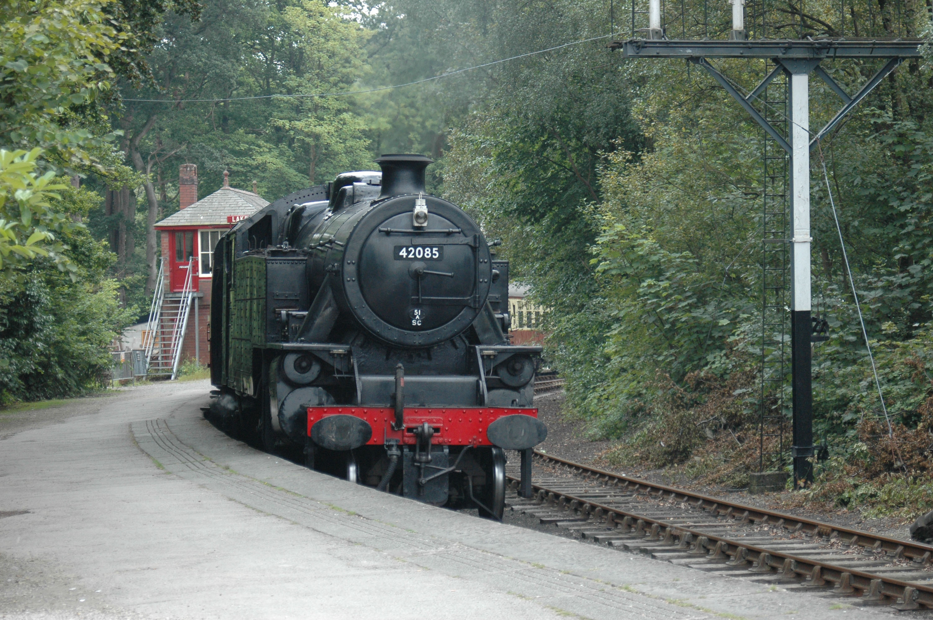
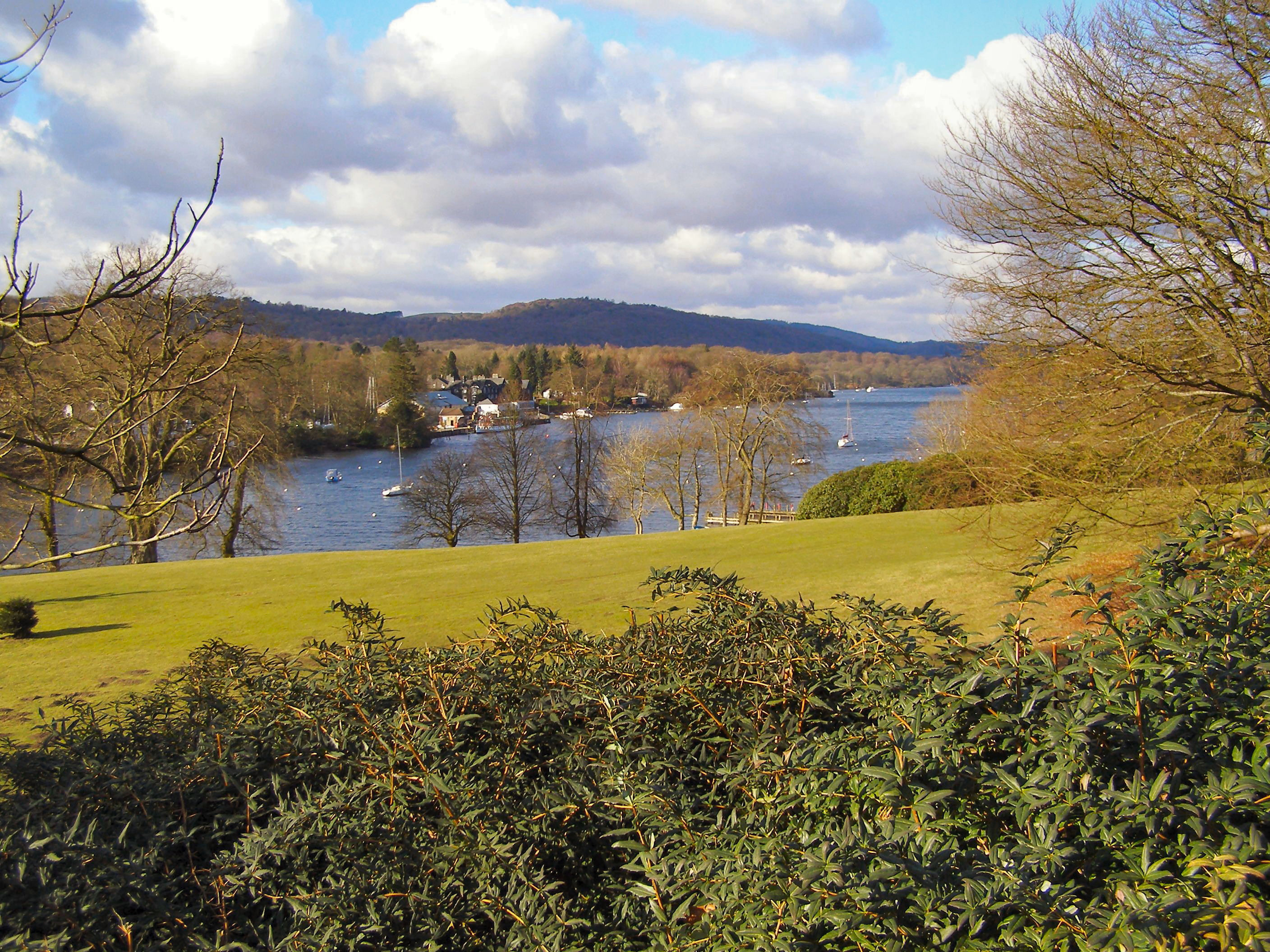
Lakeside railway station (England)
Lakeside railway station is on the heritage Lakeside and Haverthwaite Railway in England. It was previously the terminus of the Furness Railway Ulverston...

Lakes Aquarium
The Lakes Aquarium is an aquarium in the village of Lakeside on the southern shore of Windermere, Cumbria, England. It is one of the docking points of...
Nearby Amenities
Located within 500m of 54.262792,-2.929268Have you been to Bog End Moss?
Leave your review of Bog End Moss below (or comments, questions and feedback).