Moss Side

Downs, Moorland in Lancashire

England

Moss Side

Out in the country - once
Out in the country - once Credit: David Long

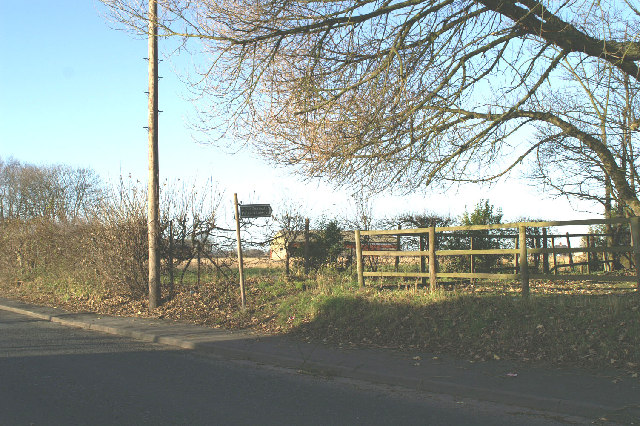
Moss Side is a small village located in Lancashire, England. Situated on the outskirts of the town of Blackburn, it is nestled amidst scenic downs and moorland. The village is known for its picturesque landscapes, which attract nature enthusiasts and hikers alike.

Surrounded by lush green fields and rolling hills, Moss Side offers a tranquil and idyllic setting for those seeking a respite from the hustle and bustle of city life. The area is home to a diverse range of flora and fauna, making it a haven for wildlife lovers. Visitors can spot various species of birds, rabbits, and even deer roaming freely in the countryside.

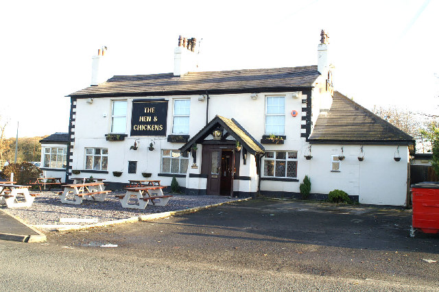
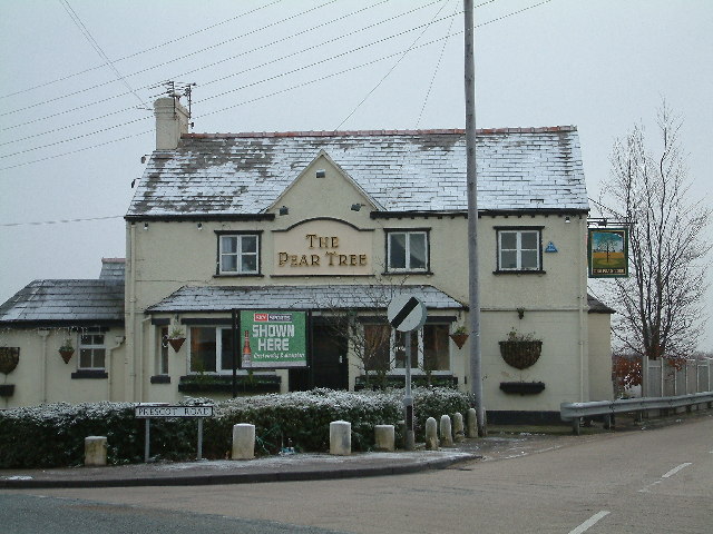
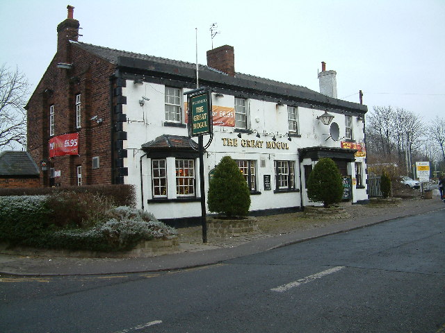
The village itself has a small population, with a close-knit community. It exudes a peaceful and friendly atmosphere, where neighbors often come together for social gatherings and events. The local pub serves as a popular meeting point, offering a warm and welcoming ambiance to residents and visitors alike.

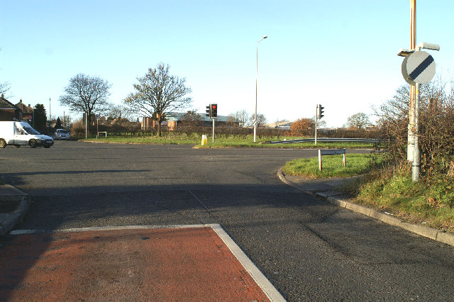
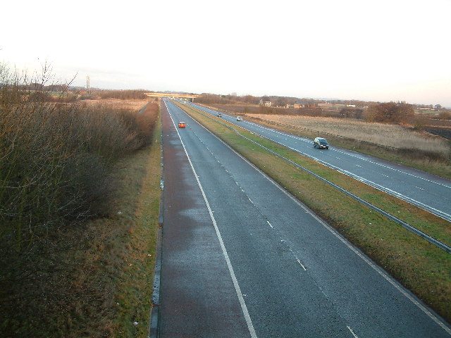
While Moss Side may be a quiet village, it is conveniently located near major transportation routes, making it easily accessible to nearby towns and cities. The village is just a short drive away from Blackburn, where residents can access a wide range of amenities, including shopping centers, restaurants, and entertainment venues.

In conclusion, Moss Side in Lancashire offers a serene and picturesque setting, with its downs and moorland providing a beautiful backdrop. The village is a haven for nature lovers and offers a close-knit community atmosphere, while still being conveniently located near larger towns and cities.

If you have any feedback on the listing, please let us know in the comments section below.

Moss Side Images

Images are sourced within 2km of 53.513425/-2.9182172 or Grid Reference SD3902. Thanks to Geograph Open Source API. All images are credited.

Out in the country - once
Ashworth Hospital
Ashworth Hospital
Escape to the country
A59 junction
A59 junction
High Pastures This large house now a doctors surgery in Maghull, was during the war the headquarters for the local Home Guard.
High Pastures
This large house now a doctors surgery in Maghull, was during the war the headquarters for the local Home Guard.
Maghull Square
Maghull Square
St George's Located in Station Road Maghull
St George's
Located in Station Road Maghull
Bridge over the Leeds & Liverpool Canal Brewery Lane Melling
Bridge over the Leeds & Liverpool Canal
Brewery Lane Melling
Wear marks On the canal Bridge, grooves caused by the ropes when barges were being towed by horses.
Location Brewery Lane Melling
Wear marks
On the canal Bridge, grooves caused by the ropes when barges were being towed by horses. Location Brewery Lane Melling
Rafael Sabatini 1875-1950 author and dramatist lived here as a child.
Rafael Sabatini
1875-1950 author and dramatist lived here as a child.
M58 Motorway  (the quiet one)
M58 Motorway (the quiet one)
The Pear Tree Melling Mount
The Pear Tree
Melling Mount
Ancient Chapel Maghull Located in the grounds of St Andrews Church. Parts of this chapel date from the 13th century. It is open for public viewing only a few days per year.
Ancient Chapel Maghull
Located in the grounds of St Andrews Church. Parts of this chapel date from the 13th century. It is open for public viewing only a few days per year.
Frank Hornby This is the grave of Frank Hornby, the inventor and manufacturer of Meccano, Dinky Toys, and Hornby Trains. Located in the grounds of St Andrews Church, Maghull.
Frank Hornby
This is the grave of Frank Hornby, the inventor and manufacturer of Meccano, Dinky Toys, and Hornby Trains. Located in the grounds of St Andrews Church, Maghull.
Frank Hornby Grave (close-up)
Frank Hornby
Grave (close-up)
The Great Mogul Located on Station Road, Maghull.
The Great Mogul
Located on Station Road, Maghull.
Thin Ice Leeds & Liverpool Canal Looking south, from Hall Lane Bridge on a cold day.
Thin Ice
Leeds & Liverpool Canal Looking south, from Hall Lane Bridge on a cold day.
Thin Ice Leeds & Liverpool Canal looking north, From Hall Lane Bridge on a cold day.
Thin Ice
Leeds & Liverpool Canal looking north, From Hall Lane Bridge on a cold day.
Show me another place!

Moss Side is located at Grid Ref: SD3902 (Lat: 53.513425, Lng: -2.9182172)

Unitary Authority: Sefton

Police Authority: Merseyside

What 3 Words

///boots.score.evolution. Near Maghull, Merseyside

Nearby Locations

Moss Side Moss Side

Related Wikis

Maghull North railway station

Maghull North is a station in Maghull, Merseyside, England, on the Northern Line of Merseyrail. The station opened on 18 June 2018 to serve the north end...

HM Prison Kennet

HM Prison Kennet was a Category C men's prison, located in Parkbourn, Maghull, in the Metropolitan Borough of Sefton in Merseyside, England. The prison...
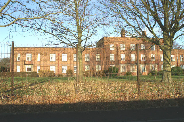
Ashworth Hospital

Ashworth Hospital is a high-security psychiatric hospital in Maghull, 10 miles (16 km) northeast of Liverpool. It is a part of Mersey Care NHS Foundation...

Kennessee Green

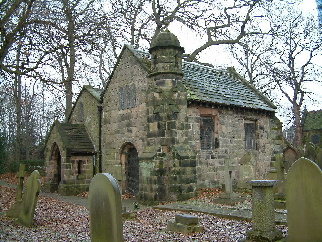
Kennessee Green is a village in the southern half of Maghull in Metropolitan Borough of Sefton, Merseyside, England. Kennessee Green has two churches:...

Nearby Amenities

Located within 500m of 53.513425,-2.9182172
Bus Stop
DEYES LANE/MOSS LANE
Bus: yes
Naptan AtcoCode: 2800S55061A
Naptan Bearing: W
Naptan CommonName: DEYES LANE/MOSS LANE
Naptan Indicator: DEYES LANE/MOSS LANE
Naptan Landmark: O/S 182 CORNER GREENHEYS DRIVE
Naptan NaptanCode: mergdaga
Naptan Notes: No Notes
Naptan PlusbusZoneRef: LVRPLCH
Naptan ShortCommonName: Deyes Ln/Moss Ln
Naptan Street: DEYES LANE
Naptan Verified: no
Public Transport: platform
Source: naptan_import
Lat/Long: 53.5155964/-2.9244725
Bus Stop
PARK LANE/BEECHWAY
Bus: yes
Naptan AtcoCode: 2800S55089A
Naptan Bearing: SE
Naptan CommonName: PARK LANE/BEECHWAY
Naptan Indicator: PARK LANE/BEECHWAY
Naptan Landmark: O/S 92
Naptan NaptanCode: mergdajm
Naptan Notes: No Notes
Naptan PlusbusZoneRef: LVRPLCH
Naptan ShortCommonName: Park Ln/Beechway
Naptan Street: PARK LANE
Naptan Verified: no
Public Transport: platform
Source: naptan_import
Lat/Long: 53.5163092/-2.9132765
Bus Stop
PARK LANE/BEECHWAY
Bus: yes
Naptan AtcoCode: 2800S55089B
Naptan Bearing: NW
Naptan CommonName: PARK LANE/BEECHWAY
Naptan Indicator: PARK LANE/BEECHWAY
Naptan Landmark: OPP 88
Naptan NaptanCode: mergdajp
Naptan Notes: No Notes
Naptan PlusbusZoneRef: LVRPLCH
Naptan ShortCommonName: Park Ln/Beechway
Naptan Street: PARK LANE
Naptan Verified: no
Public Transport: platform
Source: naptan_import
Lat/Long: 53.5161565/-2.9132581
Mini Roundabout
Direction: clockwise
Lat/Long: 53.5167146/-2.9201085
Maghull North
Network: Northern Line
Operator: Merseyrail
Ref Tiploc: MAGHNTH
Lat/Long: 53.5164036/-2.9214913
Maghull North
Network: National Rail
Network Website: https://www.nationalrail.co.uk/stations/mns/
Network Wikidata: Q26334
Operator: Merseyrail
Public Transport: station
Railway: station
Ref Crs: MNS
Ref Tiploc: MAGNTH
Train: yes
Wheelchair: yes
Wikidata: Q6730453
Wikipedia: en:Maghull North railway station
Lat/Long: 53.5167407/-2.9212339
Crossing
Crossing: traffic_signals
Lat/Long: 53.5159164/-2.919876
Communication Mobile Phone: yes
Man Made: mast
Tower Type: communication
Lat/Long: 53.5093928/-2.9158797
Maghull North
Operator: Merseyrail
Public Transport: stop_position
Railway: stop
Train: yes
Lat/Long: 53.5162789/-2.9214958
Bus Stop
Bus: yes
Public Transport: platform
Shelter: no
Lat/Long: 53.51579/-2.9188761
Crossing
Crossing: uncontrolled
Crossing Island: no
Tactile Paving: no
Lat/Long: 53.5167834/-2.9204514
Crossing
Crossing: uncontrolled
Crossing Island: no
Tactile Paving: no
Lat/Long: 53.516466/-2.9209542
Crossing
Crossing: uncontrolled
Crossing Island: no
Tactile Paving: no
Lat/Long: 53.5168357/-2.92068
Noexit: yes
Lat/Long: 53.5172929/-2.920111
Addr Housenumber: 66
Addr Street: Beechway Avenue
Lat/Long: 53.5157186/-2.9123701
Generator Method: photovoltaic
Generator Output Electricity: yes
Generator Source: solar
Generator Type: solar_photovoltaic_panel
Location: roof
Power: generator
Source: survey
Lat/Long: 53.5158209/-2.9124171
Addr Housenumber: 106
Addr Street: Beechway
Lat/Long: 53.5167328/-2.9134917
Addr Housenumber: 88
Addr Street: Beechway
Lat/Long: 53.5162419/-2.9130117
Addr Housenumber: 18
Addr Street: Beechway
Lat/Long: 53.5160057/-2.9120668
Bus Stop
SCHOOL LANE/PARK LANE
Bus: yes
Departures Board: timetable
Public Transport: platform
Shelter: no
Source: survey
Lat/Long: 53.515062/-2.9115211
Bus Stop
SCHOOL LANE/OPPOSITE PARK LANE
Bus: yes
Departures Board: timetable
Public Transport: platform
Shelter: no
Source: survey
Lat/Long: 53.5150799/-2.913087
Waste Basket
Colour: Black
Source: survey
Lat/Long: 53.5147431/-2.9113093
The data included in this document is from www.openstreetmap.org. The data is made available under ODbL.

Have you been to Moss Side?

Leave your review of Moss Side below (or comments, questions and feedback).