Clifton Common
Downs, Moorland in Monmouthshire
Wales
Clifton Common

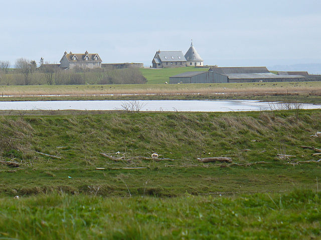
Clifton Common, located in Monmouthshire, is a picturesque area characterized by its stunning downs and moorland landscapes. Spanning over a considerable land area, the common serves as a popular destination for nature enthusiasts, hikers, and those seeking a peaceful retreat in the Welsh countryside.
The downs of Clifton Common are notable for their rolling hills covered in lush greenery, offering breathtaking panoramic views of the surrounding area. These open spaces provide ample opportunities for outdoor activities such as picnicking, kite flying, and frisbee throwing. The peaceful atmosphere and unspoiled nature make it an ideal location for families and individuals looking to reconnect with nature.
The moorland of Clifton Common adds another layer of beauty to the landscape. Characterized by its rugged terrain and vibrant purple heather, the moorland is a haven for wildlife and plant species. Visitors can often spot various bird species, including kestrels and skylarks, soaring through the sky. The moorland also supports a diverse range of flora, with patches of bracken, gorse, and bilberry dotting the landscape.
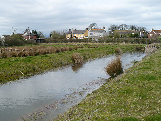
Furthermore, Clifton Common is home to numerous walking trails that cater to different skill levels. These paths wind through the downs and moorland, allowing visitors to explore the area at their own pace. The common is also equipped with picnic areas and benches, ensuring visitors can enjoy a comfortable and leisurely experience.
Overall, Clifton Common in Monmouthshire is an idyllic destination offering a mix of downs and moorland landscapes, providing visitors with a chance to immerse themselves in the natural beauty of the Welsh countryside.
If you have any feedback on the listing, please let us know in the comments section below.
Clifton Common Images
Images are sourced within 2km of 51.539812/-2.9015626 or Grid Reference ST3782. Thanks to Geograph Open Source API. All images are credited.


Clifton Common is located at Grid Ref: ST3782 (Lat: 51.539812, Lng: -2.9015626)
Unitary Authority: Newport
Police Authority: Gwent
What 3 Words
///gossiped.retract.harmonica. Near Goldcliff, Newport
Nearby Locations
Related Wikis
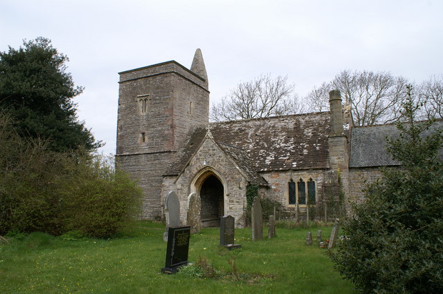
Goldcliff Priory
Goldcliff Priory was a Benedictine monastery in Goldcliff, Newport, South Wales. It was established in 1113 by Robert de Chandos as a subsidiary house...
Goldcliff, Newport
Goldcliff (Welsh: Allteuryn) is a village, parish and community to the south east of the city of Newport in South Wales. It lies within the Newport city...
Whitson
Whitson is a village on the outskirts of the city of Newport, South Wales. It is located about 7 miles (11 km) south east of Newport city centre on the...

Llanwern (electoral ward)
Llanwern is the name of an electoral ward for Newport City Council in south Wales. It covers several rural communities to the east of the city. It is represented...
Nearby Amenities
Located within 500m of 51.539812,-2.9015626Have you been to Clifton Common?
Leave your review of Clifton Common below (or comments, questions and feedback).