Level Common

Downs, Moorland in Monmouthshire

Wales

Level Common

Gates onto Saltmarsh Grasslands Wales Coast Path leaves Saltmarsh Lane and enters part of the Newport Wetlands NNR.
Gates onto Saltmarsh Grasslands Credit: M J Roscoe

Level Common is a vast expanse of land located in Monmouthshire, Wales. Covering an area of approximately 500 hectares, this beautiful landscape is characterized by its unique combination of downs and moorland. The common is situated at an elevation of around 200 meters above sea level, offering visitors breathtaking views of the surrounding countryside.

The downs found on Level Common are rolling grassy hills, which create a picturesque and serene atmosphere. These undulating slopes are covered in lush green vegetation, making it an ideal location for leisurely walks and picnics. The open nature of the downs allows for uninterrupted views of the Monmouthshire countryside, providing a peaceful and tranquil experience for nature enthusiasts.

In addition to the downs, Level Common is also home to extensive moorland areas. These expanses of land are characterized by their wet and boggy terrain, dominated by heather and other low-growing shrubs. Moorlands are known for their unique ecosystems, supporting a wide variety of plant and animal species. Visitors to Level Common can witness this diversity firsthand, as the moorland provides a rich habitat for various bird species, including curlews and lapwings.

Level Common is a popular destination for outdoor activities such as hiking, birdwatching, and nature photography. It offers a serene and unspoiled natural environment for visitors to explore and appreciate the beauty of Monmouthshire's countryside. Whether one seeks a peaceful retreat or an opportunity to connect with nature, Level Common is a must-visit destination in Monmouthshire.

If you have any feedback on the listing, please let us know in the comments section below.
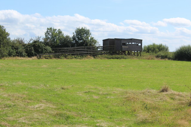
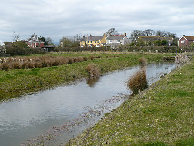
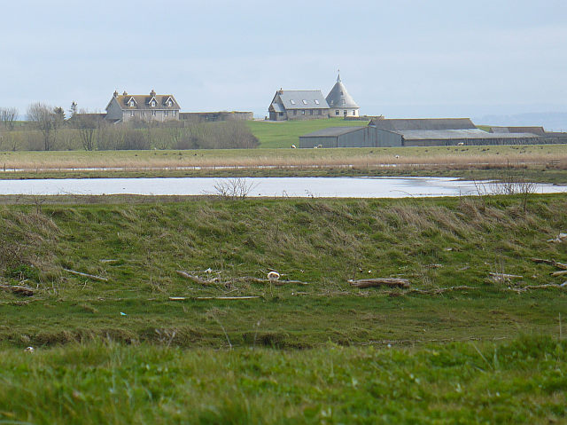
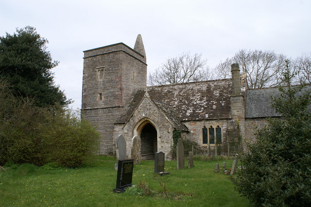
Level Common Images

Images are sourced within 2km of 51.542009/-2.9092774 or Grid Reference ST3782. Thanks to Geograph Open Source API. All images are credited.

Gates onto Saltmarsh Grasslands Wales Coast Path leaves Saltmarsh Lane and enters part of the Newport Wetlands NNR.
Gates onto Saltmarsh Grasslands
Wales Coast Path leaves Saltmarsh Lane and enters part of the Newport Wetlands NNR.
Gated footbridge on Wales Coast Path The footbridge leads to a high wooden fence (a screen?); the public footpath turns to the left and runs between a hedge and the fence.
Gated footbridge on Wales Coast Path
The footbridge leads to a high wooden fence (a screen?); the public footpath turns to the left and runs between a hedge and the fence.
Gated footbridge to field The Wales Coast Path leaves the corridor between hedge and high wooden fence and turns right into a grass field.
Gated footbridge to field
The Wales Coast Path leaves the corridor between hedge and high wooden fence and turns right into a grass field.
Redhouse Hide, Saltmarsh Grasslands Elevated hide giving panoramic views over the Newport Wetlands NNR.
Redhouse Hide, Saltmarsh Grasslands
Elevated hide giving panoramic views over the Newport Wetlands NNR.
View towards Gold Cliff from Redhouse Hide Saltmarsh Grasslands.
View towards Gold Cliff from Redhouse Hide
Saltmarsh Grasslands.
Looking southwest from Redhouse Hide Saltmarsh Grasslands.
Looking southwest from Redhouse Hide
Saltmarsh Grasslands.
Corner of mown grass field The Wales Coast Path runs from the waymarker post along the edge of the field to the right, seen from Redhouse Hide in the opposite corner of the field.
Corner of mown grass field
The Wales Coast Path runs from the waymarker post along the edge of the field to the right, seen from Redhouse Hide in the opposite corner of the field.
Gated footbridge between grass fields Wales Coast Path on public footpath, Saltmarsh Grasslands.
Gated footbridge between grass fields
Wales Coast Path on public footpath, Saltmarsh Grasslands.
Gated footbridge to track Wales Coast Path crosses the wooden bridge and turns left on to the track to Goldcliff Road.
Gated footbridge to track
Wales Coast Path crosses the wooden bridge and turns left on to the track to Goldcliff Road.
Track into Saltmarsh Grasslands from Goldcliff Road The Wales Coast Path turns right off the track to the footbridge <a href="https://www.geograph.org.uk/photo/6935726">ST3583 : Gated footbridge to track</a>. The bilingual notice on the gate says, 'Wildlife refuge area No Access'.
Track into Saltmarsh Grasslands from Goldcliff Road
The Wales Coast Path turns right off the track to the footbridge ST3583 : Gated footbridge to track. The bilingual notice on the gate says, 'Wildlife refuge area No Access'.
Track out of nature reserve to Goldcliff Road The Wales Coast Path on the track leaves the Saltmarsh Grasslands and turns right on to the road.
Track out of nature reserve to Goldcliff Road
The Wales Coast Path on the track leaves the Saltmarsh Grasslands and turns right on to the road.
Moorlands, Goldcliff Road Detached house in the countryside.
Moorlands, Goldcliff Road
Detached house in the countryside.
Gates on Boat Road The Wales Coast Path, from Goldcliff Road, goes through the left gate on a restricted byway.
Gates on Boat Road
The Wales Coast Path, from Goldcliff Road, goes through the left gate on a restricted byway.
Boat Road, Newport Wetlands NNR The Wales Coast Path goes along the lane through the Saltmarsh Grasslands towards the tidal Goldcliff Pill.
Boat Road, Newport Wetlands NNR
The Wales Coast Path goes along the lane through the Saltmarsh Grasslands towards the tidal Goldcliff Pill.
Signposts at junction of byway and Goldcliff Road The sign on the left says, 'Redwick 5km'; the right hand post has a bridle path sign. The Wales Coast Path comes along the road and turns right on to the byway.
Signposts at junction of byway and Goldcliff Road
The sign on the left says, 'Redwick 5km'; the right hand post has a bridle path sign. The Wales Coast Path comes along the road and turns right on to the byway.
Monks' Ditch above sluice, Level Common Viewed from Wales Coast Path.
Monks' Ditch above sluice, Level Common
Viewed from Wales Coast Path.
Gates on track, Newport Wetlands NNR The Wales Coast Path goes through the wooden gate into the field of mown grass.
Gates on track, Newport Wetlands NNR
The Wales Coast Path goes through the wooden gate into the field of mown grass.
Greenshank Hide, Newport Wetlands NNR Hide on embankment overlooking Monks Lagoon, Goldcliff. For an earlier similar view without the bushes - <a href="https://www.geograph.org.uk/photo/3516019">ST3682 : Bird hide, Goldcliff Lagoons</a>.
Greenshank Hide, Newport Wetlands NNR
Hide on embankment overlooking Monks Lagoon, Goldcliff. For an earlier similar view without the bushes - ST3682 : Bird hide, Goldcliff Lagoons.
Show me another place!

Level Common is located at Grid Ref: ST3782 (Lat: 51.542009, Lng: -2.9092774)

Unitary Authority: Newport

Police Authority: Gwent

What 3 Words

///president.clutter.warms. Near Goldcliff, Newport

Related Wikis

Goldcliff, Newport

Goldcliff (Welsh: Allteuryn) is a village, parish and community to the south east of the city of Newport in South Wales. It lies within the Newport city...

Goldcliff Priory

Goldcliff Priory was a Benedictine monastery in Goldcliff, Newport, South Wales. It was established in 1113 by Robert de Chandos as a subsidiary house...

Whitson

Whitson is a village on the outskirts of the city of Newport, South Wales. It is located about 7 miles (11 km) south east of Newport city centre on the...

Llanwern (electoral ward)

Llanwern is the name of an electoral ward for Newport City Council in south Wales. It covers several rural communities to the east of the city. It is represented...

Nearby Amenities

Located within 500m of 51.542009,-2.9092774
Goldcliff
Is In City: Newport
Is In Historic County: Monmouthshire
Name Cy: Allteuryn
Name En: Goldcliff
Place: village
Source: npe
Lat/Long: 51.5433853/-2.9151268
Parking
Lat/Long: 51.5411472/-2.9104634
Leisure: bird_hide
Lat/Long: 51.5399681/-2.9104009
Leisure: bird_hide
Lat/Long: 51.5377684/-2.9094798
Leisure: bird_hide
Lat/Long: 51.538572/-2.9097919
Direction: 170
Generator Method: photovoltaic
Generator Output Electricity: yes
Generator Solar Modules: 13
Generator Source: solar
Generator Type: solar_photovoltaic_panel
Location: roof
Power: generator
Lat/Long: 51.5428388/-2.9157436
Direction: SSW
Generator Method: photovoltaic
Generator Output Electricity: yes
Generator Solar Modules: 8
Generator Source: solar
Generator Type: solar_photovoltaic_panel
Location: roof
Power: generator
Lat/Long: 51.5423692/-2.9020925
The data included in this document is from www.openstreetmap.org. The data is made available under ODbL.

Have you been to Level Common?

Leave your review of Level Common below (or comments, questions and feedback).