Princes Park

Downs, Moorland in Lancashire

England

Princes Park

The Oratory The Oratory former chapel of St James's Cemetery
The Oratory Credit: Shaun Ferguson

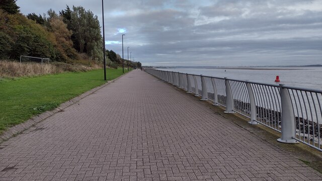
Princes Park is a picturesque and expansive public park located in the county of Lancashire, England. Situated in the Downs and Moorland region, the park is known for its stunning natural beauty and tranquil atmosphere. Covering an area of approximately 50 acres, it offers visitors a vast expanse of greenery, perfect for leisurely strolls or recreational activities.

The park is characterized by its gently rolling hills, lush grasslands, and scattered trees, creating a serene and peaceful environment for both locals and tourists alike. Princes Park boasts a variety of flora and fauna, with an abundance of wildflowers adding vibrant colors to the landscape during the spring and summer months.

Equipped with well-maintained pathways, the park provides an ideal setting for walkers, joggers, and cyclists. The pathways are also wheelchair and stroller-friendly, ensuring accessibility for all visitors. Additionally, there are designated areas for picnics and barbecues, allowing families and friends to enjoy outdoor gatherings surrounded by nature.

Princes Park is also home to several amenities and facilities. It features a children's playground, complete with swings, slides, and climbing frames, ensuring entertainment for the park's younger visitors. Sports enthusiasts can enjoy the park's tennis courts, football fields, and cricket pitches.

Overall, Princes Park in Lancashire is a cherished green space that showcases the beauty of the Downs and Moorland region. Its vast open spaces, diverse flora and fauna, and range of recreational facilities make it a popular destination for relaxation, outdoor activities, and community gatherings.

If you have any feedback on the listing, please let us know in the comments section below.
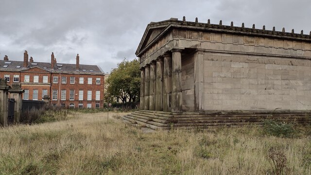
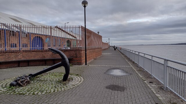
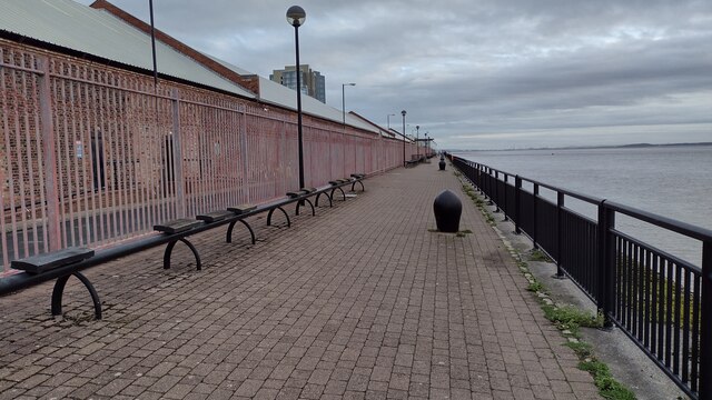
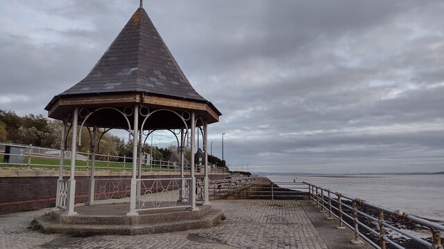
Princes Park Images

Images are sourced within 2km of 53.388133/-2.9532887 or Grid Reference SJ3688. Thanks to Geograph Open Source API. All images are credited.

The Oratory The Oratory former chapel of St James's Cemetery
The Oratory
The Oratory former chapel of St James's Cemetery
Old Anchor by the River Mersey Trans Pennine Trail passing an old anchor by the River Mersey alongside Brunswick Business Park
Old Anchor by the River Mersey
Trans Pennine Trail passing an old anchor by the River Mersey alongside Brunswick Business Park
Trans Pennine Trail by the River Mersey Trans Pennine Trail by the River Mersey alongside Brunswick Business Park
Trans Pennine Trail by the River Mersey
Trans Pennine Trail by the River Mersey alongside Brunswick Business Park
Trans Pennine Trail by the River Mersey Trans Pennine Trail by the River Mersey at Riverside Drive
Trans Pennine Trail by the River Mersey
Trans Pennine Trail by the River Mersey at Riverside Drive
Otterspool Promenade Otterspool Promenade beside the River Mersey
Otterspool Promenade
Otterspool Promenade beside the River Mersey
Bob Marley singing in the rain on Jamaica Street, Liverpool
The Liver Bird mural on a wet day in Liverpool
Brick Street, Liverpool A prosaic working street with a less prosaic view <a href="https://www.geograph.org.uk/photo/2891612">SJ3589 : Anglican Cathedral, Upper Duke Street, Liverpool</a>.
Brick Street, Liverpool
A prosaic working street with a less prosaic view SJ3589 : Anglican Cathedral, Upper Duke Street, Liverpool.
Abercromby Square, University of Liverpool
The Cathedral Church of Christ in Liverpool This imposing cathedral was based on a design by Giles Gilbert Scott. It was constructed from 1904 to 1978 and is said to be the longest cathedral in the world.
The Cathedral Church of Christ in Liverpool
This imposing cathedral was based on a design by Giles Gilbert Scott. It was constructed from 1904 to 1978 and is said to be the longest cathedral in the world.
Inside Liverpool Cathedral
K6 Telephone box inside Liverpool Cathedral The designer of Liverpool Cathedral also designed the famous K6 telephone box.
K6 Telephone box inside Liverpool Cathedral
The designer of Liverpool Cathedral also designed the famous K6 telephone box.
The Liverpool Philharmonic Dining Rooms Pub This famous pub was built in 1898-1900 and is possibly the most ornate pub in England.
The Liverpool Philharmonic Dining Rooms Pub
This famous pub was built in 1898-1900 and is possibly the most ornate pub in England.
The bar at the Liverpool Philharmonic Dining Rooms pub This famous pub was built in 1898-1900 and is possibly the most ornate pub in England.
The bar at the Liverpool Philharmonic Dining Rooms pub
This famous pub was built in 1898-1900 and is possibly the most ornate pub in England.
The lounge of the Liverpool Philharmonic Dining Rooms Pub This famous pub was built in 1898-1900 and is possibly the most ornate pub in England.
The lounge of the Liverpool Philharmonic Dining Rooms Pub
This famous pub was built in 1898-1900 and is possibly the most ornate pub in England.
Edge Hill Liverpool station
Liverpool Edge Hill station
Leece Street from St Luke's Place
Show me another place!

Princes Park is located at Grid Ref: SJ3688 (Lat: 53.388133, Lng: -2.9532887)

Unitary Authority: Liverpool

Police Authority: Merseyside

What 3 Words

///quit.code.held. Near Liverpool, Merseyside

Related Wikis

Prince's Park, Liverpool

Prince's Park in Toxteth, Liverpool, England, is a 45 ha (110 acres) municipal park, 2 mi (3.2 km) south east of Liverpool city centre. In 2009, its status...

Bellerive FCJ Catholic College

Bellerive FCJ Catholic College is an all-girls secondary school and a coeducational sixth form located on Windermere Terrace in Liverpool. It is a Roman...

The Belvedere Academy

The Belvedere Academy is an all-ability state-funded girls’ Academy secondary- formerly independent- school in Liverpool, England. Its predecessor, The...

Welsh Streets, Liverpool

The Welsh Streets are a group of late 19th century Victorian terraced streets in Toxteth, Liverpool, England. The houses were designed by Welsh architect...

Granby Four Streets

The Granby Four Streets is an area in Toxteth, Liverpool, England, comprising four streets at the tip of a triangle near the Grade II* listed Princes Park...

Christ Church, Toxteth Park

Christ Church, Toxteth Park, is in Linnet Lane, Liverpool, Merseyside, England. It is an active Anglican parish church in the deanery of Wavertree and...

10 Admiral Grove

10 Admiral Grove, a property in Toxteth, Liverpool, England, is the house in which Ringo Starr lived for twenty years before he rose to fame with the Beatles...

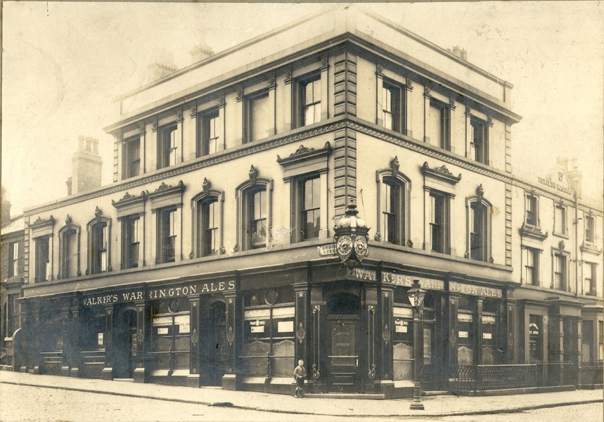
Royal Park Hotel, Toxteth

The Royal Park Hotel was a three storey, handsome public house and hotel situated on the corner of Admiral Street and North Hill Street, Toxteth, Liverpool...

Nearby Amenities

Located within 500m of 53.388133,-2.9532887
Traffic Signals
Lat/Long: 53.3870086/-2.9480009
Traffic Signals
Lat/Long: 53.3892374/-2.9496466
Crossing
Bicycle: yes
Crossing: uncontrolled
Crossing Ref: zebra
Kerb: lowered
Tactile Paving: yes
Lat/Long: 53.389982/-2.9555796
Crossing
Crossing: zebra
Kerb: lowered
Tactile Paving: yes
Lat/Long: 53.3903836/-2.9548918
Fuel
Victoria Service Station
Brand: Esso
Brand Wikidata: Q867662
Brand Wikipedia: en:Esso
Compressed Air: yes
Contact Website: https://www.esso.co.uk/en-gb/find-station/esso-liverpool-essovictoria-100342113
Operator: Esso
Phone: +44 151 727 6892
Lat/Long: 53.3851906/-2.9504575
Post Box
Parkfield Road
Collection Times: Mo-Fr 16:45; Sa 11:15
Description: Edward VII post box L17 64 on Parkfield Road near its junction with Ullet Road.
Operator: Royal Mail
Post Box Design: type_b
Post Box Type: pillar
Ref: L17 64
Royal Cypher: EVIIR
Royal Cypher Wikidata: Q33102324
Wikimedia Commons: File:Post box, Parkfield Road.jpg
Lat/Long: 53.3845216/-2.9513419
Barrier: bollard
Bollard: fixed
Motor Vehicle: no
Lat/Long: 53.387753/-2.94993
Telephone
Booth: KX100
Covered: booth
Operator: BT
Lat/Long: 53.3857964/-2.9493921
Post Box
Collection Times: Mo-Fr 17:15; Sa 12:00
Description: EIIR post box L8 272 by Machan on Sefton Park Road near to junction with Ullet Road.
Manufacturer: Machan
Operator: Royal Mail
Operator Wikidata: Q638098
Post Box Design: type_b
Post Box Type: pillar
Ref: L8 272
Royal Cypher: EIIR
Royal Cypher Wikidata: Q33102113
Wikimedia Commons: File:Post box, Sefton Park Road.jpg
Lat/Long: 53.38725/-2.9483693
Post Box
Collection Times: Mo-Fr 09:00; Sa 07:00
Description: EIIR post box L8 69 by Carron Company at Princes Gate West, Liverpool.
Manufacturer: Carron Company
Operator: Royal Mail
Operator Wikidata: Q638098
Post Box Design: type_b
Post Box Type: pillar
Ref: L8 69
Royal Cypher: EIIR
Royal Cypher Wikidata: Q33102113
Wikimedia Commons: File:Post box at Princes Gate West.jpg
Lat/Long: 53.3895856/-2.9557103
Post Box
Collection Times: Mo-Fr 09:00; Sa 07:00
Description: EIIR post box L8 234 by Carron Company on High Park Street near Powis Street, Toxteth.
Operator: Royal Mail
Operator Wikidata: Q638098
Post Box Design: type_b
Post Box Type: pillar
Ref: L8 234
Royal Cypher: EIIR
Royal Cypher Wikidata: Q33102113
Wikimedia Commons: File:Post box on High Park Street, Toxteth.jpg
Lat/Long: 53.389116/-2.9599226
Post Box
Collection Times: Mo-Fr 09:00; Sa 07:00
Description: EIIR post box L8 449 by Carron Company on Granby Street
Manufacturer: Carron Company
Operator: Royal Mail
Operator Wikidata: Q638098
Post Box Design: type_a
Post Box Type: pillar
Ref: L8 449
Royal Cypher: EIIR
Royal Cypher Wikidata: Q33102113
Wikimedia Commons: File:Post box on Granby Street near Ducie Street.jpg
Lat/Long: 53.391619/-2.9565098
Bus Stop
Princes Park / Kingsley Road
Bench: yes
Bin: yes
Bus: yes
Naptan AtcoCode: 2800S41057A
Naptan Bearing: SE
Naptan CommonName: PRINCES PARK GATES
Naptan Indicator: PRINCES PARK GATES
Naptan Landmark: O/S 38 (HOLLAND HOUSE)
Naptan NaptanCode: merdgajw
Naptan Notes: No Notes
Naptan PlusbusZoneRef: LVRPLCH
Naptan ShortCommonName: Princes Park Gates
Naptan Street: PRINCES PARK GATES
Naptan Verified: yes
Public Transport: platform
Shelter: yes
Source: naptan_import
Lat/Long: 53.3908294/-2.9559565
Bus Stop
PRINCES PARK GATES
Bus: yes
Naptan AtcoCode: 2800S41057B
Naptan Bearing: NW
Naptan CommonName: PRINCES PARK GATES
Naptan Indicator: PRINCES PARK GATES
Naptan Landmark: O/S 154
Naptan NaptanCode: merdgama
Naptan Notes: No Notes
Naptan PlusbusZoneRef: LVRPLCH
Naptan ShortCommonName: Princes Park Gates
Naptan Street: PRINCES PARK GATES
Naptan Verified: no
Public Transport: platform
Source: naptan_import
Lat/Long: 53.3907333/-2.9567212
Bus Stop
PRINCES PARK GATES
Bus: yes
Naptan AtcoCode: 2800S41057C
Naptan Bearing: NW
Naptan CommonName: PRINCES PARK GATES
Naptan Indicator: PRINCES PARK GATES
Naptan Landmark: CORNER HIGH PARK STRET O/S 150
Naptan NaptanCode: merdgamd
Naptan Notes: No Notes
Naptan PlusbusZoneRef: LVRPLCH
Naptan ShortCommonName: Princes Park Gates
Naptan Street: PRINCES PARK GATES
Naptan Verified: no
Public Transport: platform
Source: naptan_import
Lat/Long: 53.3908747/-2.9570251
PRINCES PARK GATES
Bus: yes
Naptan AtcoCode: 2800S41057D
Naptan Bearing: SE
Naptan CommonName: PRINCES PARK GATES
Naptan Indicator: PRINCES PARK GATES
Naptan Landmark: O/S 37
Naptan NaptanCode: merdgamg
Naptan Notes: No Notes
Naptan PlusbusZoneRef: LVRPLCH
Naptan ShortCommonName: Princes Park Gates
Naptan Street: PRINCES PARK GATES
Naptan Verified: yes
Physically Present: no
Public Transport: platform
Source: naptan_import
Lat/Long: 53.3908999/-2.9561234
Bus Stop
DEVONSHIRE ROAD/BELVIDERE ROAD
Bus: yes
Naptan AtcoCode: 2800S41058A
Naptan Bearing: SW
Naptan CommonName: DEVONSHIRE ROAD/BELVIDERE ROAD
Naptan Indicator: DEVONSHIRE ROAD/BELVIDERE ROAD
Naptan Landmark: O/S CO-OP DEVELOPMENT SERVICES NR 19
Naptan NaptanCode: merdgamj
Naptan Notes: No Notes
Naptan PlusbusZoneRef: LVRPLCH
Naptan ShortCommonName: Devonshire Rd
Naptan Street: DEVONSHIRE ROAD
Naptan Verified: no
Public Transport: platform
Source: naptan_import
Lat/Long: 53.3871066/-2.958354
Bus Stop
DEVONSHIRE ROAD/BELVIDERE ROAD
Bus: yes
Naptan AtcoCode: 2800S41058B
Naptan Bearing: NE
Naptan CommonName: DEVONSHIRE ROAD/BELVIDERE ROAD
Naptan Indicator: DEVONSHIRE ROAD/BELVIDERE ROAD
Naptan Landmark: O/S 58
Naptan NaptanCode: merdgamp
Naptan Notes: No Notes
Naptan PlusbusZoneRef: LVRPLCH
Naptan ShortCommonName: Devonshire Rd
Naptan Street: DEVONSHIRE ROAD
Naptan Verified: no
Public Transport: platform
Source: naptan_import
Lat/Long: 53.3871315/-2.9586102
Bus Stop
BELVIDERE ROAD/SCHOOL
Bus: yes
Naptan AtcoCode: 2800S41059A
Naptan Bearing: SE
Naptan CommonName: BELVIDERE ROAD/SCHOOL
Naptan Indicator: BELVIDERE ROAD/DEVONSHIRE ROAD
Naptan Landmark: O/S BELVIDERE SCHOOL
Naptan NaptanCode: merdgamt
Naptan Notes: No Notes
Naptan PlusbusZoneRef: LVRPLCH
Naptan ShortCommonName: Belvidere Rd/Sch
Naptan Street: BELVIDERE ROAD
Naptan Verified: no
Public Transport: platform
Source: naptan_import
Lat/Long: 53.3853124/-2.9576874
Bus Stop
BELVIDERE ROAD/DEVONSHIRE ROAD
Bench: no
Bin: no
Bus: yes
Lit: yes
Naptan AtcoCode: 2800S41059B
Naptan Bearing: NW
Naptan CommonName: BELVIDERE ROAD/DEVONSHIRE ROAD
Naptan Indicator: BELVIDERE ROAD/DEVONSHIRE ROAD
Naptan Landmark: NR 30
Naptan NaptanCode: merdgamw
Naptan Notes: No Notes
Naptan PlusbusZoneRef: LVRPLCH
Naptan ShortCommonName: Belvedere School
Naptan Street: BELVIDERE ROAD
Naptan Verified: no
Public Transport: platform
Shelter: no
Source: naptan_import
Lat/Long: 53.3847108/-2.957387
Bus Stop
SEFTON PARK ROAD/CROXTETH ROAD
Bus: yes
Naptan AtcoCode: 2800S41099A
Naptan Bearing: S
Naptan CommonName: SEFTON PARK ROAD/CROXTETH ROAD
Naptan Indicator: SEFTON PARK ROAD/CROXTETH ROAD
Naptan Landmark: O/S THREE STOREY FLATS
Naptan NaptanCode: merdgjmj
Naptan Notes: No Notes
Naptan PlusbusZoneRef: LVRPLCH
Naptan ShortCommonName: Sefton Park Rd
Naptan Street: SEFTON PARK ROAD
Naptan Verified: no
Public Transport: platform
Source: naptan_import
Lat/Long: 53.3896589/-2.9494342
Bus Stop
SEFTON PARK ROAD/CROXTETH ROAD
Bus: yes
Naptan AtcoCode: 2800S41099B
Naptan Bearing: N
Naptan CommonName: SEFTON PARK ROAD/CROXTETH ROAD
Naptan Indicator: SEFTON PARK ROAD/ULLET ROAD
Naptan Landmark: OPP 17 AND SEFTON DRIVE
Naptan NaptanCode: merdgjmp
Naptan Notes: No Notes
Naptan PlusbusZoneRef: LVRPLCH
Naptan ShortCommonName: Sefton Park Rd
Naptan Street: SEFTON PARK ROAD
Naptan Verified: no
Public Transport: platform
Source: naptan_import
Lat/Long: 53.3885539/-2.9493494
Bus Stop
CROXTETH ROAD/SEFTON PARK ROAD
Bus: yes
Naptan AtcoCode: 2800S41099C
Naptan Bearing: E
Naptan CommonName: CROXTETH ROAD/SEFTON PARK ROAD
Naptan Indicator: CROXTETH ROAD/SEFTON PARK ROAD
Naptan Landmark: O/S MULTI STOREY FLATS
Naptan NaptanCode: merdgjmt
Naptan Notes: No Notes
Naptan PlusbusZoneRef: LVRPLCH
Naptan ShortCommonName: Croxteh Rd Flats
Naptan Street: CROXTETH ROAD
Naptan Verified: no
Public Transport: platform
Source: naptan_import
Lat/Long: 53.3892654/-2.9503126
Bus Stop
SEFTON PARK ROAD/BENTLEY ROAD
Bus: yes
Naptan AtcoCode: 2800S41099D
Naptan Bearing: N
Naptan CommonName: SEFTON PARK ROAD/BENTLEY ROAD
Naptan Indicator: SEFTON PARK ROAD/ULLET ROAD
Naptan Landmark: NR SCHOOL CORNER BENTLEY ROAD
Naptan NaptanCode: merdgjmw
Naptan Notes: No Notes
Naptan PlusbusZoneRef: LVRPLCH
Naptan ShortCommonName: Archbishop Blanch
Naptan Street: SEFTON PARK ROAD
Naptan Verified: no
Public Transport: platform
Source: naptan_import
Lat/Long: 53.3912222/-2.9495291
Bus Stop
CROXTETH ROAD/SEFTON PARK ROAD
Bus: yes
Naptan AtcoCode: 2800S41099E
Naptan Bearing: W
Naptan CommonName: CROXTETH ROAD/SEFTON PARK ROAD
Naptan Indicator: CROXTETH ROAD/ULLET ROAD
Naptan Landmark: O/S 20
Naptan NaptanCode: merdgjpa
Naptan Notes: No Notes
Naptan PlusbusZoneRef: LVRPLCH
Naptan ShortCommonName: Croxteth Rd
Naptan Street: CROXTETH ROAD
Naptan Verified: no
Public Transport: platform
Source: naptan_import
Lat/Long: 53.3891975/-2.9486721
Bus Stop
CROXTETH ROAD/ULLET ROAD
Bus: yes
Naptan AtcoCode: 2800S41099F
Naptan Bearing: W
Naptan CommonName: CROXTETH ROAD/ULLET ROAD
Naptan Indicator: CROXTETH ROAD/ULLET ROAD
Naptan Landmark: O/S 26
Naptan NaptanCode: merdgjpd
Naptan Notes: No Notes
Naptan PlusbusZoneRef: LVRPLCH
Naptan ShortCommonName: Croxteth Rd
Naptan Street: CROXTETH ROAD
Naptan Verified: no
Public Transport: platform
Source: naptan_import
Lat/Long: 53.3892028/-2.9480106
Bus Stop
PARKFIELD ROAD/ULLET ROAD
Bench: no
Bin: no
Bus: yes
Lit: yes
Naptan AtcoCode: 2800S41106A
Naptan Bearing: SE
Naptan CommonName: PARKFIELD ROAD/ULLET ROAD
Naptan Indicator: PARKFIELD ROAD/ULLET ROAD
Naptan Landmark: O/S 2A
Naptan NaptanCode: merdgjwa
Naptan Notes: No Notes
Naptan PlusbusZoneRef: LVRPLCH
Naptan ShortCommonName: Parkfld Rd/Ullet Rd
Naptan Street: PARKFIELD ROAD
Naptan Verified: no
Public Transport: platform
Shelter: no
Source: naptan_import
Lat/Long: 53.3842518/-2.9511331
Bus Stop
PARKFIELD ROAD/ULLET ROAD
Bench: no
Bin: no
Bus: yes
Lit: yes
Naptan AtcoCode: 2800S41106B
Naptan Bearing: SE
Naptan CommonName: PARKFIELD ROAD/ULLET ROAD
Naptan Indicator: PARKFIELD ROAD/ULLET ROAD
Naptan Landmark: O/S 3 NR CORNER LITTLE PARKFIELD ROAD
Naptan NaptanCode: merdgjwd
Naptan Notes: No Notes
Naptan PlusbusZoneRef: LVRPLCH
Naptan ShortCommonName: Parkfld Rd/Ullet Rd
Naptan Street: PARKFIELD ROAD
Naptan Verified: no
Public Transport: platform
Shelter: no
Source: naptan_import
Lat/Long: 53.3844231/-2.9510768
Bus Stop
ULLET ROAD/SEFTON PARK ROAD
Bus: yes
Naptan AtcoCode: 2800S41107A
Naptan Bearing: NE
Naptan CommonName: ULLET ROAD/SEFTON PARK ROAD
Naptan Indicator: ULLET ROAD/SEFTON PARK ROAD
Naptan Landmark: O/S ST MARYS RC HIGH SCHOOL
Naptan NaptanCode: merdgjwg
Naptan Notes: No Notes
Naptan PlusbusZoneRef: LVRPLCH
Naptan ShortCommonName: St Marys RC School
Naptan Street: ULLET ROAD
Naptan Verified: no
Public Transport: platform
Source: naptan_import
Lat/Long: 53.386499/-2.9488978
Bus Stop
ULLET ROAD/SEFTON PARK ROAD
Bus: yes
Naptan AtcoCode: 2800S41107B
Naptan Bearing: SW
Naptan CommonName: ULLET ROAD/SEFTON PARK ROAD
Naptan Indicator: ULLET ROAD/SEFTON PARK ROAD
Naptan Landmark: OPP ST MARYS RC HIGH SCHOOL
Naptan NaptanCode: merdgjwj
Naptan Notes: No Notes
Naptan PlusbusZoneRef: LVRPLCH
Naptan ShortCommonName: St Marys RC School
Naptan Street: ULLET ROAD
Naptan Verified: no
Public Transport: platform
Source: naptan_import
Lat/Long: 53.3866643/-2.9484504
Bus Stop
KINGSLEY ROAD/CAIRNS STREET
Bench: no
Bin: no
Bus: yes
Lit: yes
Naptan AtcoCode: 2800S41162A
Naptan Bearing: N
Naptan CommonName: KINGSLEY ROAD/CAIRNS STREET
Naptan Indicator: KINGSLEY ROAD/CROXTETH ROAD
Naptan Landmark: OPP 141 NEAR CAIRNS STREET
Naptan NaptanCode: merdgpjp
Naptan Notes: No Notes
Naptan PlusbusZoneRef: LVRPLCH
Naptan ShortCommonName: Cairns St
Naptan Street: KINGSLEY ROAD
Naptan Verified: no
Public Transport: platform
Shelter: no
Source: naptan_import
Lat/Long: 53.3925118/-2.9546558
KINGSLEY ROAD/CROXTETH STREET
Bench: no
Bin: no
Bus: yes
Disused Highway: bus_stop
Disused Public Transport: platform
Lit: yes
Naptan AtcoCode: 2800S41162B
Naptan Bearing: S
Naptan CommonName: KINGSLEY ROAD/CROXTETH STREET
Naptan Indicator: KINGSLEY ROAD/CROXTETH STREET
Naptan Landmark: O/S 159
Naptan NaptanCode: merdgpjt
Naptan Notes: No Notes
Naptan PlusbusZoneRef: LVRPLCH
Naptan ShortCommonName: Kingsly Rd/Croxt St
Naptan Street: KINGSLEY ROAD
Naptan Verified: no
Shelter: no
Source: naptan_import
Lat/Long: 53.3918757/-2.9543859
Post Box
Collection Times: Mo-Fr 17:00; Sa 12:00
Description: Edward VII post box L8 114 by McDowall & Stevens on Croxteth Road, near junction of Sefton Park Road.
Manufacturer: McDowall Stevens & Co.
Operator: Royal Mail
Operator Wikidata: Q638098
Post Box Design: type_b
Post Box Type: pillar
Ref: L8 114
Royal Cypher: EVIIR
Royal Cypher Wikidata: Q33102324
Wikimedia Commons: File:Post box, Croxteth Road.jpg
Lat/Long: 53.3893124/-2.9490192
Post Box
Collection Times: Mo-Fr 17:15; Sa 12:00
Description: EIRI post box L8 250 by Carron Company on Croxteth Road, Liverpool
Manufacturer: Carron Company
Operator: Royal Mail
Operator Wikidata: Q638098
Post Box Design: type_b
Post Box Type: pillar
Ref: L8 250
Royal Cypher: EIIR
Royal Cypher Wikidata: Q33102113
Wikimedia Commons: File:Post box on Croxteth Road.jpg
Lat/Long: 53.3896247/-2.9527199
Wood Henge
Artwork Type: sculpture
Material: wood
Tourism: artwork
Lat/Long: 53.3858928/-2.9566066
Grave of Judy the Donkey
Historic: memorial
Memorial: stone
Lat/Long: 53.3883377/-2.9517129
Barrier: cycle_barrier
Bicycle: yes
Cycle Barrier: double
Cycle Barrier Installation: fixed
Entrance: yes
Lat/Long: 53.3853655/-2.9506561
Traffic Calming: hump
Lat/Long: 53.3903139/-2.9532499
Crossing
Crossing: zebra
Crossing Island: no
Kerb: lowered
Tactile Paving: yes
Lat/Long: 53.384471/-2.957082
Crossing
Crossing: traffic_signals
Crossing Ref: pelican
Kerb: flush
Tactile Paving: yes
Lat/Long: 53.3905934/-2.9556759
Finish
Description: Permanent wood post marking the finish of Princes parkrun
Information: guidepost
Running: yes
Source: survey
Tourism: information
Lat/Long: 53.3863433/-2.955923
Start
Description: Permanent wood post marking the start of Princes parkrun
Information: guidepost
Running: yes
Source: survey
Tourism: information
Lat/Long: 53.3864738/-2.9572224
Spar
Brand: Spar
Brand Wikidata: Q610492
Brand Wikipedia: en:SPAR (retailer)
Shop: convenience
Website: https://www.spar.co.uk/store-locator/hal26392-spar-aigburth/
Lat/Long: 53.3851342/-2.950446
Traffic Signals
Lat/Long: 53.3906282/-2.9557349
Generator Method: photovoltaic
Generator Output Electricity: yes
Generator Source: solar
Generator Type: solar_photovoltaic_panel
Location: roof
Power: generator
Lat/Long: 53.3898005/-2.9478614
Direction: SW
Generator Method: photovoltaic
Generator Output Electricity: yes
Generator Solar Modules: 60
Generator Source: solar
Generator Type: solar_photovoltaic_panel
Location: roof
Power: generator
Lat/Long: 53.3863876/-2.9475181
Crossing
Bicycle: yes
Button Operated: yes
Crossing: traffic_signals
Crossing Island: no
Crossing Ref: toucan
Kerb: lowered
Tactile Paving: yes
Traffic Signals Sound: no
Traffic Signals Vibration: yes
Lat/Long: 53.39048/-2.9561104
Man Made: obelisk
Material: stone
Lat/Long: 53.3893607/-2.9538231
Bicycle Rental
Sefton Park - Ullet Road
Capacity: 4
Fee: yes
Network: citybike Liverpool
Operator: citybike Liverpool
Operator Type: government
Payment Credit Cards: yes
Lat/Long: 53.3867505/-2.9481872
Crossing
Crossing: traffic_signals
Tactile Paving: yes
Lat/Long: 53.3906068/-2.9556547
Bicycle Parking
Access: yes
Bicycle Parking: stands
Capacity: 10
Covered: no
Lit: yes
Lat/Long: 53.3901726/-2.9551318
Liverpool Bridge Club
Addr Housenumber: 7A
Addr Postcode: L8 3SE
Addr Street: Croxteth Road
Club: card_games
Level: 0
Toilets: yes
Toilets Access: customers
Wheelchair: yes
Lat/Long: 53.3901629/-2.9530592
Leisure: pitch
Sport: table_tennis
Lat/Long: 53.386314/-2.9552206
Bench
Backrest: yes
Covered: yes
Material: plastic
Lat/Long: 53.3907053/-2.9562115
Bicycle Parking
Access: yes
Bicycle Parking: stands
Capacity: 4
Covered: no
Surface: paving_stones
Lat/Long: 53.3907189/-2.956237
Traffic Signals
Lat/Long: 53.3904417/-2.9560268
Addr Housenumber: 16
Addr Street: Cairns Street
Lat/Long: 53.3921726/-2.9565806
Addr Housenumber: 22
Addr Street: Cairns Street
Lat/Long: 53.3922098/-2.9562995
Addr Housenumber: 20
Addr Street: Cairns Street
Lat/Long: 53.3921928/-2.956409
Addr Housenumber: 64
Addr Street: Cairns Street
Lat/Long: 53.392396/-2.9547959
Addr Housenumber: 116
Addr Street: Kingsley Road
Lat/Long: 53.3923566/-2.9546467
The data included in this document is from www.openstreetmap.org. The data is made available under ODbL.

Have you been to Princes Park?

Leave your review of Princes Park below (or comments, questions and feedback).