Barbaryrigg Moss

Downs, Moorland in Cumberland Eden

England

Barbaryrigg Moss

Barbaryrigg Fold Barbaryrigg Fold on Barbary Rigg beside the Old Coach Road.
Barbaryrigg Fold Credit: DrewBull

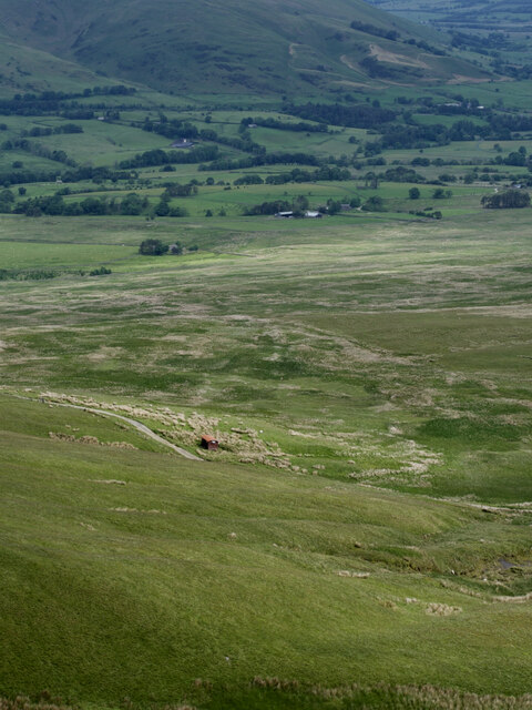
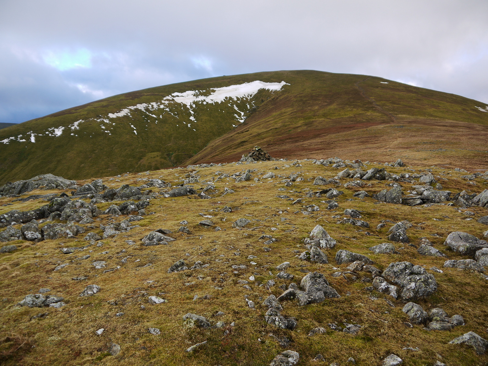
Barbaryrigg Moss, located in Cumberland, England, is a captivating expanse of moorland nestled within the Cumberland Downs. Covering a vast area of approximately 500 acres, this moss is a significant natural feature in the region. The moss is characterized by its boggy and marshy terrain, with numerous pools and channels interlacing throughout the landscape.

The moss is known for its rich biodiversity, supporting a wide array of plant and animal species. It is home to various species of mosses and lichens, creating a lush carpet-like covering on the ground. The dense vegetation also includes heather and cotton grass, which add bursts of vibrant colors to the moss during the blooming season.

Barbaryrigg Moss plays a crucial role in the local ecosystem, acting as a natural habitat for numerous bird species. Birdwatchers flock to the area to catch glimpses of red grouse, curlews, and golden plovers, among others. The moss also serves as a breeding ground for several amphibians, including common frogs and smooth newts, which thrive in the wetland environment.

The moss is a popular destination for nature enthusiasts and hikers, offering picturesque views and tranquil surroundings. Walking trails meander through the moss, allowing visitors to explore its diverse flora and fauna. However, caution must be exercised, as the boggy terrain can be treacherous, especially after heavy rainfall.

Barbaryrigg Moss is a testament to the natural beauty and ecological significance of Cumberland. Its unspoiled landscape and thriving ecosystem make it a must-visit destination for those seeking a peaceful retreat in the heart of nature.

If you have any feedback on the listing, please let us know in the comments section below.

Barbaryrigg Moss Images

Images are sourced within 2km of 54.597015/-2.9926169 or Grid Reference NY3522. Thanks to Geograph Open Source API. All images are credited.

Barbaryrigg Fold Barbaryrigg Fold on Barbary Rigg beside the Old Coach Road.
Barbaryrigg Fold
Barbaryrigg Fold on Barbary Rigg beside the Old Coach Road.
Rowantree Fold
Rowantree Fold
Threlkeld Common
Threlkeld Common
Threlkeld Common
Threlkeld Common
Boulder, Matterdale Common
Ford, Groovebeck Fold
Path towards Great Dodd
Towards the ground above Wolf Crags
Path towards Great Dodd
Old Coach Road winding west The Old Coach Road crosses the ground north of the main spine of the Eastern Fells of the Lake District connecting Dockray with St. John's in the Vale. It's seen here heading west, approaching Groove Beck.
Old Coach Road winding west
The Old Coach Road crosses the ground north of the main spine of the Eastern Fells of the Lake District connecting Dockray with St. John's in the Vale. It's seen here heading west, approaching Groove Beck.
Hill track on north side of Groove Beck The track at this point coincides nearly with the route of a bridleway.  The shallow valley is that of the Groove Beck and the distant mountain is Great Dodd.
Hill track on north side of Groove Beck
The track at this point coincides nearly with the route of a bridleway. The shallow valley is that of the Groove Beck and the distant mountain is Great Dodd.
Whams Moss Whams Moss, a dreary boggy area, lies on the northern side of High Brow which is the minor hill rising above.
Whams Moss
Whams Moss, a dreary boggy area, lies on the northern side of High Brow which is the minor hill rising above.
Peat banks at Brut Moss Brut Moss lies on the rounded ridge of Great Dodd below the rockiness at Randerside. Hart Side is the mountain in the distance.
Peat banks at Brut Moss
Brut Moss lies on the rounded ridge of Great Dodd below the rockiness at Randerside. Hart Side is the mountain in the distance.
Wolf Crags
Wolf Crags
Mart Crag-lonely tree
Shelter by the Old Coach Road Shelter or lightning conductor or Faraday Cage
Shelter by the Old Coach Road
Shelter or lightning conductor or Faraday Cage
Moorland with plantation beyond The view is eastwards from a path close to the mapped line of a bridleway north of the farm at Lobbs. The hill cone is Great Mell Fell.
Moorland with plantation beyond
The view is eastwards from a path close to the mapped line of a bridleway north of the farm at Lobbs. The hill cone is Great Mell Fell.
Gate on line of bridleway The fence crosses moorland in the vicinity of Whitesike Moss; the bridleway connects the farm at Lobbs with the 'Old Coach Road'.
Gate on line of bridleway
The fence crosses moorland in the vicinity of Whitesike Moss; the bridleway connects the farm at Lobbs with the 'Old Coach Road'.
Show me another place!

Barbaryrigg Moss is located at Grid Ref: NY3522 (Lat: 54.597015, Lng: -2.9926169)

Administrative County: Cumbria

District: Eden

Police Authority: Cumbria

What 3 Words

///factoring.helpers.slipped. Near Keswick, Cumbria

Related Wikis

Mosedale Beck (Glenderamackin)

Mosedale Beck is a river in Cumbria, England, which rises on the northern slopes of Great Dodd and flows north east, to the south of Clough Head before...

Clough Head

Clough Head ( ) (meaning: hill-top above the ravine) is a fell, or hill, in the English Lake District. It marks the northern end of the main ridge of the...

Great Dodd

Great Dodd (meaning: big round hill) is a mountain or fell in the English Lake District. It stands on the main ridge of the Helvellyn range, a line of...
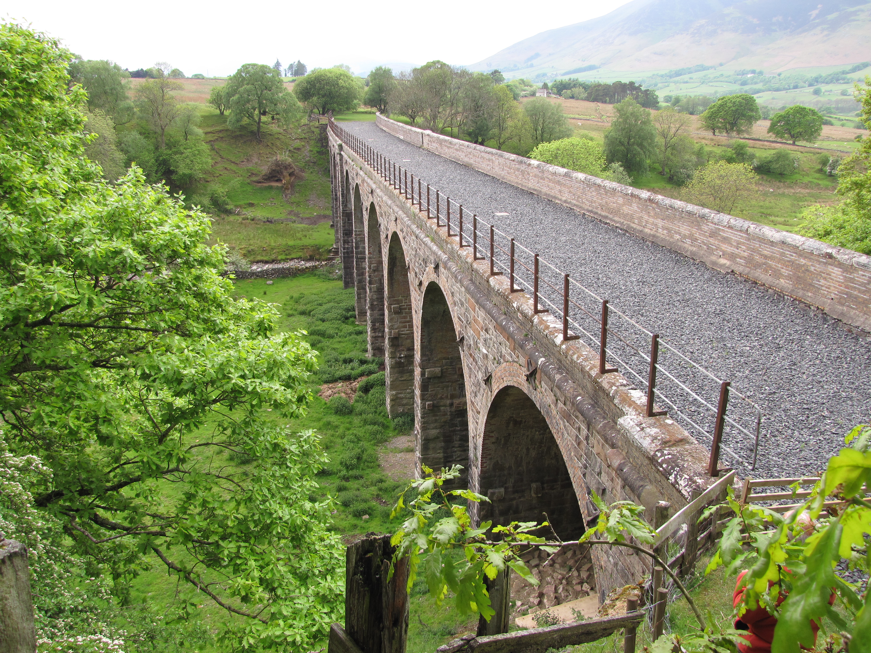
Mosedale Viaduct

The Mosedale Viaduct carried the Cockermouth, Keswick and Penrith Railway over Mosedale Beck until its closure in 1972. Building work on the viaduct...

Nearby Amenities

Located within 500m of 54.597015,-2.9926169
Wolfcrag Moss
Place: locality
Lat/Long: 54.5944392/-2.9945377
Barbary Rigg
Place: locality
Lat/Long: 54.595056/-2.9934247
Barbary Fold
Place: locality
Lat/Long: 54.595766/-2.9926452
The data included in this document is from www.openstreetmap.org. The data is made available under ODbL.

Have you been to Barbaryrigg Moss?

Leave your review of Barbaryrigg Moss below (or comments, questions and feedback).