Black Moss

Downs, Moorland in Cumberland Allerdale

England

Black Moss

Carrock Beck ford On the minor road that skirts the eastern edge of the fells south of Hesket Newmarket.
Carrock Beck ford Credit: Gordon Hatton

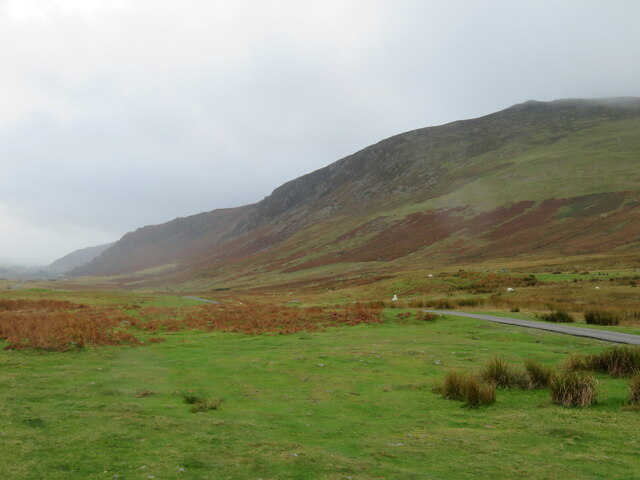
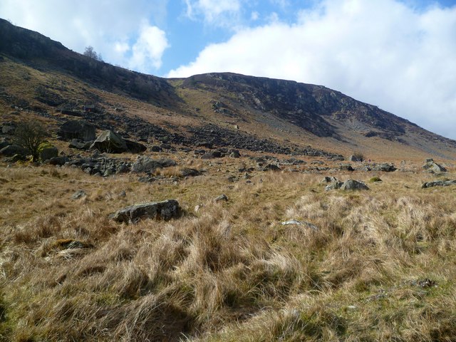
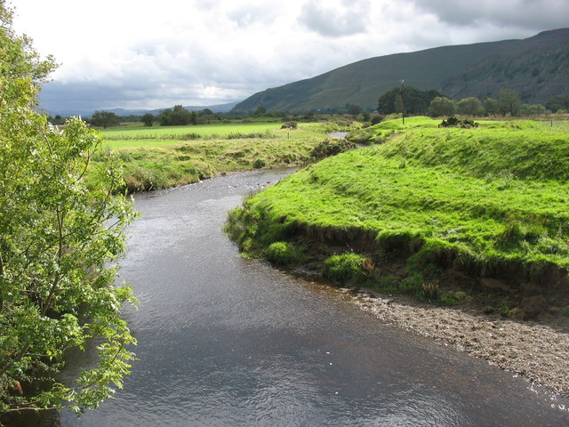
Black Moss is a vast expanse of moorland located in the Cumberland region of England. It stretches across an area of approximately 1,500 hectares, encompassing a diverse range of habitats and landscapes. The moorland is characterized by its dark, peaty soil and is covered with a thick layer of black moss, hence its name.

The vegetation in Black Moss is predominantly heather, which flourishes in the acidic and nutrient-poor conditions of the moorland. This provides a stunning display of purple hues during the summer months. Other plant species found here include cotton grass, bilberry, and sphagnum mosses.

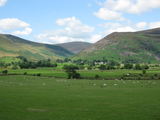
The area is known for its rich birdlife, with a variety of species making their homes in Black Moss. The moorland provides an ideal habitat for ground-nesting birds such as golden plovers, curlews, and lapwings. Birds of prey such as kestrels and merlins can also be spotted soaring above the moors.

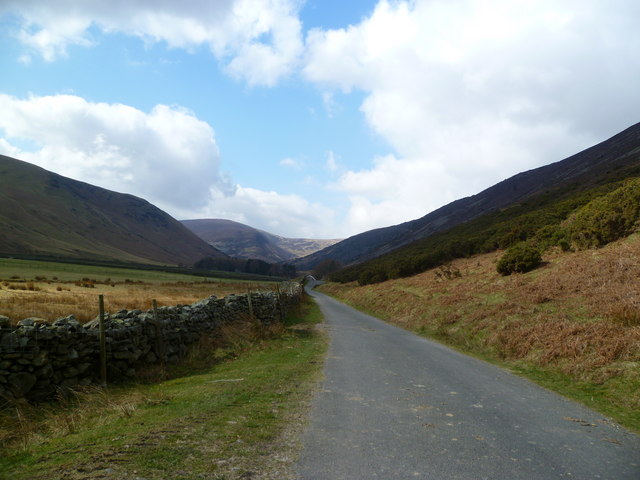
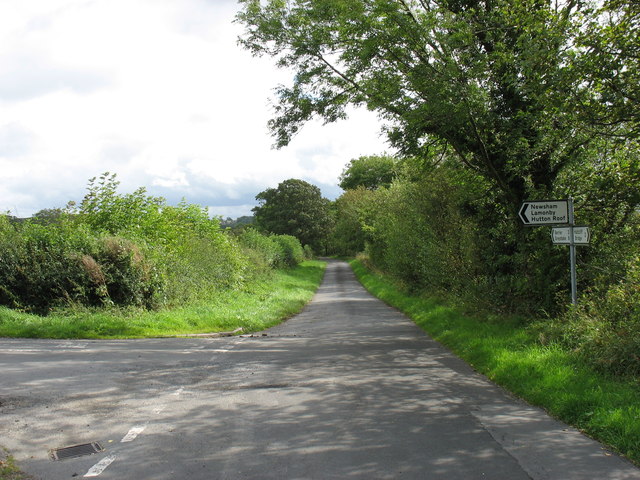
Black Moss is a popular destination for outdoor enthusiasts and nature lovers alike. It offers a network of footpaths and trails, allowing visitors to explore the stunning landscapes and observe the diverse wildlife. The moorland also provides a peaceful retreat, with its vast open spaces and panoramic views of the surrounding countryside.

Efforts have been made to conserve and protect the unique habitat of Black Moss. Conservation organizations and local authorities have implemented initiatives to manage the moorland, ensuring its long-term preservation for future generations to enjoy.

If you have any feedback on the listing, please let us know in the comments section below.

Black Moss Images

Images are sourced within 2km of 54.697203/-3.0014236 or Grid Reference NY3534. Thanks to Geograph Open Source API. All images are credited.

Carrock Beck ford On the minor road that skirts the eastern edge of the fells south of Hesket Newmarket.
Carrock Beck ford
On the minor road that skirts the eastern edge of the fells south of Hesket Newmarket.
Moorland road below Carrock Fell One of those Lake District days when the fells are cloaked in cloud and drizzle fills the air, whilst to the east the sun shines over the Vale of Eden. Here the minor road heading south towards Mosedale runs along under the steep slopes of Carrock Fell.
Moorland road below Carrock Fell
One of those Lake District days when the fells are cloaked in cloud and drizzle fills the air, whilst to the east the sun shines over the Vale of Eden. Here the minor road heading south towards Mosedale runs along under the steep slopes of Carrock Fell.
Old mine spoil below Carrock Fell There's not much to see here except areas of stone waste along what appears to be a quarried area. I wasn't sure what type of mining was done here, so was on the lookout for such as galena, fluorspar, or greenish rocks that might indicate copper deposits. Checking the area on old OS maps, the first edition shows a copper mine here, but no indication of shafts or levels. Later editions of the 6 inch map fail to show anything.
Old mine spoil below Carrock Fell
There's not much to see here except areas of stone waste along what appears to be a quarried area. I wasn't sure what type of mining was done here, so was on the lookout for such as galena, fluorspar, or greenish rocks that might indicate copper deposits. Checking the area on old OS maps, the first edition shows a copper mine here, but no indication of shafts or levels. Later editions of the 6 inch map fail to show anything.
Boulder under Carrock Fell One of many on the Common by Carrock Beck
Boulder under Carrock Fell
One of many on the Common by Carrock Beck
Carrock Beck At Rospow Hills
Carrock Beck
At Rospow Hills
Carrock Beck Near Rospow Hills
Carrock Beck
Near Rospow Hills
Descending Carrock Fell On the north flank looking towards High Pike
Descending Carrock Fell
On the north flank looking towards High Pike
Apronful of Stones Under Carrock Fell. Similar names appear in other places in the Lakes i.e. Sampson's Bratful and relate to legends about giants or the devil who carried stones in an apron.
Apronful of Stones
Under Carrock Fell. Similar names appear in other places in the Lakes i.e. Sampson's Bratful and relate to legends about giants or the devil who carried stones in an apron.
In Mosedale Quiet valley between Bowscale and Carrock Fells
In Mosedale
Quiet valley between Bowscale and Carrock Fells
Village of Mosedale overshadowed  by Carrock Fell Coomb Height in background.
Village of Mosedale overshadowed by Carrock Fell
Coomb Height in background.
Approaching the summit of Carrock Fell
A minor road junction north of Mosedale
Houses at High Row The little bridge crosses the Carrock Beck.
Houses at High Row
The little bridge crosses the Carrock Beck.
The River Caldew Looking south (upstream).
The River Caldew
Looking south (upstream).
The road junction for Hutton Roof
The footpath from Hutton Roof to Low Mill Judging by appearances, this footpath is not much used.
The footpath from Hutton Roof to Low Mill
Judging by appearances, this footpath is not much used.
Brow Top Farm, Hutton Roof
In Hutton Roof This, now a private house, is presumably the former pub which is still marked on the OS maps. At least, I could find no other likely contender in this very small village.
In Hutton Roof
This, now a private house, is presumably the former pub which is still marked on the OS maps. At least, I could find no other likely contender in this very small village.
Show me another place!

Black Moss is located at Grid Ref: NY3534 (Lat: 54.697203, Lng: -3.0014236)

Administrative County: Cumbria

District: Allerdale

Police Authority: Cumbria

What 3 Words

///airfields.glades.colleague. Near Keswick, Cumbria

Nearby Locations

Long Hill Black Moss

Related Wikis

Carrock Fell

Carrock Fell is a fell in the English Lake District, situated in the northern region of the national park, 8 miles (13 kilometres) north-east of Keswick...

Hutton Roof, Eden

Hutton Roof is a hamlet and former civil parish, now in the parish of Mungrisdale, in the Westmorland and Furness district, in the ceremonial county of...

Mosedale, Cumbria

Mosedale is a hamlet and former civil parish, now in the parish of Mungrisdale in the Eden district, in the county of Cumbria, in the north west of the...

Bowscale

Bowscale is a hamlet and former civil parish, now in the parish of Mungrisdale, in the Eden district, in the county of Cumbria, England. In 1931 the parish...

Haltcliff Bridge

Haltcliff Bridge or Haltcliffe Bridge is a hamlet on the River Caldew, in the civil parish of Mungrisdale in the county of Cumbria, England. The spelling...

High Pike

High Pike is a fell in the northern part of the English Lake District, it is located 4+1⁄2 kilometres (2+3⁄4 miles) south of Caldbeck. It has a height...

Mungrisdale

Mungrisdale is a small village and civil parish in the north east of the English Lake District in Cumbria. It is also the name of the valley in which...

Bowscale Fell

Bowscale Fell is a hill in the English Lake District. It rises above the village of Mungrisdale in the Northern Fells. Bowscale Fell stands at the extreme...

Nearby Amenities

Located within 500m of 54.697203,-3.0014236
Linewath
Place: locality
Lat/Long: 54.699675/-3.0002147
Abandoned: yes
Man Made: mine
Lat/Long: 54.6941065/-3.0055634
Black Dub
Place: locality
Lat/Long: 54.6979216/-3.0071296
Abandoned: yes
Direction: 250
Man Made: adit
Lat/Long: 54.6983132/-3.008043
Abandoned: yes
Direction: 250
Man Made: adit
Lat/Long: 54.6976267/-3.0077294
Black Moss
Place: locality
Lat/Long: 54.6959675/-3.0004652
Apronfull Of Stones
Place: locality
Lat/Long: 54.6949203/-3.0072987
Barrier: cattle_grid
Lat/Long: 54.6932859/-3.0029543
Information: guidepost
Tourism: information
Lat/Long: 54.699243/-3.0059118
Power: pole
Lat/Long: 54.6941406/-2.9963687
Power: pole
Lat/Long: 54.6950686/-2.9961179
Power: pole
Lat/Long: 54.6960023/-2.9958892
Power: pole
Lat/Long: 54.6969516/-2.9956605
Power: pole
Lat/Long: 54.6978868/-2.99542
Power: pole
Lat/Long: 54.6988161/-2.995181
Power: pole
Lat/Long: 54.6975542/-2.9967695
Power: pole
Lat/Long: 54.6981852/-2.9979229
Power: pole
Lat/Long: 54.6988047/-2.9990368
Power: pole
Lat/Long: 54.6994129/-3.000168
Power: pole
Lat/Long: 54.6979237/-2.9940252
The data included in this document is from www.openstreetmap.org. The data is made available under ODbL.

Have you been to Black Moss?

Leave your review of Black Moss below (or comments, questions and feedback).