Brae of Cordamff

Downs, Moorland in Angus

Scotland

Brae of Cordamff

Island on dry land After a dry summer, the River South Esk is rarely more than a foot deep. But here it widens for a moment and creates a still, dark, deep water.
Island on dry land Credit: Aleks Scholz

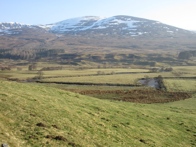
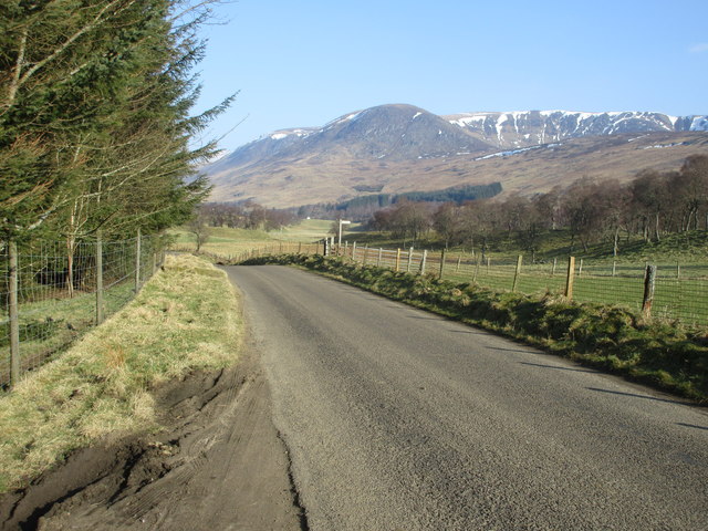
Brae of Cordamff is a picturesque area located in the county of Angus, Scotland. Situated amidst the stunning landscape of Downs and Moorland, this region offers breathtaking views and a tranquil atmosphere.

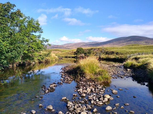
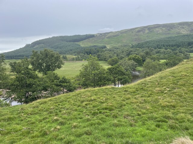
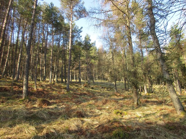
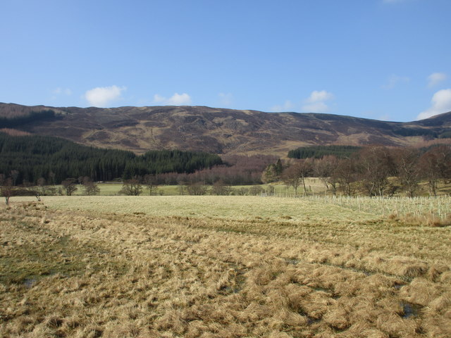
Covering an expansive area, Brae of Cordamff is known for its rolling hills, vast meadows, and scattered woodlands. The diverse terrain attracts nature enthusiasts and hikers, providing ample opportunities for outdoor activities such as walking, birdwatching, and photography.

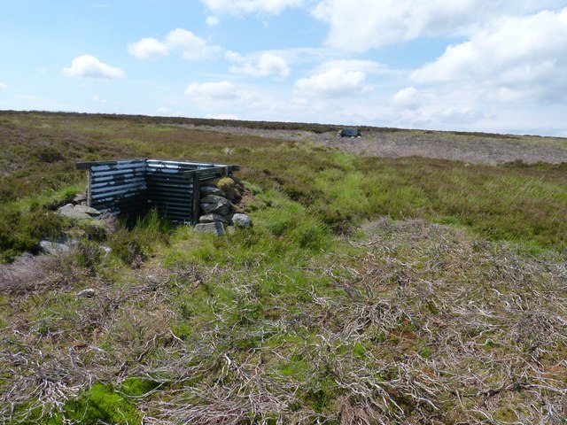
The area is characterized by its rich biodiversity, with a variety of plant and animal species calling Brae of Cordamff their home. Visitors can expect to encounter a wide range of wildlife, including deer, rabbits, and various bird species. The flora is equally impressive, boasting vibrant wildflowers and ancient trees that create a vibrant and enchanting environment.

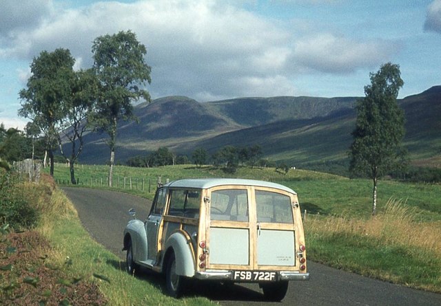
Those seeking a peaceful retreat will find solace in the secluded charm of Brae of Cordamff. The area offers a sense of serenity and provides an escape from the bustling city life. The absence of urbanization and the untouched beauty of the landscape make it an ideal destination for nature lovers and those looking to reconnect with the natural world.

In conclusion, Brae of Cordamff in Angus, Scotland, is a captivating region renowned for its stunning Downs and Moorland scenery. Its diverse terrain, abundant wildlife, and tranquil ambiance make it a perfect destination for outdoor enthusiasts and those seeking a peaceful retreat in the heart of nature.

If you have any feedback on the listing, please let us know in the comments section below.

Brae of Cordamff Images

Images are sourced within 2km of 56.816685/-3.0842506 or Grid Reference NO3369. Thanks to Geograph Open Source API. All images are credited.

Island on dry land After a dry summer, the River South Esk is rarely more than a foot deep. But here it widens for a moment and creates a still, dark, deep water.
Island on dry land
After a dry summer, the River South Esk is rarely more than a foot deep. But here it widens for a moment and creates a still, dark, deep water.
Just see the River
Just see the River
Glen Clova
Glen Clova
Bends on the River South Esk The River South Esk taking a meandering course, with Ben Tirran in the background.
Bends on the River South Esk
The River South Esk taking a meandering course, with Ben Tirran in the background.
Drums Plantation Looking up the western side of Glen Clova at Drums Plantation.
Drums Plantation
Looking up the western side of Glen Clova at Drums Plantation.
B955 heading for Clova The B955 heading north-westwards with Ben Reid and the snow-flecked Corrie of Clova in the distance.
B955 heading for Clova
The B955 heading north-westwards with Ben Reid and the snow-flecked Corrie of Clova in the distance.
Looking across Glen Clova Looking westwards across the glen from the eastern side of the B955.
Looking across Glen Clova
Looking westwards across the glen from the eastern side of the B955.
The minister's path Tradition has it that the minister from Glen Prosen Kirk also preached in the Kirk of Glen Clova and made his way between them along this hill track across the moor. Some say he walked, some that he rode a pony and others that he used a pony and trap. Along this section he could well have used any of these methods.
The minister's path
Tradition has it that the minister from Glen Prosen Kirk also preached in the Kirk of Glen Clova and made his way between them along this hill track across the moor. Some say he walked, some that he rode a pony and others that he used a pony and trap. Along this section he could well have used any of these methods.
The minister's path Tradition has it that the minister from Glen Prosen Kirk also preached in the Kirk of Glen Clova and made his way between them along this hill track across the moor. Some say he walked, some that he rode a pony and others that he used a pony and trap. At this point the descent into Glen Clova is about to begin.
The minister's path
Tradition has it that the minister from Glen Prosen Kirk also preached in the Kirk of Glen Clova and made his way between them along this hill track across the moor. Some say he walked, some that he rode a pony and others that he used a pony and trap. At this point the descent into Glen Clova is about to begin.
Gated fence On a boggy section of the minister's path where it crosses the Hillochs of Hudenkey on the watershed between Glen Prosen and Glen Clova.
Gated fence
On a boggy section of the minister's path where it crosses the Hillochs of Hudenkey on the watershed between Glen Prosen and Glen Clova.
Butt on the moor A rather prosaic looking corrugated-iron grouse butt on the moor near Downie Hillock.
Butt on the moor
A rather prosaic looking corrugated-iron grouse butt on the moor near Downie Hillock.
Dead as mutton A sheep's skull on the grouse moor.
Dead as mutton
A sheep's skull on the grouse moor.
Slightly more benign conditions on the South Esk A less wintery scene than that in <a href="https://www.geograph.org.uk/photo/1744648">NO3471 : River South Esk</a>
Slightly more benign conditions on the South Esk
A less wintery scene than that in NO3471 : River South Esk
B955 below the Craigs of Inchdowrie The western limb of the road up Glen Clova. Snow is still lingering even on south-facing slopes at the head of the Glen.
B955 below the Craigs of Inchdowrie
The western limb of the road up Glen Clova. Snow is still lingering even on south-facing slopes at the head of the Glen.
A big meander on the River South Esk
Glen Clova Looking across the Glen from Newbigging. The gash on the hillside is the Burn of North Inchdowrie <a href="https://www.geograph.org.uk/gridref/NO3472">NO3472</a>. Note the zigzag path climbing the hill to the left of the burn.
Glen Clova
Looking across the Glen from Newbigging. The gash on the hillside is the Burn of North Inchdowrie NO3472. Note the zigzag path climbing the hill to the left of the burn.
Wester Eggie Cottage on the west side of Glen Clova.
Wester Eggie
Cottage on the west side of Glen Clova.
Start of the Minister's Road, Glen Clova Starting in Drums Plantation, the Minister's Road is a ancient mountain footpath which links the central reach of Glen Clova with Glenprosen village.
Start of the Minister's Road, Glen Clova
Starting in Drums Plantation, the Minister's Road is a ancient mountain footpath which links the central reach of Glen Clova with Glenprosen village.
Show me another place!

Brae of Cordamff is located at Grid Ref: NO3369 (Lat: 56.816685, Lng: -3.0842506)

Unitary Authority: Angus

Police Authority: Tayside

What 3 Words

///collected.speaker.coats. Near Kirriemuir, Angus

Related Wikis

Clova, Angus

Clova is a village in Glen Clova, Angus, Scotland. It lies on the River South Esk, some 12 miles (19 km) north of Kirriemuir. During the 1745 Jacobite...

Ben Tirran

Ben Tirran (896 m) is a mountain in the Grampian Mountains of Scotland. It lies in the vast Mounth area of the eastern Highlands in Angus, on the northern...

Driesh

Driesh (Gaelic: Dris) is a mountain located in the Grampians of Scotland. Apart from Mount Keen (939 m/3,080 ft), it is the most easterly of the Munro...

Five Glens of Angus

The Five Glens of Angus are the five Highland glens located in the western portion of the Angus region of Scotland. The five glens from westernmost to...

Cat Law

Cat Law (671 m) is a hill in the southern Mounth of Scotland, north of Kirriemuir in Angus. A rounded peak, it lies above Strathmore in the south and offers...

Glen Doll

Glen Doll, also sometimes spelt Glendoll, lies within the Cairngorms National Park, Scotland, at the top of Glen Clova, in an area of steep hills, corries...

Nearby Amenities

Located within 500m of 56.816685,-3.0842506
Brae of Cordamff
Place: locality
Lat/Long: 56.8189514/-3.0866413
The data included in this document is from www.openstreetmap.org. The data is made available under ODbL.

Have you been to Brae of Cordamff?

Leave your review of Brae of Cordamff below (or comments, questions and feedback).