Borwick Ground Park

Downs, Moorland in Lancashire South Lakeland

England

Borwick Ground Park

Sheep grazing near Tarn Hows Woods
Sheep grazing near Tarn Hows Woods Credit: Eirian Evans

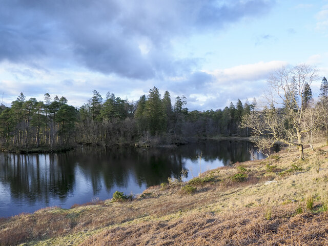
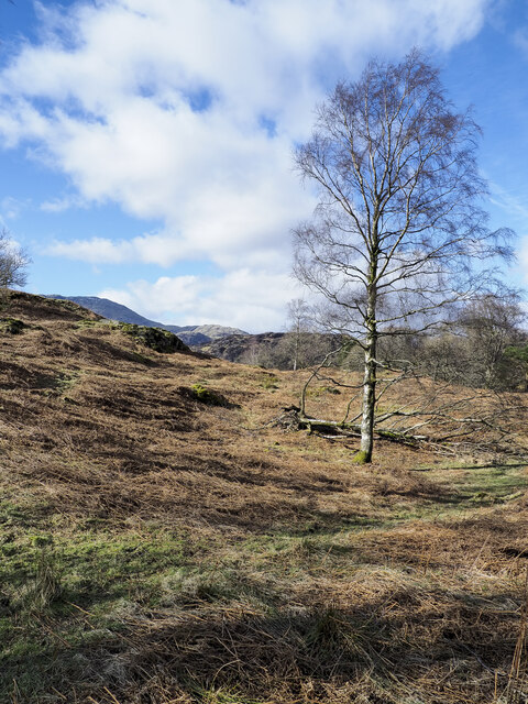
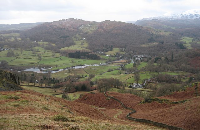
Borwick Ground Park, located in Lancashire, England, is a picturesque natural reserve that encompasses a diverse landscape of downs and moorland. Spanning over a large area, the park offers an array of stunning panoramic views and is a haven for nature enthusiasts and outdoor lovers.

The park's downs are characterized by rolling hills and grasslands, providing a serene and tranquil atmosphere. Here, visitors can enjoy leisurely walks, picnics, or simply bask in the beauty of the surrounding countryside. The downs are home to a variety of flora and fauna, including wildflowers, butterflies, and small mammals, making it an ideal spot for nature photography and birdwatching.

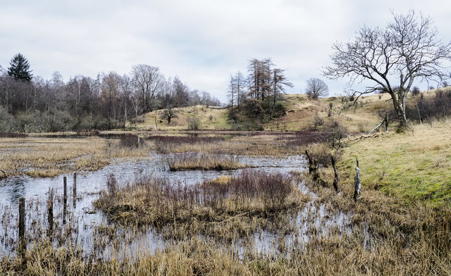
In contrast, the moorland section of Borwick Ground Park offers a more rugged and untamed landscape. With its vast expanses of heather, peat bogs, and rocky outcrops, the moorland provides a unique and challenging terrain for hikers and nature adventurers. The area is also dotted with small streams and ponds, adding to its natural charm.

Aside from its natural beauty, Borwick Ground Park is also known for its historical significance. The park features ancient burial mounds and remnants of Iron Age settlements, providing a glimpse into the region's past.

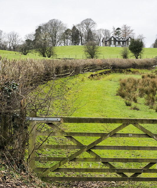
Visitors to Borwick Ground Park can enjoy the various walking trails and pathways that crisscross the park, catering to all levels of fitness and interests. The park also has designated picnic areas, parking facilities, and informational signage to enhance the visitor experience.

Overall, Borwick Ground Park is a captivating natural retreat that offers a blend of downs and moorland, making it a must-visit destination for those seeking tranquility, natural beauty, and a connection with Lancashire's rich history.

If you have any feedback on the listing, please let us know in the comments section below.

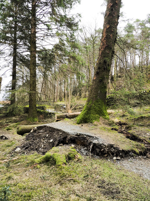
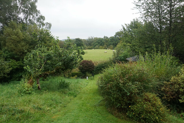
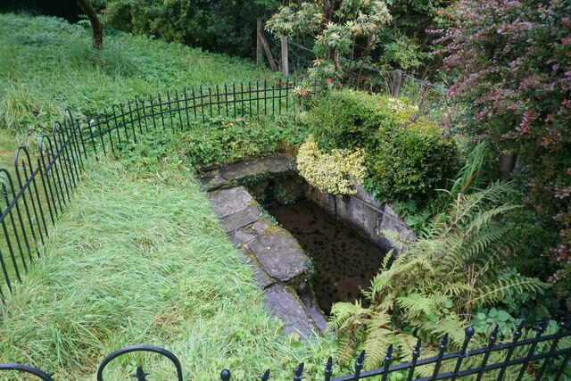
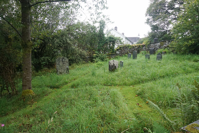
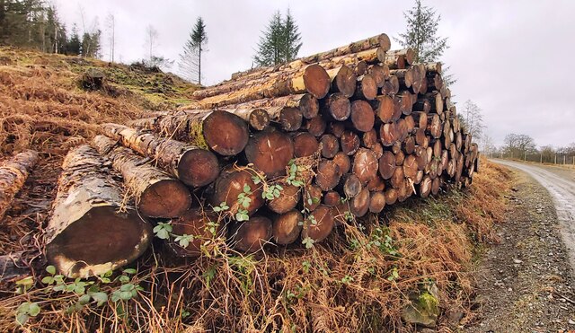
Borwick Ground Park Images

Images are sourced within 2km of 54.390463/-3.0200875 or Grid Reference SD3399. Thanks to Geograph Open Source API. All images are credited.

Sheep grazing near Tarn Hows Woods
Eastern side of Tarn Hows Tarn Hows is an archetypal Lake District location close to the village of Coniston. It's partly an artificial creation, the result of damming one of three tarns to create a larger feature.
Eastern side of Tarn Hows
Tarn Hows is an archetypal Lake District location close to the village of Coniston. It's partly an artificial creation, the result of damming one of three tarns to create a larger feature.
Birch tree on bracken-strewn slope The tree is on a hill slope south-west of Tarn Hows. The bracken is of course dead, the residue of the previous year's growth.
Wetherlam just shows above knolls at the left side horizon.
Birch tree on bracken-strewn slope
The tree is on a hill slope south-west of Tarn Hows. The bracken is of course dead, the residue of the previous year's growth. Wetherlam just shows above knolls at the left side horizon.
Wharton Tarn The tarn is a small area of water lying just over a kilometre south of Tarn Hows. It appears to be infilling with vegetation.
Wharton Tarn
The tarn is a small area of water lying just over a kilometre south of Tarn Hows. It appears to be infilling with vegetation.
Hedge rising at edge of field The B5285 descends alongside the trimmed hedge which appears to have been grown alongside a fence which it is demolishing as it grows. Highfield House is the large residence at the top of the slope.
Hedge rising at edge of field
The B5285 descends alongside the trimmed hedge which appears to have been grown alongside a fence which it is demolishing as it grows. Highfield House is the large residence at the top of the slope.
Damage to woodland path adjacent to road Along this path close to Tarn Hows there are many fallen trees brought down by the storms  of winter 2021-2022. The foreground tree has almost gone and has prised away the path surface passing its base. Sawn tree trunks can be seen beyond and there were many more but not all are victims of those storms. Some felling of trees has been going on because of infection with the Phytophthora ramorum disease.
Damage to woodland path adjacent to road
Along this path close to Tarn Hows there are many fallen trees brought down by the storms of winter 2021-2022. The foreground tree has almost gone and has prised away the path surface passing its base. Sawn tree trunks can be seen beyond and there were many more but not all are victims of those storms. Some felling of trees has been going on because of infection with the Phytophthora ramorum disease.
The western end of Tarn Hows A beautiful place when there is bracken and snow on the hills. The Langdale Pikes are on the skyline.
The western end of Tarn Hows
A beautiful place when there is bracken and snow on the hills. The Langdale Pikes are on the skyline.
Moorland beside Tarn Hows If my memory serves me correct (over 50 years ago) this area was National Trust Land immediately adjacent to Tarn Hows.  Looking at current images and mapping, the location appears to be tree covered. No doubt a Lakeland connoisseur could put me right. At any rate I was circumnavigating Tarn Hows when the image was taken. I believe it is the Coniston Fells snow-covered beyond.
Moorland beside Tarn Hows
If my memory serves me correct (over 50 years ago) this area was National Trust Land immediately adjacent to Tarn Hows. Looking at current images and mapping, the location appears to be tree covered. No doubt a Lakeland connoisseur could put me right. At any rate I was circumnavigating Tarn Hows when the image was taken. I believe it is the Coniston Fells snow-covered beyond.
Tarn Hows, April 1970 A beautiful place before it was sanitised by the National Trust and overwhelmed by visitors.
Tarn Hows, April 1970
A beautiful place before it was sanitised by the National Trust and overwhelmed by visitors.
Looking down on Tarn Hows An interesting comparison with Peter Trimming's May 2013 image  <a href="https://www.geograph.org.uk/photo/3477734">SD3399 : A Quiet day at Tarn Hows</a> but taken in winter 40 years earlier.
Looking down on Tarn Hows
An interesting comparison with Peter Trimming's May 2013 image SD3399 : A Quiet day at Tarn Hows but taken in winter 40 years earlier.
Garden behind Hawkshead Hill Baptist Church A very restful place, which is the intention. At the bottom is an outdoor baptistry.
Garden behind Hawkshead Hill Baptist Church
A very restful place, which is the intention. At the bottom is an outdoor baptistry.
The open air baptistry at Hawkshead Hill It is described by OS as a tank. It is not known how old this is, but the Baptists have been meeting on the site since 1709 when the cottage was registered as a meeting place.
The open air baptistry at Hawkshead Hill
It is described by OS as a tank. It is not known how old this is, but the Baptists have been meeting on the site since 1709 when the cottage was registered as a meeting place.
Graveyard at Hawkshead Hill This accompanies the Baptist Church which has met on this site since 1709. A lot of the early burials did not have a gravestone.
Graveyard at Hawkshead Hill
This accompanies the Baptist Church which has met on this site since 1709. A lot of the early burials did not have a gravestone.
Logs at Low Park
Logs at Low Park
The Cumbria Way near Tarn Hows Cottage The Cumbria Way follows this path near Tarn Hows Cottage (next photograph <a href="https://www.geograph.org.uk/photo/7548651">SD3299 : Gate near Tarn Hows Cottage</a>).
The Cumbria Way near Tarn Hows Cottage
The Cumbria Way follows this path near Tarn Hows Cottage (next photograph SD3299 : Gate near Tarn Hows Cottage).
Gate near Tarn Hows Cottage This gate is on the Cumbria Way long distance path near Tarn Hows Cottage.
The public footpath runs between the buildings here, but the path which The Cumbria Way follows has been diverted to the south avoiding the cottages (photograph <a href="https://www.geograph.org.uk/photo/7650687">SD3299 : Tarn Hows Cottage</a>) which are let as holiday accommodation (next photograph <a href="https://www.geograph.org.uk/photo/7548681">SD3299 : Tarn Hows Cottage access road</a>).
Gate near Tarn Hows Cottage
This gate is on the Cumbria Way long distance path near Tarn Hows Cottage. The public footpath runs between the buildings here, but the path which The Cumbria Way follows has been diverted to the south avoiding the cottages (photograph SD3299 : Tarn Hows Cottage) which are let as holiday accommodation (next photograph SD3299 : Tarn Hows Cottage access road).
Tarn Hows Cottage access road The public footpath runs between the buildings at Tarn Hows Cottage which is let as holiday accommodation.  This access road is the route of The Cumbria Way which has been diverted to pass to the south of the buildings (next photograph <a href="https://www.geograph.org.uk/photo/7550626">SD3299 : The Cumbria Way near Tarn Hows Cottage</a>).
Tarn Hows Cottage access road
The public footpath runs between the buildings at Tarn Hows Cottage which is let as holiday accommodation. This access road is the route of The Cumbria Way which has been diverted to pass to the south of the buildings (next photograph SD3299 : The Cumbria Way near Tarn Hows Cottage).
The Cumbria Way near Tarn Hows Cottage The Cumbria Way follows the access track to Tarn Hows Cottage near Tarn Hows Intake (next photograph <a href="https://www.geograph.org.uk/photo/7655792">SD3299 : The Cumbria Way near Tarn Hows Cottage</a>).
The Cumbria Way near Tarn Hows Cottage
The Cumbria Way follows the access track to Tarn Hows Cottage near Tarn Hows Intake (next photograph SD3299 : The Cumbria Way near Tarn Hows Cottage).
Show me another place!

Borwick Ground Park is located at Grid Ref: SD3399 (Lat: 54.390463, Lng: -3.0200875)

Administrative County: Cumbria

District: South Lakeland

Police Authority: Cumbria

What 3 Words

///together.perplexed.dated. Near Ambleside, Cumbria

Related Wikis

Tarn Hows

Tarn Hows is an area of the Lake District National Park in North West England, It contains a picturesque tarn, approximately 2 miles (3.2 km) northeast...

Hawkshead Hill

Hawkshead Hill is a hamlet in the South Lakeland district, in the county of Cumbria, England. It is in the Lake District National Park. == Location... ==

Black Fell (Lake District)

Black Fell is a fell in the English Lake District. It rises to the north of Tarn Hows, between Coniston and Hawkshead. == Topography == Black Fell is the...

Yew Tree Tarn

Yew Tree Tarn is a small lake in the English Lake District situated in between the towns of Ambleside and Coniston. The tarn was formed when the local...

Hawkshead

Hawkshead is a village and civil parish in Westmorland and Furness, Cumbria, England. Within the boundaries of the historic county of Lancashire, the parish...

Beatrix Potter Gallery

The Beatrix Potter Gallery is a gallery run by the National Trust in a 17th-century stone-built house in Hawkshead, Cumbria, England. It is dedicated to...

Hawkshead Market Hall

Hawkshead Market Hall, also known as Hawkshead Town Hall, is a municipal building in The Square in Hawkshead, Cumbria, England. The building, which is...

St Michael and All Angels Church, Hawkshead

St Michael and All Angels Church is in the village of Hawkshead, Cumbria, England. It is an active Anglican parish church in the deanery of Windermere...

Nearby Amenities

Located within 500m of 54.390463,-3.0200875
Barrier: stile
Lat/Long: 54.3923217/-3.0257897
Borwick Ground Park
Place: locality
Lat/Long: 54.3902609/-3.0192791
Power: pole
Lat/Long: 54.3927073/-3.0144535
Power: pole
Lat/Long: 54.3919943/-3.0146068
Power: pole
Lat/Long: 54.3913674/-3.0147227
Power: pole
Lat/Long: 54.3895198/-3.0151452
Power: pole
Lat/Long: 54.3884144/-3.0153163
Power: pole
Lat/Long: 54.3878019/-3.0158315
Power: pole
Lat/Long: 54.3869954/-3.0164715
The data included in this document is from www.openstreetmap.org. The data is made available under ODbL.

Have you been to Borwick Ground Park?

Leave your review of Borwick Ground Park below (or comments, questions and feedback).