Common Moss

Downs, Moorland in Lancashire South Lakeland

England

Common Moss

A593 to Skelwith Bridge Looking along the road between Coniston and Ambleside.
A593 to Skelwith Bridge Credit: DS Pugh

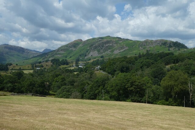
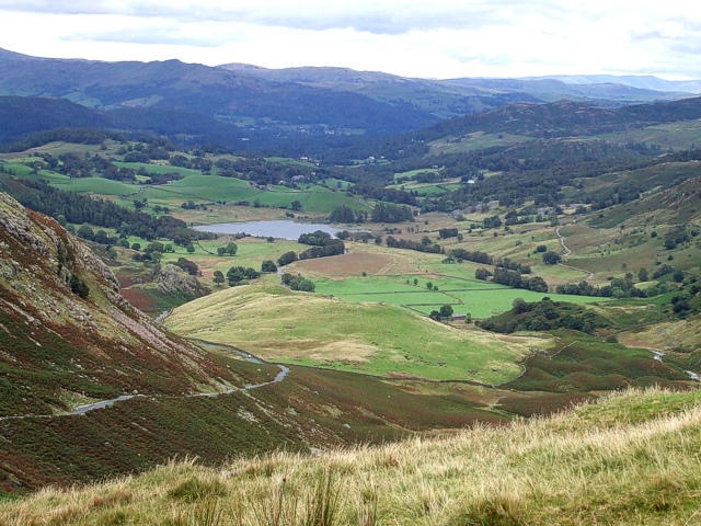
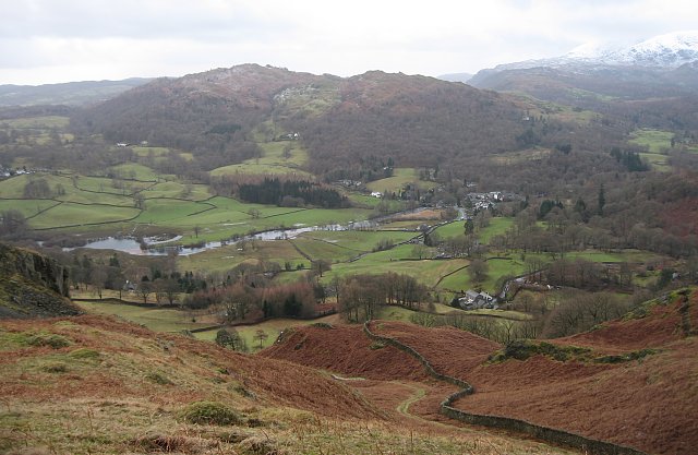
Common Moss, Lancashire, is a picturesque region located in the northern part of England. It is characterized by its diverse ecosystem consisting of downs, moorland, and common mosses. The area spans over vast expanses of rolling hills and scenic landscapes, offering visitors a serene and tranquil environment.

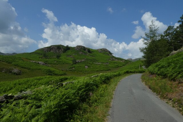
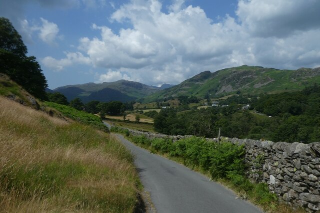
The downs of Common Moss are known for their gentle slopes and lush grasslands. These open spaces are ideal for grazing livestock and are often dotted with sheep and cattle. The downs also provide breathtaking panoramic views of the surrounding countryside, making it a popular spot for hiking enthusiasts and nature lovers.

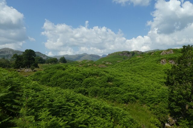
The moorland in Common Moss is characterized by its heather-covered hills and peat bogs. This unique habitat supports a wide range of plant and animal species, including rare birds such as the golden plover and curlew. The moorland is a designated Site of Special Scientific Interest (SSSI) due to its ecological importance.

Common mosses, as the name suggests, are a common feature in this region. These small, green plants thrive in the damp and shaded areas of the mosses, adding to the overall beauty and biodiversity of the area. Visitors can enjoy leisurely walks along the mosses, taking in the serene atmosphere and observing the various moss species that inhabit the region.

In addition to its natural attractions, Common Moss is also home to several charming villages and historic sites. Visitors can explore traditional cottages, visit ancient churches, and learn about the rich cultural heritage of the area.

Overall, Common Moss, Lancashire, offers a unique blend of natural beauty, diverse ecosystems, and historical charm, making it a must-visit destination for those seeking a peaceful and enriching experience.

If you have any feedback on the listing, please let us know in the comments section below.

Common Moss Images

Images are sourced within 2km of 54.41242/-3.045302 or Grid Reference NY3202. Thanks to Geograph Open Source API. All images are credited.

A593 to Skelwith Bridge Looking along the road between Coniston and Ambleside.
A593 to Skelwith Bridge
Looking along the road between Coniston and Ambleside.
Smithy Brow Looking along Smithy Brow from the A593.
Smithy Brow
Looking along Smithy Brow from the A593.
Bracken near Oxen Fell High Cross Looking over the fells from the A593.
Bracken near Oxen Fell High Cross
Looking over the fells from the A593.
Footpath beside the A593 Looking along a footpath on the edge of a sheep field.
Footpath beside the A593
Looking along a footpath on the edge of a sheep field.
Stream in a field Looking across a field beside the A593. The stream is running dry.
Stream in a field
Looking across a field beside the A593. The stream is running dry.
Rough pasture beside the A593 Looking across a field from the footpath along its edge.
Rough pasture beside the A593
Looking across a field from the footpath along its edge.
Logs beside a track Looking along a track leading to Low Oxen Fell.
Logs beside a track
Looking along a track leading to Low Oxen Fell.
Towards Great How Looking across bracken from the track.
Towards Great How
Looking across bracken from the track.
Road beside Tonge Intake Plantation Looking along a track to High Park and Stang End.
Road beside Tonge Intake Plantation
Looking along a track to High Park and Stang End.
Road towards High Park Looking along the track from the A593 to High Park.
Road towards High Park
Looking along the track from the A593 to High Park.
Road and Great How Looking along the road leading to High Park and Stang End.
Road and Great How
Looking along the road leading to High Park and Stang End.
Road passing Great How Looking along the road to High Park.
Road passing Great How
Looking along the road to High Park.
Hay field above High Park Looking across a cut field near Great How.
Hay field above High Park
Looking across a cut field near Great How.
Lane to High Park Looking down the lane to High Park and Stang End.
Lane to High Park
Looking down the lane to High Park and Stang End.
Towards High Park Looking to the farm and tea rooms at High Park.
Towards High Park
Looking to the farm and tea rooms at High Park.
Field near High Park Looking over farmland from the tea rooms at High Park towards Lingmoor.
Field near High Park
Looking over farmland from the tea rooms at High Park towards Lingmoor.
Path to Colwith Force Looking along a path from High Park.
Path to Colwith Force
Looking along a path from High Park.
Lane to Stang End Looking along the lane from High Park to Stang End.
Lane to Stang End
Looking along the lane from High Park to Stang End.
Show me another place!

Common Moss is located at Grid Ref: NY3202 (Lat: 54.41242, Lng: -3.045302)

Administrative County: Cumbria

District: South Lakeland

Police Authority: Cumbria

What 3 Words

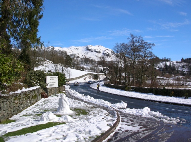
///recitals.trooper.cured. Near Ambleside, Cumbria

Related Wikis

Little Langdale

Little Langdale is a valley in the Lake District, England, containing Little Langdale Tarn and a hamlet also called Little Langdale. A second tarn, Blea...

Slater's Bridge

Slater's Bridge is a traditional packhorse bridge in Little Langdale in the English Lake District, standing at National Grid Reference NY3120502996....

Skelwith

Skelwith is a civil parish in South Lakeland, Cumbria, England, which includes the village of Skelwith Bridge. In the 2001 census the parish had a population...

Yew Tree Tarn

Yew Tree Tarn is a small lake in the English Lake District situated in between the towns of Ambleside and Coniston. The tarn was formed when the local...

Holme Fell

Holme Fell or Holm Fell is a fell in the Lake District in Cumbria, England. It is located between Coniston Water and Little Langdale, almost isolated from...

Black Fell (Lake District)

Black Fell is a fell in the English Lake District. It rises to the north of Tarn Hows, between Coniston and Hawkshead. == Topography == Black Fell is the...

Elter Water

Elter Water is a small lake in the Lake District in North West England, half a mile southeast of the village of the same name. It has a length of 0.62...

Elterwater Bridge

Elterwater Bridge is a Grade II listed single-arch bridge spanning Great Langdale Beck in Elterwater, Cumbria, England. The structure dates to 1702.The...

Nearby Amenities

Located within 500m of 54.41242,-3.045302
Little Fell
Is In Country Code: GB
Is In County: Cumbria
Is In Region: Lake District
Natural: peak
Source: npe
Lat/Long: 54.4140994/-3.046465
Low Fell
Is In Country Code: GB
Is In County: Cumbria
Is In Region: Lake District
Natural: fell
Source: npe
Lat/Long: 54.4099661/-3.0423022
Barrier: cattle_grid
Lat/Long: 54.4159881/-3.043844
Barrier: stile
Lat/Long: 54.4151993/-3.0500519
Barrier: cattle_grid
Lat/Long: 54.4165576/-3.0442791
The Dubs
Place: locality
Lat/Long: 54.4115437/-3.0504422
Great How
Place: locality
Lat/Long: 54.415018/-3.0443729
Common Moss
Place: locality
Lat/Long: 54.4128204/-3.0455638
Sheep Gaps
Place: locality
Lat/Long: 54.4127865/-3.0418
Passing Place
Lat/Long: 54.4165116/-3.0443352
Passing Place
Lat/Long: 54.4153054/-3.0429918
Passing Place
Lat/Long: 54.4132291/-3.0401202
Power: pole
Lat/Long: 54.4101179/-3.0474067
Power: pole
Lat/Long: 54.4097714/-3.0462339
Power: pole
Lat/Long: 54.4105094/-3.0487409
Power: pole
Lat/Long: 54.4163119/-3.0486679
Power: pole
Lat/Long: 54.4087543/-3.0453443
The data included in this document is from www.openstreetmap.org. The data is made available under ODbL.

Have you been to Common Moss?

Leave your review of Common Moss below (or comments, questions and feedback).