Atkinson's Coppice

Wood, Forest in Lancashire South Lakeland

England

Atkinson's Coppice

Elter Water Elter Water in the distance looking to Lingmoor Fell and the Langdale Pikes
Elter Water Credit: Shaun Ferguson

Atkinson's Coppice is a beautiful wood located in Lancashire, England. Covering an area of approximately 50 acres, this enchanting forest is a popular destination for nature lovers and outdoor enthusiasts.

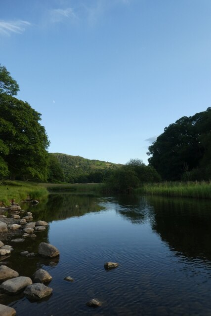
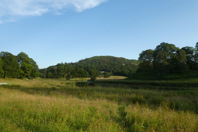
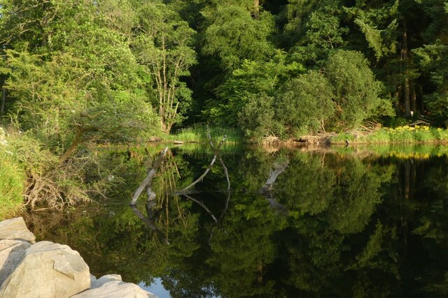
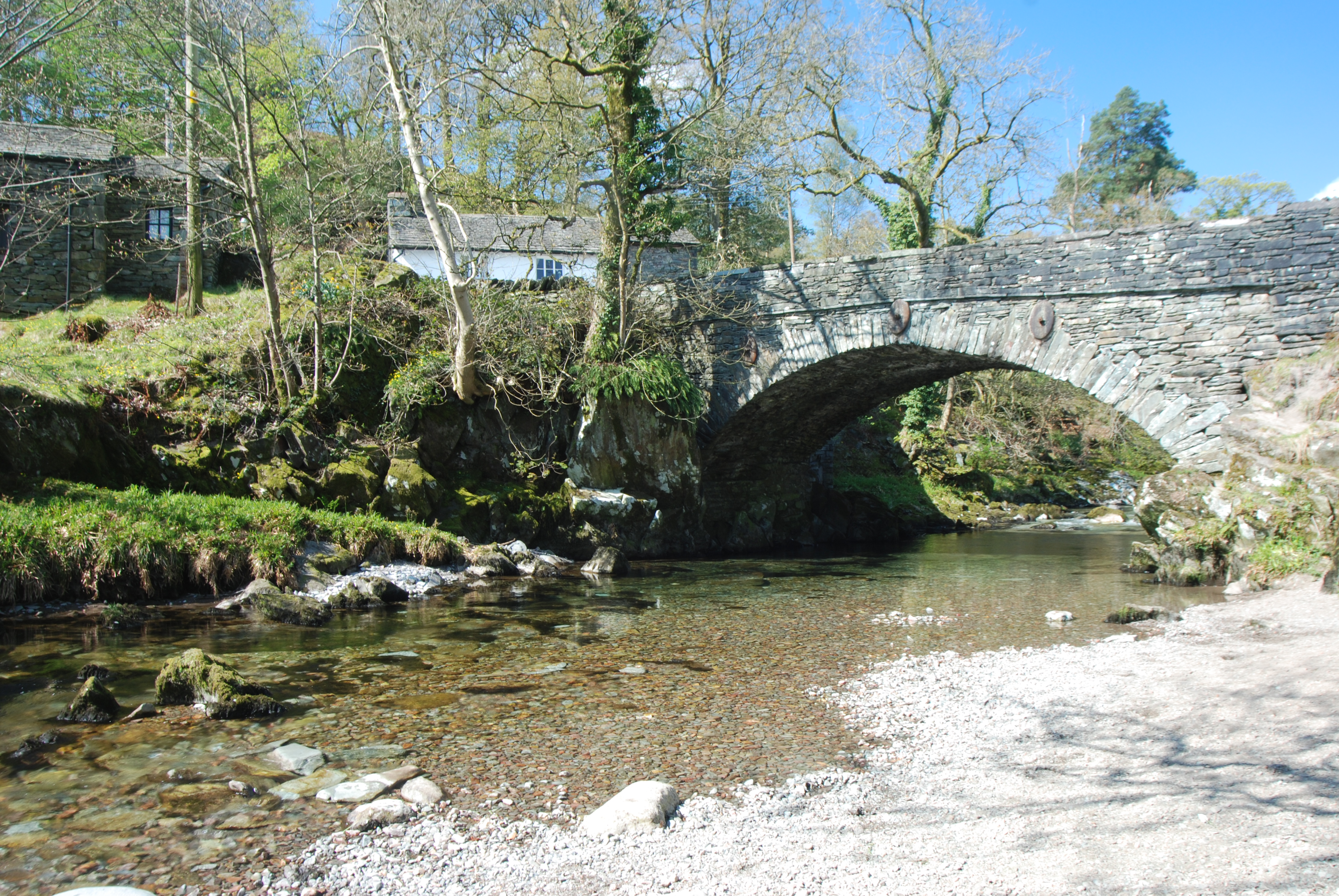
The coppice is predominantly made up of deciduous trees such as oak, birch, and beech, creating a rich and diverse woodland ecosystem. The thick canopy formed by these trees provides a cool and shaded environment, making it a perfect retreat during hot summer months.

Walking through Atkinson's Coppice, visitors are greeted with a symphony of sounds from various bird species, including woodpeckers, thrushes, and owls. The wood is also home to a variety of mammals, including deer, foxes, and rabbits, adding to the wildlife spectacle.

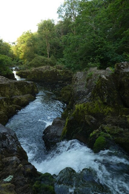
Tranquil streams wind their way through the forest, contributing to the serene atmosphere. These waterways are also home to a multitude of aquatic creatures, such as frogs, newts, and small fish.

Atkinson's Coppice is a haven for outdoor activities, offering well-maintained trails for hiking and cycling. The dense vegetation and undulating terrain make it an ideal location for exploring and discovering hidden gems within the woods.

The wood is managed by a local conservation organization, ensuring the preservation of its natural beauty and protection of its inhabitants. Regular educational programs and guided walks are organized to raise awareness about the importance of conserving this remarkable woodland.

In conclusion, Atkinson's Coppice in Lancashire is a captivating forest that offers a serene and picturesque experience for visitors. With its diverse flora and fauna, it provides a unique opportunity to connect with nature and appreciate the beauty of the natural world.

If you have any feedback on the listing, please let us know in the comments section below.

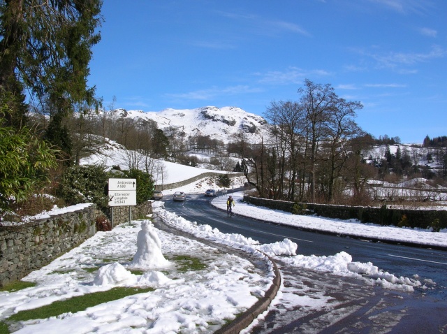
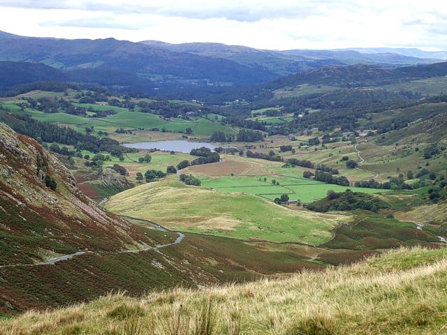
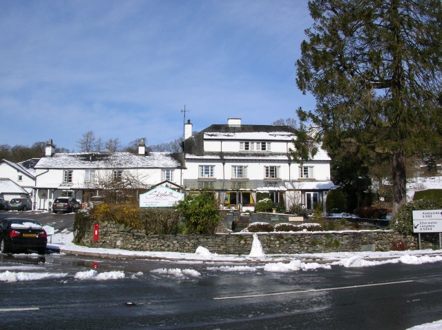
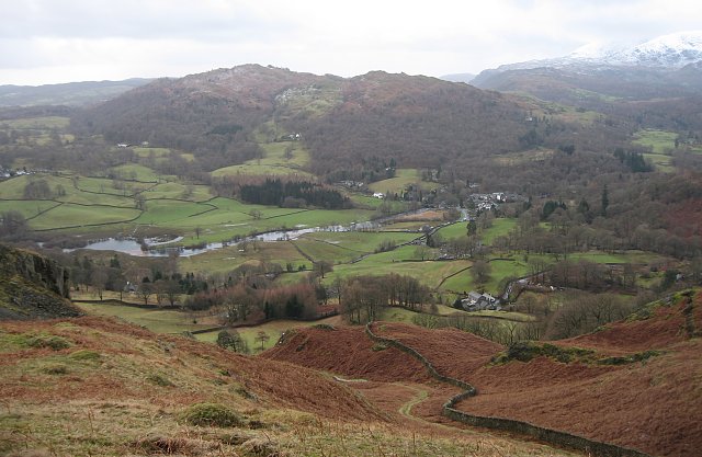
Atkinson's Coppice Images

Images are sourced within 2km of 54.417516/-3.0358309 or Grid Reference NY3202. Thanks to Geograph Open Source API. All images are credited.

Elter Water Elter Water in the distance looking to Lingmoor Fell and the Langdale Pikes
Elter Water
Elter Water in the distance looking to Lingmoor Fell and the Langdale Pikes
Path to Elterwater Path to Elterwater passing Chesters by the River
Path to Elterwater
Path to Elterwater passing Chesters by the River
Field at Loughrigg Fold Looking across towards Loughrigg Tarn.
Field at Loughrigg Fold
Looking across towards Loughrigg Tarn.
Fields beside Great Langdale Beck Looking across farmland from the bridleway between Elterwater and Skelwith Bridge.
Fields beside Great Langdale Beck
Looking across farmland from the bridleway between Elterwater and Skelwith Bridge.
Brathay exiting Elterwater Looking along the River Brathay on a summers' evening.
Brathay exiting Elterwater
Looking along the River Brathay on a summers' evening.
Sun setting over Elterwater Looking across Elterwater on a midsummer's evening.
Sun setting over Elterwater
Looking across Elterwater on a midsummer's evening.
Towards the Brathay Looking towards a wider section of the River Brathay after its exit from Elterwater.
Towards the Brathay
Looking towards a wider section of the River Brathay after its exit from Elterwater.
River Brathay south of Elterwater Looking along a wider section of the Brathay after it has exited Elterwater.
River Brathay south of Elterwater
Looking along a wider section of the Brathay after it has exited Elterwater.
River Brathay near Bridge How Coppice Looking downstream along the river.
River Brathay near Bridge How Coppice
Looking downstream along the river.
Brathay above Skelwith Force Looking along a calm section of the River Brathay downstream of Elterwater.
Brathay above Skelwith Force
Looking along a calm section of the River Brathay downstream of Elterwater.
Down Skelwith Force Looking down a rather empty Skelwith Force.
Down Skelwith Force
Looking down a rather empty Skelwith Force.
A593 to Skelwith Bridge Looking along the road between Coniston and Ambleside.
A593 to Skelwith Bridge
Looking along the road between Coniston and Ambleside.
Smithy Brow Looking along Smithy Brow from the A593.
Smithy Brow
Looking along Smithy Brow from the A593.
Bracken near Oxen Fell High Cross Looking over the fells from the A593.
Bracken near Oxen Fell High Cross
Looking over the fells from the A593.
Footpath beside the A593 Looking along a footpath on the edge of a sheep field.
Footpath beside the A593
Looking along a footpath on the edge of a sheep field.
Stream in a field Looking across a field beside the A593. The stream is running dry.
Stream in a field
Looking across a field beside the A593. The stream is running dry.
Rough pasture beside the A593 Looking across a field from the footpath along its edge.
Rough pasture beside the A593
Looking across a field from the footpath along its edge.
Logs beside a track Looking along a track leading to Low Oxen Fell.
Logs beside a track
Looking along a track leading to Low Oxen Fell.
Show me another place!

Atkinson's Coppice is located at Grid Ref: NY3202 (Lat: 54.417516, Lng: -3.0358309)

Administrative County: Cumbria

District: South Lakeland

Police Authority: Cumbria

What 3 Words

///motivations.undertook.overheat. Near Ambleside, Cumbria

Related Wikis

Skelwith

Skelwith is a civil parish in South Lakeland, Cumbria, England, which includes the village of Skelwith Bridge. In the 2001 census the parish had a population...

Elter Water

Elter Water is a small lake in the Lake District in North West England, half a mile southeast of the village of the same name. It has a length of 0.62...

Little Langdale

Little Langdale is a valley in the Lake District, England, containing Little Langdale Tarn and a hamlet also called Little Langdale. A second tarn, Blea...

Skelwith Bridge

Skelwith Bridge is a small village in the southern area of the Lake District in Cumbria, England. Historically, Skelwith Bridge is part of Westmorland...

Slater's Bridge

Slater's Bridge is a traditional packhorse bridge in Little Langdale in the English Lake District, standing at National Grid Reference NY3120502996....

Elterwater Bridge

Elterwater Bridge is a Grade II listed single-arch bridge spanning Great Langdale Beck in Elterwater, Cumbria, England. The structure dates to 1702.The...

Black Fell (Lake District)

Black Fell is a fell in the English Lake District. It rises to the north of Tarn Hows, between Coniston and Hawkshead. == Topography == Black Fell is the...

Elterwater

Elterwater is a village in the English Lake District and the county of Cumbria. The village lies half a mile (800 m) north-west of the lake of Elter Water...

Nearby Amenities

Located within 500m of 54.417516,-3.0358309
Barrier: stile
Lat/Long: 54.4182863/-3.0310705
Barrier: stile
Lat/Long: 54.4186229/-3.0307866
Barrier: kissing_gate
Lat/Long: 54.4193428/-3.0291253
Colwith Force
Waterway: waterfall
Lat/Long: 54.4193838/-3.0373276
Barrier: stile
Lat/Long: 54.4178621/-3.0323553
Frequency: 0
Generator Method: run-of-the-river
Generator Output Electricity: 7.2 kW
Generator Source: hydro
Power: generator
Lat/Long: 54.4194616/-3.0370027
Post Box
Collection Times: Mo-Fr 16:45; Sa 10:00
Operator: Royal Mail
Post Box Type: lamp
Ref: LA22 196
Royal Cypher: EIIR
Royal Cypher Wikidata: Q33102113
Source: survey
Lat/Long: 54.4159916/-3.0308697
Grit Bin
Lat/Long: 54.4159345/-3.0309701
Give Way
Direction: forward
Lat/Long: 54.4189964/-3.0342452
Parking
Capacity: 3
Fee: no
Park Ride: no
Parking: surface
Supervised: no
Surface: asphalt
Lat/Long: 54.4179021/-3.0326879
Give Way
Direction: forward
Lat/Long: 54.41586/-3.0309329
Forge Wood
Natural: wood
Lat/Long: 54.4195584/-3.0398745
Benson Close
Place: locality
Lat/Long: 54.4208845/-3.0369865
Hiking: yes
Information: guidepost
Source: GPS Survey
Tourism: information
Lat/Long: 54.4178535/-3.032411
Hiking: yes
Information: guidepost
Source: GPS Survey
Tourism: information
Lat/Long: 54.418145/-3.0334604
Power: pole
Lat/Long: 54.416756/-3.0287064
Power: pole
Lat/Long: 54.4209163/-3.0315575
Power: pole
Lat/Long: 54.4200053/-3.0308521
Power: pole
Lat/Long: 54.4197275/-3.0318823
Power: pole
Lat/Long: 54.4196372/-3.0340128
Power: pole
Lat/Long: 54.419853/-3.0357846
Power: pole
Lat/Long: 54.4200589/-3.0374062
Power: pole
Lat/Long: 54.4199841/-3.0385405
Power: pole
Lat/Long: 54.4199179/-3.0392701
Power: pole
Lat/Long: 54.4197938/-3.0401403
Power: pole
Lat/Long: 54.4196598/-3.040928
Power: pole
Lat/Long: 54.4195328/-3.0416867
Power: pole
Lat/Long: 54.4193749/-3.042632
Power: pole
Lat/Long: 54.4202101/-3.0412583
Power: pole
Lat/Long: 54.4171871/-3.028138
The data included in this document is from www.openstreetmap.org. The data is made available under ODbL.

Have you been to Atkinson's Coppice?

Leave your review of Atkinson's Coppice below (or comments, questions and feedback).