Bonny Lands

Downs, Moorland in Herefordshire

England

Bonny Lands

Little Penlan Farm, Dorstone Farm above the Golden Valley
Little Penlan Farm, Dorstone Credit: Philip Halling

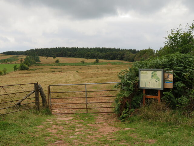
Bonny Lands is a picturesque region located in Herefordshire, England, known for its stunning downs and moorland landscapes. Spanning approximately 200 square miles, it offers a diverse range of natural beauty, making it a popular destination for nature enthusiasts and outdoor adventurers.

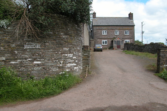
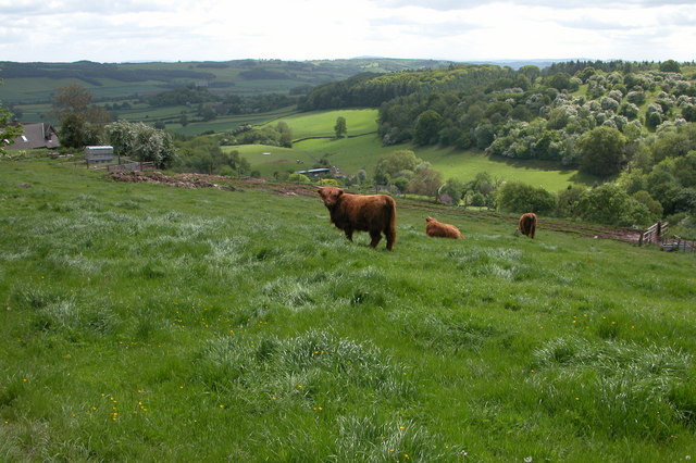
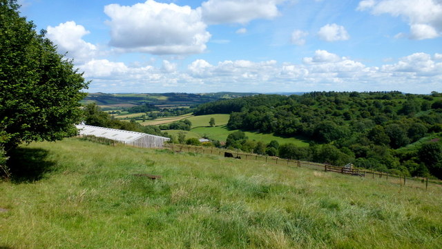
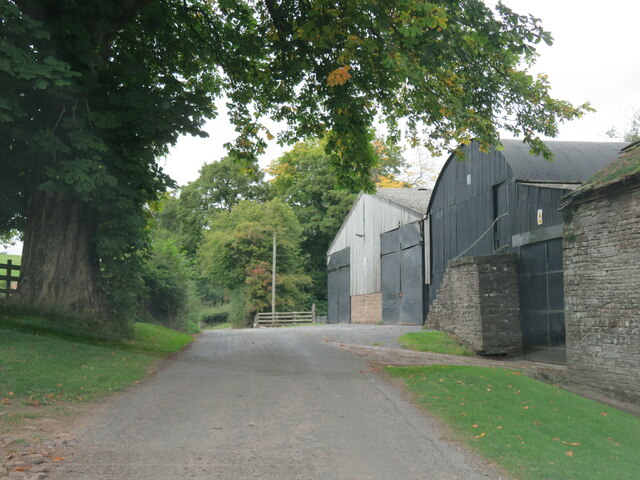
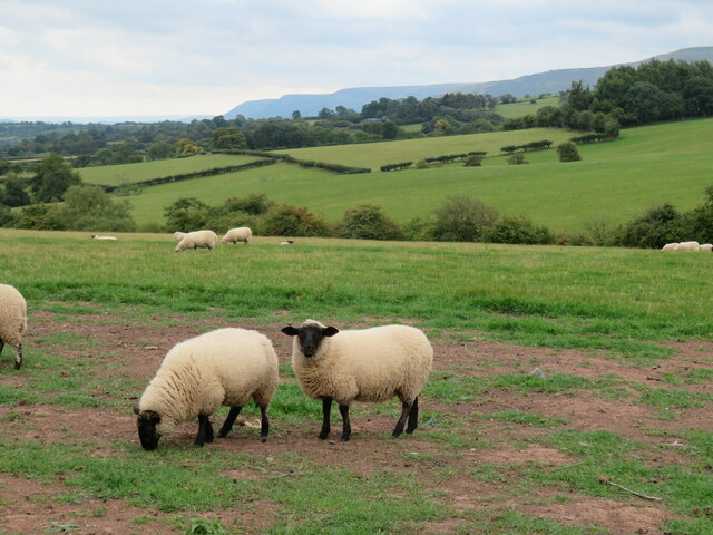
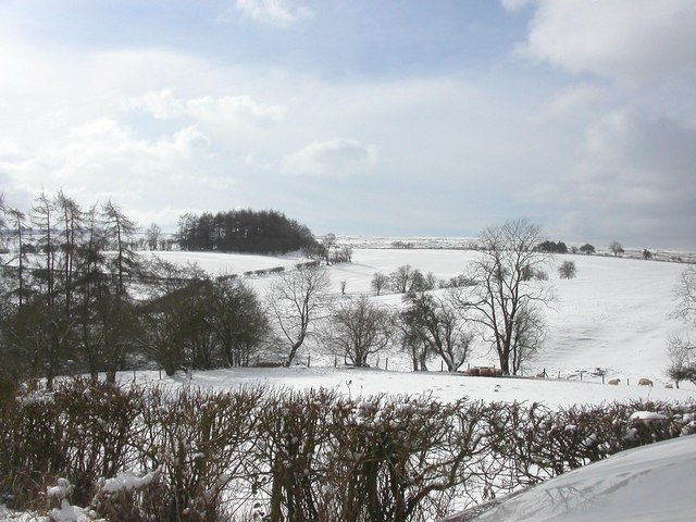
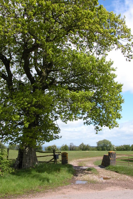
The downs of Bonny Lands are characterized by rolling hills covered in lush grasslands, providing grazing opportunities for livestock. These open spaces offer panoramic views of the surrounding countryside, with charming villages dotting the landscape. The downs are particularly captivating during the spring and summer months when wildflowers bloom, creating a vibrant and colorful tapestry.

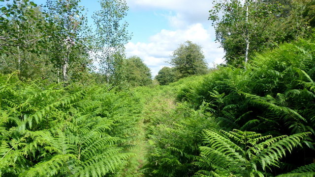
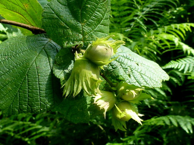
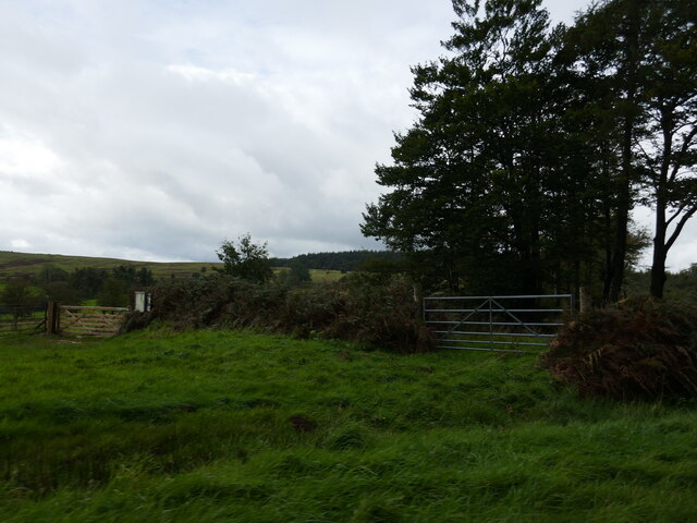
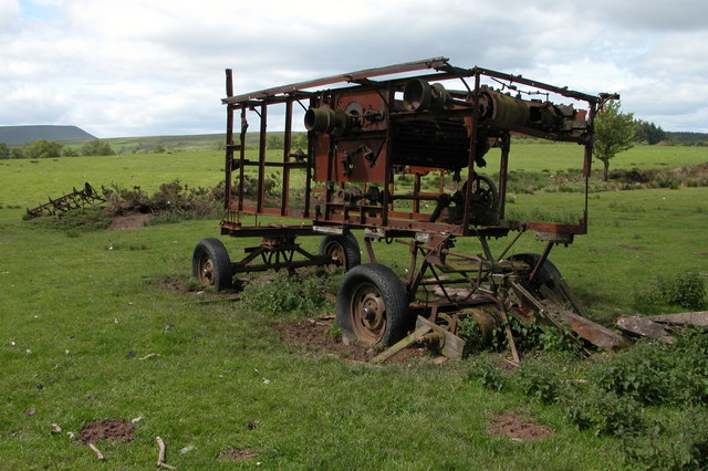
The moorland in Bonny Lands adds another layer of beauty to the region. These expansive areas are covered in heather, gorse, and bracken, providing a habitat for various wildlife species. Visitors can often spot birds of prey, including buzzards and kestrels, soaring above the moors. Additionally, the moorland is home to several species of ground-nesting birds, such as curlews and lapwings, adding to the region's biodiversity.

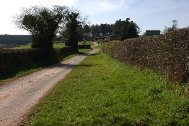
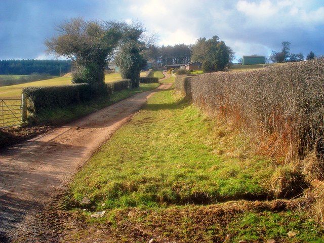
Bonny Lands offers a range of outdoor activities for visitors to enjoy. Hiking and walking trails crisscross the region, providing opportunities to explore the stunning landscapes at a leisurely pace. The area is also popular for cycling, with numerous routes catering to different skill levels. For those seeking a more relaxed experience, there are several picnic spots where visitors can unwind and take in the breathtaking views.

Overall, Bonny Lands in Herefordshire is a captivating region that showcases the natural beauty of downs and moorland landscapes. With its diverse flora and fauna, it offers a tranquil escape for nature lovers and a chance to immerse oneself in the scenic countryside of England.

If you have any feedback on the listing, please let us know in the comments section below.

Bonny Lands Images

Images are sourced within 2km of 52.053166/-3.0373421 or Grid Reference SO2839. Thanks to Geograph Open Source API. All images are credited.

Little Penlan Farm, Dorstone Farm above the Golden Valley
Little Penlan Farm, Dorstone
Farm above the Golden Valley
Highland cattle in Herefordshire Highland cattle in a field opposite Little Penlan Farm, above Dorstone in the Golden Valley.
Highland cattle in Herefordshire
Highland cattle in a field opposite Little Penlan Farm, above Dorstone in the Golden Valley.
Cottage at Common Bach On a steeply-rising lane west of Dorstone.
Cottage at Common Bach
On a steeply-rising lane west of Dorstone.
No through lane Leading to West Lawn; a remote spot west of Dorstone.
No through lane
Leading to West Lawn; a remote spot west of Dorstone.
Park Farm near Snodhill
Sheep pasture at Park Farm Looking north-east across a large field at the top of the hill. Woodbury Hill in the distance. No grass left in this field, so the sheep are relying on hay for feed.
Sheep pasture at Park Farm
Looking north-east across a large field at the top of the hill. Woodbury Hill in the distance. No grass left in this field, so the sheep are relying on hay for feed.
Lane to Park Farm Looking south-west to the farm buildings, which lie at the end of this mile-and-a-half access lane from Snodhill.
Lane to Park Farm
Looking south-west to the farm buildings, which lie at the end of this mile-and-a-half access lane from Snodhill.
Bridleway through West Lawn Common Young birch and hazel has much competition from bracken in this corner of the grid square.
Bridleway through West Lawn Common
Young birch and hazel has much competition from bracken in this corner of the grid square.
Green hazel Immature fruits of Corylus avellana by the bridleway across West Lawn Common.
Green hazel
Immature fruits of Corylus avellana by the bridleway across West Lawn Common.
Common Bach View east from Little Penlan Farm over to the Golden valley between Dorstone and Peterchurch.
Common Bach
View east from Little Penlan Farm over to the Golden valley between Dorstone and Peterchurch.
Barns at Tyuchaf Still in Herefordshire, but now into farms with Welsh names. Tyuchaf/Upper House is by the road from Llanrosser to Hay on Wye over some lonely hill country a few miles east of the border.
Barns at Tyuchaf
Still in Herefordshire, but now into farms with Welsh names. Tyuchaf/Upper House is by the road from Llanrosser to Hay on Wye over some lonely hill country a few miles east of the border.
Gateway into access land Gate giving access to Cefn Hill, a large are of open ground at around the 400m contour.
Gateway into access land
Gate giving access to Cefn Hill, a large are of open ground at around the 400m contour.
Sheep pastures above Escley Brook Sheep grazing in the first of the improved fields close to the moorland of Cefn Hill. The land drops away here towards the head of the Escley Brook, whilst in the distance is the long eastern flank of the Black Mountains.
Sheep pastures above Escley Brook
Sheep grazing in the first of the improved fields close to the moorland of Cefn Hill. The land drops away here towards the head of the Escley Brook, whilst in the distance is the long eastern flank of the Black Mountains.
Entrances to Cefn Hill and New House Wood Both are extensive areas of publicly accessible land.
Entrances to Cefn Hill and New House Wood
Both are extensive areas of publicly accessible land.
Coming down from Vagar Hill The road to Hay had become blocked, our car had got stuck while turning back and some kind passing Australians had just given us a push.
Coming down from Vagar Hill
The road to Hay had become blocked, our car had got stuck while turning back and some kind passing Australians had just given us a push.
Entrance to Penlan Farm This farm is on the eastern slopes of Vagar Hill and about 1000ft above sea level.
Entrance to Penlan Farm
This farm is on the eastern slopes of Vagar Hill and about 1000ft above sea level.
Transmitter mast on Vagar Hill
Rusting old farm machine The rusting skeletal remains of a threshing machine on Vagar Hill. Hay Bluff can be seen in the background on the horizon.
Rusting old farm machine
The rusting skeletal remains of a threshing machine on Vagar Hill. Hay Bluff can be seen in the background on the horizon.
Show me another place!

Bonny Lands is located at Grid Ref: SO2839 (Lat: 52.053166, Lng: -3.0373421)

Unitary Authority: County of Herefordshire

Police Authority: West Mercia

What 3 Words

///jogged.gilding.refrained. Near Dorstone, Herefordshire

Related Wikis

Dorstone Castle

Dorstone Castle was in the village of Dorstone in Herefordshire, England, located 6 miles to the east of Hay-on-Wye. == Motte and bailey == This was a...

Craswall Priory

Craswall Priory was a Grandmontine priory in Herefordshire, England at grid reference SO27253770 dating from 1220 to 1225. The poor condition of the ruins...

Dorstone

Dorstone is a village within the Golden Valley, Herefordshire, England. There is a church and public house with restaurant. The Golden Valley area offers...

Snodhill Castle

Snodhill Castle is a ruined motte-and-bailey castle, about 1 mi (1.6 km) south of the village of Dorstone in west Herefordshire, England. It is recognized...

Nearby Amenities

Located within 500m of 52.053166,-3.0373421
Power: pole
Source: bing
Lat/Long: 52.0519467/-3.0434674
Power: pole
Source: bing
Lat/Long: 52.0520737/-3.044087
Power: pole
Source: bing
Lat/Long: 52.0512765/-3.0401981
Power: pole
Source: bing
Lat/Long: 52.0514607/-3.0410969
Power: pole
Source: bing
Lat/Long: 52.0518241/-3.0428696
Power: pole
Source: bing
Lat/Long: 52.0517146/-3.0423353
Power: pole
Source: bing
Lat/Long: 52.0515986/-3.0417696
Man Made: tower
Tower Type: communication
Lat/Long: 52.0512996/-3.0398628
Bonny Lands Trig Point
Man Made: survey_point
Name Alt: Vagar Hill Trig Point
Ref: S7940
Source: Bing
Tpuk Ref: TP1528
Lat/Long: 52.0510213/-3.0397939
The data included in this document is from www.openstreetmap.org. The data is made available under ODbL.

Have you been to Bonny Lands?

Leave your review of Bonny Lands below (or comments, questions and feedback).