Bleathwaite Moss

Downs, Moorland in Lancashire South Lakeland

England

Bleathwaite Moss

Elizabeth II postbox, Torver Postbox No. LA21 28.
Elizabeth II postbox, Torver Credit: JThomas

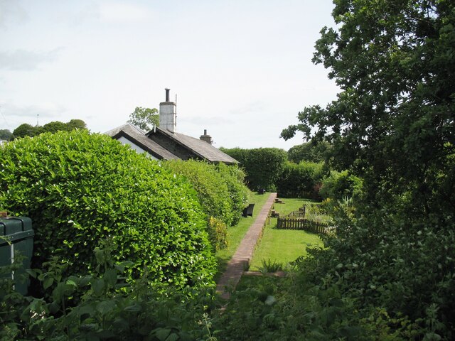
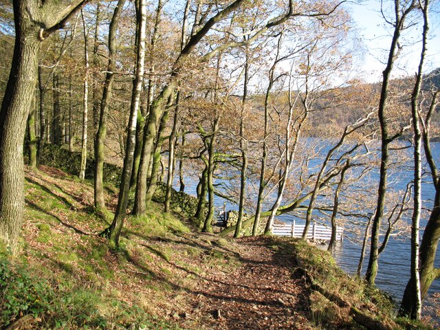
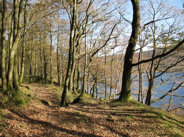
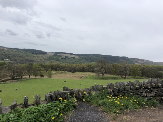
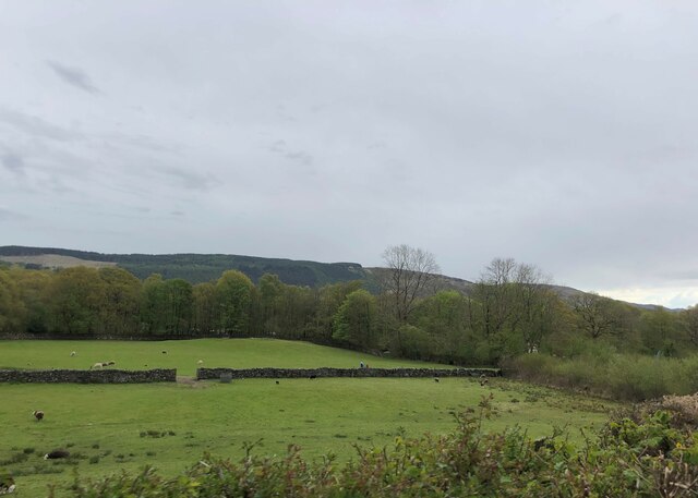
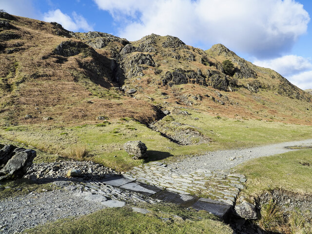
Bleathwaite Moss is a scenic area located in Lancashire, England, known for its vast expanse of downs and moorland. Situated in the northern part of the county, it covers an area of approximately 10 square kilometers. The moss is characterized by its unique landscape, featuring undulating hills, heather-covered moorland, and occasional peat bogs.

The area is renowned for its rich biodiversity and serves as an important habitat for several plant and animal species. The moorland is adorned with vibrant purple heather during the summer months, creating a picturesque sight for visitors. It is also home to a variety of bird species including skylarks, meadow pipits, and curlews, making it a popular destination for birdwatchers.

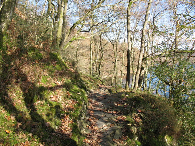
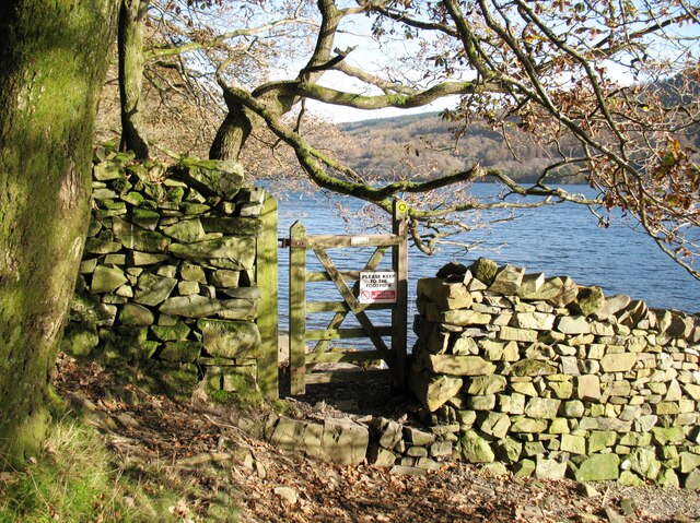
Bleathwaite Moss offers ample opportunities for outdoor activities such as hiking, cycling, and wildlife spotting. Several well-maintained paths and trails crisscross the area, providing stunning views of the surrounding countryside. Explorers can also discover remnants of the area's industrial past, including old mining pits and disused railway tracks.

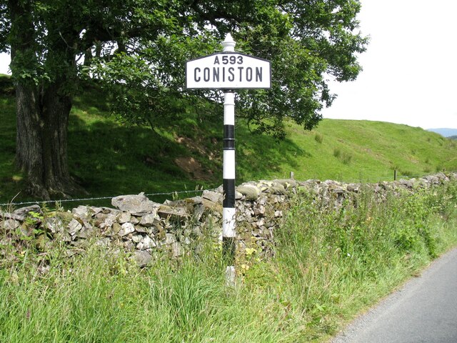
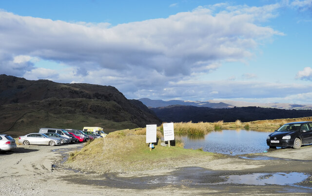
The moss is easily accessible, with a network of roads connecting it to nearby towns and villages. There are also parking facilities available for visitors. Local amenities such as cafes, shops, and accommodations can be found in the surrounding areas, providing convenience for those looking to explore Bleathwaite Moss.

Overall, Bleathwaite Moss in Lancashire is a natural haven offering a tranquil escape for nature enthusiasts and those seeking to immerse themselves in the beauty of the British countryside.

If you have any feedback on the listing, please let us know in the comments section below.

Bleathwaite Moss Images

Images are sourced within 2km of 54.352661/-3.0979904 or Grid Reference SD2895. Thanks to Geograph Open Source API. All images are credited.

Elizabeth II postbox, Torver Postbox No. LA21 28.
Elizabeth II postbox, Torver
Postbox No. LA21 28.
Torver Goods Yard The old railway goods yard at Torver is now used by a local builder for storage.  The stone built goods shed contained a loading platform upon which was mounted a 1 ton hand operated crane manufactured by R. Kitchen ironfounders in Warrington.  The crane has subsequently been relocated to the rear of The Wilson’s Arms.  The goods shed was used as a hay barn after the railway closed but lost its roof in a fire and stood derelict for a number of years before being repaired, altered and re-roofed and brought back into use.
Torver Goods Yard
The old railway goods yard at Torver is now used by a local builder for storage. The stone built goods shed contained a loading platform upon which was mounted a 1 ton hand operated crane manufactured by R. Kitchen ironfounders in Warrington. The crane has subsequently been relocated to the rear of The Wilson’s Arms. The goods shed was used as a hay barn after the railway closed but lost its roof in a fire and stood derelict for a number of years before being repaired, altered and re-roofed and brought back into use.
Torver The road here passing in front of the cottages and The Wilson Arms was originally the A593 road until it was realigned between a point near Torver Station and Dalton Road Gates level crossing, taking advantage of the alignment of the former railway.
Torver
The road here passing in front of the cottages and The Wilson Arms was originally the A593 road until it was realigned between a point near Torver Station and Dalton Road Gates level crossing, taking advantage of the alignment of the former railway.
Torver Station The station building is now let as a holiday cottage and the old platform is still visible.  The platform and track bed have been converted into a garden with a fenced pond.
Torver station was on the Foxfield to Coniston branch of The Furness Railway.  It was only provided with a single low platform; the red sandstone coping stones still bear a few faint traces of white paint on the platform edge more than 60 years after the line closed to passengers.
Torver Station
The station building is now let as a holiday cottage and the old platform is still visible. The platform and track bed have been converted into a garden with a fenced pond. Torver station was on the Foxfield to Coniston branch of The Furness Railway. It was only provided with a single low platform; the red sandstone coping stones still bear a few faint traces of white paint on the platform edge more than 60 years after the line closed to passengers.
Coniston village sign This road sign on the A593 was erected by Lancashire County Council, pre-dating the formation of Cumbria in 1974 which incorporated that part of Lancashire north of Morecambe Bay.
Located at Park Gate, the sign is unusually far from the village, being almost 1.6km (1 mile) south of the centre of Coniston.
Coniston village sign
This road sign on the A593 was erected by Lancashire County Council, pre-dating the formation of Cumbria in 1974 which incorporated that part of Lancashire north of Morecambe Bay. Located at Park Gate, the sign is unusually far from the village, being almost 1.6km (1 mile) south of the centre of Coniston.
Rocky path in Torver Common Wood The Cumbria Way follows a public footpath along the western shore of Coniston Water through Torver Common Wood, rounding a rocky spur above the lake shortly before reaching Harrison’s Coppice (next photograph <a href="https://www.geograph.org.uk/photo/7005690">SD2994 : Paths in Torver Common Wood</a>).
Rocky path in Torver Common Wood
The Cumbria Way follows a public footpath along the western shore of Coniston Water through Torver Common Wood, rounding a rocky spur above the lake shortly before reaching Harrison’s Coppice (next photograph SD2994 : Paths in Torver Common Wood).
Gate beside Coniston Water The public footpath from Delicars to Coniston passes through the gate leading from Torver Common Wood into Harrison Coppice.
The waymark on the right hand gatepost indicates that this is the route of The Cumbria Way (next photograph <a href="https://www.geograph.org.uk/photo/7006419">SD2994 : The Cumbria Way, Harrison Coppice</a>).
Gate beside Coniston Water
The public footpath from Delicars to Coniston passes through the gate leading from Torver Common Wood into Harrison Coppice. The waymark on the right hand gatepost indicates that this is the route of The Cumbria Way (next photograph SD2994 : The Cumbria Way, Harrison Coppice).
The Cumbria Way near Coniston Water The Cumbria Way follows the public footpath from Delicars to Coniston along the western shore of Coniston Water (next photograph <a href="https://www.geograph.org.uk/photo/7005687">SD2994 : Gate beside Coniston Water</a>).
The Cumbria Way near Coniston Water
The Cumbria Way follows the public footpath from Delicars to Coniston along the western shore of Coniston Water (next photograph SD2994 : Gate beside Coniston Water).
Paths in Torver Common Wood The path on the left doubles back up through the wood towards the top of Torver Back Common.  The public footpath from Delicars to Coniston and The Cumbria Way follow the path dropping down to the right towards the shore of Coniston Water (next photograph <a href="https://www.geograph.org.uk/photo/7005689">SD2994 : The Cumbria Way near Coniston Water</a>).
Paths in Torver Common Wood
The path on the left doubles back up through the wood towards the top of Torver Back Common. The public footpath from Delicars to Coniston and The Cumbria Way follow the path dropping down to the right towards the shore of Coniston Water (next photograph SD2994 : The Cumbria Way near Coniston Water).
Pasture south of Coniston Park coppice behind and Grizedale Forest on the hills
Pasture south of Coniston
Park coppice behind and Grizedale Forest on the hills
Grazing near Coniston Park Coppice
Cragg Cottage On the northern outskirts of Torver. In the process of making a new parking area.
Cragg Cottage
On the northern outskirts of Torver. In the process of making a new parking area.
The Wilsons Arms, Torver Public House with attached Deli
The Wilsons Arms, Torver
Public House with attached Deli
The Cumbria Way, Harrison Coppice The Cumbria Way follows the public footpath from Delicars to Coniston along the western shore of Coniston Water through Harrison Coppice (next photograph <a href="https://www.geograph.org.uk/photo/7006411">SD3094 : Ford in Harrison Coppice</a>).
The Cumbria Way, Harrison Coppice
The Cumbria Way follows the public footpath from Delicars to Coniston along the western shore of Coniston Water through Harrison Coppice (next photograph SD3094 : Ford in Harrison Coppice).
The Coniston Branch near Park Gate Now only used by walkers and sheep, this is the route of the former Furness Railway branch line from Foxfield to Coniston.
The last passenger service ran on 4 October 1958 with a final enthusiasts’ special train on the 27 August 1961.  The last freight train ran during the week ending 29 April 1962 and the track was lifted early in 1963.
The Coniston Branch near Park Gate
Now only used by walkers and sheep, this is the route of the former Furness Railway branch line from Foxfield to Coniston. The last passenger service ran on 4 October 1958 with a final enthusiasts’ special train on the 27 August 1961. The last freight train ran during the week ending 29 April 1962 and the track was lifted early in 1963.
Walna Scar Road stream crossing A well constructed, stone-built feature allowing Hussey Well Beck to flow across the Walna Scar Road without causing undue erosion to its surface.
Walna Scar Road stream crossing
A well constructed, stone-built feature allowing Hussey Well Beck to flow across the Walna Scar Road without causing undue erosion to its surface.
Have you paid and displayed? The 'waste ground' here at the end of the publicly motorable stretch of the Walna Scar Road was for years accepted as a free car parking area for visitors and walkers, the photographer has used it a number of times in the past. Now, (early 2022), the Rydal estate levies a charge of £8 for all day parking! There are no facilities, no surfacing to the area, in fact no improvement to the space other than the embedding of a few logs to demarcate some spaces. As can be seen, at least one vehicle has even had to be parked with the driver's side of it including the driver's exit, in a flood!
Have you paid and displayed?
The 'waste ground' here at the end of the publicly motorable stretch of the Walna Scar Road was for years accepted as a free car parking area for visitors and walkers, the photographer has used it a number of times in the past. Now, (early 2022), the Rydal estate levies a charge of £8 for all day parking! There are no facilities, no surfacing to the area, in fact no improvement to the space other than the embedding of a few logs to demarcate some spaces. As can be seen, at least one vehicle has even had to be parked with the driver's side of it including the driver's exit, in a flood!
Old Bridge Marker on Hollage Bridge, Torver Bridge Marker cut in the north parapet of Hollage Bridge, Torver Beck, on the A5084. Torver parish. Inscription reads C C HOLLAGE BRIDGE / REBUILT 1903.

Milestone Society National ID: LA_TORV01br
Old Bridge Marker on Hollage Bridge, Torver
Bridge Marker cut in the north parapet of Hollage Bridge, Torver Beck, on the A5084. Torver parish. Inscription reads C C HOLLAGE BRIDGE / REBUILT 1903. Milestone Society National ID: LA_TORV01br
Show me another place!

Bleathwaite Moss is located at Grid Ref: SD2895 (Lat: 54.352661, Lng: -3.0979904)

Administrative County: Cumbria

District: South Lakeland

Police Authority: Cumbria

What 3 Words

///forms.flattery.squabbles. Near Ambleside, Cumbria

Related Wikis

Bowmanstead

Bowmanstead is a village in Cumbria, England. It is situated 1 mile to the south of Coniston and contains a Catholic church and a pub - The Ship Inn, it...

Torver railway station

Torver railway station served the village of Torver, in Lancashire, England (now in Cumbria). It was on the branch line to Coniston. == History == Authorised...

St Luke's Church, Torver

St Luke's Church is in the village of Torver, Cumbria, England. It is an active Anglican parish church in the deanery of Furness, the archdeaconry of...
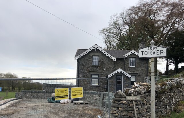
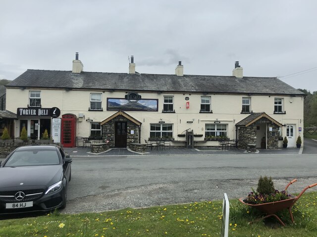
Torver

Torver is a village and civil parish in the South Lakeland district of Cumbria, England, 3 miles (4.8 km) south west of the village of Coniston and 1 mile...

Coniston Hall

Coniston Hall is a former house on the west bank of Coniston Water in the English Lake District. It is recorded in the National Heritage List for England...
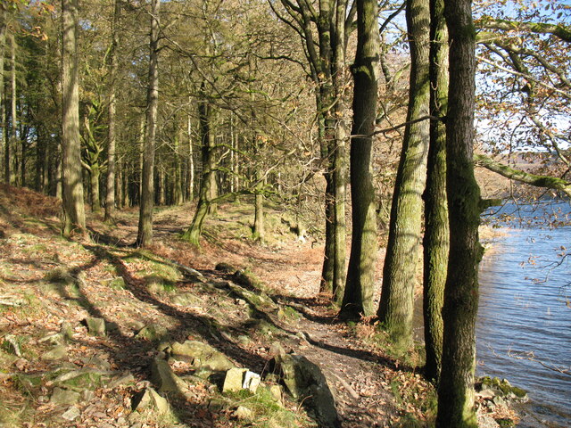
Coniston Water

Coniston Water is a lake in the Lake District in North West England. It is the third largest by volume, after Windermere and Ullswater, and the fifth-largest...

Coniston railway station (England)

Coniston railway station was the northern terminus of the Coniston branch line in the village of Coniston, Lancashire, England (now in Cumbria). ��2�...

Cat Bank

Cat Bank is a hamlet in Cumbria, England. == References ==

Nearby Amenities

Located within 500m of 54.352661,-3.0979904
Barrier: stile
Material: stone
Step Count: 3
Stile: stepover
Lat/Long: 54.3527674/-3.0998893
Barrier: stile
Lat/Long: 54.3554795/-3.092987
Bleathwaite Pasture
Place: locality
Lat/Long: 54.3520165/-3.094665
Power: pole
Lat/Long: 54.3515841/-3.1054089
Power: pole
Lat/Long: 54.351856/-3.1037583
Power: pole
Lat/Long: 54.351646/-3.1031818
Power: pole
Lat/Long: 54.3512008/-3.1019365
Power: pole
Lat/Long: 54.3509168/-3.1011264
Power: pole
Lat/Long: 54.3505579/-3.0992473
Power: pole
Lat/Long: 54.3502875/-3.0993575
Power: pole
Lat/Long: 54.3492275/-3.0998018
Power: pole
Lat/Long: 54.3486992/-3.1000181
Ford: yes
Lat/Long: 54.35158/-3.1045776
The data included in this document is from www.openstreetmap.org. The data is made available under ODbL.

Have you been to Bleathwaite Moss?

Leave your review of Bleathwaite Moss below (or comments, questions and feedback).