Alt Common

Downs, Moorland in Herefordshire

England

Alt Common

Pool on Little Mountain A piece of low moorland I last visited in the snow of January 2010; <a href="https://www.geograph.org.uk/photo/1657094">SO2842 : Walkers on Little Mountain</a>.
Pool on Little Mountain Credit: Jonathan Billinger

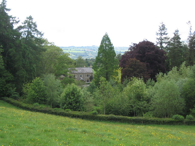
Alt Common is a stunning area located in Herefordshire, England, known for its picturesque downs and moorland landscapes. Covering an expansive area, Alt Common offers visitors a tranquil and rural escape from the hustle and bustle of city life.

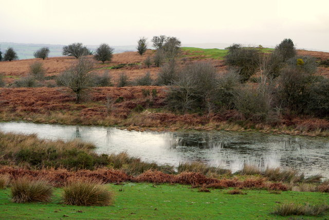
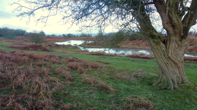
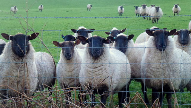
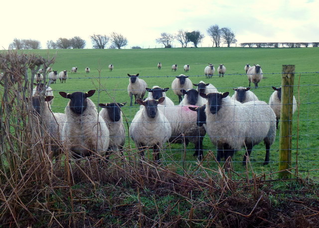
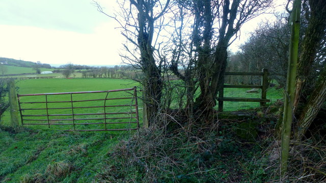
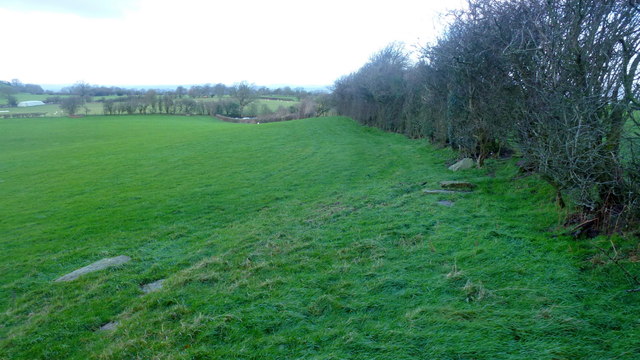
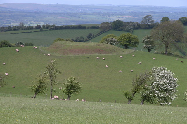
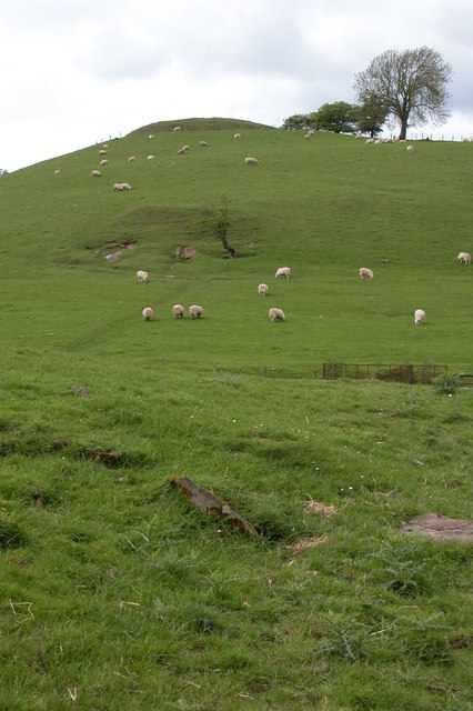
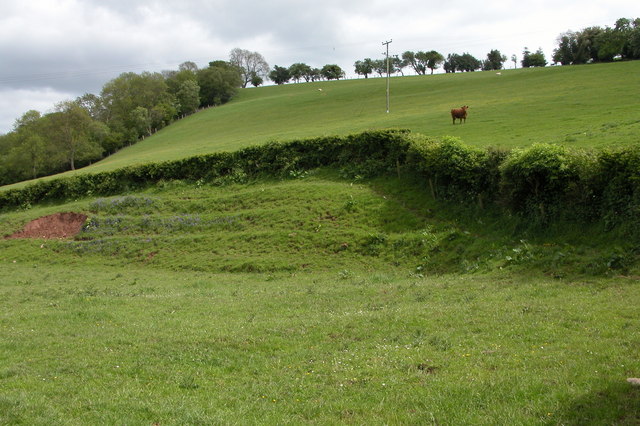
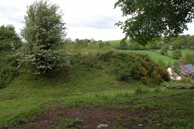
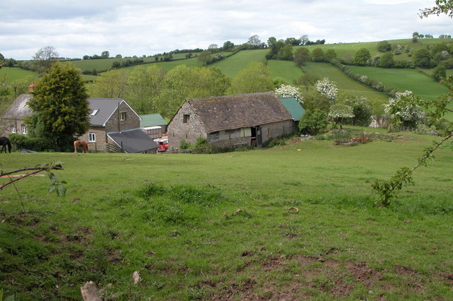
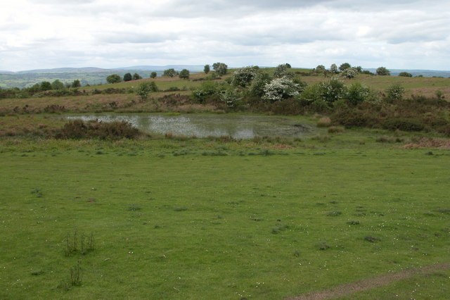
The downs of Alt Common are characterized by rolling hills and vast open spaces, providing breathtaking views of the surrounding countryside. Dotted with sheep and cattle, the downs offer a sense of serenity and harmony with nature. A variety of wildflowers and grasses can also be found, adding bursts of color to the landscape during the warmer months.

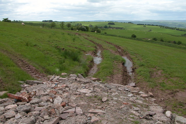
The moorland of Alt Common features a more rugged and wild terrain. Here, visitors can explore heathland, rocky outcrops, and small streams, immersing themselves in the untouched beauty of the area. This diverse habitat is home to a rich array of wildlife, including birds of prey, rabbits, and various species of reptiles and amphibians.

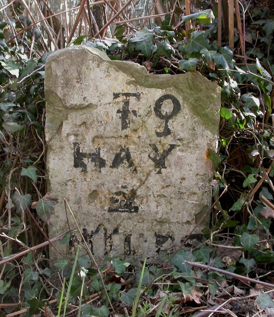
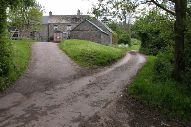
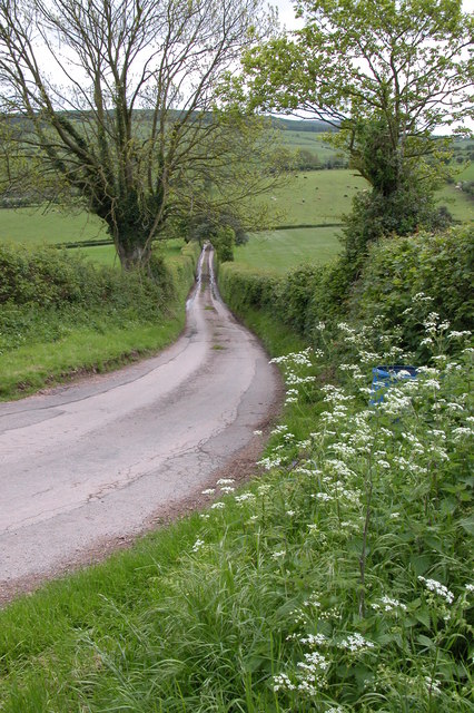
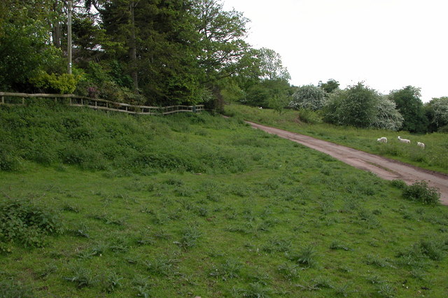
Hiking and walking are popular activities in Alt Common, with a network of well-marked trails guiding visitors through the different areas. These paths offer an opportunity to appreciate the stunning vistas, observe the local wildlife, and breathe in the fresh country air.

Alt Common is a haven for nature lovers and outdoor enthusiasts, offering a true escape into the heart of the English countryside. Whether exploring the gentle downs or venturing into the wild moorland, visitors are sure to find peace and beauty in this enchanting corner of Herefordshire.

If you have any feedback on the listing, please let us know in the comments section below.

Alt Common Images

Images are sourced within 2km of 52.074145/-3.0641648 or Grid Reference SO2742. Thanks to Geograph Open Source API. All images are credited.

Pool on Little Mountain A piece of low moorland I last visited in the snow of January 2010; <a href="https://www.geograph.org.uk/photo/1657094">SO2842 : Walkers on Little Mountain</a>.
Pool on Little Mountain
A piece of low moorland I last visited in the snow of January 2010; SO2842 : Walkers on Little Mountain.
Little Mountain Common A piece of low moorland I last visited in the snow of January 2010; <a href="https://www.geograph.org.uk/photo/1657094">SO2842 : Walkers on Little Mountain</a>.
Little Mountain Common
A piece of low moorland I last visited in the snow of January 2010; SO2842 : Walkers on Little Mountain.
Where's the food then? Some inquisitive Black-face sheep appear to see what a Geographer is doing at this spot at 8:22am on a cold February morning.
Where's the food then?
Some inquisitive Black-face sheep appear to see what a Geographer is doing at this spot at 8:22am on a cold February morning.
Sheep in a field to the south of Little Mountain See <a href="https://www.geograph.org.uk/photo/4821631">SO2842 : Where's the food then?</a> for a close-up.
Sheep in a field to the south of Little Mountain
See SO2842 : Where's the food then? for a close-up.
Stile on Tomkyn's Lane Footpath leads north-west towards Llanerch-y-coed.
Stile on Tomkyn's Lane
Footpath leads north-west towards Llanerch-y-coed.
Footpath from Tomkyn's Lane Footpath leads north-west towards Llanerch-y-coed.
Footpath from Tomkyn's Lane
Footpath leads north-west towards Llanerch-y-coed.
Old Milestone, B4348, Rock Coppice The milestone is located 150m east of the junction with Priory Lane against the hedgerow, 15m from B stone, on the south side of the road.  Parish of Clifford (Hererfordshire District). Carved stone post, erected by the Whitney & Brewardine turnpike trust in the 19th century. 

Inscription reads:-
TO
HAY
2
MILES

Milestone Society National ID: HF_HYHF02
Old Milestone, B4348, Rock Coppice
The milestone is located 150m east of the junction with Priory Lane against the hedgerow, 15m from B stone, on the south side of the road. Parish of Clifford (Hererfordshire District). Carved stone post, erected by the Whitney & Brewardine turnpike trust in the 19th century. Inscription reads:- TO HAY 2 MILES Milestone Society National ID: HF_HYHF02
Fields at Mynydd Brith On the northern slopes of Cefn Hill.
Fields at Mynydd Brith
On the northern slopes of Cefn Hill.
Castle Motte, Nant-y-bar See: <span class="nowrap"><a title="http://www.gatehouse-gazetteer.info/English%20sites/1449.html" rel="nofollow ugc noopener" href="http://www.gatehouse-gazetteer.info/English%20sites/1449.html">Link</a><img style="margin-left:2px;" alt="External link" title="External link - shift click to open in new window" src="https://s1.geograph.org.uk/img/external.png" width="10" height="10"/></span>
Castle Motte, Nant-y-bar
See: LinkExternal link
Castle Motte, Nant-y-bar Viewed from below by a farm. See: <span class="nowrap"><a title="http://www.gatehouse-gazetteer.info/English%20sites/1449.html" rel="nofollow ugc noopener" href="http://www.gatehouse-gazetteer.info/English%20sites/1449.html">Link</a><img style="margin-left:2px;" alt="External link" title="External link - shift click to open in new window" src="https://s1.geograph.org.uk/img/external.png" width="10" height="10"/></span>
Castle Motte, Nant-y-bar
Viewed from below by a farm. See: LinkExternal link
Farm Buildings, Nant-y-bar
Farmland at Nant-y-bar
Motte and Bailey, Mynydd Brith <span class="nowrap"><a title="http://www.gatehouse-gazetteer.info/English%20sites/1448.html" rel="nofollow ugc noopener" href="http://www.gatehouse-gazetteer.info/English%20sites/1448.html">Link</a><img style="margin-left:2px;" alt="External link" title="External link - shift click to open in new window" src="https://s1.geograph.org.uk/img/external.png" width="10" height="10"/></span>
Motte and Bailey, Mynydd Brith
Farm at Mynydd Brith
Mynydd Brith Farm on the opposite side of the road from the castle motte and bailey.
Mynydd Brith
Farm on the opposite side of the road from the castle motte and bailey.
Lane to Little Mountain View to the south down a no through road to Little Mountain
Lane to Little Mountain
View to the south down a no through road to Little Mountain
'Little Mountain' At 303m, Little Mountain could contravene the Trade Descriptions Act. It certainly is not a mountain. This area of common land is now a nature reserve. See: <span class="nowrap"><a title="http://www.herefordshire.gov.uk/leisure/parks_recreation/2581.asp" rel="nofollow ugc noopener" href="http://www.herefordshire.gov.uk/leisure/parks_recreation/2581.asp">Link</a><img style="margin-left:2px;" alt="External link" title="External link - shift click to open in new window" src="https://s1.geograph.org.uk/img/external.png" width="10" height="10"/></span>
'Little Mountain'
At 303m, Little Mountain could contravene the Trade Descriptions Act. It certainly is not a mountain. This area of common land is now a nature reserve. See: LinkExternal link
Drive to Pen-y-llan The farm at Pen-y-llan is obscured behind the trees on the left, the farm is on the edge of Little Mountain.
Drive to Pen-y-llan
The farm at Pen-y-llan is obscured behind the trees on the left, the farm is on the edge of Little Mountain.
Show me another place!

Alt Common is located at Grid Ref: SO2742 (Lat: 52.074145, Lng: -3.0641648)

Unitary Authority: County of Herefordshire

Police Authority: West Mercia

What 3 Words

///mothering.compose.pixies. Near Clifford, Herefordshire

Nearby Locations

Cot Wood Alt Common

Related Wikis

Westbrook railway station (England)

Westbrook railway station was a station to the northwest of Dorstone, Herefordshire, England. The station was opened in 1881, closed to passengers in 1941...

Greens Siding railway station

Greens Siding railway station was a station to the east of Clifford, Herefordshire, England. The station was opened in 1903, closed to passengers in 1941...

Clifford Priory

Clifford Priory was a priory in Herefordshire, England at grid reference SO2531944576. == References ==

Cusop

Cusop is a village and civil parish in Herefordshire, England that lies at the foot of Cusop Hill next to the town of Hay-on-Wye in Wales. It is a short...

Clifford railway station

Clifford railway station was a station in Clifford, Herefordshire, England. The station was opened in 1881, closed to passengers in 1941 and closed completely...

Dorstone Castle

Dorstone Castle was in the village of Dorstone in Herefordshire, England, located 6 miles to the east of Hay-on-Wye. == Motte and bailey == This was a...

Dulas Bridge

Dulas Bridge spans Dulas Brook, a tributary of the River Wye in Hay-on-Wye, Powys, Wales.The Dulas bridge, near Hay station, was a joint counties bridge...

Hay Festival

The Hay Festival of Literature & Arts, better known as the Hay Festival (Welsh: Gŵyl Y Gelli), is an annual literature festival held in Hay-on-Wye, Powys...

Have you been to Alt Common?

Leave your review of Alt Common below (or comments, questions and feedback).