Shute Lawns
Downs, Moorland in Devon East Devon
England
Shute Lawns

Shute Lawns is a picturesque village located in the county of Devon, England. Situated amidst the beautiful countryside, it offers a captivating blend of downs, moorland, and enchanting landscapes. The village is nestled in a valley, surrounded by rolling hills and meandering streams, creating an idyllic setting for residents and visitors alike.
The downs of Shute Lawns are characterized by their vast stretches of green fields dotted with grazing sheep and cattle. These open spaces provide a haven for outdoor enthusiasts, offering ample opportunities for hiking, picnicking, and enjoying the natural beauty of the area. The downs are also home to a variety of wildlife, including birds, rabbits, and even the occasional deer.
Adjacent to the downs, the moorland of Shute Lawns adds an additional layer of charm to the village. With its rugged terrain and heather-covered hills, the moorland offers a sense of tranquility and solitude. It serves as a popular destination for nature lovers, birdwatchers, and those seeking a peaceful escape from the hustle and bustle of city life.
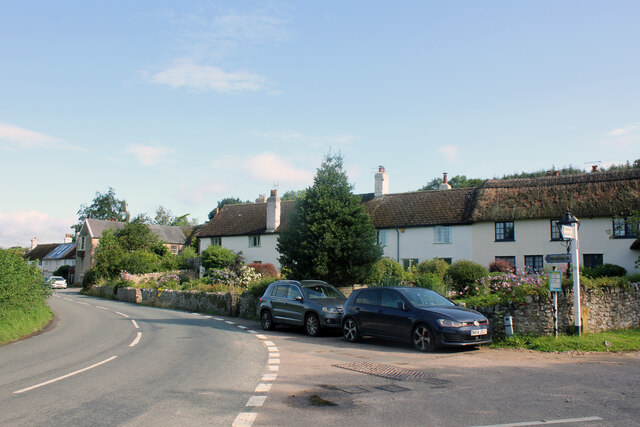
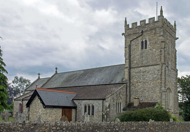
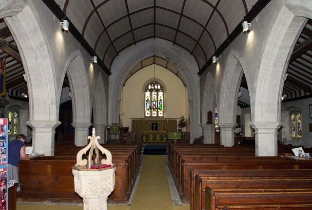
The village itself is small and welcoming, with a tight-knit community that takes pride in its heritage and natural surroundings. Traditional stone cottages line the narrow streets, adding to the village's charm and character. Shute Lawns also boasts a historic church, dating back several centuries, which serves as a focal point for community gatherings and events.
Overall, Shute Lawns, Devon, is a hidden gem in the heart of the English countryside. With its downs, moorland, and warm community spirit, it offers a unique and delightful experience for nature enthusiasts and those seeking a peaceful retreat.
If you have any feedback on the listing, please let us know in the comments section below.
Shute Lawns Images
Images are sourced within 2km of 50.76953/-3.0556797 or Grid Reference SY2597. Thanks to Geograph Open Source API. All images are credited.


Shute Lawns is located at Grid Ref: SY2597 (Lat: 50.76953, Lng: -3.0556797)
Administrative County: Devon
District: East Devon
Police Authority: Devon and Cornwall
What 3 Words
///nightcap.bedrock.rock. Near Colyton, Devon
Nearby Locations
Related Wikis
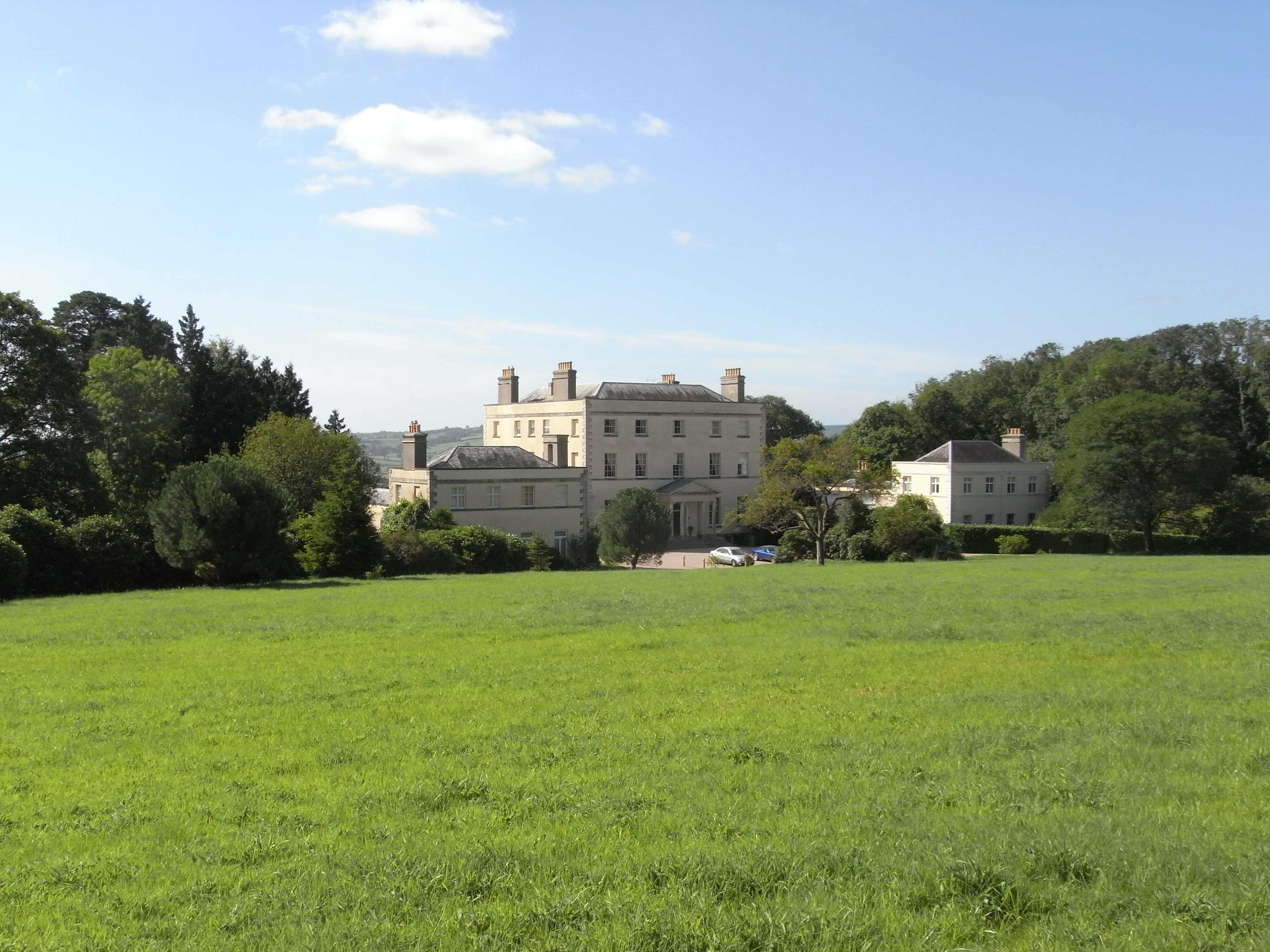
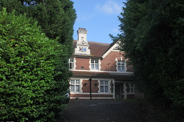
New Shute House
New Shute House is a late Palladian country house built between 1785 and 1789 by Sir John de la Pole, 6th Baronet (1757–1799) and is situated within the...

Shute, Devon
Shute is a village, parish and former manor located 3 miles (5 km) west of Axminster in East Devon, off the A35 road. It is surrounded by farmland and...

Old Shute House
See also: New Shute HouseOld Shute House (known as Shute Barton between about 1789 and the 20th century), located at Shute, near Colyton, Axminster, Devon...
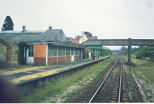
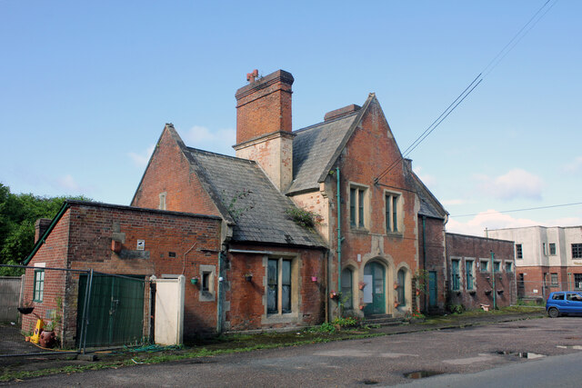
Seaton Junction railway station
Seaton Junction is a closed railway station on the West of England Main Line from London Waterloo to Exeter. It was situated 3 miles west of Axminster...
Nearby Amenities
Located within 500m of 50.76953,-3.0556797Have you been to Shute Lawns?
Leave your review of Shute Lawns below (or comments, questions and feedback).