Borrowdale Fells

Downs, Moorland in Cumberland Allerdale

England

Borrowdale Fells

Bracken covered slope descending towards Seatoller The slope is on the minor hill, High Doat, south-west of its summit.
The central, sunlit hill is known as Thornythwaite Fell which has little individual identity and is basically a rising ridge continuing to Glaramara, a summit on the skyline above.
Bracken covered slope descending towards Seatoller Credit: Trevor Littlewood

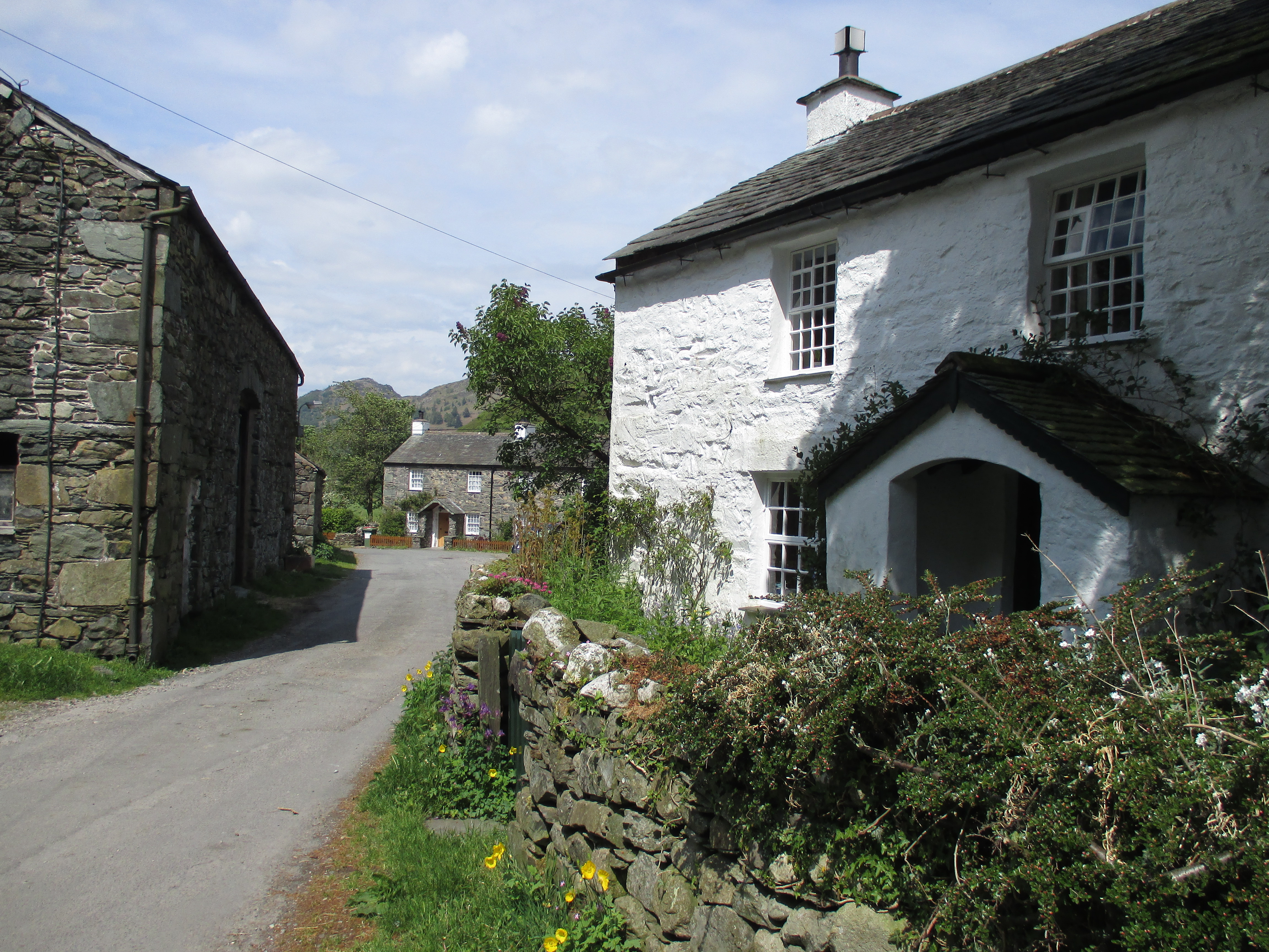
Borrowdale Fells, located in Cumberland, England, is a picturesque and diverse landscape encompassing downs, moorland, and rugged mountains. Situated in the northern part of the Lake District National Park, it covers an area of approximately 200 square miles.

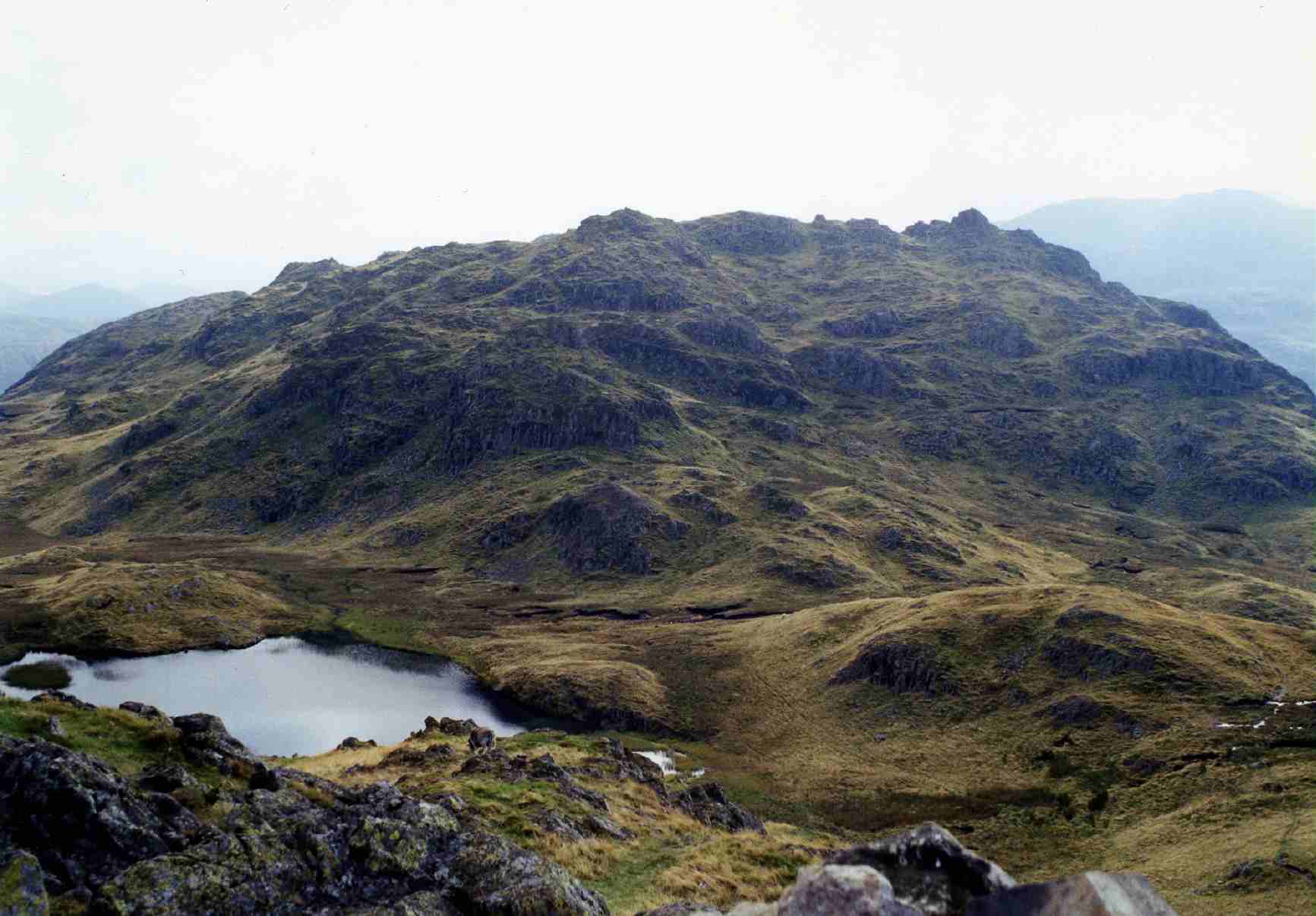
The fells are characterized by their striking beauty, with towering mountains, deep valleys, and cascading waterfalls. The highest peak in the area is Scafell Pike, standing at an impressive 3,209 feet above sea level. Other notable peaks include Great Gable, Glaramara, and Pillar.

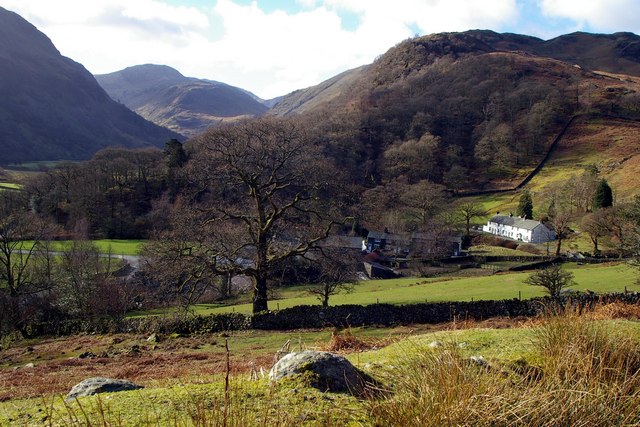
The landscape of Borrowdale Fells is a result of glacial activity during the last Ice Age. The valleys, such as the popular Borrowdale Valley, were carved out by glaciers, leaving behind steep slopes and stunning U-shaped formations. The fells are also home to several serene lakes, including Derwentwater, Buttermere, and Crummock Water, which add to the area's natural beauty.

The vegetation in Borrowdale Fells varies, with lower slopes covered in lush meadows and woodlands, while the higher elevations are characterized by heather-covered moorland and rocky outcrops. The area supports a diverse range of wildlife, including red deer, mountain goats, and a variety of bird species.

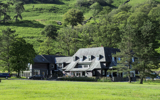
Borrowdale Fells is a haven for outdoor enthusiasts and offers a multitude of recreational activities. Hiking and climbing are popular pursuits, with numerous trails and routes catering to all abilities. The area also provides opportunities for water sports, fishing, and wildlife spotting.

Overall, Borrowdale Fells in Cumberland is a captivating and diverse landscape, offering breathtaking natural beauty, outdoor adventures, and a tranquil escape into nature.

If you have any feedback on the listing, please let us know in the comments section below.

Borrowdale Fells Images

Images are sourced within 2km of 54.500889/-3.1571517 or Grid Reference NY2512. Thanks to Geograph Open Source API. All images are credited.

Bracken covered slope descending towards Seatoller The slope is on the minor hill, High Doat, south-west of its summit.
The central, sunlit hill is known as Thornythwaite Fell which has little individual identity and is basically a rising ridge continuing to Glaramara, a summit on the skyline above.
Bracken covered slope descending towards Seatoller
The slope is on the minor hill, High Doat, south-west of its summit. The central, sunlit hill is known as Thornythwaite Fell which has little individual identity and is basically a rising ridge continuing to Glaramara, a summit on the skyline above.
Blackmoss Pot Langstrath Beck, in spate, passes through a narrow cleft in a band of rocks.
Blackmoss Pot
Langstrath Beck, in spate, passes through a narrow cleft in a band of rocks.
The B5289, Seatoller The main road which passes through Borrowdale and over the Honister Pass. An open-top stagecoach bus sits at its turning point on the edge of Seatoller after an early morning service along the narrow and twisty road from Keswick.
The B5289, Seatoller
The main road which passes through Borrowdale and over the Honister Pass. An open-top stagecoach bus sits at its turning point on the edge of Seatoller after an early morning service along the narrow and twisty road from Keswick.
Chapel House Farm, Borrowdale
Path above Old Mill Cottage On the path from Strands Bridge to Glaramara.
Path above Old Mill Cottage
On the path from Strands Bridge to Glaramara.
Approaching The Combe On the path from Strands Bridge to Glaramara. Ahead is the intake wall and gate into The Combe. On the skyline ahead is Raven Crag and to the left, through the branches of the hawthorn, the pinnacle of Combe Head can be seen.
Approaching The Combe
On the path from Strands Bridge to Glaramara. Ahead is the intake wall and gate into The Combe. On the skyline ahead is Raven Crag and to the left, through the branches of the hawthorn, the pinnacle of Combe Head can be seen.
In The Combe A bunch of Herdwicks are sizing up their visitors.
In The Combe
A bunch of Herdwicks are sizing up their visitors.
Raven Crag Heading for Glaramara, but the summit ahead is Combe Head - Glaramara cannot be seen yet.
Raven Crag
Heading for Glaramara, but the summit ahead is Combe Head - Glaramara cannot be seen yet.
Glaramara Having walked the path from Strands Bridge, the objective of the summit is a short distance (and a bit of a scramble) ahead.
Glaramara
Having walked the path from Strands Bridge, the objective of the summit is a short distance (and a bit of a scramble) ahead.
Cairn on Glaramara A quirky cairn on the summit with a view along Borrowdale, and Skiddaw and Blencathra on the skyline.
Cairn on Glaramara
A quirky cairn on the summit with a view along Borrowdale, and Skiddaw and Blencathra on the skyline.
View of Seathwaite
View of Seathwaite
Sheep movement in Borrowdale Traffic and pedestrians were asked politely to pause for a while as a large flock of sheep was moved from one field to another.
Sheep movement in Borrowdale
Traffic and pedestrians were asked politely to pause for a while as a large flock of sheep was moved from one field to another.
Route of Cumbria Way near to Stonethwaite Stonethwaite is a small settlement on the west side of Stonethwaite Beck; it's bypassed by the Cumbria Way which is on the other side of the stream.
Route of Cumbria Way near to Stonethwaite
Stonethwaite is a small settlement on the west side of Stonethwaite Beck; it's bypassed by the Cumbria Way which is on the other side of the stream.
Glaramara Glaramara, in addition to being the name of a Borrowdale mountain, is a mountain hotel in the valley; it's seen here from the B5289 near to Seatoller.
Glaramara
Glaramara, in addition to being the name of a Borrowdale mountain, is a mountain hotel in the valley; it's seen here from the B5289 near to Seatoller.
Seatoller The tiny settlement of Seatoller at the foot of the Borrowdale side of the road crossing Honister Pass.
Seatoller
The tiny settlement of Seatoller at the foot of the Borrowdale side of the road crossing Honister Pass.
Helicopter landing at hotel in Borrowdale The aircraft is landing at 'Glaramara', a mountain hotel at Seatoller. It wasn't delivering wealthy clients but lifting materials for path and bridge repair work on nearby mountains; this was the final flight of the operation. The debris behind the man on the ground is the remains of a wooden bridge which had been brought down.
Helicopter landing at hotel in Borrowdale
The aircraft is landing at 'Glaramara', a mountain hotel at Seatoller. It wasn't delivering wealthy clients but lifting materials for path and bridge repair work on nearby mountains; this was the final flight of the operation. The debris behind the man on the ground is the remains of a wooden bridge which had been brought down.
Lone tree in The Combe The Combe is the upper valley of Combe Gill in Borrowdale. The tree is just beyond the groove of Rottenstone Gill.
Raven Crag is the cliff at the valley head.
Lone tree in The Combe
The Combe is the upper valley of Combe Gill in Borrowdale. The tree is just beyond the groove of Rottenstone Gill. Raven Crag is the cliff at the valley head.
Signs at Stonethwaite Bridge Choice of three bridleways on the Cumbria Way at Stonethwaite.
Signs at Stonethwaite Bridge
Choice of three bridleways on the Cumbria Way at Stonethwaite.
Show me another place!

Borrowdale Fells is located at Grid Ref: NY2512 (Lat: 54.500889, Lng: -3.1571517)

Administrative County: Cumbria

District: Allerdale

Police Authority: Cumbria

What 3 Words

///emeralds.waters.lyricist. Near Keswick, Cumbria

Related Wikis

Lake District

The Lake District, also known as the Lakes or Lakeland, is a mountainous region and national park in North West England. It is primarily famous for its...

Rosthwaite Fell

Rosthwaite Fell is a fell in the English Lake District. It is situated some 12 kilometres (7+1⁄2 miles) due south of Keswick and 2 kilometres (1+1⁄4 miles...

Stonethwaite

Stonethwaite is a small village in the Lake District in the English county of Cumbria, historically part of Cumberland, it is situated in the valley of...

Seatoller

Seatoller is a settlement in Borrowdale in the English Lake District. Historically part of Cumberland, it lies on the B5289 road at the east foot of the...

Nearby Amenities

Located within 500m of 54.500889,-3.1571517
Thornythwaite Fell
Place: locality
Lat/Long: 54.4980048/-3.1548605
The Combe
Place: locality
Lat/Long: 54.5003711/-3.1572631
The data included in this document is from www.openstreetmap.org. The data is made available under ODbL.

Have you been to Borrowdale Fells?

Leave your review of Borrowdale Fells below (or comments, questions and feedback).