Market Muir

Downs, Moorland in Perthshire

Scotland

Market Muir

Den o'Alyth A delightful place where the Alyth Burn carves its way through old red sandstone outcrops in a deep wooded valley. Seen on a damp day of dripping leaves and a hint of mist in the air.
Den o'Alyth Credit: Gordon Hatton

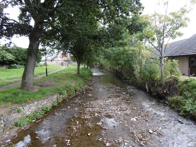
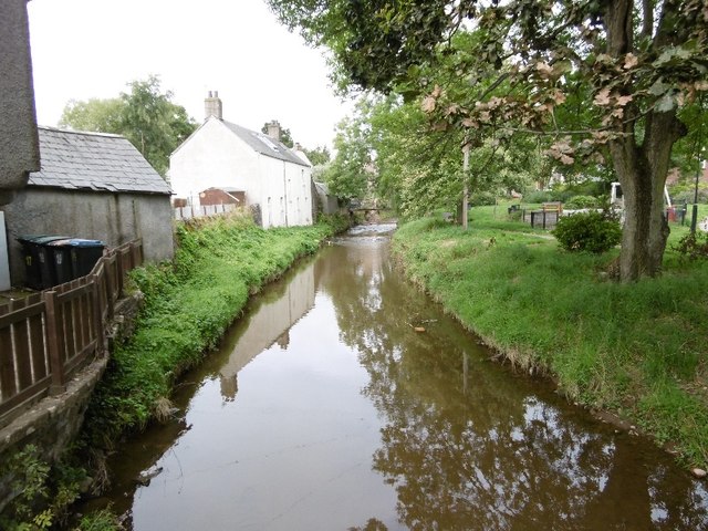
Market Muir is a picturesque area located in Perthshire, Scotland. Situated amidst the breathtaking Downs and Moorland landscapes, it offers visitors a unique and tranquil experience. With its rich history and stunning natural beauty, Market Muir is a popular destination for nature enthusiasts and history buffs alike.

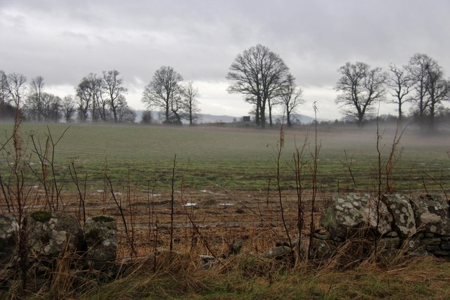
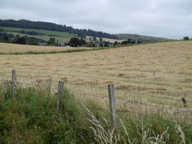
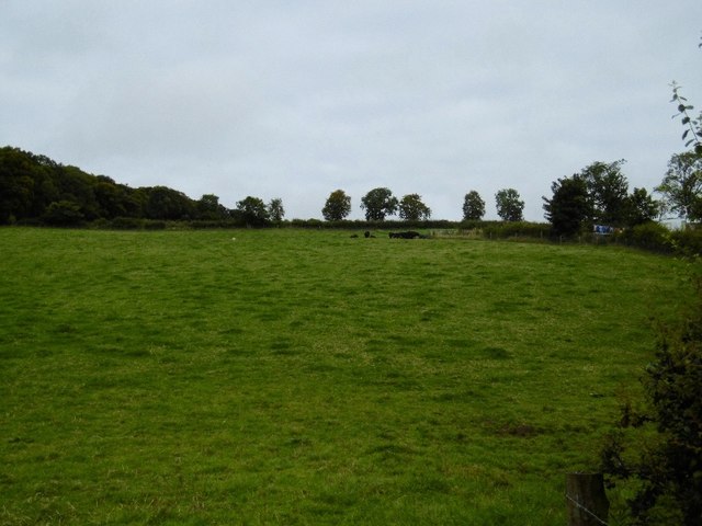
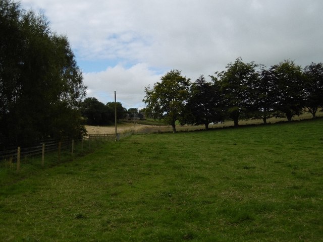
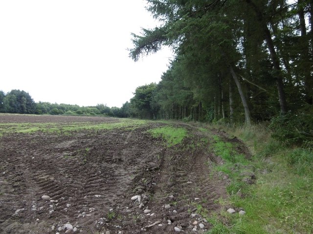
The Downs of Market Muir showcase rolling hills covered in vibrant green grasses, interspersed with colorful wildflowers during the warmer months. The undulating terrain provides breathtaking panoramic views of the surrounding countryside, creating a sense of serenity and calm. These Downs are perfect for leisurely walks, picnics, and birdwatching, with numerous species of birds calling this area their home.

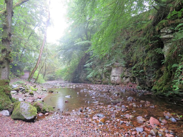
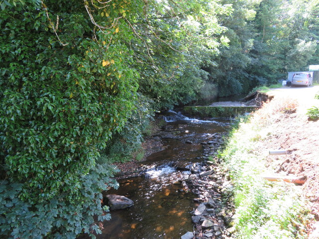
The Moorland in Market Muir is characterized by expansive stretches of heather, ferns, and mosses, creating a contrasting landscape against the Downs. This rugged terrain is home to a variety of wildlife, including deer, hares, and foxes. The Moorland offers a unique opportunity for visitors to immerse themselves in nature, with its vast open spaces and peaceful atmosphere.

In addition to its natural beauty, Market Muir also has a rich historical background. The area was once a bustling market town, and remnants of its past can still be seen today. Visitors can explore the ruins of old buildings and discover ancient artifacts that provide a glimpse into the area's vibrant history.

Market Muir in Perthshire is a hidden gem, offering visitors the chance to escape the hustle and bustle of city life and immerse themselves in the beauty of nature and the echoes of the past.

If you have any feedback on the listing, please let us know in the comments section below.

Market Muir Images

Images are sourced within 2km of 56.616788/-3.2243223 or Grid Reference NO2447. Thanks to Geograph Open Source API. All images are credited.

Den o'Alyth A delightful place where the Alyth Burn carves its way through old red sandstone outcrops in a deep wooded valley. Seen on a damp day of dripping leaves and a hint of mist in the air.
Den o'Alyth
A delightful place where the Alyth Burn carves its way through old red sandstone outcrops in a deep wooded valley. Seen on a damp day of dripping leaves and a hint of mist in the air.
Woodland path, Den o'Alyth A place for interesting fungus on old tree trunks and for the occasional scampering of red squirrels.
Woodland path, Den o'Alyth
A place for interesting fungus on old tree trunks and for the occasional scampering of red squirrels.
Alyth High Parish Church A Neo-Norman style building designed by Thomas Hamilton in 1839. Viewed from the bridge carrying Bamff Road over the Alyth Burn.
Alyth High Parish Church
A Neo-Norman style building designed by Thomas Hamilton in 1839. Viewed from the bridge carrying Bamff Road over the Alyth Burn.
The Alyth Burn Having passed under Bamff Road in Alyth.
The Alyth Burn
Having passed under Bamff Road in Alyth.
The Alyth Burn By-passing a weir on the left side.
The Alyth Burn
By-passing a weir on the left side.
Field with broken dyke by the A926
Arable land, New Alyth Newly harvested barley field.
Arable land, New Alyth
Newly harvested barley field.
Alyth Burn View downstream from the bridge between David Street and Mill Street.
Alyth Burn
View downstream from the bridge between David Street and Mill Street.
Field, The Brae Above Alyth.
Field, The Brae
Above Alyth.
Behind Alyth Looking along the Back Burn at the southern foot of Hill of Alyth.
Behind Alyth
Looking along the Back Burn at the southern foot of Hill of Alyth.
Stripwood near Alyth
Alyth Burn Upstream from the bridge at the end of David Street.
Alyth Burn
Upstream from the bridge at the end of David Street.
Back of an icecream cabinet Caught my eye as it named the refrigerant - cyclopentane.    A shop in Alyth.
Back of an icecream cabinet
Caught my eye as it named the refrigerant - cyclopentane. A shop in Alyth.
Airlie Street, Alyth
Rows of straw, New Alyth Harvested field near Alyth.
Rows of straw, New Alyth
Harvested field near Alyth.
Repairs, Alyth Burn Repairs after severe flooding in July 2015.
Repairs, Alyth Burn
Repairs after severe flooding in July 2015.
Alyth Burn Repairs underway after severe flooding in July 2015.
Alyth Burn
Repairs underway after severe flooding in July 2015.
Loyalbank Mixed farming overlooking Strathmore near Alyth.
Loyalbank
Mixed farming overlooking Strathmore near Alyth.
Show me another place!

Market Muir is located at Grid Ref: NO2447 (Lat: 56.616788, Lng: -3.2243223)

Unitary Authority: Perth and Kinross

Police Authority: Tayside

What 3 Words

///beakers.tester.sleeping. Near Alyth, Perth & Kinross

Related Wikis

Alyth railway station

The Alyth railway station served the town of Alyth in the Scottish county of Perth and Kinross. The station was the terminus of a branch line from Alyth...

Alyth Town Hall

Alyth Town Hall is a municipal structure in Albert Street in Alyth, Scotland. The structure, which is currently used as a community events venue, is not...
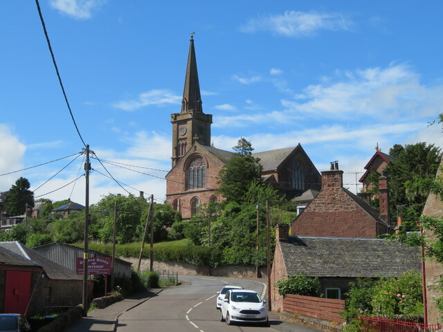
Alyth

Alyth () (Scottish Gaelic: Ailt) is a town in Perth and Kinross, Scotland, five miles (eight kilometres) northeast of Blairgowrie and about 17 miles (27...
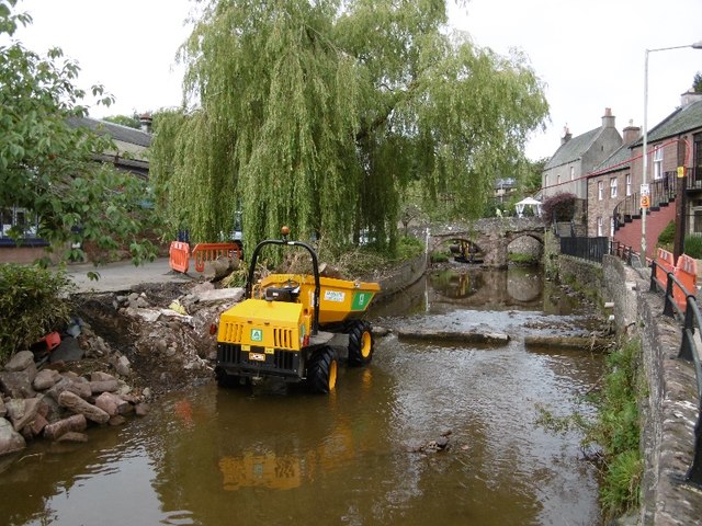
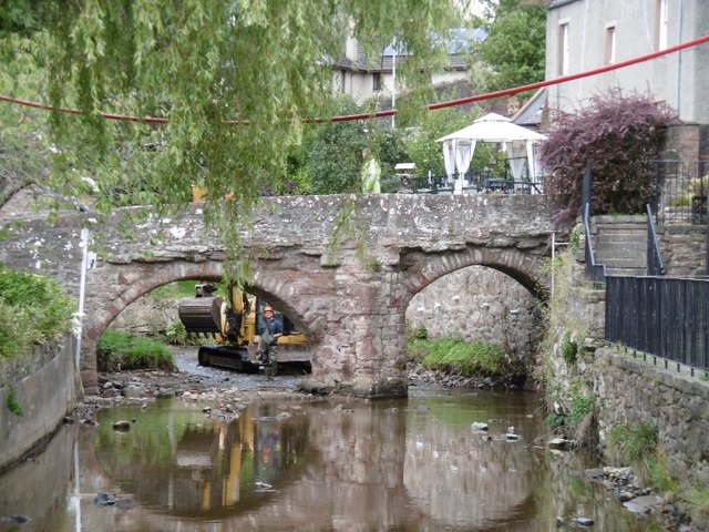
Pack Bridge

Pack Bridge is a bridge in the Scottish town of Alyth, Perth and Kinross. Intended to carry packhorses loaded with panniers across Alyth Burn, it is one...

Alyth market cross

Alyth market cross is a mercat cross located in Alyth, Perth and Kinross, Scotland. Now Category B listed, it dates to 1670. It has a rectangular shaft...

Golf Club Halt railway station (Scotland)

Golf Club Halt was a station which served Alyth Golf Club, in the Scottish county of Perth and Kinross. It was served by trains on the Alyth Railway which...

Jordanstone railway station

Jordanstone railway station served the area to the south of the village of Alyth in the Scottish county of Perth and Kinross. The station was on the Alyth...

Inverquiech Castle

Inverquiech Castle is a ruined 13th century castle near Inverquiech, Perth and Kinross, Scotland. == History == Built at the confluence of the Quiech Burn...

Nearby Amenities

Located within 500m of 56.616788,-3.2243223
Bus Stop
Bus: yes
Public Transport: platform
Lat/Long: 56.6171607/-3.2241663
Bus Stop
Bus: yes
Naptan AtcoCode: 6480159
Naptan NaptanCode: 73728379
Public Transport: platform
Lat/Long: 56.6172292/-3.2233949
Bus Stop
Bus: yes
Public Transport: platform
Lat/Long: 56.6199254/-3.2274696
Costcutter
Addr City: Alyth
Addr Housenumber: 73
Addr Postcode: PH11 8AN
Addr Street: Airlie Street
Brand: Costcutter
Brand Wikidata: Q5175072
Shop: convenience
Lat/Long: 56.6206042/-3.2279309
Bus Stop
Bus: yes
Public Transport: platform
Lat/Long: 56.6173801/-3.220459
Bus Stop
Bus: yes
Public Transport: platform
Lat/Long: 56.6172393/-3.2207664
Turning Circle
Lat/Long: 56.6206305/-3.2232495
Old Marketplace
Historic: archaeological_site
Lat/Long: 56.6167374/-3.2225704
Post Box
Collection Plate: CP1D
Collection Plate Date: 2016-07-20
Collection Times: Mo-Fr 09:00; Sa 07:00
Manufacturer: Carron Company Stirlingshire
Operator: Royal Mail
Post Box Type: pillar
Ref: PH11 128D
Royal Cypher: GR
Royal Cypher Wikidata: Q33102273
Source: survey;local knowledge
Lat/Long: 56.6198527/-3.2272306
Post Box
Collection Plate: CP5D
Collection Plate Date: 2016-07-20
Collection Times: Mo-Fr 09:00; Sa 07:00
Manufacturer: W T Allen & Co. London
Operator: Royal Mail
Post Box Mounting: stone_wall
Post Box Type: wall
Ref: PH11 84D
Royal Cypher: EVIIR
Source: survey;local knowledge
Lat/Long: 56.6173872/-3.2236414
Noexit: yes
Lat/Long: 56.6201625/-3.226509
Power: pole
Lat/Long: 56.6176188/-3.2177592
Power: pole
Lat/Long: 56.6180902/-3.2181808
Power: pole
Lat/Long: 56.6187874/-3.2176984
Power: pole
Lat/Long: 56.6180393/-3.2192405
Power: pole
Lat/Long: 56.6178868/-3.2203182
Power: pole
Lat/Long: 56.6177503/-3.2212719
Power: pole
Lat/Long: 56.6176262/-3.2221173
Power: pole
Lat/Long: 56.6181708/-3.2228591
Power: pole
Lat/Long: 56.6187117/-3.2235896
Power: pole
Lat/Long: 56.6193158/-3.2244215
Power: pole
Lat/Long: 56.6146154/-3.2304616
Power: pole
Lat/Long: 56.6143685/-3.2292914
Power: pole
Lat/Long: 56.6142581/-3.2287819
Power: pole
Lat/Long: 56.6138474/-3.2269805
Power: pole
Lat/Long: 56.6136588/-3.2261418
Power: pole
Lat/Long: 56.6133673/-3.2248386
Power: pole
Lat/Long: 56.613103/-3.223655
Power: pole
Lat/Long: 56.612871/-3.2225998
Power: pole
Lat/Long: 56.6126117/-3.221432
Power: pole
Lat/Long: 56.6150632/-3.2305427
Power: pole
Lat/Long: 56.615954/-3.2307254
Power: pole
Lat/Long: 56.6168075/-3.2309147
Power: pole
Lat/Long: 56.6171722/-3.2298168
Power: pole
Lat/Long: 56.6175531/-3.2287391
Alyth
Historic Railway: station
Railway: site
Wikidata: Q4738796
Wikipedia: en:Alyth railway station
Lat/Long: 56.619475/-3.2254994
Shelter
Shelter Type: public_transport
Lat/Long: 56.6199418/-3.2271074
The data included in this document is from www.openstreetmap.org. The data is made available under ODbL.

Have you been to Market Muir?

Leave your review of Market Muir below (or comments, questions and feedback).