Brandelhow Park

Downs, Moorland in Cumberland Allerdale

England

Brandelhow Park

Derwent Water seen from Brandlehow Landing Stage Bleaberry Fell and Castlerigg Fell can be seen on the other side of the lake.
Derwent Water seen from Brandlehow Landing Stage Credit: Clive Nicholson

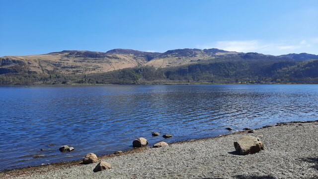
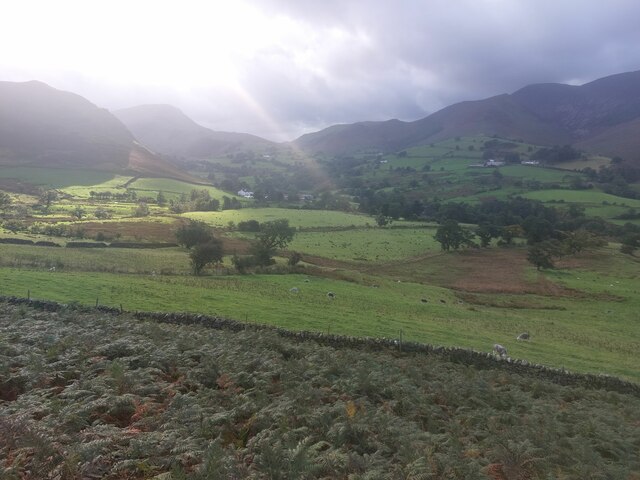
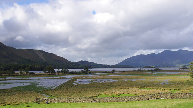
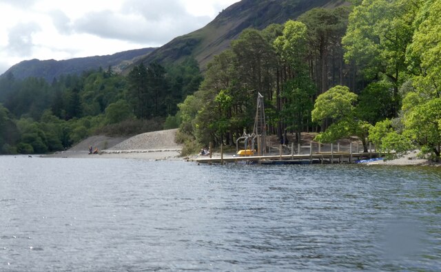
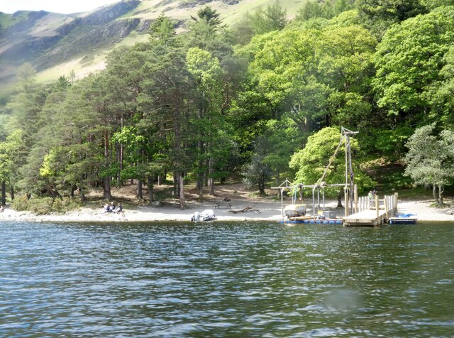
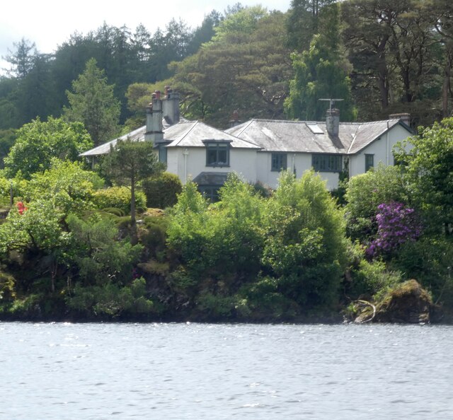
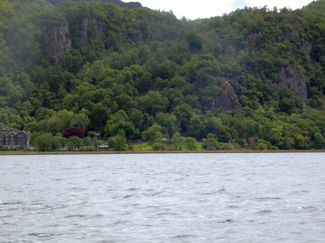
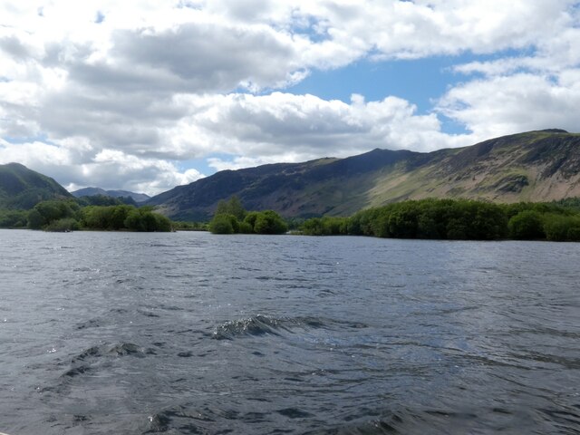
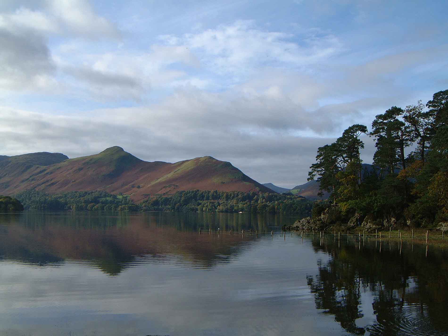
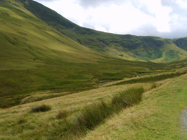
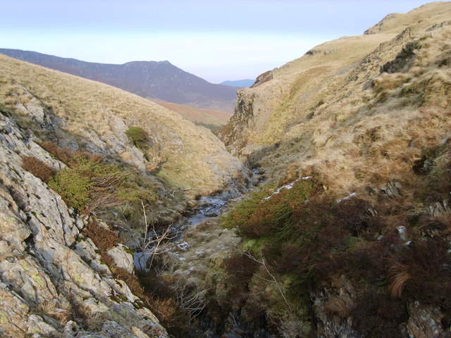
Brandelhow Park is a picturesque natural area located in the heart of Cumberland, England. Situated in the region known as Downs, Moorland, it covers a vast expanse of approximately 200 acres. The park is known for its stunning landscapes, diverse wildlife, and rich history.

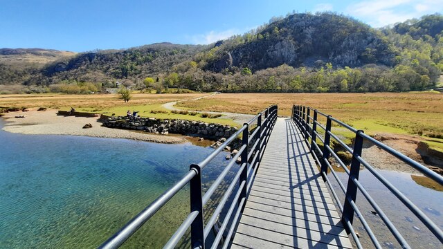
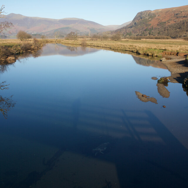
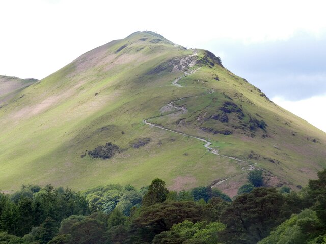
The park boasts a variety of terrains, including rolling hills, open moorland, and dense woodland. This creates a unique and ever-changing environment, offering visitors a range of experiences throughout the year. The park is popular with nature enthusiasts and hikers, who can explore the numerous walking trails that wind their way through the area.

Brandelhow Park is also home to a rich array of wildlife. Visitors may encounter a variety of bird species, including buzzards, kestrels, and owls, which thrive in the park's diverse habitats. The park is also a haven for small mammals, such as rabbits, foxes, and badgers, adding to its natural charm.

In addition to its natural beauty, Brandelhow Park holds significant historical importance. It is home to ancient archaeological sites, including burial mounds and stone circles, which date back to prehistoric times. These remnants of the past provide a fascinating glimpse into the area's history and add an element of intrigue to the park's ambiance.

Overall, Brandelhow Park in Cumberland is a captivating natural area that offers visitors a chance to immerse themselves in the beauty of the English countryside. With its diverse landscapes, abundant wildlife, and historical significance, it provides a rich and rewarding experience for all who visit.

If you have any feedback on the listing, please let us know in the comments section below.

Brandelhow Park Images

Images are sourced within 2km of 54.567851/-3.165931 or Grid Reference NY2419. Thanks to Geograph Open Source API. All images are credited.

Derwent Water seen from Brandlehow Landing Stage Bleaberry Fell and Castlerigg Fell can be seen on the other side of the lake.
Derwent Water seen from Brandlehow Landing Stage
Bleaberry Fell and Castlerigg Fell can be seen on the other side of the lake.
Footbridge over the River Derwent Across the flat river flood plain can be seen Shepherds Crag.
Footbridge over the River Derwent
Across the flat river flood plain can be seen Shepherds Crag.
Newlands Church The small church with attached former schoolroom in an isolated setting in the Newlands Valley.
Newlands Church
The small church with attached former schoolroom in an isolated setting in the Newlands Valley.
Yewthwaite Gill The course of Yewthwaite Gill, the sides of the channel showing sides of extensive erosion.
Yewthwaite Gill
The course of Yewthwaite Gill, the sides of the channel showing sides of extensive erosion.
The pastures of Yewthwaite Looking across the grassy pastures of Yewthwaite. After a day of heavy rain the sun is beginning to break through the clouds above the valley.
The pastures of Yewthwaite
Looking across the grassy pastures of Yewthwaite. After a day of heavy rain the sun is beginning to break through the clouds above the valley.
River Derwent flood plain The flat ground at the head of Derwent Water frequently floods. Skiddaw is in the far distance.
River Derwent flood plain
The flat ground at the head of Derwent Water frequently floods. Skiddaw is in the far distance.
River Derwent From the Chinese Bridge — looks nice enough to swim in, but take a closer look into the water in the shadow of the bridge: a dead sheep.
River Derwent
From the Chinese Bridge — looks nice enough to swim in, but take a closer look into the water in the shadow of the bridge: a dead sheep.
Path to Catbells The zig-zag path up to Catbells as viewed from Derwentwater.
Path to Catbells
The zig-zag path up to Catbells as viewed from Derwentwater.
High Brandelhow The jetty here is currently undergoing repair.
High Brandelhow
The jetty here is currently undergoing repair.
High Brandelhow The landing stage is presently undergoing repair.
High Brandelhow
The landing stage is presently undergoing repair.
Brandelhow Point Housing at Brandelhow Point.
Brandelhow Point
Housing at Brandelhow Point.
Housing at Brandelhow Point
Southern end of Derwentwater On the left is the Lodore Falls Hotel.  The B5289 to Borrowdale hugs the ground beneath Shepherds Crag <a href="https://www.geograph.org.uk/photo/1513276">NY2618 : Shepherds Crag</a>.
Southern end of Derwentwater
On the left is the Lodore Falls Hotel. The B5289 to Borrowdale hugs the ground beneath Shepherds Crag NY2618 : Shepherds Crag.
Buoys on Derwentwater Buoys direct boats into the channel for the Lodore landing stage. On the right water from the lake drains into the River Derwent. In the background is the Lodore Falls Hotel.
Buoys on Derwentwater
Buoys direct boats into the channel for the Lodore landing stage. On the right water from the lake drains into the River Derwent. In the background is the Lodore Falls Hotel.
Great Bay The southern end of Derwentwater.
Great Bay
The southern end of Derwentwater.
Outflow to the River Derwent 
Buoys direct vessels away from the river and towards the channel into the Lodore landing stage.
Outflow to the River Derwent
Buoys direct vessels away from the river and towards the channel into the Lodore landing stage.
Lodore Falls Hotel 
The main building dates from 1870 and was built on the site of a public house that dates back to at least 1795. It has had a number of owners over the years and is currently owned by Lake District Hotels Ltd. <span class="nowrap"><a title="https://issuu.com/lakedistricthotelsltd/docs/lodore_hotel_history_web" rel="nofollow ugc noopener" href="https://issuu.com/lakedistricthotelsltd/docs/lodore_hotel_history_web">Link</a><img style="margin-left:2px;" alt="External link" title="External link - shift click to open in new window" src="https://s1.geograph.org.uk/img/external.png" width="10" height="10"/></span>
Lodore Falls Hotel
The main building dates from 1870 and was built on the site of a public house that dates back to at least 1795. It has had a number of owners over the years and is currently owned by Lake District Hotels Ltd. LinkExternal link
Lodore Landing Stage
Show me another place!

Brandelhow Park is located at Grid Ref: NY2419 (Lat: 54.567851, Lng: -3.165931)

Administrative County: Cumbria

District: Allerdale

Police Authority: Cumbria

What 3 Words

///writers.fulfilled.texts. Near Keswick, Cumbria

Nearby Locations

Brandelhow Park Cat Bells

Related Wikis

Cat Bells

Cat Bells is a fell in the English Lake District in the county of Cumbria. It has a height of 451 metres (1,480 ft) and is one of the most popular fells...
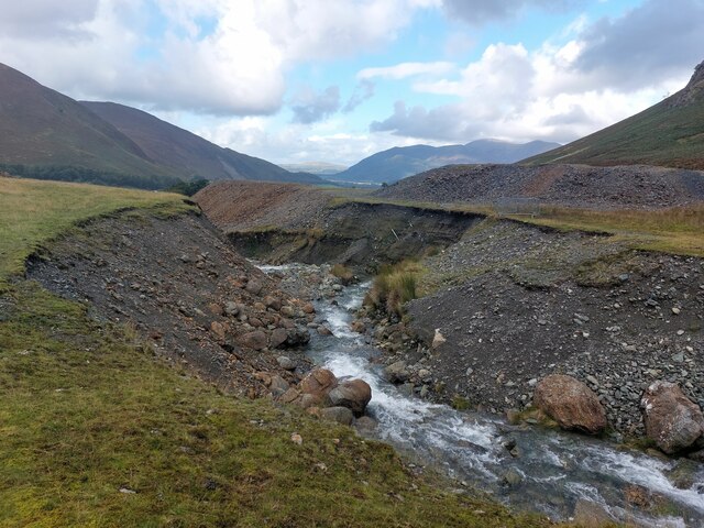
Rigg Beck

Rigg Beck is a minor river of Cumbria in England. Rigg Beck is also the name of a famous dwelling – the Purple House – placed where the Beck crosses the...

Little Town, Cumbria

Little Town is a hamlet in the civil parish of Above Derwent, in the Allerdale district of Cumbria, England. It is in the Workington constituency of the...

Newlands Valley

The Newlands Valley is in the Lake District National Park in Cumbria, England. It is regarded as one of the most picturesque and quiet valleys in the national...

Keskadale Beck

Keskadale Beck is a minor river of Cumbria, England. The beck rises at the confluence of High Hole Beck (which rises beneath Robinson Crags) and Moss Beck...

Scope Beck

Scope Beck is a minor river in the county of Cumbria in England. The beck runs through Little Dale, a valley between the mountains of Hindscarth (to the...
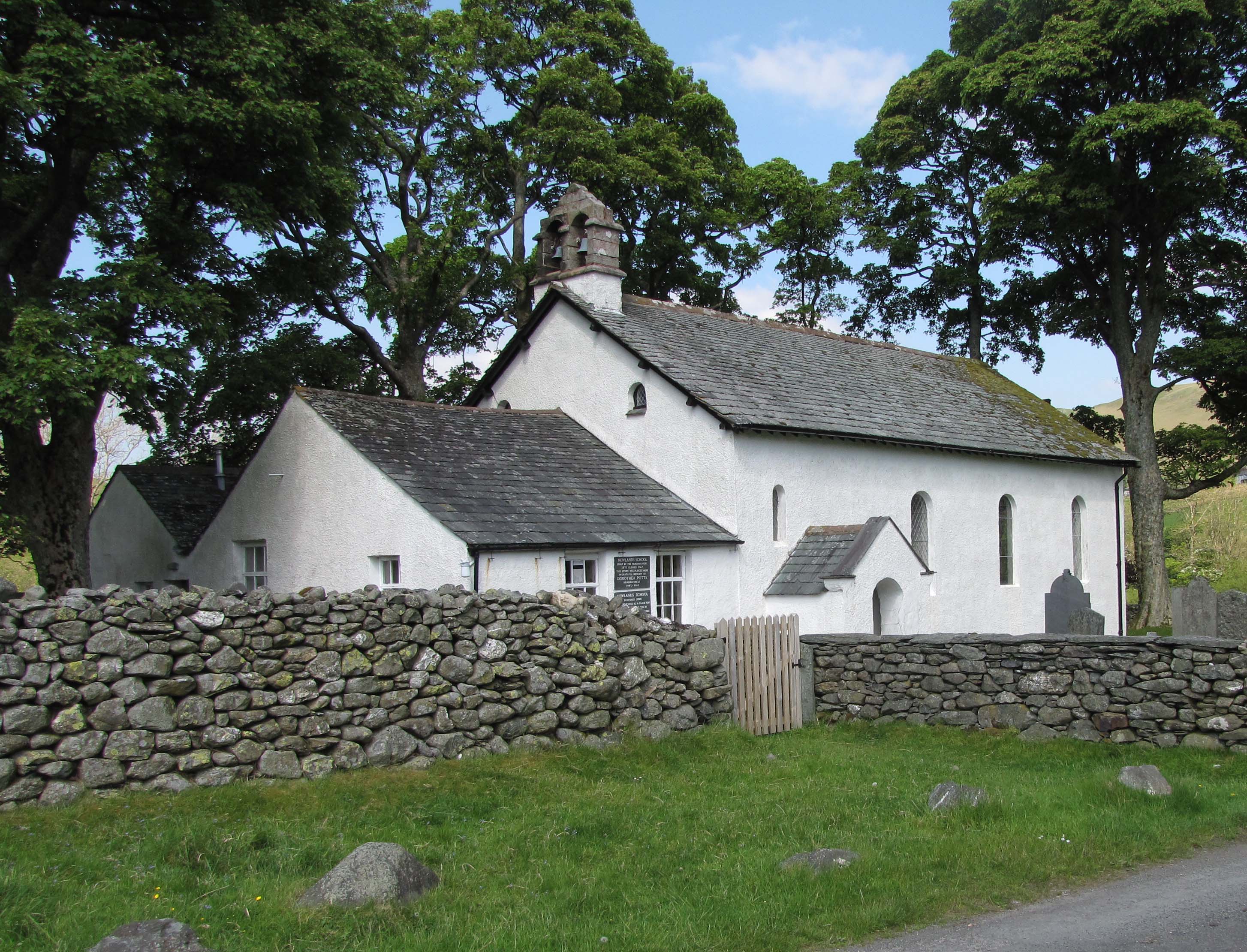
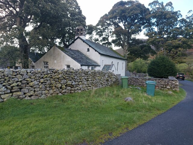
Newlands Church

Newlands Church is a 16th-century church situated less than 500 metres west of the hamlet of Little Town, Cumbria, England in the Newlands Valley of the...

Stair, Cumbria

Stair is a village in Cumbria, England. It is situated in the Newlands Valley, to the west of Derwent Water and within the Lake District National Park...

Nearby Amenities

Located within 500m of 54.567851,-3.165931
Cat Bells
Ele: 451
Natural: peak
Source: npe + survey
Wikidata: Q5051616
Wikipedia: en:Cat Bells
Lat/Long: 54.5683522/-3.1706606
Bus Stop
Brandelhow Park at track
Bus: yes
Local Ref: AT
Naptan AtcoCode: 090002111548
Naptan Bearing: S
Naptan BusStopType: CUS
Naptan CommonName: Brandelhow Park at track
Naptan Indicator: at
Naptan Landmark: Brandelhow Park-Derwent Water
Naptan NaptanCode: cumadatj
Naptan Street: No name
Naptan Verified: no
Public Transport: platform
Source: naptan_import
Lat/Long: 54.5709502/-3.1633782
Bus Stop
Brandelhow Park opp track
Bus: yes
Naptan AtcoCode: 090002113744
Naptan Bearing: N
Naptan BusStopType: CUS
Naptan CommonName: Brandelhow Park opp track
Naptan Indicator: o/s
Naptan Landmark: Brandelhow Park-Derwent Water
Naptan NaptanCode: cumadgaw
Naptan Street: No name
Naptan Verified: no
Public Transport: platform
Source: naptan_import
Lat/Long: 54.5709844/-3.1635648
Ferry Terminal
High Brandelhow
Ferry: yes
Public Transport: station
Lat/Long: 54.5675759/-3.1584714
Barrier: kissing_gate
Lat/Long: 54.5651699/-3.1600991
Brandlehow Lead Mine
Abandoned: yes
Man Made: mine
Mineral: lead
Lat/Long: 54.5663965/-3.1606257
Bench
Lat/Long: 54.5648491/-3.1623522
Tourism: viewpoint
Lat/Long: 54.5648661/-3.1622829
Brandlehow Park
Place: locality
Lat/Long: 54.5686462/-3.1649482
Barrier: kissing_gate
Bicycle: no
Foot: yes
Horse: no
Motor Vehicle: no
Wheelchair: no
Lat/Long: 54.5684425/-3.1626414
Mart Bield
Place: locality
Lat/Long: 54.5668153/-3.1731661
Barrier: kissing_gate
Material: wood
Lat/Long: 54.5708968/-3.1634273
Bench
Backrest: no
Lat/Long: 54.5650022/-3.1635568
Covered: no
Leisure: picnic_table
Material: wood
Lat/Long: 54.5677854/-3.1589177
Covered: no
Leisure: picnic_table
Lat/Long: 54.5674055/-3.1588791
The data included in this document is from www.openstreetmap.org. The data is made available under ODbL.

Have you been to Brandelhow Park?

Leave your review of Brandelhow Park below (or comments, questions and feedback).