Gardiner's Brae

Downs, Moorland in Dumfriesshire

Scotland

Gardiner's Brae

Road (B7068) descending from Standburn Looking south-westward.
Road (B7068) descending from Standburn Credit: Peter Wood

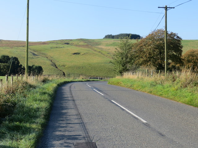
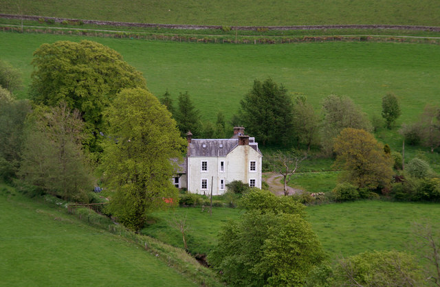
Gardiner's Brae is a picturesque area located in Dumfriesshire, Scotland. Situated amidst the stunning Downs and Moorland, it offers breathtaking views and a serene atmosphere. This tranquil spot is a haven for nature enthusiasts and those seeking a peaceful retreat.

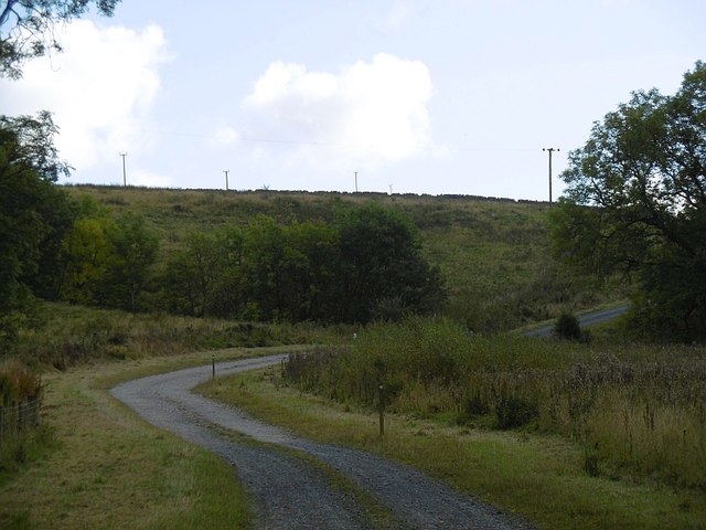
The landscape of Gardiner's Brae is characterized by rolling hills and open moorlands, covered in heather and grasses that create a vibrant and colorful vista. The area is known for its diverse wildlife, including various bird species, rabbits, and occasionally deer. The Downs, with their wide open spaces and gentle slopes, provide a perfect setting for leisurely walks and picnics.

The stunning natural beauty of Gardiner's Brae is complemented by its rich history and cultural significance. The area is dotted with remnants of ancient settlements, stone circles, and burial mounds, which serve as a testament to its long-standing human habitation. These historical sites attract archaeology enthusiasts and history buffs alike.

Visitors to Gardiner's Brae can enjoy a range of outdoor activities, such as hiking, birdwatching, and photography. The area is crisscrossed by several well-maintained trails, allowing visitors to explore the landscape at their own pace. In addition, the vast open spaces are ideal for kite flying and other recreational activities.

Overall, Gardiner's Brae in Dumfriesshire offers a captivating blend of natural beauty, historical significance, and outdoor recreation. It is a place where one can immerse themselves in the tranquility of nature and experience the rich heritage of the region.

If you have any feedback on the listing, please let us know in the comments section below.

Gardiner's Brae Images

Images are sourced within 2km of 55.13367/-3.226649 or Grid Reference NY2182. Thanks to Geograph Open Source API. All images are credited.

Road (B7068) descending from Standburn Looking south-westward.
Road (B7068) descending from Standburn
Looking south-westward.
Newhall Newhall Farm.
Newhall
Newhall Farm.
Milton House View of Milton House from the side of Birsca.
Milton House
View of Milton House from the side of Birsca.
Pyatshaws Burn Heading for the Water of Milk.
Pyatshaws Burn
Heading for the Water of Milk.
Old dyke A collapsed field boundary near Paddockhole.
Old dyke
A collapsed field boundary near Paddockhole.
Logpile, Paddockhole Stacked logs awaiting collection. A small conifer wood by the Water of Milk was being cut down.
Logpile, Paddockhole
Stacked logs awaiting collection. A small conifer wood by the Water of Milk was being cut down.
Corrie to Paddockhole road There are young conifers beyond the ashes.
Corrie to Paddockhole road
There are young conifers beyond the ashes.
Newhall Hill Sheep graze some well drained ground on the edge of the Southern Uplands.
Newhall Hill
Sheep graze some well drained ground on the edge of the Southern Uplands.
B7068, Paddockhole Langholm to Lockerbie road.
B7068, Paddockhole
Langholm to Lockerbie road.
Paddockhill Bridge Over the Water of Milk.
Paddockhill Bridge
Over the Water of Milk.
Minsca wind farm entrance A different set of notices from previous photographs suggesting that SSE no longer have an interest here.  One of them seems to have sneaked in to Scotland from somewhere less developed as it attempts to forbid access. Other signage is however compliant with the Law.

As usual, the road uses a new route onto the public road, bypassing a farm.
Minsca wind farm entrance
A different set of notices from previous photographs suggesting that SSE no longer have an interest here. One of them seems to have sneaked in to Scotland from somewhere less developed as it attempts to forbid access. Other signage is however compliant with the Law. As usual, the road uses a new route onto the public road, bypassing a farm.
Locks, Minsca wind farm An "OR gate".  Opening any one of the locks will open the gate. Every interest on the hill has its own lock.
Locks, Minsca wind farm
An "OR gate". Opening any one of the locks will open the gate. Every interest on the hill has its own lock.
Minsca wind farm road There was a road up the hill before the wind farm was built and a new entrance section was built linking it with the road bypassing Linnhall.
Minsca wind farm road
There was a road up the hill before the wind farm was built and a new entrance section was built linking it with the road bypassing Linnhall.
Minsca wind farm notices One seems to have strayed in from east of the border - attempting to forbid access (and smoking!). Other photographs show the site being managed by SSE, now it is Infinis.  Hi Infinis, welcome to Scotland.
Minsca wind farm notices
One seems to have strayed in from east of the border - attempting to forbid access (and smoking!). Other photographs show the site being managed by SSE, now it is Infinis. Hi Infinis, welcome to Scotland.
Water of Milk Downstream of Paddockhole.
Water of Milk
Downstream of Paddockhole.
Water of Milk Near Whiteknowe.
Water of Milk
Near Whiteknowe.
Water of Milk Sheep graze south of the river.
Water of Milk
Sheep graze south of the river.
Whiteknowe Looking over the Water of Milk.
Whiteknowe
Looking over the Water of Milk.
Show me another place!

Gardiner's Brae is located at Grid Ref: NY2182 (Lat: 55.13367, Lng: -3.226649)

Unitary Authority: Dumfries and Galloway

Police Authority: Dumfries and Galloway

What 3 Words

///galaxy.suffer.firewall. Near Lockerbie, Dumfries & Galloway

Related Wikis

Annandale and Eskdale

Annandale and Eskdale is a committee area in Dumfries and Galloway, Scotland. It covers the areas of Annandale and Eskdale, the straths of the River Annan...

Burnswark Hill

Burnswark Hill (also known as Birrenswark), to the east of the A74(M) between Ecclefechan and Lockerbie in Dumfries and Galloway, Scotland, is a prominent...

Whitcastles stone circle

Whitcastles or Little Hartfell (grid reference NY 2240 8806) is a stone circle 6½ miles NE of Lockerbie, Dumfries and Galloway. Nine fallen stones lie...

Scotsbrig

Scotsbrig is a farm near Ecclefechan, Dumfries and Galloway, Scotland, and a Category B listed building. Thomas Carlyle lived there with his family in...

Nearby Amenities

Located within 500m of 55.13367,-3.226649
Power: pole
Lat/Long: 55.1324631/-3.2197561
Power: pole
Lat/Long: 55.1327282/-3.220905
Power: pole
Lat/Long: 55.1329947/-3.2220127
Power: pole
Lat/Long: 55.1332819/-3.2232053
Power: pole
Lat/Long: 55.1335426/-3.224313
Power: pole
Lat/Long: 55.1337752/-3.2253253
Power: pole
Lat/Long: 55.1340418/-3.2264665
Power: pole
Lat/Long: 55.1343436/-3.2277364
Power: pole
Lat/Long: 55.1345778/-3.2287514
Power: pole
Lat/Long: 55.1346705/-3.2291043
Power: pole
Lat/Long: 55.1345734/-3.2305313
Power: pole
Lat/Long: 55.1344747/-3.2319481
Power: pole
Lat/Long: 55.1343981/-3.233352
Power: pole
Lat/Long: 55.1319889/-3.2205959
Power: pole
Lat/Long: 55.1312629/-3.2203228
Power: pole
Lat/Long: 55.1352272/-3.2329476
Power: pole
Lat/Long: 55.1360194/-3.2325689
The data included in this document is from www.openstreetmap.org. The data is made available under ODbL.

Have you been to Gardiner's Brae?

Leave your review of Gardiner's Brae below (or comments, questions and feedback).