Angerton Moss

Downs, Moorland in Lancashire South Lakeland

England

Angerton Moss

A595 at Ellermire Bridge
A595 at Ellermire Bridge Credit: Colin Pyle

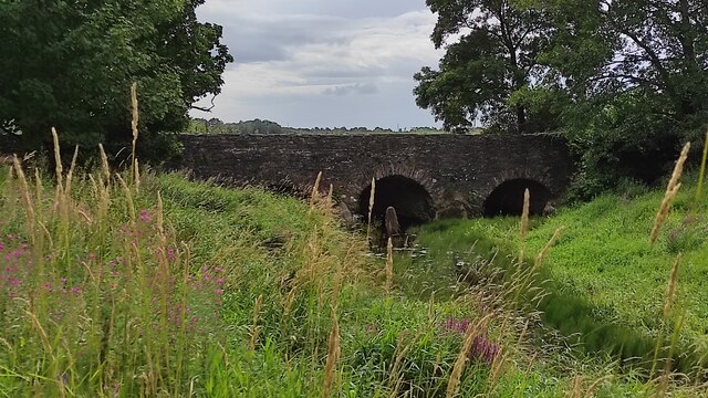
Angerton Moss is a vast and picturesque area situated in Lancashire, England. This region is known for its diverse landscape, featuring downs, moorland, and marshy terrain. Spanning across several square miles, Angerton Moss is a haven for nature enthusiasts and offers a unique charm that is distinctly Lancastrian.

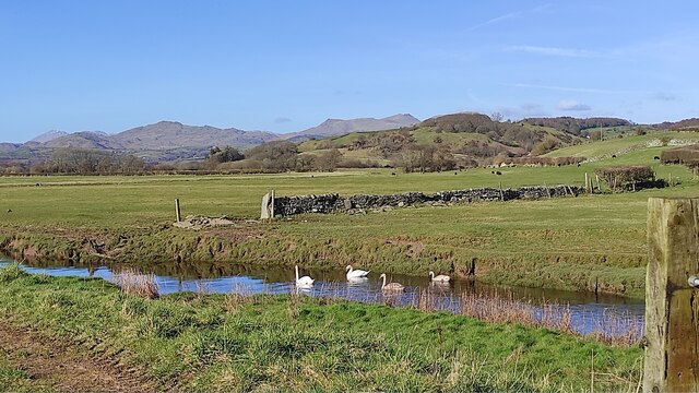
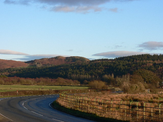
The downs in Angerton Moss provide a stunning backdrop of rolling hills and expansive grasslands. These open spaces are home to an array of plant and animal species, showcasing the region's ecological diversity. Visitors can enjoy leisurely walks or hikes, taking in the breathtaking views and observing wildlife such as rabbits, hares, and various bird species.

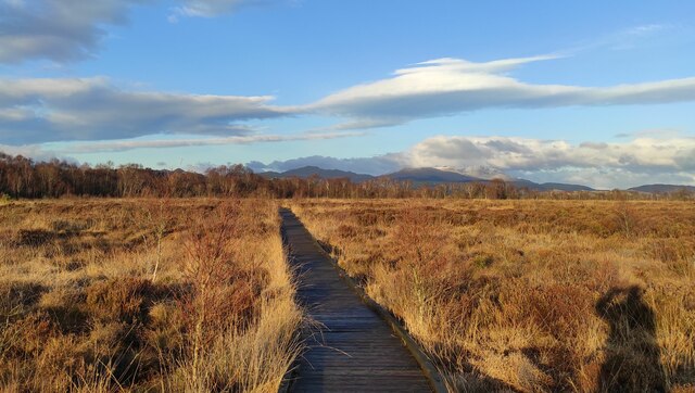
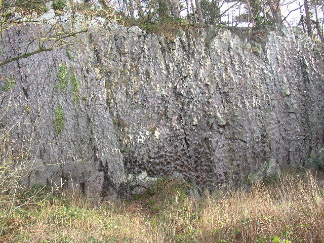
Moorland areas in Angerton Moss offer a different experience, with their rugged and wild beauty. These upland habitats are characterized by heather-covered hills, scattered with rocky outcrops. Moorland wildlife includes iconic species like red grouse and curlews, which can be spotted in their natural habitats.

The marshy sections of Angerton Moss provide a distinct contrast. These wetland areas are teeming with life, with an abundance of reeds, sedges, and bog plants. Marsh birds, such as snipes and lapwings, thrive in this environment, making it a fantastic spot for birdwatching.

Angerton Moss is a place of tranquility, where visitors can immerse themselves in the beauty of nature. It offers a variety of outdoor activities, including hiking, birdwatching, and photography. With its diverse landscape and rich biodiversity, this Lancashire gem is a must-visit destination for nature enthusiasts and those seeking a peaceful escape.

If you have any feedback on the listing, please let us know in the comments section below.

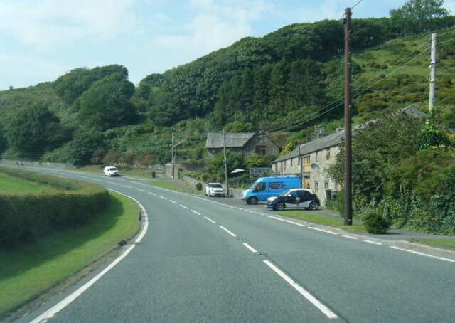
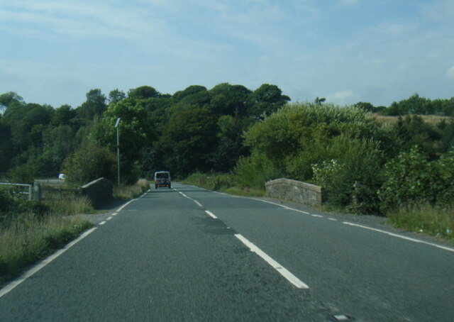
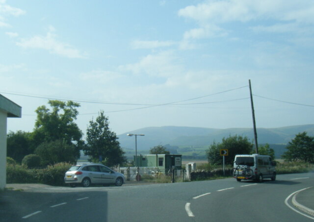
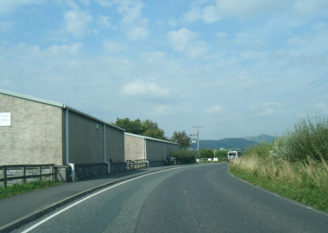
Angerton Moss Images

Images are sourced within 2km of 54.254402/-3.2012614 or Grid Reference SD2184. Thanks to Geograph Open Source API. All images are credited.
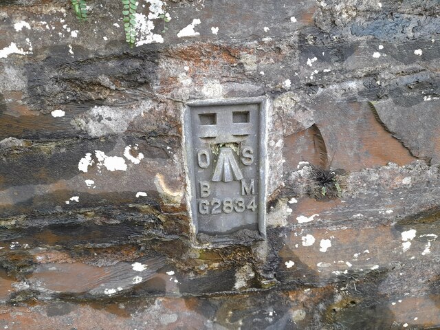
A595 at Ellermire Bridge
A595 at Galloper Pool Bridge
A595 near Skellow Crag End
A595 north of Foxfield
Wreaks Causeway End Bridge over Kirkby Pool Wreaks Causeway End Bridge carrying the A595.
Listed Building entry number 1138084. Grade II.
Listing includes carvings on the coping stones of the parapets.
<span class="nowrap"><a title="https://historicengland.org.uk/listing/the-list/list-entry/1138084?section=official-listing" rel="nofollow ugc noopener" href="https://historicengland.org.uk/listing/the-list/list-entry/1138084?section=official-listing">Link</a><img style="margin-left:2px;" alt="External link" title="External link - shift click to open in new window" src="https://s1.geograph.org.uk/img/external.png" width="10" height="10"/></span>
Wreaks Causeway End Bridge over Kirkby Pool
Wreaks Causeway End Bridge carrying the A595. Listed Building entry number 1138084. Grade II. Listing includes carvings on the coping stones of the parapets. LinkExternal link
Carved words on Wreaks Causeway End Bridge Wreaks Causeway End Bridge carrying the A595.
Listed Building entry number 1138084. Grade II.
Listing includes carvings on the coping stones of the parapets.
<span class="nowrap"><a title="https://historicengland.org.uk/listing/the-list/list-entry/1138084?section=official-listing" rel="nofollow ugc noopener" href="https://historicengland.org.uk/listing/the-list/list-entry/1138084?section=official-listing">Link</a><img style="margin-left:2px;" alt="External link" title="External link - shift click to open in new window" src="https://s1.geograph.org.uk/img/external.png" width="10" height="10"/></span>

"Do not stop long at the fair". One of many carvings on the parapets. Many of the stones have been damaged, presumably during bridge widening. Other carvings include "Yellow for ever", "Be kind to the poor", "A sensible man wont offend me and no other can", "Forget me not", "Happy land", "England for ever", "I can paddle my own canoe", "Tomorrow may be silent", "Thomas Dawson post messenger arrives [6 10 a m]".
Carved words on Wreaks Causeway End Bridge
Wreaks Causeway End Bridge carrying the A595. Listed Building entry number 1138084. Grade II. Listing includes carvings on the coping stones of the parapets. LinkExternal link "Do not stop long at the fair". One of many carvings on the parapets. Many of the stones have been damaged, presumably during bridge widening. Other carvings include "Yellow for ever", "Be kind to the poor", "A sensible man wont offend me and no other can", "Forget me not", "Happy land", "England for ever", "I can paddle my own canoe", "Tomorrow may be silent", "Thomas Dawson post messenger arrives [6 10 a m]".
Ordnance Survey Cut Mark This OS cut mark can be found on the north parapet of Galloper Pool Bridge. It marks a point 6.352m above mean sea level.
Ordnance Survey Cut Mark
This OS cut mark can be found on the north parapet of Galloper Pool Bridge. It marks a point 6.352m above mean sea level.
Ordnance Survey Flush Bracket (G2834) This OS Flush Bracket can be found on the north buttress of Wreaks Causeway Bridge. It marks a point 6.471m above mean sea level.
Ordnance Survey Flush Bracket (G2834)
This OS Flush Bracket can be found on the north buttress of Wreaks Causeway Bridge. It marks a point 6.471m above mean sea level.
Ordnance Survey Flush Bracket (S7106) This OS Flush Bracket can be found on old school building which is now a private property. It marks a point 14.673m above mean sea level.
Ordnance Survey Flush Bracket (S7106)
This OS Flush Bracket can be found on old school building which is now a private property. It marks a point 14.673m above mean sea level.
Ordnance Survey Cut Mark This OS cut mark can be found on the NE parapet of Ellermire Bridge. It marks a point 11.408m above mean sea level.
Ordnance Survey Cut Mark
This OS cut mark can be found on the NE parapet of Ellermire Bridge. It marks a point 11.408m above mean sea level.
Ordnance Survey Cut Mark This OS cut mark can be found on the house which was once the Mission Church. It marks a point 12.722m above mean sea level.
Ordnance Survey Cut Mark
This OS cut mark can be found on the house which was once the Mission Church. It marks a point 12.722m above mean sea level.
Ordnance Survey Cut Mark This hidden OS cut mark can be found on the wall SW side of the road. It marks a point 32.935m above mean sea level.
Ordnance Survey Cut Mark
This hidden OS cut mark can be found on the wall SW side of the road. It marks a point 32.935m above mean sea level.
path at Duddon Mosses National Nature Reserve On Bank End Moss. Caw and the Coniston range on the skyline, with a snow-capped "Old Man".
path at Duddon Mosses National Nature Reserve
On Bank End Moss. Caw and the Coniston range on the skyline, with a snow-capped "Old Man".
Swans on Kirkby Pool near Moss House, Angerton Kirkby Pool flows through the mosses, entering the Duddon estuary at Kirkby-in-Furness. On the skyline are Caw and the Coniston range.
Swans on Kirkby Pool near Moss House, Angerton
Kirkby Pool flows through the mosses, entering the Duddon estuary at Kirkby-in-Furness. On the skyline are Caw and the Coniston range.
Foxfield signal box and station Foxfield signal box and station, trains to Carlisle and Barrow
Foxfield signal box and station
Foxfield signal box and station, trains to Carlisle and Barrow
Bank End Hill From the A595, the view includes spoil heaps from Kirby Slate Quarries at SD2484.
Bank End Hill
From the A595, the view includes spoil heaps from Kirby Slate Quarries at SD2484.
'Donkey Rock', Broughton-in-Furness By the roadside at SD210867, Bush Green Quarry has a cliff-face 70m across and 10m high that shows 'sole structures' in the almost vertically bedded turbidite sandstones and mudstones (Coniston Grits) of Silurian age, about 400 million years old. These are knobbly lumps on the surface of the rock, formed by the deposition of hard material on the sea-bed by deep-water currents, and there are more than 1800 of them, mainly types known as flute and load casts, covering six bedding planes (see <span class="nowrap"><a title="www.ougsnw.org.uk/photo_gallery/Geoscenes/" rel="nofollow ugc noopener" href="http://www.ougsnw.org.uk/photo_gallery/Geoscenes/">Link</a><img style="margin-left:2px;" alt="External link" title="External link - shift click to open in new window" src="https://s1.geograph.org.uk/img/external.png" width="10" height="10"/></span> Foxfield.html).    Further information see Moseley 1978 Geology of the Lake District, p 143, Yorkshire Geological Society.
'Donkey Rock', Broughton-in-Furness
By the roadside at SD210867, Bush Green Quarry has a cliff-face 70m across and 10m high that shows 'sole structures' in the almost vertically bedded turbidite sandstones and mudstones (Coniston Grits) of Silurian age, about 400 million years old. These are knobbly lumps on the surface of the rock, formed by the deposition of hard material on the sea-bed by deep-water currents, and there are more than 1800 of them, mainly types known as flute and load casts, covering six bedding planes (see LinkExternal link Foxfield.html). Further information see Moseley 1978 Geology of the Lake District, p 143, Yorkshire Geological Society.
Wreaks Causeway The road from Broughton in Furness to Grizebeck curves round to cross Wreaks Moss
Wreaks Causeway
The road from Broughton in Furness to Grizebeck curves round to cross Wreaks Moss
Show me another place!

Angerton Moss is located at Grid Ref: SD2184 (Lat: 54.254402, Lng: -3.2012614)

Administrative County: Cumbria

District: South Lakeland

Police Authority: Cumbria

What 3 Words

///advantage.included.reset. Near Millom, Cumbria

Related Wikis

Foxfield, Cumbria

Foxfield is a village on the west coast of Cumbria, England, in the Furness district that was part of Lancashire from 1182 to 1974. It lies on the Duddon...

Foxfield railway station

Foxfield is a railway station on the Cumbrian Coast Line, which runs between Carlisle and Barrow-in-Furness. The station, situated 11+1⁄2 miles (19 km...

Angerton, South Lakeland

Angerton is a civil parish in the Westmorland and Furness district of the ceremonial county of Cumbria, England, historically part of the Furness portion...

Eccle Riggs

Eccle Riggs is a country house located on Eccle Riggs, a ridge of land about 0.75 miles (1.2 km) to the south of Broughton-in-Furness, Cumbria, England...

Broughton-in-Furness railway station

Broughton-in-Furness railway station served the market town of Broughton-in-Furness, in Lancashire, England (now in Cumbria). It was on the branch line...

Kirkby-in-Furness railway station

Kirkby-in-Furness is a railway station on the Cumbrian Coast Line, which runs between Carlisle and Barrow-in-Furness. The station, situated 9+1⁄4 miles...

St Mary Magdalene's Church, Broughton-in-Furness

St Mary Magdalene's Church is in Broughton-in-Furness, Cumbria, England. It is an active Anglican parish church in the deanery of Furness, the archdeaconry...

Kirkby Ireleth

Kirkby Ireleth is a civil parish in the South Lakeland district of the English county of Cumbria. It includes the villages of Grizebeck and Kirkby-in...

Nearby Amenities

Located within 500m of 54.254402,-3.2012614
Power: tower
Lat/Long: 54.2517155/-3.202557
Power: tower
Lat/Long: 54.2536727/-3.2055504
Power: tower
Lat/Long: 54.2555953/-3.2085088
Power: tower
Lat/Long: 54.2500952/-3.2000813
Railway: level_crossing
Lat/Long: 54.2523555/-3.2075312
Railway: level_crossing
Lat/Long: 54.252365/-3.2074902
Power: pole
Lat/Long: 54.2541802/-3.20759
Power: pole
Lat/Long: 54.2535179/-3.206478
Power: pole
Lat/Long: 54.250935/-3.2052418
Barrier: kissing_gate
Lat/Long: 54.2532927/-3.2010866
Power: pole
Lat/Long: 54.2523271/-3.2044098
Power: pole
Lat/Long: 54.2529698/-3.2055261
Power: pole
Lat/Long: 54.2535139/-3.206471
Power: pole
Lat/Long: 54.2548979/-3.208861
Power: pole
Lat/Long: 54.2517095/-3.1956407
Power: pole
Lat/Long: 54.255992/-3.2033289
Power: pole
Lat/Long: 54.2564352/-3.2047238
Power: pole
Lat/Long: 54.2568614/-3.2061542
The data included in this document is from www.openstreetmap.org. The data is made available under ODbL.

Have you been to Angerton Moss?

Leave your review of Angerton Moss below (or comments, questions and feedback).