Halfway

Settlement in Derbyshire

England

Halfway

Mosborough Hall Hotel A 17th century house, now a hotel.  There is another building nearby called Mosborough Hall, confusion is easy.  This one is the hotel.

This is a grade II listed building - see <span class="nowrap"><a title="https://historicengland.org.uk/listing/the-list/list-entry/1255139?section=official-list-entry" rel="nofollow ugc noopener" href="https://historicengland.org.uk/listing/the-list/list-entry/1255139?section=official-list-entry">Link</a><img style="margin-left:2px;" alt="External link" title="External link - shift click to open in new window" src="https://s1.geograph.org.uk/img/external.png" width="10" height="10"/></span>.  The hotel's own web site traces the history back to the 12th century, but not in this building. - <span class="nowrap"><a title="https://www.mosboroughhall.co.uk/about-us/our-history" rel="nofollow ugc noopener" href="https://www.mosboroughhall.co.uk/about-us/our-history">Link</a><img style="margin-left:2px;" alt="External link" title="External link - shift click to open in new window" src="https://s1.geograph.org.uk/img/external.png" width="10" height="10"/></span>
Mosborough Hall Hotel Credit: Bob Harvey

Halfway is a small village located in the county of Derbyshire, England. It lies approximately halfway between the towns of Chesterfield and Sheffield, hence its name. With a population of around 2,000 residents, Halfway is a close-knit community that offers a tranquil and picturesque setting.

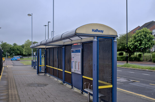
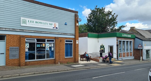
The village is primarily residential, characterized by rows of charming cottages and a few local amenities. These include a post office, a convenience store, a pub, and a primary school, which serves the local children. Despite its small size, Halfway benefits from excellent transport links, with regular bus services connecting it to nearby towns.

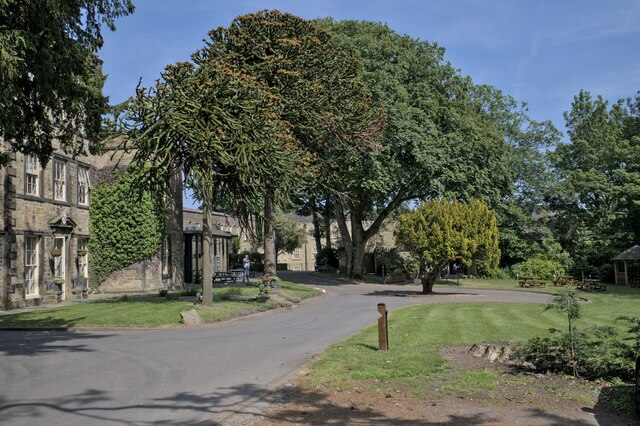
Surrounded by stunning countryside, Halfway attracts nature enthusiasts and outdoor lovers alike. There are several walking and cycling routes in the area, providing opportunities to explore the scenic landscapes and enjoy the fresh air. The nearby Moss Valley Country Park is a popular spot for nature walks and picnics.

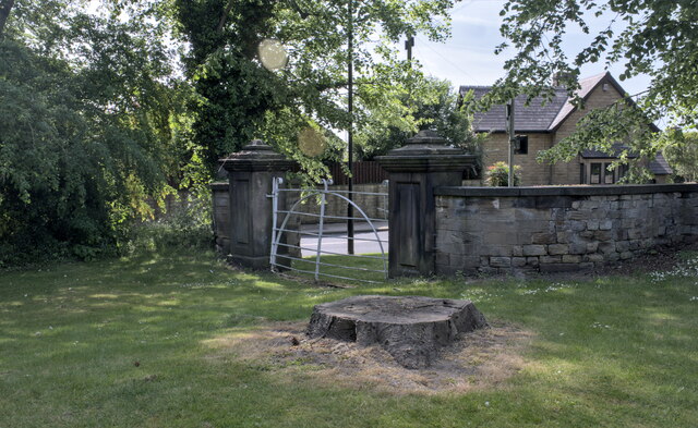
Halfway is also rich in history, with its origins dating back to medieval times. The village still retains some historic buildings, such as the Grade II listed Halfway House, which was once a coaching inn. Additionally, the nearby Renishaw Hall and Gardens, a stately home dating back to the 17th century, offers visitors a glimpse into the area's past.

Overall, Halfway is a charming village that offers a peaceful and idyllic lifestyle. Its scenic surroundings, community spirit, and convenient location make it an attractive place to live or visit for those seeking a slower pace of life in the heart of the English countryside.

If you have any feedback on the listing, please let us know in the comments section below.
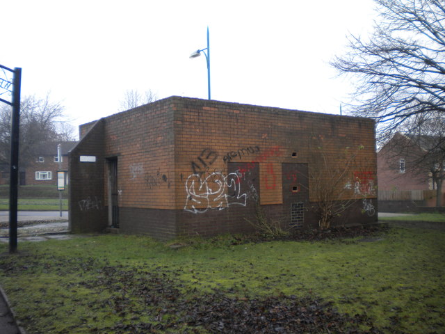
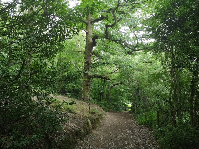
Halfway Images

Images are sourced within 2km of 53.324378/-1.344626 or Grid Reference SK4381. Thanks to Geograph Open Source API. All images are credited.

Mosborough Hall Hotel A 17th century house, now a hotel.  There is another building nearby called Mosborough Hall, confusion is easy.  This one is the hotel.

This is a grade II listed building - see <span class="nowrap"><a title="https://historicengland.org.uk/listing/the-list/list-entry/1255139?section=official-list-entry" rel="nofollow ugc noopener" href="https://historicengland.org.uk/listing/the-list/list-entry/1255139?section=official-list-entry">Link</a><img style="margin-left:2px;" alt="External link" title="External link - shift click to open in new window" src="https://s1.geograph.org.uk/img/external.png" width="10" height="10"/></span>.  The hotel's own web site traces the history back to the 12th century, but not in this building. - <span class="nowrap"><a title="https://www.mosboroughhall.co.uk/about-us/our-history" rel="nofollow ugc noopener" href="https://www.mosboroughhall.co.uk/about-us/our-history">Link</a><img style="margin-left:2px;" alt="External link" title="External link - shift click to open in new window" src="https://s1.geograph.org.uk/img/external.png" width="10" height="10"/></span>
Mosborough Hall Hotel
A 17th century house, now a hotel. There is another building nearby called Mosborough Hall, confusion is easy. This one is the hotel. This is a grade II listed building - see LinkExternal link. The hotel's own web site traces the history back to the 12th century, but not in this building. - LinkExternal link
The South Frontage The south frontage of Mosborough Hall Hotel, as described in the Historic England listing.  This is a grade II listed building - see <span class="nowrap"><a title="https://historicengland.org.uk/listing/the-list/list-entry/1255139?section=official-list-entry" rel="nofollow ugc noopener" href="https://historicengland.org.uk/listing/the-list/list-entry/1255139?section=official-list-entry">Link</a><img style="margin-left:2px;" alt="External link" title="External link - shift click to open in new window" src="https://s1.geograph.org.uk/img/external.png" width="10" height="10"/></span>.  

The hotel's own web site traces the history back to the 12th century, but not in this building. - <span class="nowrap"><a title="https://www.mosboroughhall.co.uk/about-us/our-history" rel="nofollow ugc noopener" href="https://www.mosboroughhall.co.uk/about-us/our-history">Link</a><img style="margin-left:2px;" alt="External link" title="External link - shift click to open in new window" src="https://s1.geograph.org.uk/img/external.png" width="10" height="10"/></span>
The South Frontage
The south frontage of Mosborough Hall Hotel, as described in the Historic England listing. This is a grade II listed building - see LinkExternal link. The hotel's own web site traces the history back to the 12th century, but not in this building. - LinkExternal link
The crest over the door This is the heraldic device above the french windows in <a href="https://www.geograph.org.uk/photo/7503378">SK4280 : The South Frontage</a>, at Mosborough Hall Hotel.  I have been unable to identify the attribution of this badge.
The crest over the door
This is the heraldic device above the french windows in SK4280 : The South Frontage, at Mosborough Hall Hotel. I have been unable to identify the attribution of this badge.
Mosborough Hall Hotel This is a grade II listed building - see <span class="nowrap"><a title="https://historicengland.org.uk/listing/the-list/list-entry/1255139?section=official-list-entry" rel="nofollow ugc noopener" href="https://historicengland.org.uk/listing/the-list/list-entry/1255139?section=official-list-entry">Link</a><img style="margin-left:2px;" alt="External link" title="External link - shift click to open in new window" src="https://s1.geograph.org.uk/img/external.png" width="10" height="10"/></span>.
Mosborough Hall Hotel
This is a grade II listed building - see LinkExternal link.
Entrance gateway No longer in use, this gateway is grade II listed in its own right - see <span class="nowrap"><a title="https://historicengland.org.uk/listing/the-list/list-entry/1255082" rel="nofollow ugc noopener" href="https://historicengland.org.uk/listing/the-list/list-entry/1255082">Link</a><img style="margin-left:2px;" alt="External link" title="External link - shift click to open in new window" src="https://s1.geograph.org.uk/img/external.png" width="10" height="10"/></span> .
Entrance gateway
No longer in use, this gateway is grade II listed in its own right - see LinkExternal link .
Tram Shelter The tram shelter at Halfway Park and Ride
Tram Shelter
The tram shelter at Halfway Park and Ride
Pink tram Boarding the tram at Halfway
Pink tram
Boarding the tram at Halfway
Lloyds Bank, Eckington Opened a new account online last month for a special purpose, other accounts all being in Sheffield. It was allocated to this small office 9 miles from my home. Had to go and see where it was before closing the account. 

Got there and found the branch itself was closing- on Wednesday 9th August 2023. It was busy with every queuing customer probably over 60.
Lloyds Bank, Eckington
Opened a new account online last month for a special purpose, other accounts all being in Sheffield. It was allocated to this small office 9 miles from my home. Had to go and see where it was before closing the account. Got there and found the branch itself was closing- on Wednesday 9th August 2023. It was busy with every queuing customer probably over 60.
Bus in Eckington bus station Stagecoach Chesterfield 15696, a Scania N230/Alexander Dennis Enviro 400, pauses in Eckington's small bus station on its way from Chesterfield to Sheffield.
Bus in Eckington bus station
Stagecoach Chesterfield 15696, a Scania N230/Alexander Dennis Enviro 400, pauses in Eckington's small bus station on its way from Chesterfield to Sheffield.
Church Street, Eckington Leading from the town centre towards the main road to Sheffield.
Church Street, Eckington
Leading from the town centre towards the main road to Sheffield.
Large house on Church Street, Eckington
Angel Hotel, Eckington Now apparently converted into flats.
Angel Hotel, Eckington
Now apparently converted into flats.
Footpath to Eckington bus station Leading up the slight hill from Market Street.
Footpath to Eckington bus station
Leading up the slight hill from Market Street.
Disused toilets, Eckington bus station This apparently long disused toilet block elevates the bus station from merely basic firmly into the depressing category.
Disused toilets, Eckington bus station
This apparently long disused toilet block elevates the bus station from merely basic firmly into the depressing category.
Eckington bus station Simply four bus shelters along a large turning circle, seen under a gradually clearing winter sky.
Eckington bus station
Simply four bus shelters along a large turning circle, seen under a gradually clearing winter sky.
Path off Boiley Lane
Eckington Church
Eckington Church
Sheffield Country Walk Woodland path approaching Eckington on the Sheffield Country Walk
Sheffield Country Walk
Woodland path approaching Eckington on the Sheffield Country Walk
Show me another place!

Halfway is located at Grid Ref: SK4381 (Lat: 53.324378, Lng: -1.344626)

Unitary Authority: Sheffield

Police Authority: South Yorkshire

What 3 Words

///ghost.strutting.scratches. Near Beighton, South Yorkshire

Nearby Locations

Halfway Westfield

Related Wikis

Eckington Cemetery

Eckington Cemetery is a cemetery in Eckington, Derbyshire, England. The cemetery serves Eckington itself, as well as nearby villages such as Mosborough...
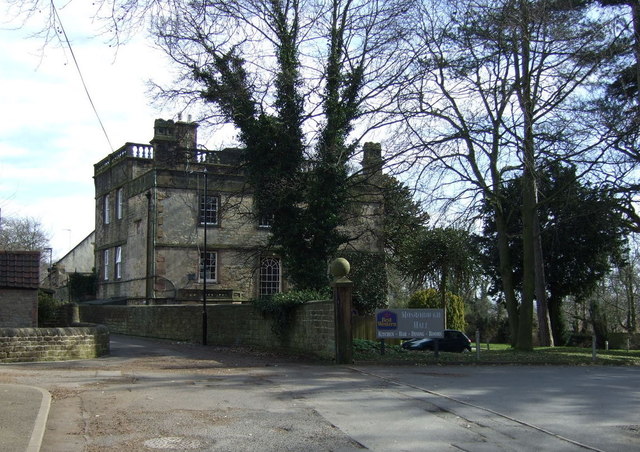
Mosborough Hall

Mosborough Hall is a 17th-century Grade II-listed building in Mosborough, Sheffield, England. The building was originally a manor house in what was then...

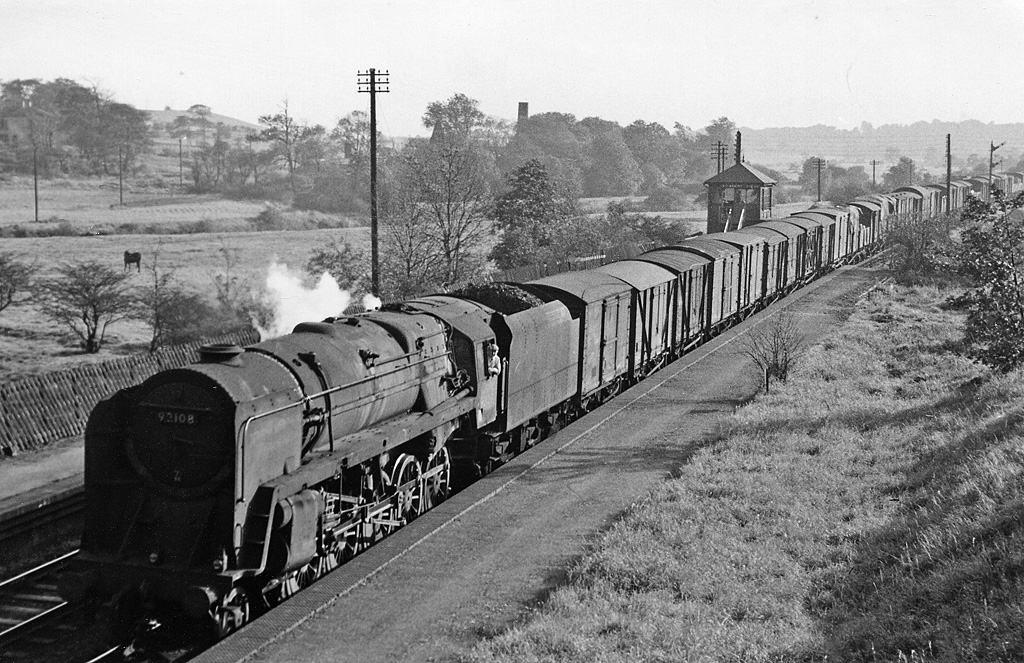
Killamarsh West railway station

Killamarsh West is a former railway station in Halfway, South Yorkshire, England. == History == A station was opened on the site by the North Midland Railway...

Killamarsh Central railway station

Killamarsh Central is a former railway station in Killamarsh, Derbyshire, England. == Ambiguity == Three stations served the village, all of which started...

Nearby Amenities

Located within 500m of 53.324378,-1.344626
Traffic Signals
Lat/Long: 53.3204692/-1.3465715
Halfway
Network: Supertram
Operator: Stagecoach
Public Transport: stop_position
Railway: tram_stop
Tram: yes
Lat/Long: 53.3285388/-1.3442988
Turning Circle
Lat/Long: 53.3252383/-1.3495121
Bus Stop
Station Road/South View
Alt Name: Station Road/South View
Bus: yes
Naptan AltCommonName: Station Road/South View
Naptan AtcoCode: 370021628
Naptan Bearing: N
Naptan CommonName: Station Road/South View
Naptan Indicator: 21628
Naptan Landmark: Syt Depot
Naptan PlusbusZoneRef: ROTHCEN
Naptan Street: Station Road
Naptan Verified: no
Public Transport: platform
Shelter: yes
Source: naptan_import
Lat/Long: 53.3275394/-1.3398053
Bus Stop
Station Road/Eckington Way
Alt Name: Station Road/Eckington Way
Bench: no
Bus: yes
Lit: no
Naptan AltCommonName: Station Road/Eckington Way
Naptan AtcoCode: 370021658
Naptan Bearing: NE
Naptan CommonName: Station Road/Eckington Way
Naptan Indicator: 21658
Naptan Landmark: Traffic Island
Naptan PlusbusZoneRef: ROTHCEN
Naptan Street: Station Road
Naptan Verified: no
Public Transport: platform
Shelter: no
Source: naptan_import
Tactile Paving: yes
Lat/Long: 53.3276719/-1.3435718
Bus Stop
Rotherham Road/School Avenue
Alt Name: Rotherham Road/School Avenue
Bus: yes
Naptan AltCommonName: Rotherham Road/School Avenue
Naptan AtcoCode: 370021659
Naptan Bearing: N
Naptan CommonName: Rotherham Road/School Avenue
Naptan Indicator: 21659
Naptan Landmark: MORRISONS
Naptan PlusbusZoneRef: ROTHCEN
Naptan Street: Rotherham Road
Naptan Verified: no
Public Transport: platform
Shelter: yes
Source: naptan_import
Lat/Long: 53.3250289/-1.3460113
Bus Stop
Rotherham Road/Station Road
Bus: yes
Naptan AtcoCode: 370021660
Naptan Bearing: S
Naptan CommonName: Rotherham Road/Station Road
Naptan Indicator: 21660
Naptan Landmark: Traffic Island
Naptan PlusbusZoneRef: ROTHCEN
Naptan Street: Rotherham Road
Naptan Verified: no
Public Transport: platform
Source: naptan_import
Lat/Long: 53.3267309/-1.3456534
Bus Stop
Westfield Southway/Eastcroft Drive
Alt Name: Westfield Southway/Eastcroft Drive
Bus: yes
Naptan AltCommonName: Westfield Southway/Eastcroft Drive
Naptan AtcoCode: 370021672
Naptan Bearing: S
Naptan CommonName: Westfield Southway/Eastcroft Drive
Naptan Indicator: 21672
Naptan Landmark: Subway/The Mill
Naptan PlusbusZoneRef: ROTHCEN
Naptan Street: Westfield Southway
Naptan Verified: no
Public Transport: platform
Source: naptan_import
Lat/Long: 53.3280157/-1.348817
Bus Stop
Station Road/Halfway Drive
Bus: yes
Naptan AtcoCode: 370021673
Naptan Bearing: NE
Naptan CommonName: Station Road/Halfway Drive
Naptan Indicator: 21673
Naptan Landmark: The Joseph Glover Pub
Naptan PlusbusZoneRef: ROTHCEN
Naptan Street: Station Road
Naptan Verified: no
Public Transport: platform
Source: naptan_import
Lat/Long: 53.3277432/-1.3483106
Bus Stop
Station Road/Halfway Drive
Bus: yes
Naptan AtcoCode: 370021674
Naptan Bearing: SW
Naptan CommonName: Station Road/Halfway Drive
Naptan Indicator: 21674
Naptan Landmark: The Mill
Naptan PlusbusZoneRef: ROTHCEN
Naptan Street: Station Road
Naptan Verified: no
Public Transport: platform
Source: naptan_import
Lat/Long: 53.3276256/-1.3481623
Bus Stop
Rotherham Road/Sewell Road
Alt Name: Rotherham Road/Sewell Road
Bus: yes
Naptan AltCommonName: Rotherham Road/Sewell Road
Naptan AtcoCode: 370021702
Naptan Bearing: N
Naptan CommonName: Rotherham Road/Sewell Road
Naptan Indicator: 21702
Naptan Landmark: 21702
Naptan PlusbusZoneRef: ROTHCEN
Naptan Street: Rotherham Road
Naptan Verified: no
Public Transport: platform
Source: naptan_import
Lat/Long: 53.3235391/-1.3462439
Bus Stop
Rotherham Road/Sewell Road
Bus: yes
Naptan AtcoCode: 370021703
Naptan Bearing: SE
Naptan CommonName: Rotherham Road/Sewell Road
Naptan Indicator: 21703
Naptan Landmark: Outside Pet Care Animal Feed S
Naptan PlusbusZoneRef: ROTHCEN
Naptan Street: Rotherham Road
Naptan Verified: no
Public Transport: platform
Source: naptan_import
Lat/Long: 53.3226249/-1.3460165
Bus Stop
Rotherham Road/Hollow Lane
Alt Name: Rotherham Road/Hollow Lane
Bus: yes
Naptan AltCommonName: Rotherham Road/Hollow Lane
Naptan AtcoCode: 370021704
Naptan Bearing: N
Naptan CommonName: Rotherham Road/Hollow Lane
Naptan Indicator: 21704
Naptan Landmark: Willon Holmes
Naptan PlusbusZoneRef: ROTHCEN
Naptan Street: Rotherham Road
Naptan Verified: no
Public Transport: platform
Source: naptan_import
Lat/Long: 53.3219795/-1.3463567
Bus Stop
Halfway Tram Terminus/Park and Ride
Alt Name: Halfway Tram Terminus/Park and Ride
Bus: yes
Naptan AltCommonName: Halfway Tram Terminus/Park and Ride
Naptan AtcoCode: 370026725
Naptan Bearing: N
Naptan CommonName: Halfway Tram Terminus/Park and Ride
Naptan Indicator: 26725
Naptan Landmark: Halfway Tram Stop
Naptan PlusbusZoneRef: ROTHCEN
Naptan Street: Eckington Way
Naptan Verified: no
Public Transport: platform
Source: naptan_import
Lat/Long: 53.3283233/-1.3445278
Bus Stop
Station Road/Rotherham Road
Bench: yes
Bus: yes
Lit: yes
Naptan AtcoCode: 370027027
Naptan Bearing: N
Naptan CommonName: Station Road/Rotherham Road
Naptan Indicator: 27027
Naptan Landmark: Opposite Halfway Park & Ride
Naptan PlusbusZoneRef: ROTHCEN
Naptan Street: Station Road
Naptan Verified: no
Public Transport: platform
Shelter: yes
Source: naptan_import
Tactile Paving: no
Lat/Long: 53.3275001/-1.3422946
Bus Stop
Oxclose/Morrisons
Alt Name: Oxclose/Morrisons
Bench: no
Bus: yes
Naptan AltCommonName: Oxclose/Morrisons
Naptan AtcoCode: 370027225
Naptan Bearing: N
Naptan CommonName: Oxclose/Morrisons
Naptan Indicator: 27225
Naptan Landmark: 27225
Naptan PlusbusZoneRef: ROTHCEN
Naptan Street: Service Road
Naptan Verified: no
Public Transport: platform
Shelter: no
Source: naptan_import
Tactile Paving: no
Lat/Long: 53.3247036/-1.3431471
Bicycle Parking
Bicycle Parking: stands
Capacity: 12
Covered: yes
Lat/Long: 53.3278424/-1.344135
Turning Circle
Lat/Long: 53.3252929/-1.3510577
Crossing
Bicycle: yes
Crossing: traffic_signals
Lat/Long: 53.3277527/-1.3461373
Turning Circle
Lat/Long: 53.3279687/-1.3407318
Mini Roundabout
Direction: clockwise
Lat/Long: 53.3243142/-1.3438572
Turning Circle
Lat/Long: 53.3261335/-1.3434177
Turning Circle
Lat/Long: 53.3265142/-1.3472834
Turning Circle
Lat/Long: 53.3257423/-1.3473353
Turning Circle
Lat/Long: 53.3246905/-1.3480689
Turning Circle
Lat/Long: 53.3241869/-1.348045
Turning Circle
Lat/Long: 53.3233467/-1.3515612
Turning Circle
Lat/Long: 53.3231042/-1.3504598
Turning Circle
Lat/Long: 53.3232331/-1.3489337
Turning Circle
Lat/Long: 53.3227521/-1.3490245
Turning Circle
Lat/Long: 53.3232882/-1.3498426
Turning Circle
Lat/Long: 53.3217811/-1.3503689
Turning Circle
Lat/Long: 53.3219172/-1.3491077
Turning Circle
Lat/Long: 53.3214041/-1.3495636
Turning Circle
Lat/Long: 53.3214131/-1.3485304
Turning Circle
Lat/Long: 53.3211636/-1.3471149
Turning Circle
Lat/Long: 53.3205013/-1.3473681
Turning Circle
Lat/Long: 53.3200737/-1.345776
Turning Circle
Lat/Long: 53.3207053/-1.3428315
Turning Circle
Lat/Long: 53.3206035/-1.3447133
Turning Circle
Lat/Long: 53.3210581/-1.3444352
Turning Circle
Lat/Long: 53.3213116/-1.3455225
Turning Circle
Lat/Long: 53.3206208/-1.3419259
Bicycle Parking
Bicycle Parking: stands
Capacity: 26
Covered: no
Lat/Long: 53.324964/-1.3437761
Atm
Lat/Long: 53.3253015/-1.343564
Railway: buffer_stop
Lat/Long: 53.3280481/-1.3444659
Recycling
Location: overground
Recycling Cans: yes
Recycling Clothes: yes
Recycling Glass: yes
Recycling Paper: yes
Recycling Type: container
Lat/Long: 53.3242957/-1.3445976
Turning Circle
Lat/Long: 53.3205681/-1.3406769
Traffic Calming: table
Lat/Long: 53.3223013/-1.3418677
Traffic Calming: table
Lat/Long: 53.3223416/-1.3421041
Turning Circle
Lat/Long: 53.3223926/-1.3429998
Traffic Calming: table
Lat/Long: 53.3225342/-1.3421057
Crossing
Bicycle: yes
Crossing: traffic_signals
Crossing Ref: pegasus
Lat/Long: 53.3232486/-1.346152
Traffic Calming: table
Lat/Long: 53.3235527/-1.3474913
Traffic Calming: table
Lat/Long: 53.3237967/-1.3475973
Traffic Calming: table
Lat/Long: 53.3242493/-1.3475657
Crossing
Bicycle: yes
Crossing: unmarked
Lat/Long: 53.324706/-1.3461582
Barrier: lift_gate
Bicycle: yes
Foot: yes
Motorcar: yes
Motorcycle: yes
Lat/Long: 53.3246312/-1.3410967
Barrier: entrance
Bicycle: yes
Foot: yes
Motorcar: yes
Motorcycle: yes
Lat/Long: 53.3250721/-1.341973
Traffic Calming: table
Lat/Long: 53.3243765/-1.3472118
Traffic Calming: table
Lat/Long: 53.3246153/-1.3475795
Turning Circle
Lat/Long: 53.3271894/-1.3461473
Crossing
Bicycle: yes
Crossing: unmarked
Lat/Long: 53.3274671/-1.345242
Crossing
Bicycle: yes
Crossing: unmarked
Lat/Long: 53.3243826/-1.3466945
Railway: tram_crossing
Lat/Long: 53.3283165/-1.3443705
Telephone
Booth: KX100
Covered: booth
Lat/Long: 53.327818/-1.3460784
War Memorial
Historic: memorial
Lat/Long: 53.3277987/-1.3466381
Post Box
Collection Times: Mo-Fr 09:00, Sa 07:00
Post Box Type: pillar
Ref: S20 391
Royal Cypher: EIIR
Royal Cypher Wikidata: Q33102113
Lat/Long: 53.3275501/-1.3399951
Entrance: yes
Lat/Long: 53.3248315/-1.3437721
Post Box
Collection Times: Mo-Fr 16:00; Sa 11:30
Post Box Type: pillar
Ref: S20 1253
Royal Cypher: EIIR
Royal Cypher Wikidata: Q33102113
Lat/Long: 53.3248054/-1.3436928
Parking
Lat/Long: 53.3275709/-1.3461028
Parking
Lat/Long: 53.3275153/-1.3458722
Post Box
Collection Times: Mo-Fr 09:00; Sa 07:00
Post Box Type: lamp
Ref: S20 734D
Royal Cypher: EIIR
Royal Cypher Wikidata: Q33102113
Lat/Long: 53.3236072/-1.3462282
Post Box
Collection Times: Mo-Fr 09:00; Sa 07:00
Post Box Type: pillar
Ref: S20 1026D
Royal Cypher: EIIR
Royal Cypher Wikidata: Q33102113
Lat/Long: 53.3217327/-1.349757
Entrance: yes
Lat/Long: 53.3246603/-1.3436755
Toilets
Fee: no
Lat/Long: 53.3251753/-1.3434088
Defibrillator
Access: customers
Check Date: 2023-03-09
Defibrillator Location: By cafe. Available when shop open.
Emergency: defibrillator
Indoor: yes
Level: 0
Lat/Long: 53.325055/-1.3434235
Cafe
Morrisons Cafe
Lat/Long: 53.3249514/-1.3434521
Artwork Type: sculpture
Material: steel
Tourism: artwork
Lat/Long: 53.3263986/-1.3426204
Generator Method: photovoltaic
Generator Output Electricity: yes
Generator Source: solar
Generator Type: solar_photovoltaic_panel
Location: roof
Power: generator
Lat/Long: 53.3247921/-1.3478074
Generator Method: photovoltaic
Generator Output Electricity: yes
Generator Source: solar
Generator Type: solar_photovoltaic_panel
Location: roof
Power: generator
Lat/Long: 53.3238325/-1.3483197
Generator Method: photovoltaic
Generator Output Electricity: yes
Generator Source: solar
Generator Type: solar_photovoltaic_panel
Location: roof
Power: generator
Lat/Long: 53.3238277/-1.3481909
Generator Method: photovoltaic
Generator Output Electricity: yes
Generator Source: solar
Generator Type: solar_photovoltaic_panel
Location: roof
Power: generator
Lat/Long: 53.3217193/-1.3471583
Generator Method: photovoltaic
Generator Output Electricity: yes
Generator Source: solar
Generator Type: solar_photovoltaic_panel
Location: roof
Power: generator
Lat/Long: 53.3209968/-1.3468458
Generator Method: photovoltaic
Generator Output Electricity: yes
Generator Source: solar
Generator Type: solar_photovoltaic_panel
Location: roof
Power: generator
Lat/Long: 53.32073/-1.3470107
Generator Method: photovoltaic
Generator Output Electricity: yes
Generator Source: solar
Generator Type: solar_photovoltaic_panel
Location: roof
Power: generator
Lat/Long: 53.3205898/-1.347063
Generator Method: photovoltaic
Generator Output Electricity: yes
Generator Source: solar
Generator Type: solar_photovoltaic_panel
Location: roof
Power: generator
Lat/Long: 53.3217386/-1.3488373
Generator Method: photovoltaic
Generator Output Electricity: yes
Generator Source: solar
Generator Type: solar_photovoltaic_panel
Location: roof
Power: generator
Lat/Long: 53.3217306/-1.3490948
Generator Method: photovoltaic
Generator Output Electricity: yes
Generator Source: solar
Generator Type: solar_photovoltaic_panel
Location: roof
Power: generator
Lat/Long: 53.3225268/-1.3488132
Generator Method: photovoltaic
Generator Output Electricity: yes
Generator Source: solar
Generator Type: solar_photovoltaic_panel
Location: roof
Power: generator
Lat/Long: 53.3224131/-1.3488159
Generator Method: photovoltaic
Generator Output Electricity: yes
Generator Source: solar
Generator Type: solar_photovoltaic_panel
Location: roof
Power: generator
Lat/Long: 53.3226069/-1.348789
Generator Method: photovoltaic
Generator Output Electricity: yes
Generator Source: solar
Generator Type: solar_photovoltaic_panel
Location: roof
Power: generator
Lat/Long: 53.3231212/-1.3487273
Generator Method: photovoltaic
Generator Output Electricity: yes
Generator Source: solar
Generator Type: solar_photovoltaic_panel
Location: roof
Power: generator
Lat/Long: 53.3229978/-1.3487381
Generator Method: photovoltaic
Generator Output Electricity: yes
Generator Source: solar
Generator Type: solar_photovoltaic_panel
Location: roof
Power: generator
Lat/Long: 53.3229097/-1.3487488
Generator Method: photovoltaic
Generator Output Electricity: yes
Generator Source: solar
Generator Type: solar_photovoltaic_panel
Location: roof
Power: generator
Lat/Long: 53.322812/-1.348789
Generator Method: photovoltaic
Generator Output Electricity: yes
Generator Source: solar
Generator Type: solar_photovoltaic_panel
Location: roof
Power: generator
Lat/Long: 53.322836/-1.3492128
Generator Method: photovoltaic
Generator Output Electricity: yes
Generator Source: solar
Generator Type: solar_photovoltaic_panel
Location: roof
Power: generator
Lat/Long: 53.3230331/-1.3491645
Generator Method: photovoltaic
Generator Output Electricity: yes
Generator Source: solar
Generator Type: solar_photovoltaic_panel
Location: roof
Power: generator
Lat/Long: 53.3231372/-1.3491404
Generator Method: photovoltaic
Generator Output Electricity: yes
Generator Source: solar
Generator Type: solar_photovoltaic_panel
Location: roof
Power: generator
Lat/Long: 53.323291/-1.3517717
Generator Method: photovoltaic
Generator Output Electricity: yes
Generator Source: solar
Generator Type: solar_photovoltaic_panel
Location: roof
Power: generator
Lat/Long: 53.3232542/-1.3511011
Generator Method: photovoltaic
Generator Output Electricity: yes
Generator Source: solar
Generator Type: solar_photovoltaic_panel
Location: roof
Power: generator
Lat/Long: 53.3232478/-1.351026
Generator Method: photovoltaic
Generator Output Electricity: yes
Generator Source: solar
Generator Type: solar_photovoltaic_panel
Location: roof
Power: generator
Lat/Long: 53.3232349/-1.3508543
Generator Method: photovoltaic
Generator Output Electricity: yes
Generator Source: solar
Generator Type: solar_photovoltaic_panel
Location: roof
Power: generator
Lat/Long: 53.3232365/-1.3507873
Generator Method: photovoltaic
Generator Output Electricity: yes
Generator Source: solar
Generator Type: solar_photovoltaic_panel
Location: roof
Power: generator
Lat/Long: 53.3232285/-1.3505942
Generator Method: photovoltaic
Generator Output Electricity: yes
Generator Source: solar
Generator Type: solar_photovoltaic_panel
Location: roof
Power: generator
Lat/Long: 53.3232253/-1.350511
Generator Method: photovoltaic
Generator Output Electricity: yes
Generator Source: solar
Generator Type: solar_photovoltaic_panel
Location: roof
Power: generator
Lat/Long: 53.3229834/-1.350908
Generator Method: photovoltaic
Generator Output Electricity: yes
Generator Source: solar
Generator Type: solar_photovoltaic_panel
Location: roof
Power: generator
Lat/Long: 53.3229818/-1.3507471
Generator Method: photovoltaic
Generator Output Electricity: yes
Generator Source: solar
Generator Type: solar_photovoltaic_panel
Location: roof
Power: generator
Lat/Long: 53.3229786/-1.3505754
Generator Method: photovoltaic
Generator Output Electricity: yes
Generator Source: solar
Generator Type: solar_photovoltaic_panel
Location: roof
Power: generator
Lat/Long: 53.3227511/-1.3513184
Generator Method: photovoltaic
Generator Output Electricity: yes
Generator Source: solar
Generator Type: solar_photovoltaic_panel
Location: roof
Power: generator
Lat/Long: 53.3227415/-1.3508999
Generator Method: photovoltaic
Generator Output Electricity: yes
Generator Source: solar
Generator Type: solar_photovoltaic_panel
Location: roof
Power: generator
Lat/Long: 53.3227383/-1.3507685
Generator Method: photovoltaic
Generator Output Electricity: yes
Generator Source: solar
Generator Type: solar_photovoltaic_panel
Location: roof
Power: generator
Lat/Long: 53.3217193/-1.3506022
Grit Bin
Operator: Sheffield City Council
Operator Type: government
Operator Wikidata: Q7492609
Seasonal: no
Lat/Long: 53.3273395/-1.3429513
Grit Bin
Operator: Sheffield City Council
Operator Type: government
Operator Wikidata: Q7492609
Seasonal: no
Lat/Long: 53.3233745/-1.342757
Grit Bin
Operator: Sheffield City Council
Operator Type: government
Operator Wikidata: Q7492609
Seasonal: no
Lat/Long: 53.3226632/-1.3507547
Grit Bin
Operator: Sheffield City Council
Operator Type: government
Operator Wikidata: Q7492609
Seasonal: no
Lat/Long: 53.323545/-1.3476186
Turning Circle
Lat/Long: 53.3228552/-1.3414183
Generator Source: solar
Location: roof
Power: generator
Lat/Long: 53.3200851/-1.3451386
Generator Source: solar
Location: roof
Power: generator
Lat/Long: 53.319989/-1.3436553
Generator Source: solar
Location: roof
Power: generator
Lat/Long: 53.3207901/-1.3434434
Generator Source: solar
Location: roof
Power: generator
Lat/Long: 53.3206843/-1.3431054
Generator Source: solar
Location: roof
Power: generator
Lat/Long: 53.3202341/-1.342687
Generator Source: solar
Location: roof
Power: generator
Lat/Long: 53.3202149/-1.3432047
Generator Source: solar
Location: roof
Power: generator
Lat/Long: 53.3210384/-1.3438913
Generator Source: solar
Location: roof
Power: generator
Lat/Long: 53.3212932/-1.3440979
Barrier: entrance
Lat/Long: 53.3207312/-1.3418818
Barrier: entrance
Lat/Long: 53.320649/-1.3407162
Generator Source: solar
Location: roof
Power: generator
Lat/Long: 53.322369/-1.3416477
Generator Source: solar
Location: roof
Power: generator
Lat/Long: 53.3221719/-1.3421841
Generator Source: solar
Location: roof
Power: generator
Lat/Long: 53.322091/-1.3423397
Generator Source: solar
Location: roof
Power: generator
Lat/Long: 53.322031/-1.3426025
Generator Source: solar
Location: roof
Power: generator
Lat/Long: 53.3217378/-1.3421573
Generator Source: solar
Location: roof
Power: generator
Lat/Long: 53.321632/-1.3410549
Playground: yes
Lat/Long: 53.3210568/-1.3419266
Playground: yes
Lat/Long: 53.3211578/-1.3419025
Playground: yes
Lat/Long: 53.3211946/-1.3417791
Playground: yes
Lat/Long: 53.3211914/-1.34113
Playground: yes
Lat/Long: 53.3210929/-1.3411447
Generator Method: photovoltaic
Generator Output Electricity: yes
Generator Source: solar
Generator Type: solar_photovoltaic_panel
Location: roof
Power: generator
Lat/Long: 53.3271823/-1.3447174
Generator Method: photovoltaic
Generator Output Electricity: yes
Generator Source: solar
Generator Type: solar_photovoltaic_panel
Location: roof
Power: generator
Lat/Long: 53.3276693/-1.3418823
Generator Method: photovoltaic
Generator Output Electricity: yes
Generator Source: solar
Generator Type: solar_photovoltaic_panel
Location: roof
Power: generator
Lat/Long: 53.3276733/-1.3404273
Generator Method: photovoltaic
Generator Output Electricity: yes
Generator Source: solar
Generator Type: solar_photovoltaic_panel
Location: roof
Power: generator
Lat/Long: 53.3277085/-1.3404474
Crossing
Bicycle: yes
Crossing: unmarked
Lat/Long: 53.3274423/-1.3450239
Crossing
Bicycle: yes
Crossing: unmarked
Lat/Long: 53.3276352/-1.3444488
Crossing
Bicycle: yes
Crossing: unmarked
Lat/Long: 53.327752/-1.3443971
Crossing
Bicycle: yes
Crossing: unmarked
Lat/Long: 53.3281088/-1.3449206
Crossing
Bicycle: yes
Crossing: unmarked
Lat/Long: 53.3280784/-1.3447668
Crossing
Bicycle: yes
Crossing: unmarked
Lat/Long: 53.3278347/-1.3454967
Crossing
Bicycle: yes
Crossing: unmarked
Lat/Long: 53.3277142/-1.3454806
Crossing
Bicycle: yes
Crossing: unmarked
Lat/Long: 53.3276436/-1.3455778
Crossing
Bicycle: yes
Crossing: unmarked
Lat/Long: 53.3246999/-1.3463201
Crossing
Bicycle: yes
Crossing: unmarked
Lat/Long: 53.3239623/-1.3445145
Crossing
Bicycle: yes
Crossing: unmarked
Lat/Long: 53.3239077/-1.3443295
Crossing
Bicycle: yes
Crossing: unmarked
Lat/Long: 53.3241281/-1.3463187
Crossing
Bicycle: yes
Crossing: unmarked
Lat/Long: 53.3241488/-1.3461201
Crossing
Bicycle: yes
Crossing: unmarked
Lat/Long: 53.3243385/-1.3458218
Crossing
Bicycle: yes
Crossing: unmarked
Lat/Long: 53.3244438/-1.3458053
Crossing
Bicycle: yes
Crossing: unmarked
Lat/Long: 53.3275301/-1.3430568
Crossing
Bicycle: yes
Crossing: unmarked
Lat/Long: 53.3277023/-1.3437781
The data included in this document is from www.openstreetmap.org. The data is made available under ODbL.

Have you been to Halfway?

Leave your review of Halfway below (or comments, questions and feedback).