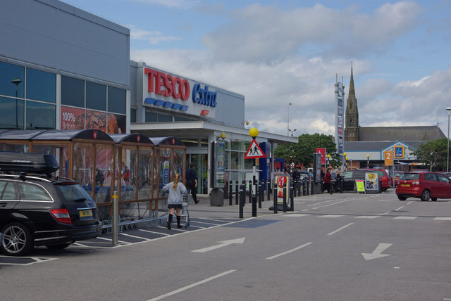
Cornerhouse Park

Downs, Moorland in Lancashire Barrow-in-Furness

England

Cornerhouse Park

Ormsgill Slag Heap
Ormsgill Slag Heap Credit: Peter McDermott

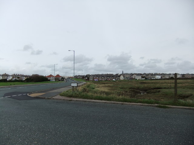
Cornerhouse Park is a picturesque green space located in Lancashire, England. Nestled between the towns of Downs and Moorland, this park covers an expansive area of approximately 10 acres, making it an ideal destination for outdoor enthusiasts and nature lovers alike.

The park is known for its lush greenery, with a variety of trees, plants, and flowers dotting the landscape. Visitors can stroll along the well-maintained pathways, taking in the beauty of the surroundings and enjoying the tranquility that the park offers. The park also boasts a large open space, perfect for picnics, sports activities, and leisurely walks.

For those seeking a bit of adventure, Cornerhouse Park features a well-equipped playground area. Children can enjoy swings, slides, climbing frames, and other play equipment, providing hours of entertainment and fun. The park also has a designated area for ball games, allowing visitors to engage in friendly matches of football, cricket, or other sports.

Cornerhouse Park is not only a recreational space but also a hub for community events and gatherings. It plays host to various festivals, fairs, and outdoor concerts throughout the year, bringing the local community together and fostering a sense of unity.

Furthermore, the park offers ample parking facilities and has accessible paths for individuals with disabilities, ensuring that everyone can enjoy the natural beauty and amenities it provides. With its peaceful ambiance, well-maintained facilities, and stunning surroundings, Cornerhouse Park is a true gem in Lancashire's landscape, attracting visitors from near and far.

If you have any feedback on the listing, please let us know in the comments section below.

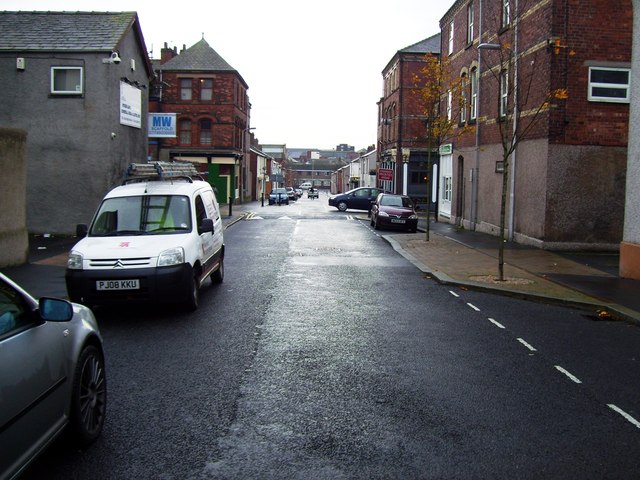
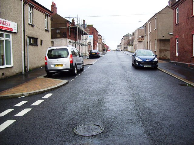
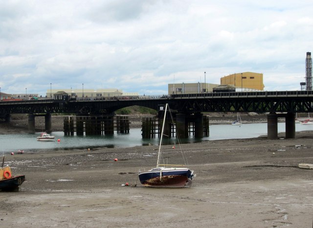
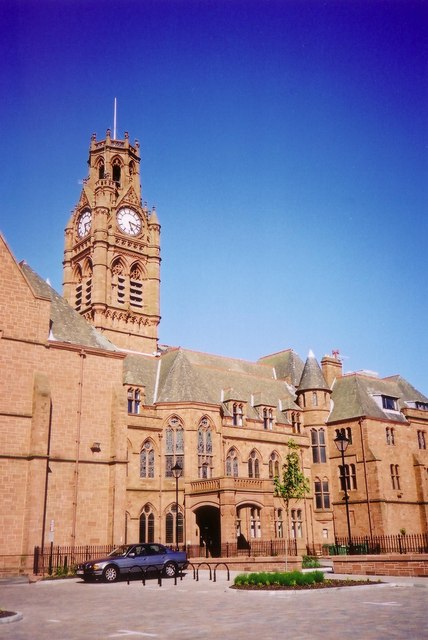
Cornerhouse Park Images

Images are sourced within 2km of 54.113184/-3.2348673 or Grid Reference SD1969. Thanks to Geograph Open Source API. All images are credited.

Ormsgill Slag Heap
Ormsgill Slag Heap
Ordnance Survey Cut Mark This OS cut mark can be found on No67 Holker Street. It marks a point 17.540m above mean sea level.
Ordnance Survey Cut Mark
This OS cut mark can be found on No67 Holker Street. It marks a point 17.540m above mean sea level.
Ordnance Survey Cut Mark This OS cut mark can be found on No134 Holker Street. It marks a point 17.072m above mean sea level.
Ordnance Survey Cut Mark
This OS cut mark can be found on No134 Holker Street. It marks a point 17.072m above mean sea level.
Furness Golf Clubhouse, Walney Island
Footpath around North Scale, Walney Island
Boats and Walney Channel, North Scale, Walney Island
Michaelson Road, Barrow in Furness
View towards the Port of Barrow
Road from the Port of Barrow towards the Town Centre
Bae Systems, Devonshire Dock Hall Once home for the construction of nuclear submarines.
Could always turn it into a cathedral!
Les - the DDH is still very much home to nuclear submarine construction with several of the Astute class under construction and one day there may be the trident replacement subs.  Information supplied by Chris Allen
Bae Systems, Devonshire Dock Hall
Once home for the construction of nuclear submarines. Could always turn it into a cathedral! Les - the DDH is still very much home to nuclear submarine construction with several of the Astute class under construction and one day there may be the trident replacement subs. Information supplied by Chris Allen
Dock Museum, Barrow in Furness <span class="nowrap"><a title="http://www.dockmuseum.org.uk/" rel="nofollow ugc noopener" href="http://www.dockmuseum.org.uk/">Link</a><img style="margin-left:2px;" alt="External link" title="External link - shift click to open in new window" src="https://s1.geograph.org.uk/img/external.png" width="10" height="10"/></span>
Dock Museum, Barrow in Furness
HMS Onyx Retired submarine HMS Onyx in Buccleuch Dock. It is an Oberon class sub. built by Cammell Laird and launched in 1966. Diesel electric powered with 8 torpedo tubes. Now awaiting resiting and preservation at the Dock Museum. Sadly, the tower crane is rarely used these days.
HMS Onyx
Retired submarine HMS Onyx in Buccleuch Dock. It is an Oberon class sub. built by Cammell Laird and launched in 1966. Diesel electric powered with 8 torpedo tubes. Now awaiting resiting and preservation at the Dock Museum. Sadly, the tower crane is rarely used these days.
Vickerstown
Vickerstown
Bath Street, Hindpool
Jubilee Bridge crossing Walney Channel
The entrance to Barrow Town Hall in May 2000 Viewed from the far side of an adjacent small car park.
The entrance to Barrow Town Hall in May 2000
Viewed from the far side of an adjacent small car park.
Tesco Extra, Barrow in Furness Large modern supermarket on former industrial land in the Hindpool area of the town.
Tesco Extra, Barrow in Furness
Large modern supermarket on former industrial land in the Hindpool area of the town.
Show me another place!

Cornerhouse Park is located at Grid Ref: SD1969 (Lat: 54.113184, Lng: -3.2348673)

Administrative County: Cumbria

District: Barrow-in-Furness

Police Authority: Cumbria

What 3 Words

///custom.ladder.burn. Near Barrow in Furness, Cumbria

Related Wikis

John Whinnerah Institute

The John Whinnerah Institute is a Grade II listed Art Deco building and former educational establishment located on Abbey Road in Barrow-in-Furness, England...

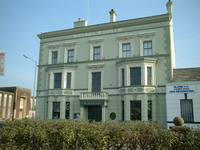
Custom House, Barrow-in-Furness

The Custom House in Barrow-in-Furness, Cumbria, England is a former government building, having housed the customs offices for trade handled at the Ports...
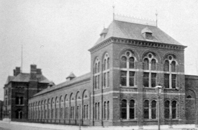
Barrow Jute Works

The Barrow Jute Works was a jute and flax mill located in Barrow-in-Furness, Lancashire (now Cumbria), England during the late 19th and early 20th centuries...

Abbey Road, Barrow-in-Furness

Abbey Road is the principal north to south arterial road through Barrow-in-Furness, Cumbria, England. == Background == Abbey Road's name derives from...

Barrow-in-Furness Central Fire Station

The Central Fire Station on Abbey Road in Barrow-in-Furness, Cumbria, England is a Grade II listed former fire station that has been described by Historic...

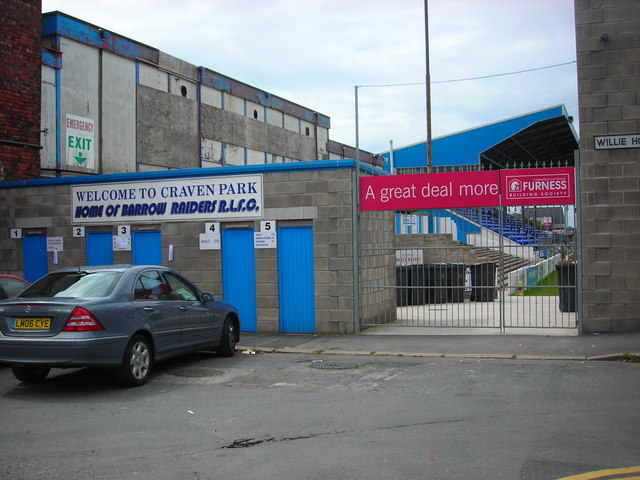
Craven Park, Barrow-in-Furness

Craven Park (also referred to as the Matt Johnson Prestige Stadium for sponsorship reasons) is a rugby league stadium in Barrow-in-Furness, Cumbria, England...

St Mary of Furness Roman Catholic Church

St Mary of Furness is a Roman Catholic church located on Duke Street in Barrow-in-Furness, England. The congregation was founded in 1858, however the current...

Ramsden Square

Ramsden Square is a square located at the intersection of Abbey Road and Duke Street in Barrow-in-Furness, Cumbria, England. It marks the boundary of the...

Nearby Amenities

Located within 500m of 54.113184,-3.2348673
Source: PGS
Lat/Long: 54.1130281/-3.241965
Source: PGS
Lat/Long: 54.1129117/-3.2416109
Source: PGS
Lat/Long: 54.1122924/-3.2419306
Source: PGS
Lat/Long: 54.1121102/-3.2420161
Source: Landsat photo
Lat/Long: 54.1094824/-3.2353887
Source: Landsat photo
Lat/Long: 54.1089537/-3.2327456
Source: Landsat photo
Lat/Long: 54.1097591/-3.2322728
Barrow-in-Furness
Is In: Cumbria; England; Great Britain; United Kingdom; Europe
Name Ru: Барроу-ин-Фёрнесс
Place: town
Lat/Long: 54.1113351/-3.2289494
Traffic Signals
Traffic Signals: signal
Traffic Signals Direction: forward
Lat/Long: 54.1121493/-3.2383886
Crossing
Crossing: zebra
Lat/Long: 54.114402/-3.238925
Bus Stop
Docks Museum (N bound)
Bus: yes
Naptan AtcoCode: 090010020491
Naptan Bearing: N
Naptan CommonName: Docks Museum (N bound)
Naptan Indicator: o/s
Naptan Landmark: Dock Museum
Naptan NaptanCode: cumajpdg
Naptan PlusbusZoneRef: BAROW
Naptan Street: North Road
Naptan Verified: no
Public Transport: platform
Source: naptan_import
Lat/Long: 54.1112534/-3.2402848
Bus Stop
Docks Museum (S bound)
Bus: yes
Naptan AtcoCode: 090010020493
Naptan Bearing: S
Naptan CommonName: Docks Museum (S bound)
Naptan Indicator: opp
Naptan Landmark: Docks Museum
Naptan NaptanCode: cumajpdm
Naptan PlusbusZoneRef: BAROW
Naptan Street: North Road
Naptan Verified: no
Public Transport: platform
Source: naptan_import
Lat/Long: 54.1118614/-3.2390593
Bus Stop
Ramsden Square (Stop 3)
Bus: yes
Local Ref: AT
Naptan AtcoCode: 090010020502
Naptan CommonName: Ramsden Square (Stop 3)
Naptan Indicator: at
Naptan Landmark: bus terminus
Naptan NaptanCode: cumajpgt
Naptan PlusbusZoneRef: BAROW
Naptan Street: Ramsden Square
Naptan Verified: no
Public Transport: platform
Source: naptan_import
Lat/Long: 54.1141853/-3.2324584
Bus Stop
Ramsden Square (Stop 2)
Bus: yes
Local Ref: AT
Naptan AtcoCode: 090010020503
Naptan CommonName: Ramsden Square (Stop 2)
Naptan Indicator: at
Naptan Landmark: bus terminus
Naptan NaptanCode: cumajpgw
Naptan PlusbusZoneRef: BAROW
Naptan Street: Ramsden Square
Naptan Verified: no
Public Transport: platform
Source: naptan_import
Lat/Long: 54.114321/-3.2323706
Bus Stop
Duke Street (W)
Bus: yes
Local Ref: AT
Naptan AtcoCode: 090010020506
Naptan Bearing: W
Naptan CommonName: Duke Street (W)
Naptan Indicator: at
Naptan Landmark: Ramsden Square
Naptan NaptanCode: cumajpjg
Naptan PlusbusZoneRef: BAROW
Naptan Street: Duke Street
Naptan Verified: no
Public Transport: platform
Source: naptan_import
Lat/Long: 54.1135822/-3.2307882
Bus Stop
Duke Street
Bus: yes
Local Ref: AT
Naptan AtcoCode: 090010020507
Naptan Bearing: W
Naptan CommonName: Duke Street
Naptan Indicator: at
Naptan Landmark: Ramsden Square
Naptan NaptanCode: cumajpjm
Naptan PlusbusZoneRef: BAROW
Naptan Street: Duke Street
Naptan Verified: no
Public Transport: platform
Source: naptan_import
Lat/Long: 54.1135201/-3.2307099
Bus Stop
Ramsden Square
Bus: yes
Naptan AtcoCode: 090010020508
Naptan Bearing: S
Naptan CommonName: Ramsden Square
Naptan Indicator: opp
Naptan Landmark: House of Lords Pub
Naptan NaptanCode: cumajpjp
Naptan PlusbusZoneRef: BAROW
Naptan Street: Abbey Road
Naptan Verified: no
Public Transport: platform
Source: naptan_import
Lat/Long: 54.1145662/-3.2303737
Bus Stop
House of Lords PH
Bus: yes
Naptan AtcoCode: 090010020511
Naptan Bearing: S
Naptan CommonName: House of Lords PH
Naptan Indicator: opp
Naptan Landmark: House of Lords Pub
Naptan NaptanCode: cumajpjt
Naptan PlusbusZoneRef: BAROW
Naptan Street: Abbey Road
Naptan Verified: no
Public Transport: platform
Source: naptan_import
Lat/Long: 54.1146302/-3.2302685
Bus Stop
Duke Street / Cavendish Street
Bus: yes
Local Ref: AT
Naptan AtcoCode: 090010020514
Naptan Bearing: E
Naptan CommonName: Duke Street / Cavendish Street
Naptan Indicator: at
Naptan Landmark: Cavendish Street junction
Naptan NaptanCode: cumajpmd
Naptan PlusbusZoneRef: BAROW
Naptan Street: Duke Street
Naptan Verified: no
Public Transport: platform
Shelter: yes
Source: naptan_import
Lat/Long: 54.1130365/-3.2296553
Bus Stop
Town Hall (1)
Bus: yes
Local Ref: AT
Naptan AtcoCode: 090010020517
Naptan Bearing: N
Naptan CommonName: Town Hall (1)
Naptan Indicator: at
Naptan Landmark: Town Hall
Naptan NaptanCode: cumajpmp
Naptan PlusbusZoneRef: BAROW
Naptan Street: Cornwallis St
Naptan Verified: no
Public Transport: platform
Source: naptan_import
Lat/Long: 54.1118423/-3.2286562
Bus Stop
Town Hall (2)
Bus: yes
Local Ref: AT
Naptan AtcoCode: 090010020519
Naptan Bearing: N
Naptan CommonName: Town Hall (2)
Naptan Indicator: at
Naptan Landmark: Town Hall
Naptan NaptanCode: cumajpmw
Naptan PlusbusZoneRef: BAROW
Naptan Street: Cornwallis St
Naptan Verified: no
Public Transport: platform
Source: naptan_import
Lat/Long: 54.1119245/-3.228521
Bus Stop
Town Hall (3)
Bench: yes
Bin: yes
Bus: yes
Local Ref: AT
Naptan AtcoCode: 090010020521
Naptan Bearing: S
Naptan CommonName: Town Hall (3)
Naptan Indicator: at
Naptan Landmark: Town Hall
Naptan NaptanCode: cumajptd
Naptan PlusbusZoneRef: BAROW
Naptan Street: Cornwallis St
Naptan Verified: no
Public Transport: platform
Shelter: yes
Source: naptan_import
Lat/Long: 54.1118916/-3.2282293
Bus Stop
Town Hall (4)
Bench: yes
Bin: no
Bus: yes
Local Ref: AT
Naptan AtcoCode: 090010020522
Naptan Bearing: E
Naptan CommonName: Town Hall (4)
Naptan Indicator: at
Naptan Landmark: Town Hall
Naptan NaptanCode: cumajptg
Naptan PlusbusZoneRef: BAROW
Naptan Street: Cornwallis St
Naptan Verified: no
Public Transport: platform
Shelter: yes
Source: naptan_import
Lat/Long: 54.1120642/-3.2280509
Bus Stop
The Furness Railway
Bus: yes
Local Ref: AT
Naptan AtcoCode: 090010020523
Naptan Bearing: SW
Naptan CommonName: The Furness Railway
Naptan Indicator: at
Naptan Landmark: Jubilee House
Naptan NaptanCode: cumajptj
Naptan PlusbusZoneRef: BAROW
Naptan Street: Abbey Road
Naptan Verified: no
Public Transport: platform
Source: naptan_import
Lat/Long: 54.1151121/-3.2294653
Bus Stop
Ramsden Square (Stop 1)
Bus: yes
Local Ref: AT
Naptan AtcoCode: 090010021163
Naptan CommonName: Ramsden Square (Stop 1)
Naptan Indicator: at
Naptan Landmark: bus terminus
Naptan NaptanCode: cumajwam
Naptan PlusbusZoneRef: BAROW
Naptan Street: Ramsden Square
Naptan Verified: no
Public Transport: platform
Source: naptan_import
Lat/Long: 54.113961/-3.2324211
Bus Stop
Brown Barron
Bus: yes
Naptan AtcoCode: 090010021750
Naptan Bearing: W
Naptan BusStopType: CUS
Naptan CommonName: Brown Barron
Naptan Indicator: near
Naptan Landmark: junction with Sidney Street
Naptan NaptanCode: cumajwpd
Naptan PlusbusZoneRef: BAROW
Naptan Street: Duke Street
Naptan Verified: no
Public Transport: platform
Source: naptan_import
Lat/Long: 54.1124771/-3.2289809
Bus Stop
Duke Street Library and Museum
Bus: yes
Naptan AtcoCode: 090010022362
Naptan Bearing: E
Naptan BusStopType: CUS
Naptan CommonName: Duke Street Library and Museum
Naptan Indicator: o/s
Naptan Landmark: Library
Naptan NaptanCode: cumamajp
Naptan PlusbusZoneRef: BAROW
Naptan Street: Duke Street
Naptan Verified: no
Public Transport: platform
Source: naptan_import
Lat/Long: 54.1145663/-3.2321178
Bus Stop
Queens Hotel
Bus: yes
Naptan AtcoCode: 090010022520
Naptan Bearing: W
Naptan CommonName: Queens hotel
Naptan Indicator: near
Naptan Landmark: junction with Blake Street
Naptan NaptanCode: cumamapw
Naptan PlusbusZoneRef: BAROW
Naptan Street: Duke Street
Naptan Verified: no
Public Transport: platform
Shelter: no
Source: naptan_import
Lat/Long: 54.1169072/-3.2361192
Bus Stop
The Queens Head Hotel
Bus: yes
Naptan AtcoCode: 090010022788
Naptan Bearing: E
Naptan BusStopType: CUS
Naptan CommonName: The Queens Head Hotel
Naptan Indicator: o/s
Naptan Landmark: St James School Playing Field
Naptan NaptanCode: cumamdmt
Naptan PlusbusZoneRef: BAROW
Naptan Street: Blake Street
Naptan Verified: no
Public Transport: platform
Source: naptan_import
Lat/Long: 54.1173115/-3.2361313
Bus Stop
Hollywood Park
Bus: yes
Naptan AtcoCode: 090010023160
Naptan Bearing: E
Naptan CommonName: Hollywood Park
Naptan Indicator: o/s
Naptan Landmark: Cannon Health Club
Naptan NaptanCode: cumamdwj
Naptan PlusbusZoneRef: BAROW
Naptan Street: No name
Naptan Verified: no
Public Transport: platform
Source: naptan_import
Lat/Long: 54.1144736/-3.2385727
Bus Stop
Hindpool Park for Tesco
Bus: yes
Naptan AtcoCode: 090010024030
Naptan Bearing: NW
Naptan CommonName: Hindpool Park for Tesco's
Naptan Indicator: near
Naptan Landmark: Tesco's
Naptan NaptanCode: cumdpgpd
Naptan PlusbusZoneRef: BAROW
Naptan Street: Hindpool Road
Naptan Verified: no
Public Transport: platform
Source: naptan_import
Lat/Long: 54.1138747/-3.2353156
Restaurant
Flavours World Buffet
Addr City: Barrow-in-Furness
Addr Housenumber: 107-109
Addr Postcode: LA14 1RH
Addr Street: Duke Street
Lat/Long: 54.1132795/-3.2304476
Mini Roundabout
Direction: clockwise
Lat/Long: 54.1129133/-3.2350134
Crossing
Crossing: unmarked
Crossing Island: no
Crossing Markings: no
Crossing Signals: yes
Crossing Ref: puffin
Tactile Paving: yes
Lat/Long: 54.1107055/-3.2343562
Crossing
Crossing: unmarked
Crossing Island: no
Crossing Markings: no
Crossing Signals: yes
Crossing Ref: puffin
Tactile Paving: yes
Lat/Long: 54.1108424/-3.2347004
Mini Roundabout
Direction: clockwise
Lat/Long: 54.112522/-3.2342629
Crossing
Crossing: zebra
Lat/Long: 54.1142751/-3.2370651
Crossing
Crossing: unmarked
Crossing Island: no
Crossing Markings: no
Tactile Paving: no
Lat/Long: 54.1120161/-3.2409192
Barrier: height_restrictor
Maxheight: 2
Lat/Long: 54.1126179/-3.2281907
Crossing
Crossing: traffic_signals
Crossing Island: no
Crossing Markings: dots
Crossing Ref: puffin
Tactile Paving: yes
Lat/Long: 54.1123417/-3.2388649
Source: Landsat photo
Lat/Long: 54.1091386/-3.2356161
Crossing
Crossing: marked
Crossing Island: no
Crossing Markings: yes
Crossing Ref: zebra
Tactile Paving: yes
Lat/Long: 54.1163705/-3.2350626
Traffic Signals
Traffic Signals: signal
Traffic Signals Direction: forward
Lat/Long: 54.1128834/-3.238124
Crossing
Crossing: zebra
Lat/Long: 54.1135349/-3.2349414
Crossing
Bicycle: yes
Button Operated: yes
Crossing: traffic_signals
Crossing Island: no
Crossing Markings: dots
Crossing Signals: yes
Crossing Ref: toucan
Tactile Paving: yes
Lat/Long: 54.1131303/-3.2331128
Recycling
Lat/Long: 54.1124048/-3.2357817
James Ramsden Statue
Artwork Type: statue
Historic: monument
Wikidata: Q7527477
Wikipedia: en:James Ramsden (industrialist)
Lat/Long: 54.1140799/-3.2313838
Barrier: bollard
Lat/Long: 54.1143009/-3.2306617
Barrier: bollard
Lat/Long: 54.1142995/-3.2306643
Barrier: bollard
Lat/Long: 54.1143021/-3.2306601
Street Lamp
Lat/Long: 54.1110839/-3.2291063
Street Lamp
Lat/Long: 54.1109095/-3.2288242
Barrier: bollard
Lat/Long: 54.1104174/-3.2294749
Barrier: bollard
Lat/Long: 54.1104028/-3.2294475
Crossing
Bicycle: yes
Crossing: unmarked
Crossing Island: no
Crossing Markings: no
Crossing Signals: yes
Crossing Ref: toucan
Tactile Paving: yes
Lat/Long: 54.114163/-3.2356415
Crossing
Crossing: zebra
Lat/Long: 54.1130289/-3.235571
Crossing
Crossing: zebra
Lat/Long: 54.1132305/-3.2352434
Crossing
Crossing: unmarked
Crossing Markings: no
Tactile Paving: yes
Lat/Long: 54.1119368/-3.2369989
Crossing
Crossing: zebra
Lat/Long: 54.1126625/-3.2364328
Crossing
Crossing: zebra
Lat/Long: 54.1142971/-3.2376867
Crossing
Crossing: zebra
Lat/Long: 54.1148222/-3.2394905
Parking
Addr City: Barrow-in-Furness
Addr Street: Lawson Street
Capacity: 10
Fee: no
Lat/Long: 54.1108693/-3.229368
Crossing
Crossing: zebra
Lat/Long: 54.1143995/-3.2379628
Crossing
Crossing: unmarked
Crossing Island: no
Crossing Markings: no
Crossing Signals: yes
Crossing Ref: pelican
Tactile Paving: yes
Lat/Long: 54.113811/-3.2367237
Crossing
Bicycle: yes
Button Operated: yes
Crossing: traffic_signals
Crossing Island: no
Crossing Markings: dots
Crossing Signals: yes
Crossing Ref: toucan
Tactile Paving: yes
Lat/Long: 54.1132929/-3.2342316
Crossing
Crossing: traffic_signals
Crossing Island: no
Tactile Paving: yes
Lat/Long: 54.1122436/-3.2285033
Crossing
Bicycle: yes
Button Operated: yes
Crossing: traffic_signals
Crossing Island: no
Crossing Markings: dots
Crossing Signals: yes
Crossing Ref: toucan
Tactile Paving: yes
Lat/Long: 54.1151961/-3.237283
Crossing
Crossing: zebra
Lat/Long: 54.1116656/-3.2400913
Crossing
Crossing: zebra
Lat/Long: 54.1129273/-3.2353938
Crossing
Crossing: zebra
Lat/Long: 54.1128216/-3.2352005
Crossing
Crossing: zebra
Lat/Long: 54.1131281/-3.2350631
Crossing
Crossing: zebra
Lat/Long: 54.1134329/-3.2351139
Crossing
Crossing: zebra
Lat/Long: 54.113823/-3.2354467
Crossing
Crossing: zebra
Lat/Long: 54.1137249/-3.2356203
Crossing
Button Operated: yes
Crossing: traffic_signals
Crossing Island: yes
Crossing Markings: dots
Crossing Signals: yes
Crossing Ref: puffin
Tactile Paving: yes
Lat/Long: 54.1106543/-3.2305049
Crossing
Button Operated: yes
Crossing: traffic_signals
Crossing Island: yes
Crossing Markings: dots
Crossing Signals: yes
Crossing Ref: puffin
Tactile Paving: yes
Lat/Long: 54.1109867/-3.2305262
Crossing
Button Operated: yes
Crossing: traffic_signals
Crossing Island: yes
Crossing Markings: dots
Crossing Signals: yes
Crossing Ref: puffin
Tactile Paving: yes
Lat/Long: 54.1107395/-3.2301302
Crossing
Crossing: unmarked
Crossing Island: no
Crossing Markings: no
Crossing Signals: yes
Crossing Ref: puffin
Tactile Paving: yes
Lat/Long: 54.1106791/-3.2346384
Crossing
Crossing: unmarked
Crossing Island: no
Crossing Markings: no
Crossing Signals: yes
Crossing Ref: puffin
Tactile Paving: yes
Lat/Long: 54.1108734/-3.2344136
Crossing
Crossing: unmarked
Crossing Markings: no
Tactile Paving: yes
Lat/Long: 54.1122854/-3.236926
Crossing
Crossing: unmarked
Crossing Markings: no
Tactile Paving: yes
Lat/Long: 54.1120879/-3.2375388
Entrance: yes
Lat/Long: 54.112628/-3.2389569
Waste Basket
Lat/Long: 54.1139745/-3.2369785
Entrance: yes
Lat/Long: 54.1140513/-3.2365907
Crossing
Crossing: marked
Crossing Island: no
Crossing Markings: yes
Crossing Ref: zebra
Tactile Paving: no
Lat/Long: 54.11397/-3.2366532
Waste Basket
Lat/Long: 54.114227/-3.237106
Waste Basket
Lat/Long: 54.1143322/-3.2377236
Waste Basket
Lat/Long: 54.1143649/-3.237198
Entrance: yes
Lat/Long: 54.1143857/-3.2368954
Entrance: yes
Lat/Long: 54.1146156/-3.2374313
Crossing
Crossing: zebra
Lat/Long: 54.1145463/-3.2373385
Entrance: yes
Lat/Long: 54.1147057/-3.238381
Entrance: yes
Lat/Long: 54.1148849/-3.2379197
Entrance: yes
Lat/Long: 54.1151066/-3.23752
Entrance: yes
Lat/Long: 54.1149148/-3.2395076
Entrance: yes
Lat/Long: 54.1155279/-3.2388859
Entrance: yes
Lat/Long: 54.1161185/-3.2388218
Entrance: yes
Lat/Long: 54.1142077/-3.2385796
Entrance: yes
Lat/Long: 54.1135315/-3.2376935
Waste Basket
Lat/Long: 54.1139305/-3.2367295
Crossing
Crossing: zebra
Lat/Long: 54.1108737/-3.2321451
Crossing
Crossing: zebra
Lat/Long: 54.1107561/-3.2323215
Man Made: chimney
Note: sewer vent
Lat/Long: 54.1143046/-3.2320164
Man Made: chimney
Note: sewer vent
Lat/Long: 54.1141945/-3.2319332
Man Made: chimney
Note: sewer vent
Lat/Long: 54.1139663/-3.2319399
Man Made: chimney
Note: sewer vent
Lat/Long: 54.1140333/-3.2325935
Defibrillator
Emergency: defibrillator
Lat/Long: 54.1134801/-3.2327627
Crossing
Crossing: marked
Crossing Island: yes
Crossing Markings: zebra
Crossing Ref: zebra
Tactile Paving: yes
Lat/Long: 54.1138467/-3.2317136
Crossing
Crossing: marked
Crossing Island: yes
Crossing Markings: zebra
Crossing Ref: zebra
Tactile Paving: yes
Lat/Long: 54.1138842/-3.2317778
Crossing
Crossing: marked
Crossing Island: yes
Crossing Markings: zebra
Crossing Ref: zebra
Tactile Paving: yes
Lat/Long: 54.1142717/-3.23177
Crossing
Crossing: marked
Crossing Island: yes
Crossing Markings: zebra
Crossing Ref: zebra
Tactile Paving: yes
Lat/Long: 54.1143058/-3.2317137
Crossing
Crossing: marked
Crossing Island: yes
Crossing Markings: zebra
Crossing Ref: zebra
Tactile Paving: yes
Lat/Long: 54.114283/-3.2310619
Crossing
Crossing: marked
Crossing Island: yes
Crossing Markings: zebra
Crossing Ref: zebra
Tactile Paving: yes
Lat/Long: 54.1142494/-3.2309952
Crossing
Crossing: marked
Crossing Island: yes
Crossing Markings: zebra
Crossing Ref: zebra
Tactile Paving: yes
Lat/Long: 54.1138811/-3.2310246
Crossing
Crossing: marked
Crossing Island: yes
Crossing Markings: zebra
Crossing Ref: zebra
Tactile Paving: yes
Lat/Long: 54.1138471/-3.2310875
Barrier: bollard
Lat/Long: 54.1156278/-3.2332841
Barrier: bollard
Lat/Long: 54.1164302/-3.234543
Barrier: bollard
Lat/Long: 54.1162542/-3.2346509
Barrier: bollard
Lat/Long: 54.1159828/-3.2342193
Barrier: bollard
Lat/Long: 54.1157519/-3.2338757
Barrier: bollard
Lat/Long: 54.1157385/-3.2338552
Barrier: bollard
Lat/Long: 54.113072/-3.2329798
Barrier: bollard
Lat/Long: 54.1130481/-3.2330304
Barrier: bollard
Motor Vehicle: no
Lat/Long: 54.1130642/-3.2330077
Pearson Theory Test Centre
Addr City: Barrow-in-Furness
Addr Housenumber: 111
Addr Postcode: LA14 1XA
Addr Street: Duke Street
Note: Driving Theory Test Centre
Office: government
Lat/Long: 54.113421/-3.2306613
Crossing
Lat/Long: 54.1108793/-3.2355005
Crossing
Lat/Long: 54.1109777/-3.2359458
Crossing
Lat/Long: 54.110781/-3.235056
Crossing
Lat/Long: 54.1109276/-3.2357188
Crossing
Lat/Long: 54.110829/-3.2352732
Waste Basket
Lat/Long: 54.1160704/-3.2340786
Waste Basket
Lat/Long: 54.1159568/-3.2338634
Willie Horne
Historic: memorial
Memorial Type: statue
Wikidata: Q8021571
Wikipedia: en:Willie Horne#Statue
Lat/Long: 54.1160366/-3.233935
Barrier: bollard
Lat/Long: 54.1160625/-3.2338856
Barrier: bollard
Lat/Long: 54.1160726/-3.2338993
Barrier: bollard
Lat/Long: 54.1158102/-3.2347717
Barrier: bollard
Lat/Long: 54.115769/-3.2347147
Barrier: bollard
Lat/Long: 54.1157967/-3.2347534
Barrier: bollard
Lat/Long: 54.1157835/-3.2347351
Bench
Lat/Long: 54.1155291/-3.2361085
Bench
Lat/Long: 54.1155108/-3.2361391
Barrier: bollard
Lat/Long: 54.1155437/-3.2360811
Barrier: bollard
Lat/Long: 54.1155557/-3.2360626
Barrier: bollard
Lat/Long: 54.115478/-3.2362034
Barrier: bollard
Lat/Long: 54.1154914/-3.2361805
Barrier: bollard
Lat/Long: 54.1155011/-3.2361614
Barrier: bollard
Lat/Long: 54.1154675/-3.2362245
Barrier: bollard
Lat/Long: 54.1154552/-3.2362404
Barrier: bollard
Lat/Long: 54.1154645/-3.2362551
Barrier: bollard
Lat/Long: 54.1154746/-3.236271
Barrier: bollard
Lat/Long: 54.1154843/-3.2362876
Barrier: bollard
Lat/Long: 54.115494/-3.2363041
Barrier: bollard
Lat/Long: 54.1155034/-3.2363213
Barrier: bollard
Lat/Long: 54.1155142/-3.2363366
Barrier: bollard
Lat/Long: 54.1155265/-3.2363513
Barrier: bollard
Lat/Long: 54.1155355/-3.2363659
Barrier: bollard
Lat/Long: 54.1155474/-3.2363825
Barrier: bollard
Lat/Long: 54.1155587/-3.2363997
Bicycle Parking
Capacity: 12
Lat/Long: 54.1153518/-3.2388635
Barrier: bollard
Lat/Long: 54.1160335/-3.2371694
Barrier: bollard
Lat/Long: 54.116025/-3.2371851
Barrier: bollard
Lat/Long: 54.116017/-3.2372164
Barrier: bollard
Lat/Long: 54.1160145/-3.2372394
Barrier: bollard
Lat/Long: 54.1160592/-3.2373137
Hindpool
Place: suburb
Lat/Long: 54.1102387/-3.2302393
Cafe
Costa
Addr City: Barrow-in-Furness
Addr Parentstreet: Hindpool Road
Addr Postcode: LA14 2PD
Addr Street: Hindpool Retail Park
Addr Unit: 8A
Brand: Costa
Brand Wikidata: Q608845
Brand Wikipedia: en:Costa Coffee
Cuisine: coffee_shop
Fhrs Id: 778969
Takeaway: yes
Lat/Long: 54.1137895/-3.2339348
Fast Food
Subway
Addr City: Barrow-in-Furness
Addr County: Cumbria
Addr Housename: Hindpool Retail Park
Addr Parentstreet: Hindpool Road
Addr Postcode: LA14 2PD
Addr Street: Hindpool Retail Park
Addr Unit: 8B
Brand: Subway
Brand Wikidata: Q244457
Brand Wikipedia: en:Subway (restaurant)
Contact Website: https://restaurants.subway.com/united-kingdom/en/barrow-in-furness/hindpool-retail-park
Cuisine: sandwich
Fhrs Id: 1597933
Takeaway: yes
Lat/Long: 54.1137209/-3.2338239
Addr City: Barrow-in-Furness
Addr Housenumber: 107
Addr Postcode: LA14 1LU
Addr Street: Duke Street
Check Date: 2022-05-27
Disused Amenity: post_office
Old Name: Duke Street Post Office
Lat/Long: 54.113743/-3.230494
Crossing
Crossing: zebra
Lat/Long: 54.1095012/-3.2370839
Crossing
Crossing: zebra
Lat/Long: 54.1097967/-3.2384348
Barrier: full-height_turnstile
Lat/Long: 54.110417/-3.235255
Barrier: sliding_gate
Lat/Long: 54.1098601/-3.2395183
Barrier: full-height_turnstile
Lat/Long: 54.1098808/-3.239392
Barrier: full-height_turnstile
Lat/Long: 54.1098749/-3.2393605
Barrier: full-height_turnstile
Lat/Long: 54.1098688/-3.2393276
Crossing
Bicycle: yes
Crossing: unmarked
Crossing Island: yes
Crossing Markings: no
Tactile Paving: yes
Lat/Long: 54.1127207/-3.2333428
Crossing
Bicycle: yes
Crossing: unmarked
Crossing Island: yes
Crossing Markings: no
Tactile Paving: yes
Lat/Long: 54.1126573/-3.2338064
Crossing
Crossing: traffic_signals
Crossing Markings: dots
Crossing Signals: yes
Crossing Ref: puffin
Tactile Paving: yes
Lat/Long: 54.1124412/-3.2384258
Entrance: yes
Lat/Long: 54.1139219/-3.2383242
Telephone
Booth: KX100
Covered: booth
Lat/Long: 54.1172666/-3.2366403
Charging Station
Capacity: 2
Operator: Tesco
Lat/Long: 54.1125727/-3.2365728
Charging Station
Capacity: 2
Operator: Tesco
Lat/Long: 54.1126126/-3.2365108
Restaurant
Panda Garden
Addr City: Barrow-in-Furness
Addr Housenumber: 88
Addr Postcode: LA14 1RD
Addr Street: Duke Street
Cuisine: chinese
Fhrs Id: 917255
Lat/Long: 54.1131709/-3.2296865
Addr City: Barrow-in-Furness
Addr Housenumber: 30-32
Addr Postcode: LA14 1DB
Addr Street: Portland Walk
Disused Amenity: cafe
Level: 1
Old Name: Debenhams Cafe
Lat/Long: 54.1129734/-3.2279642
Entrance: main
Lat/Long: 54.1120633/-3.2278722
Fast Food
Grilla Cheese
Addr City: Barrow-in-Furness
Addr Housenumber: 21
Addr Postcode: LA14 1ST
Addr Street: Dalkeith Street
Cuisine: cheese_toastie
Fhrs Id: 1175478
Lat/Long: 54.1141373/-3.2280581
Direction: SE
Generator Method: photovoltaic
Generator Output Electricity: yes
Generator Source: solar
Generator Type: solar_photovoltaic_panel
Location: roof
Power: generator
Lat/Long: 54.1109271/-3.2299652
Direction: SE
Generator Method: photovoltaic
Generator Output Electricity: yes
Generator Source: solar
Generator Type: solar_photovoltaic_panel
Location: roof
Power: generator
Lat/Long: 54.1108917/-3.2298767
Direction: SE
Generator Method: photovoltaic
Generator Output Electricity: yes
Generator Solar Modules: 6
Generator Source: solar
Generator Type: solar_photovoltaic_panel
Location: roof
Power: generator
Lat/Long: 54.1117305/-3.229788
Iceland
Addr City: Barrow-in-Furness
Addr Housename: The Range
Addr Housenumber: 133
Addr Parentstreet: Hindpool Road
Addr Postcode: LA14 1XW
Addr Street: Hindpool Retail Park
Brand: Iceland
Brand Wikidata: Q721810
Brand Wikipedia: en:Iceland (supermarket)
Note: oncession with The Range
Shop: frozen_food
Lat/Long: 54.1138739/-3.233303
Atm
Opening Hours: 24/7
Operator: Tesco
Lat/Long: 54.1133671/-3.2353262
Barrier: bollard
Lat/Long: 54.1127877/-3.2294941
Bank
Furness Building Society
Addr City: Barrow-in-Furness
Addr Street: Duke Street
Lat/Long: 54.1121108/-3.2285766
Atlas-Sterns
Addr City: Barrow-in-Furness
Addr Housenumber: 63
Addr Postcode: LA14 1RW
Addr Street: Duke Street
Shop: window_blind
Lat/Long: 54.1123942/-3.2290337
Brown Barron
Addr City: Barrow-in-Furness
Addr Housenumber: 65
Addr Postcode: LA14 1RW
Addr Street: Duke Street
Office: solicitor
Phone: +44 1229 828814
Website: https://www.brown-barron.co.uk/
Lat/Long: 54.1124322/-3.2290882
New Home Centre
Addr City: Barrow-in-Furness
Addr Housenumber: 67
Addr Postcode: LA14 1RW
Addr Street: Duke Street
Office: estate_agent
Lat/Long: 54.1124684/-3.2291523
Poole Townsend
Addr City: Barrow-in-Furness
Addr Housenumber: 69-75
Addr Postcode: LA14 1RP
Addr Street: Duke Street
Office: estate_agent
Phone: +44 1229 811811
Lat/Long: 54.1125535/-3.2292922
Addr City: Barrow-in-Furness
Addr Housenumber: 79
Addr Postcode: LA14 1RP
Addr Street: Duke Street
Check Date: 2022-05-27
Disused Shop: yes
Lat/Long: 54.1126573/-3.2294568
Addr City: Barrow-in-Furness
Addr Housenumber: 81
Addr Postcode: LA14 1RH
Addr Street: Duke Street
Disused Shop: yes
Lat/Long: 54.1128258/-3.2297
Bureau De Change
Provincial Funding
Addr City: Barrow-in-Furness
Addr Housenumber: 83-85
Addr Postcode: LA14 1RH
Addr Street: Duke Street
Office: loans
Lat/Long: 54.1128591/-3.2297808
The Priory
Addr City: Barrow-in-Furness
Addr Housenumber: 87
Addr Postcode: LA14 1RH
Addr Street: Duke Street
Shop: hairdresser
Lat/Long: 54.1129007/-3.2298532
PC Lettings Ltd
Addr City: Barrow-in-Furness
Addr Housenumber: 89
Addr Postcode: LA14 1RH
Addr Street: Duke Street
Office: estate_agent
Lat/Long: 54.1129424/-3.2299206
Dandy's
Addr City: Barrow-in-Furness
Addr Housenumber: 91-99
Addr Postcode: LA14 1RH
Addr Street: Duke Street
Shop: furniture
Lat/Long: 54.1130617/-3.2300927
Clarkson Hirst
Addr City: Barrow-in-Furness
Addr Housenumber: 101
Addr Postcode: LA14 1RH
Addr Street: Duke Street
Office: solicitor
Lat/Long: 54.113165/-3.2302604
Mellon & Co
Addr City: Barrow-in-Furness
Addr Housenumber: 66-68
Addr Postcode: LA14 1RX
Addr Street: Duke Street
Office: conveyancing
Lat/Long: 54.1125988/-3.2287699
Addr City: Barrow-in-Furness
Addr Housenumber: 70
Addr Postcode: LA14 1RX
Addr Street: Duke Street
Disused Office: yes
Old Name: Corrie & Co
Lat/Long: 54.1126413/-3.2288389
Fast Food
Marmaris
Addr City: Barrow-in-Furness
Addr Housenumber: 72
Addr Postcode: LA14 1RX
Addr Street: Duke Street
Cuisine: pizza;burger;kebab
Fhrs Id: 225846
Lat/Long: 54.1126762/-3.2288943
Addr City: Barrow-in-Furness
Addr Housenumber: 74
Addr Postcode: LA14 1RX
Addr Street: Duke Street
Disused Office: accountant
Old Name: G Moon & Co
Lat/Long: 54.1127117/-3.2289564
Cancer Care
Addr City: Barrow-in-Furness
Addr Housenumber: 76
Addr Postcode: LA14 1RX
Addr Street: Duke Street
Office: charity
Phone: +44 1229 836926
Website: https://www.cancercare.org.uk/contact-us/barrow
Lat/Long: 54.1127457/-3.2290159
Healthwatch Cumbria
Addr City: Barrow-in-Furness
Addr Housename: Cavendish House
Addr Housenumber: 78
Addr Postcode: LA14 1RX
Addr Street: Duke Street
Office: healthcare
Lat/Long: 54.1127961/-3.2290861
Fast Food
New Taste
Addr City: Barrow-in-Furness
Addr Housenumber: 84
Addr Postcode: LA14 1RD
Addr Street: Duke Street
Cuisine: chinese;cantonese
Fhrs Id: 1221277
Lat/Long: 54.1130869/-3.2295503
TnT Records
Addr City: Barrow-in-Furness
Addr Housenumber: 86
Addr Postcode: LA14 1RD
Addr Street: Duke Street
Shop: music
Lat/Long: 54.1131298/-3.2296221
Boss
Addr City: Barrow-in-Furness
Addr Housenumber: 90
Addr Postcode: LA14 1RD
Addr Street: Duke Street
Shop: beauty
Lat/Long: 54.1132156/-3.2297623
Unity
Addr City: Barrow-in-Furness
Addr Housenumber: 92-96
Addr Postcode: LA14 1RD
Addr Street: Duke Street
Healthcare: rehabilitation
Office: healthcare
Operator: NHS
Phone: +44 1229 207020
Website: https://www.nhs.uk/services/service-directory/unity-drug-and-alcohol-recovery-service-barrow-in-furness/N10876350
Lat/Long: 54.1132918/-3.2298715
Craig & Meyer
Addr City: Barrow-in-Furness
Addr Housenumber: 98-100
Addr Postcode: LA14 1RD
Addr Street: Duke Street
Office: architect
Lat/Long: 54.1133883/-3.2300361
Addr City: Barrow-in-Furness
Addr Housenumber: 102
Addr Postcode: LA14 1RD
Addr Street: Duke Street
Lat/Long: 54.1134431/-3.2301154
Addr City: Barrow-in-Furness
Addr Housenumber: 103
Addr Postcode: LA14 1RH
Addr Street: Duke Street
Lat/Long: 54.1131998/-3.2303158
Addr City: Barrow-in-Furness
Addr Housenumber: 105
Addr Postcode: LA14 1RH
Addr Street: Duke Street
Lat/Long: 54.1132406/-3.2303762
Restaurant
Odd Frog
Addr City: Barrow-in-Furness
Addr Housenumber: 121-123
Addr Postcode: LA14 1XA
Addr Street: Duke Street
Cuisine: tapas
Fhrs Id: 1107669
Lat/Long: 54.1136968/-3.2312286
Bicycle Parking
Bicycle Parking: stands
Capacity: 4
Covered: no
Operator: Burger King
Lat/Long: 54.113989/-3.2350083
Post Box
Post Box Type: indoor_pillar
Ref: LA14 14
Lat/Long: 54.1131842/-3.2356881
Post Box
Operator: Royal Mail
Operator Wikidata: Q638098
Post Box Design: type_k
Post Box Type: pillar
Ref: LA14 56
Lat/Long: 54.1136805/-3.230643
Post Box
Operator: Royal Mail
Operator Wikidata: Q638098
Post Box Type: pillar
Ref: LA14 155
Lat/Long: 54.1117765/-3.2284311
Post Box
Operator: Royal Mail
Operator Wikidata: Q638098
Post Box Type: pillar
Ref: LA14 156
Lat/Long: 54.1117625/-3.2284597
Waste Basket
Lat/Long: 54.114195/-3.2349948
Waste Basket
Lat/Long: 54.114179/-3.2346575
Waste Basket
Lat/Long: 54.1143751/-3.2343027
Vending Machine
Vending: parking_tickets
Lat/Long: 54.1113669/-3.2290629
Vending Machine
Vending: parking_tickets
Lat/Long: 54.1108502/-3.2292632
Vending Machine
Vending: parking_tickets
Lat/Long: 54.1107453/-3.2285538
Sports Direct
Addr City: Barrow-in-Furness
Addr Housename: Unit B Cornmill Park
Addr Postcode: LA14 2GN
Addr Street: Cornmill Crossing
Brand: Sports Direct
Brand Wikidata: Q7579661
Brand Wikipedia: en:SportsDirect.com
Level: 1
Shop: sports
Website: https://fr.sportsdirect.com/barrow-fit-sd-store-2684
Lat/Long: 54.1115389/-3.2320798
Everlast Gyms
Addr City: Barrow-in-Furness
Addr Housename: Unit B Cornmill Park
Addr Postcode: LA14 2GN
Addr Street: Cornmill Crossing
Alt Name: Everlast Fitness Club
Brand: Everlast Gyms
Brand Wikidata: Q112947134
Leisure: fitness_centre
Level: 0
Website: https://www.everlastfitnessclubs.com/clubs/barrow
Lat/Long: 54.1117009/-3.2324178
Bench
Backrest: yes
Lat/Long: 54.1134784/-3.2421385
Bench
Backrest: yes
Lat/Long: 54.1134491/-3.2421106
Entrance: yes
Lat/Long: 54.1121458/-3.2404827
Telephone
Booth: K6
Covered: booth
Listed Status: Grade II
Lat/Long: 54.114454/-3.2309806
Telephone
Booth: K6
Covered: booth
Listed Status: Grade II
Lat/Long: 54.114445/-3.2309961
Crossing
Crossing: unmarked
Crossing Island: no
Crossing Markings: no
Crossing Signals: yes
Crossing Ref: puffin
Tactile Paving: yes
Lat/Long: 54.1150887/-3.2295083
Bench
Lat/Long: 54.1144279/-3.2322734
Bench
Lat/Long: 54.1144075/-3.2323083
Progression Solicitors
Addr City: Barrow-in-Furness
Addr Housenumber: 114
Addr Postcode: LA14 1LW
Addr Street: Duke Street
Office: solicitor
Opening Hours: Mo-Fr 09:00-17:00
Phone: +44 1229 808404
Website: https://www.progressionsolicitors.com/solicitors-barrow-in-furness/
Lat/Long: 54.113811/-3.2306009
J. L. Winder & Co
Addr City: Barrow-in-Furness
Office: accountant
Lat/Long: 54.1136981/-3.2314433
Corrie & Co
Addr City: Barrow-in-Furness
Office: estate_agent
Lat/Long: 54.1136995/-3.2317113
Brown & Murray
Addr City: Barrow-in-Furness
Office: lawyer
Lat/Long: 54.1136971/-3.231599
Atm
Fee: no
Indoor: yes
Level: 0
Lat/Long: 54.1121514/-3.2280365
Photo Booth
Indoor: yes
Level: 0
Lat/Long: 54.1122121/-3.228132
Crossing
Bicycle: yes
Button Operated: yes
Crossing: traffic_signals
Crossing Island: no
Crossing Markings: dots
Crossing Signals: yes
Crossing Ref: toucan
Tactile Paving: yes
Lat/Long: 54.1165827/-3.2384075
Crossing
Bicycle: yes
Crossing: unmarked
Crossing Island: yes
Crossing Markings: no
Tactile Paving: yes
Lat/Long: 54.112654/-3.233328
Crossing
Bicycle: yes
Crossing: unmarked
Crossing Island: yes
Crossing Markings: no
Tactile Paving: yes
Lat/Long: 54.1126792/-3.2338902
Crossing
Crossing: unmarked
Crossing Island: no
Crossing Markings: no
Tactile Paving: no
Lat/Long: 54.1125781/-3.2340747
Give Way
Direction: forward
Lat/Long: 54.112592/-3.2340011
Traffic Signals
Traffic Signals: signal
Traffic Signals Direction: backward
Lat/Long: 54.1164906/-3.238595
Traffic Signals
Traffic Signals: signal
Traffic Signals Direction: forward
Lat/Long: 54.1166304/-3.2384039
Crossing
Button Operated: yes
Crossing: traffic_signals
Crossing Island: yes
Crossing Markings: dots
Crossing Ref: puffin
Tactile Paving: yes
Lat/Long: 54.1164895/-3.2385376
Crossing
Crossing: unmarked
Crossing Markings: no
Tactile Paving: yes
Lat/Long: 54.1119858/-3.2368938
Crossing
Crossing: unmarked
Crossing Markings: no
Tactile Paving: yes
Lat/Long: 54.1121677/-3.2375334
Crossing
Crossing: unmarked
Crossing Markings: no
Tactile Paving: yes
Lat/Long: 54.1122166/-3.2368607
Cycleway: asl
Direction: forward
Lat/Long: 54.1121523/-3.2389173
Cycleway: asl
Direction: forward
Lat/Long: 54.1125297/-3.2383445
Crossing
Crossing: traffic_signals
Crossing Island: no
Crossing Markings: dots
Crossing Signals: yes
Crossing Ref: puffin
Tactile Paving: yes
Lat/Long: 54.1124486/-3.2386146
Traffic Signals
Traffic Signals: signal
Traffic Signals Direction: forward
Lat/Long: 54.1124816/-3.2383846
Traffic Signals
Traffic Signals: signal
Traffic Signals Direction: forward
Lat/Long: 54.1121898/-3.2388687
Traffic Signals
Traffic Signals: signal
Traffic Signals Direction: backward
Lat/Long: 54.1123573/-3.2389214
Traffic Signals
Traffic Signals: signal
Traffic Signals Direction: forward
Lat/Long: 54.1128846/-3.2382488
Traffic Signals
Traffic Signals: signal
Traffic Signals Direction: forward
Lat/Long: 54.1130715/-3.2378295
Crossing
Button Operated: yes
Crossing: traffic_signals
Crossing Island: no
Crossing Markings: dots
Crossing Signals: yes
Crossing Ref: puffin
Tactile Paving: yes
Lat/Long: 54.1129236/-3.2382602
Crossing
Button Operated: yes
Crossing: traffic_signals
Crossing Island: no
Crossing Markings: dashes
Crossing Signals: yes
Crossing Ref: puffin
Tactile Paving: yes
Lat/Long: 54.1129913/-3.2381408
Traffic Signals
Traffic Signals: crossing
Traffic Signals Direction: forward
Lat/Long: 54.1137829/-3.2367716
Traffic Signals
Traffic Signals: crossing
Traffic Signals Direction: forward
Lat/Long: 54.1138212/-3.2365116
Crossing
Crossing: unmarked
Crossing Island: no
Crossing Markings: no
Crossing Signals: yes
Crossing Ref: pelican
Tactile Paving: yes
Lat/Long: 54.113792/-3.2365629
Removed Highway: traffic_signals
Traffic Signals Direction: forward
Lat/Long: 54.1115931/-3.239633
Direction: forward
Removed Cycleway: asl
Lat/Long: 54.1116264/-3.2395853
Removed Highway: traffic_signals
Traffic Signals Direction: backward
Lat/Long: 54.1120503/-3.2389873
Traffic Signals
Traffic Signals: signal
Traffic Signals Direction: backward
Lat/Long: 54.115067/-3.2295471
Traffic Signals
Traffic Signals: signal
Traffic Signals Direction: forward
Lat/Long: 54.1153131/-3.2291053
Cycleway: asl
Direction: forward
Lat/Long: 54.1150972/-3.2291606
Traffic Signals
Traffic Signals: signal
Traffic Signals Direction: forward
Lat/Long: 54.1150556/-3.2291174
Crossing
Crossing: unmarked
Crossing Island: no
Crossing Markings: no
Crossing Signals: yes
Crossing Ref: puffin
Tactile Paving: yes
Lat/Long: 54.1151319/-3.2291966
Crossing
Crossing: unmarked
Crossing Island: no
Crossing Markings: no
Crossing Signals: yes
Crossing Ref: puffin
Tactile Paving: yes
Lat/Long: 54.1152755/-3.2291723
Crossing
Crossing: unmarked
Crossing Island: yes
Crossing Markings: no
Tactile Paving: yes
Lat/Long: 54.1170547/-3.236152
Give Way
Direction: backward
Lat/Long: 54.1125365/-3.2382751
Crossing
Lat/Long: 54.1110127/-3.2342529
Crossing
Lat/Long: 54.1112217/-3.2340784
Crossing
Lat/Long: 54.1111023/-3.2342274
Crossing
Lat/Long: 54.1110294/-3.2345052
Traffic Signals
Traffic Signals: signal
Traffic Signals Direction: forward
Lat/Long: 54.1106808/-3.2342855
Traffic Signals
Traffic Signals: signal
Traffic Signals Direction: backward
Lat/Long: 54.1109089/-3.2343744
Traffic Signals
Traffic Signals: signal
Traffic Signals Direction: backward
Lat/Long: 54.1106432/-3.2346777
Traffic Signals
Traffic Signals: signal
Traffic Signals Direction: backward
Lat/Long: 54.1108604/-3.2347433
Traffic Signals
Traffic Signals: signal
Traffic Signals Direction: forward
Lat/Long: 54.1106975/-3.2306373
Traffic Signals
Traffic Signals: signal
Traffic Signals Direction: forward
Lat/Long: 54.1106016/-3.2300794
Crossing
Button Operated: yes
Crossing: traffic_signals
Crossing Island: yes
Crossing Markings: dots
Crossing Signals: yes
Crossing Ref: puffin
Tactile Paving: yes
Lat/Long: 54.1107499/-3.2305531
Crossing
Button Operated: yes
Crossing: traffic_signals
Crossing Island: yes
Crossing Markings: dots
Crossing Signals: yes
Crossing Ref: puffin
Tactile Paving: yes
Lat/Long: 54.1106517/-3.2301678
Crossing
Button Operated: yes
Crossing: traffic_signals
Crossing Island: yes
Crossing Markings: dots
Crossing Signals: yes
Crossing Ref: puffin
Tactile Paving: yes
Lat/Long: 54.1108982/-3.2305711
Cycleway: asl
Direction: forward
Lat/Long: 54.1107266/-3.2305905
Cycleway: asl
Direction: forward
Lat/Long: 54.1110051/-3.2305606
Traffic Signals
Traffic Signals: signal
Traffic Signals Direction: forward
Lat/Long: 54.1110386/-3.2306115
Cycleway: asl
Direction: forward
Lat/Long: 54.1106339/-3.2301363
Barrier: kerb
Lat/Long: 54.110401/-3.2295046
Traffic Signals
Traffic Signals: signal
Traffic Signals Direction: forward
Lat/Long: 54.1109764/-3.2300963
Bicycle Parking
Access: yes
Bicycle Parking: stands
Capacity: 8
Covered: yes
Fee: no
Lat/Long: 54.1117054/-3.2409348
Crossing
Crossing: unmarked
Crossing Island: no
Crossing Markings: no
Tactile Paving: yes
Lat/Long: 54.1123872/-3.2390047
Crossing
Crossing: traffic_signals
Crossing Island: yes
Crossing Markings: dashes
Tactile Paving: yes
Lat/Long: 54.1121617/-3.238427
Bicycle Parking
Access: yes
Bicycle Parking: stands
Capacity: 10
Covered: no
Fee: no
Lat/Long: 54.1121678/-3.2406209
Crossing
Button Operated: yes
Crossing: traffic_signals
Crossing Island: no
Crossing Markings: dots
Crossing Signals: yes
Crossing Ref: puffin
Tactile Paving: yes
Lat/Long: 54.1109083/-3.2301607
Cycleway: asl
Lat/Long: 54.1109263/-3.2301508
Give Way
Direction: forward
Lat/Long: 54.1122104/-3.2379514
Give Way
Direction: forward
Lat/Long: 54.113146/-3.2386032
Give Way
Direction: forward
Lat/Long: 54.1101247/-3.229251
The data included in this document is from www.openstreetmap.org. The data is made available under ODbL.

Have you been to Cornerhouse Park?

Leave your review of Cornerhouse Park below (or comments, questions and feedback).