Cwm-yr-Ingel Wood

Downs, Moorland in Radnorshire

Wales

Cwm-yr-Ingel Wood

The Radnorshire Arms (Beguildy) This public house is situated by the B4355 road.
The Radnorshire Arms (Beguildy) Credit: Fabian Musto

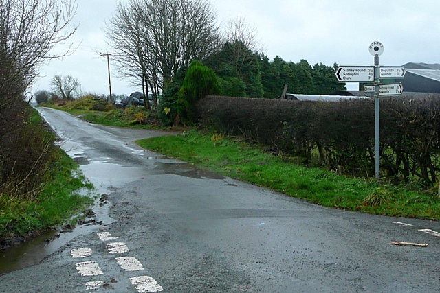
Cwm-yr-Ingel Wood is a stunning natural landscape located in Radnorshire, Wales. Spread across the downs and moorland, this woodland area offers a picturesque setting characterized by its diverse flora and fauna, making it a popular destination for nature enthusiasts and hikers.

The wood is nestled within a deep valley, or cwm, which gives it its name. The valley is surrounded by rolling hills covered in heather, gorse, and other moorland vegetation. The wood itself is predominantly made up of deciduous trees, including oak, beech, and birch, which create a vibrant and colorful canopy during the autumn months.

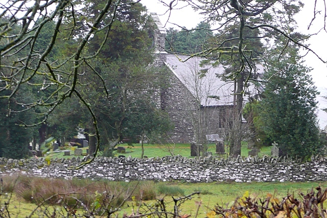
The diverse ecosystem of Cwm-yr-Ingel Wood is home to a variety of wildlife. Visitors may spot red kites soaring above, while the woodlands provide habitat for species such as badgers, foxes, and rabbits. Birdwatchers will be delighted by the presence of woodpeckers, nuthatches, and various species of warblers.

The wood is crisscrossed with walking trails, allowing visitors to explore its beauty at their own pace. These trails offer breathtaking views of the surrounding landscape and provide opportunities for photography and picnicking. Additionally, the wood is part of a larger nature reserve, ensuring the protection and conservation of this valuable ecosystem.

Cwm-yr-Ingel Wood is a hidden gem in Radnorshire, offering a peaceful and serene escape from the hustle and bustle of everyday life. Whether you are a nature lover, a keen hiker, or simply seeking tranquility, this wood is a must-visit destination.

If you have any feedback on the listing, please let us know in the comments section below.

Cwm-yr-Ingel Wood Images

Images are sourced within 2km of 52.395699/-3.1922369 or Grid Reference SO1878. Thanks to Geograph Open Source API. All images are credited.

The Radnorshire Arms (Beguildy) This public house is situated by the B4355 road.
The Radnorshire Arms (Beguildy)
This public house is situated by the B4355 road.
Beguildy telephone exchange This is southeast from the village post office.
Beguildy telephone exchange
This is southeast from the village post office.
Telephone box at Beguildy This K6 telephone box still had a telephone inside on my visit. This is by the telephone exchange near the B4355 road.
Telephone box at Beguildy
This K6 telephone box still had a telephone inside on my visit. This is by the telephone exchange near the B4355 road.
Sign at Beguildy Church in Wales Primary School
Site of Beguildy primary school Some four years after the building was last photographed on Geograph <a href="https://www.geograph.org.uk/photo/6301324">SO1979 : Beguildy Primary School, now closed</a>, the building is no longer standing. It was still present on Google Maps street view of Beguildy in June 2021, so it might have been demolished during 2021-23. The primary school closed around late 2013.
Site of Beguildy primary school
Some four years after the building was last photographed on Geograph SO1979 : Beguildy Primary School, now closed, the building is no longer standing. It was still present on Google Maps street view of Beguildy in June 2021, so it might have been demolished during 2021-23. The primary school closed around late 2013.
Beguildy post office and the Radnorshire Arms The several antique brand signs on the post office gives a glimpse of what Beguildy looked like in the early or mid twentieth century, and I wonder if they have always been on the building since they were first installed there. The B4355 road is in the photograph.
Beguildy post office and the Radnorshire Arms
The several antique brand signs on the post office gives a glimpse of what Beguildy looked like in the early or mid twentieth century, and I wonder if they have always been on the building since they were first installed there. The B4355 road is in the photograph.
Beguildy post office The several antique brand signs on the post office gives a glimpse of what Beguildy looked like in the early or mid twentieth century, and I wonder if they have always been on the building since they were first installed there. I remember seeing photographs of the post office on Geograph in 2018, and it felt great to see it in person some five years later. This is situated by the B4355 road.
Beguildy post office
The several antique brand signs on the post office gives a glimpse of what Beguildy looked like in the early or mid twentieth century, and I wonder if they have always been on the building since they were first installed there. I remember seeing photographs of the post office on Geograph in 2018, and it felt great to see it in person some five years later. This is situated by the B4355 road.
St. Michael and All Angels church (Beguildy) The medieval church on this site was first recorded in 1291, and the plan of nave and chancel was in existence by the late medieval period (notably the medieval rood screen). The chancel was rebuilt in 1885, and the remainder of the structure was restored by W. H. Bryden from 1895-96; he replaced the collapsed west tower with the present bellcote. This church was grade II* listed in October 1951. 
(Source: Cadw Listing, BritishListedBuildings)
St. Michael and All Angels church (Beguildy)
The medieval church on this site was first recorded in 1291, and the plan of nave and chancel was in existence by the late medieval period (notably the medieval rood screen). The chancel was rebuilt in 1885, and the remainder of the structure was restored by W. H. Bryden from 1895-96; he replaced the collapsed west tower with the present bellcote. This church was grade II* listed in October 1951. (Source: Cadw Listing, BritishListedBuildings)
Cottages at Beguildy These two cottages are south of St. Michael and All Angels parish church. They look like they were built a few centuries ago, but they do not have listed status as of July 2023.
Cottages at Beguildy
These two cottages are south of St. Michael and All Angels parish church. They look like they were built a few centuries ago, but they do not have listed status as of July 2023.
Church Cottage (Beguildy) Viewed from the church porch.
Church Cottage (Beguildy)
Viewed from the church porch.
Inside St. Michael and All Angels church (Beguildy) Three intriguing features at the west end of the nave. The octagonal font from the C14, bier and Craven Arms chair are in view.
Inside St. Michael and All Angels church (Beguildy)
Three intriguing features at the west end of the nave. The octagonal font from the C14, bier and Craven Arms chair are in view.
Inside St. Michael and All Angels church (Beguildy) The interior of Beguildy parish church stars a late medieval rood screen.
Inside St. Michael and All Angels church (Beguildy)
The interior of Beguildy parish church stars a late medieval rood screen.
Bells inside St. Michael and All Angels church (Beguildy) Three-light window on the site of the collapsed west tower, which was replaced by a bellcote during the Victorian restoration from 1895-96.
Bells inside St. Michael and All Angels church (Beguildy)
Three-light window on the site of the collapsed west tower, which was replaced by a bellcote during the Victorian restoration from 1895-96.
Window inside St. Michael and All Angels church (Beguildy) One of many delightful stained-glass windows in Beguildy parish church, and this two-light window is in the nave.
Window inside St. Michael and All Angels church (Beguildy)
One of many delightful stained-glass windows in Beguildy parish church, and this two-light window is in the nave.
Roof inside St. Michael and All Angels church (Beguildy) The late medieval roof in the nave survived the Victorian restoration of Beguildy church from 1895-96.
Roof inside St. Michael and All Angels church (Beguildy)
The late medieval roof in the nave survived the Victorian restoration of Beguildy church from 1895-96.
Chancel at St. Michael and All Angels church (Beguildy) The interior of the chancel at Beguildy parish church is dominated by a three-light window, situated at the east end of the church building (stained-glass from 1954).
Chancel at St. Michael and All Angels church (Beguildy)
The interior of the chancel at Beguildy parish church is dominated by a three-light window, situated at the east end of the church building (stained-glass from 1954).
Monument at St. Michael and All Angels church (Beguildy) This monument is situated in the north wall of the chancel, and this is dedicated to Samuel Evans (d. 7th June 1835) who lived to the old age of ninety-three.
Monument at St. Michael and All Angels church (Beguildy)
This monument is situated in the north wall of the chancel, and this is dedicated to Samuel Evans (d. 7th June 1835) who lived to the old age of ninety-three.
Window inside St. Michael and All Angels church (Beguildy) This two-light window in the south wall of the chancel has no stained-glass, compared to the many windows with stained-glass in the nave at Beguildy church, but this window enables a great view of the countryside south of the village.
Window inside St. Michael and All Angels church (Beguildy)
This two-light window in the south wall of the chancel has no stained-glass, compared to the many windows with stained-glass in the nave at Beguildy church, but this window enables a great view of the countryside south of the village.
Show me another place!

Cwm-yr-Ingel Wood is located at Grid Ref: SO1878 (Lat: 52.395699, Lng: -3.1922369)

Unitary Authority: Powys

Police Authority: Dyfed Powys

What 3 Words

///applause.strength.marzipan. Near Knighton, Powys

Related Wikis

Beguildy

Beguildy (Welsh: Bugeildy) is a village and community in Powys, Wales. It lies in a remote tract of countryside, 8 miles (13 km) northwest of Knighton...

Beacon Hill, Powys

Beacon Hill (Welsh: Mynydd Disglair) is a hill in the county of Radnorshire, Wales. It lies within the Powys unitary council area. It is located north...

East Wales

East Wales (Welsh: Dwyrain Cymru) is either a ITL 3 statistical region of Wales or generally a region encompassing the easternmost parts of the country...

Quabbs

Quabbs is a small, scattered hamlet in the southwest of Shropshire, near the border between England and Wales. The name, which also occurs in Gloucestershire...

Bettws-y-Crwyn

Bettws-y-Crwyn (Welsh: Betws-y-crwyn / Betwsycrowyn) is a small, remote village and civil parish in south-west Shropshire, England. It is close to the...

Llanfair Waterdine

Llanfair Waterdine, sometimes written as Llanvair Waterdine and meaning St Mary's Church Waterdine, is a small village and civil parish in Shropshire,...

Llangynllo railway station

Llangynllo railway station is a countryside stop in Powys about 5 miles west of Knighton, on the Heart of Wales Line. The station is located 1.4 miles...

Ale Oak

Ale Oak is a hamlet in Shropshire, England. == External links == Media related to Ale Oak at Wikimedia Commons

Nearby Amenities

Located within 500m of 52.395699,-3.1922369
Building: yes
Lat/Long: 52.3999064/-3.1945665
Building: yes
Lat/Long: 52.3995791/-3.1900389
The data included in this document is from www.openstreetmap.org. The data is made available under ODbL.

Have you been to Cwm-yr-Ingel Wood?

Leave your review of Cwm-yr-Ingel Wood below (or comments, questions and feedback).