Ash Priors Common

Downs, Moorland in Somerset Somerset West and Taunton

England

Ash Priors Common

Bishops Lydeard Station, West Somerset Railway From the road bridge.
Bishops Lydeard Station, West Somerset Railway Credit: David Stowell

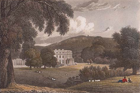
Ash Priors Common is a picturesque area located in Somerset, England. Covering a vast expanse of downs and moorland, it offers visitors a unique and diverse landscape to explore. The common is situated in the southern part of Somerset, near the village of Ash Priors.

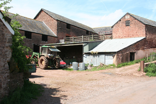
The downs of Ash Priors Common are characterized by rolling hills covered with lush green grass and scattered with wildflowers. The area is home to a variety of wildlife, including rabbits, foxes, and numerous bird species. Visitors can enjoy leisurely walks along the well-maintained paths that wind through the downs, providing stunning panoramic views of the surrounding countryside.

In contrast, the moorland of Ash Priors Common offers a distinct atmosphere. Here, visitors can experience a more rugged and untamed landscape. The moorland is characterized by open expanses of heather and bracken, interspersed with rocky outcrops and small streams. This unique habitat supports a diverse range of plant and animal species, including rare birds such as the Dartford warbler.

Ash Priors Common is a haven for nature enthusiasts and avid walkers alike. The area features a network of footpaths and trails, allowing visitors to explore the beauty of the downs and moorland at their own pace. Additionally, there are designated areas for picnicking and camping, providing an opportunity to immerse oneself in the tranquility of the surroundings.

Overall, Ash Priors Common offers a rich and varied landscape, providing visitors with a truly immersive experience in the heart of Somerset's natural beauty.

If you have any feedback on the listing, please let us know in the comments section below.

Ash Priors Common Images

Images are sourced within 2km of 51.052494/-3.2087575 or Grid Reference ST1528. Thanks to Geograph Open Source API. All images are credited.
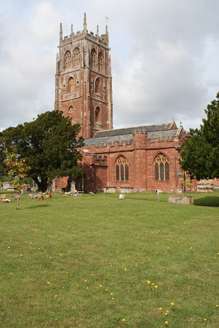
Bishops Lydeard Station, West Somerset Railway From the road bridge.
Bishops Lydeard Station, West Somerset Railway
From the road bridge.
Bishops Lydeard, West Somerset Railway The engine prepares to take on water whilst the S&T staff work on re-instating the signalling that will hopefully one day permit a resumption of through services to Taunton.
Bishops Lydeard, West Somerset Railway
The engine prepares to take on water whilst the S&T staff work on re-instating the signalling that will hopefully one day permit a resumption of through services to Taunton.
Halse: the village from the south Several cottages retain thatched roofs
Halse: the village from the south
Several cottages retain thatched roofs
Halse: St James’ Church According to Robin Bush, writing in ‘Somerset. The Complete Guide’ [Wimborne, 1994], the church may stand on a pagan site. The site is to the south, above the village
Halse: St James’ Church
According to Robin Bush, writing in ‘Somerset. The Complete Guide’ [Wimborne, 1994], the church may stand on a pagan site. The site is to the south, above the village
Ash Priors: Ash Common Aid from English Nature’s Wildspace Grant assists the local council manage the common, which was made a Local Nature Reserve in 1995. Plants such as Devil’s Bit Scabious, Heath and Common Spotted Orchid, Lousewort, Milkwort and Purple Moor Grass grow here
Ash Priors: Ash Common
Aid from English Nature’s Wildspace Grant assists the local council manage the common, which was made a Local Nature Reserve in 1995. Plants such as Devil’s Bit Scabious, Heath and Common Spotted Orchid, Lousewort, Milkwort and Purple Moor Grass grow here
Bishop’s Lydeard: St Mary’s Church The impressive four-stage Somerset tower with set-back buttresses dates from the 15th century. The churchyard contains the stumps of two medieval crosses; the church is noted for its rood screen and carved 16th century bench ends
Bishop’s Lydeard: St Mary’s Church
The impressive four-stage Somerset tower with set-back buttresses dates from the 15th century. The churchyard contains the stumps of two medieval crosses; the church is noted for its rood screen and carved 16th century bench ends
Mount Street, Bishops Lydeard Mount Street, looking North North East towards Quantock Hills. Bishop's Lydeard infamous Red Garage in foreground. Bishops Lydeard isn't just about the West Somerset Railway you know!
Mount Street, Bishops Lydeard
Mount Street, looking North North East towards Quantock Hills. Bishop's Lydeard infamous Red Garage in foreground. Bishops Lydeard isn't just about the West Somerset Railway you know!
Bishops Lydeard: West Somerset Railway 80136 and 53809 backing down onto their train which will later depart for Minehead. Seen from the south side of the road bridge by the station
Bishops Lydeard: West Somerset Railway
80136 and 53809 backing down onto their train which will later depart for Minehead. Seen from the south side of the road bridge by the station
Bishops Lydeard: West Somerset Railway Steam shrouds 53809 as the locomotive, double headed with 80136, hidden, hauls its train into Lydeard station, destination Minehead
Bishops Lydeard: West Somerset Railway
Steam shrouds 53809 as the locomotive, double headed with 80136, hidden, hauls its train into Lydeard station, destination Minehead
Former Inn? This large house on the edge of Ash Priors could well have been the Inn marked on old maps.
Former Inn?
This large house on the edge of Ash Priors could well have been the Inn marked on old maps.
Ash Priors An idyllic village street scene. Perhaps one day the numerous electricity wires can be buried underground.
Ash Priors
An idyllic village street scene. Perhaps one day the numerous electricity wires can be buried underground.
Bishops Lydeard: Cotford St Luke New housing at Burge Meadow. Looking roughly east
Bishops Lydeard: Cotford St Luke
New housing at Burge Meadow. Looking roughly east
Bishop's Lydeard: lane near Stallenge Farm Looking north on a no-through road with the Quantocks in the background
Bishop's Lydeard: lane near Stallenge Farm
Looking north on a no-through road with the Quantocks in the background
Bishop’s Lydeard: towards Lower Stoford Looking north west from near the entrance to Hopkins Farm. (Lower Stoford is at ST14452877)
Bishop’s Lydeard: towards Lower Stoford
Looking north west from near the entrance to Hopkins Farm. (Lower Stoford is at ST14452877)
Halse: barns at Northway Farm Looking north-north-west
Halse: barns at Northway Farm
Looking north-north-west
Whiskey Trail Crossing Sandy Lane is a public footpath that links Sandhill Park and Bishops Lydeard. The alternative name of Whiskey Trail came from the American servicemen billeted in the grounds of the Park during WW2. It crosses the West Somerset Railway as shown in the picture.
Whiskey Trail Crossing
Sandy Lane is a public footpath that links Sandhill Park and Bishops Lydeard. The alternative name of Whiskey Trail came from the American servicemen billeted in the grounds of the Park during WW2. It crosses the West Somerset Railway as shown in the picture.
Bishops Lydeard The crossroads on what could be called the village centre.
Bishops Lydeard
The crossroads on what could be called the village centre.
Arrival at Bishop's Lydeard
Show me another place!

Ash Priors Common is located at Grid Ref: ST1528 (Lat: 51.052494, Lng: -3.2087575)

Administrative County: Somerset

District: Somerset West and Taunton

Police Authority: Avon and Somerset

What 3 Words

///announced.circle.assorted. Near Bishops Lydeard, Somerset

Nearby Locations

Ash Priors Common

Related Wikis

Nearby Amenities

Located within 500m of 51.052494,-3.2087575
Brand: National Grid
Brand Wikidata: Q1465461
Colour: gray
Line Attachment: suspension
Material: metal
Operator: National Grid Electricity Distribution Plc
Operator Old: Western Power Distribution
Operator Wikidata: Q7988183
Owner: National Grid Electricity Distribution (South West) Plc
Owner Wikidata: Q114397866
Power: tower
Source: bing
Structure: lattice
Lat/Long: 51.0509796/-3.2100242
Brand: National Grid
Brand Wikidata: Q1465461
Colour: gray
Line Attachment: suspension
Material: metal
Operator: National Grid Electricity Distribution Plc
Operator Old: Western Power Distribution
Operator Wikidata: Q7988183
Owner: National Grid Electricity Distribution (South West) Plc
Owner Wikidata: Q114397866
Power: tower
Source: bing
Structure: lattice
Lat/Long: 51.0520589/-3.2116083
Brand: National Grid
Brand Wikidata: Q1465461
Colour: gray
Line Attachment: suspension
Material: metal
Operator: National Grid Electricity Distribution Plc
Operator Old: Western Power Distribution
Operator Wikidata: Q7988183
Owner: National Grid Electricity Distribution (South West) Plc
Owner Wikidata: Q114397866
Power: tower
Source: bing
Structure: lattice
Lat/Long: 51.0495253/-3.2078912
Passing Place
Side: left
Lat/Long: 51.0538038/-3.2126452
Give Way
Direction: forward
Lat/Long: 51.0547646/-3.2111374
Give Way
Direction: forward
Lat/Long: 51.0532934/-3.2140886
Ford: yes
Lat/Long: 51.0521225/-3.2096692
Brand: National Grid
Brand Wikidata: Q1465461
Colour: gray
Design: three-level
Line Attachment: suspension
Material: metal
Operator: National Grid Electricity Distribution Plc
Operator Old: Western Power Distribution
Operator Wikidata: Q7988183
Owner: National Grid Electricity Distribution (South West) Plc
Owner Wikidata: Q114397866
Power: tower
Source: bing
Structure: lattice
Lat/Long: 51.0537855/-3.2145395
Access: private
Door: overhead
Entrance: yes
Motorcar: private
Lat/Long: 51.0523781/-3.213261
Crossing
Bicycle: no
Crossing: unmarked
Horse: yes
Tactile Paving: no
Lat/Long: 51.0540492/-3.2122163
Crossing: unmarked
Lat/Long: 51.0534824/-3.2131201
Access: private
Door: overhead
Entrance: yes
Motorcar: private
Lat/Long: 51.0530272/-3.2145457
Give Way
Direction: forward
Lat/Long: 51.0531001/-3.2136115
Give Way
Direction: backward
Lat/Long: 51.0531342/-3.2135395
Give Way
Direction: backward
Lat/Long: 51.0529138/-3.2139314
Access: private
Door: overhead
Entrance: yes
Motorcar: private
Lat/Long: 51.0522987/-3.2142642
Access: private
Barrier: cattle_grid
Foot: no
Horse: no
Vehicle: private
Lat/Long: 51.0528944/-3.2138124
Give Way
Lat/Long: 51.053021/-3.2072675
Brand: National Grid
Brand Wikidata: Q1465461
Material: wood
Operator: National Grid Electricity Distribution Plc
Operator Old: Western Power Distribution
Operator Wikidata: Q7988183
Owner: National Grid Electricity Distribution (South West) Plc
Owner Wikidata: Q114397866
Power: pole
Lat/Long: 51.0494668/-3.2034749
Brand: National Grid
Brand Wikidata: Q1465461
Material: wood
Operator: National Grid Electricity Distribution Plc
Operator Old: Western Power Distribution
Operator Wikidata: Q7988183
Owner: National Grid Electricity Distribution (South West) Plc
Owner Wikidata: Q114397866
Power: pole
Lat/Long: 51.0502867/-3.2038186
Brand: National Grid
Brand Wikidata: Q1465461
Material: wood
Operator: National Grid Electricity Distribution Plc
Operator Old: Western Power Distribution
Operator Wikidata: Q7988183
Owner: National Grid Electricity Distribution (South West) Plc
Owner Wikidata: Q114397866
Power: pole
Lat/Long: 51.0512333/-3.2042625
Brand: National Grid
Brand Wikidata: Q1465461
Material: wood
Operator: National Grid Electricity Distribution Plc
Operator Old: Western Power Distribution
Operator Wikidata: Q7988183
Owner: National Grid Electricity Distribution (South West) Plc
Owner Wikidata: Q114397866
Power: pole
Lat/Long: 51.0520486/-3.2046197
Brand: National Grid
Brand Wikidata: Q1465461
Material: wood
Operator: National Grid Electricity Distribution Plc
Operator Old: Western Power Distribution
Operator Wikidata: Q7988183
Owner: National Grid Electricity Distribution (South West) Plc
Owner Wikidata: Q114397866
Power: pole
Lat/Long: 51.052704/-3.2049173
Power: pole
Lat/Long: 51.05305/-3.2050687
Brand: National Grid
Brand Wikidata: Q1465461
Material: wood
Operator: National Grid Electricity Distribution Plc
Operator Old: Western Power Distribution
Operator Wikidata: Q7988183
Owner: National Grid Electricity Distribution (South West) Plc
Owner Wikidata: Q114397866
Power: pole
Lat/Long: 51.0541211/-3.2055605
Brand: National Grid
Brand Wikidata: Q1465461
Material: wood
Operator: National Grid Electricity Distribution Plc
Operator Old: Western Power Distribution
Operator Wikidata: Q7988183
Owner: National Grid Electricity Distribution (South West) Plc
Owner Wikidata: Q114397866
Power: pole
Lat/Long: 51.0551864/-3.2060418
Brand: National Grid
Brand Wikidata: Q1465461
Material: wood
Operator: National Grid Electricity Distribution Plc
Operator Old: Western Power Distribution
Operator Wikidata: Q7988183
Owner: National Grid Electricity Distribution (South West) Plc
Owner Wikidata: Q114397866
Power: pole
Lat/Long: 51.0562389/-3.2065124
Brand: National Grid
Brand Wikidata: Q1465461
Material: wood
Operator: National Grid Electricity Distribution Plc
Operator Old: Western Power Distribution
Operator Wikidata: Q7988183
Owner: National Grid Electricity Distribution (South West) Plc
Owner Wikidata: Q114397866
Power: pole
Lat/Long: 51.0496427/-3.2076016
Brand: National Grid
Brand Wikidata: Q1465461
Material: wood
Operator: National Grid Electricity Distribution Plc
Operator Old: Western Power Distribution
Operator Wikidata: Q7988183
Owner: National Grid Electricity Distribution (South West) Plc
Owner Wikidata: Q114397866
Power: pole
Lat/Long: 51.0489205/-3.2060599
Brand: National Grid
Brand Wikidata: Q1465461
Material: wood
Operator: National Grid Electricity Distribution Plc
Operator Old: Western Power Distribution
Operator Wikidata: Q7988183
Owner: National Grid Electricity Distribution (South West) Plc
Owner Wikidata: Q114397866
Power: pole
Lat/Long: 51.0501489/-3.2087121
Brand: National Grid
Brand Wikidata: Q1465461
Material: wood
Operator: National Grid Electricity Distribution Plc
Operator Old: Western Power Distribution
Operator Wikidata: Q7988183
Owner: National Grid Electricity Distribution (South West) Plc
Owner Wikidata: Q114397866
Power: pole
Lat/Long: 51.0506594/-3.2098091
Board Type: nature
Description: Map and species information for walkers.
Information: board
Tourism: information
Lat/Long: 51.052714/-3.2063973
Brand: National Grid
Brand Wikidata: Q1465461
Material: wood
Operator: National Grid Electricity Distribution Plc
Operator Old: Western Power Distribution
Operator Wikidata: Q7988183
Owner: National Grid Electricity Distribution (South West) Plc
Owner Wikidata: Q114397866
Power: pole
Lat/Long: 51.0524767/-3.2027656
Brand: National Grid
Brand Wikidata: Q1465461
Material: wood
Operator: National Grid Electricity Distribution Plc
Operator Old: Western Power Distribution
Operator Wikidata: Q7988183
Owner: National Grid Electricity Distribution (South West) Plc
Owner Wikidata: Q114397866
Power: pole
Lat/Long: 51.0525611/-3.2158438
Brand: National Grid
Brand Wikidata: Q1465461
Material: wood
Operator: National Grid Electricity Distribution Plc
Operator Old: Western Power Distribution
Operator Wikidata: Q7988183
Owner: National Grid Electricity Distribution (South West) Plc
Owner Wikidata: Q114397866
Power: pole
Lat/Long: 51.0513801/-3.2136753
Brand: National Grid
Brand Wikidata: Q1465461
Design: two-level
Guyed: yes
Line Management: split
Material: wood
Operator: National Grid Electricity Distribution Plc
Operator Old: Western Power Distribution
Operator Wikidata: Q7988183
Owner: National Grid Electricity Distribution (South West) Plc
Owner Wikidata: Q114397866
Power: pole
Lat/Long: 51.0504955/-3.2126229
Brand: National Grid
Brand Wikidata: Q1465461
Devices: 1
Frequency: 50
Location Transition: yes
Material: wood
Operator: National Grid Electricity Distribution Plc
Operator Old: Western Power Distribution
Operator Wikidata: Q7988183
Owner: National Grid Electricity Distribution (South West) Plc
Owner Wikidata: Q114397866
Phases: 3
Power: pole
Transformer: distribution
Lat/Long: 51.0520056/-3.2145738
Brand: National Grid
Brand Wikidata: Q1465461
Design: two-level
Guyed: yes
Material: wood
Operator: National Grid Electricity Distribution Plc
Operator Old: Western Power Distribution
Operator Wikidata: Q7988183
Owner: National Grid Electricity Distribution (South West) Plc
Owner Wikidata: Q114397866
Power: pole
Lat/Long: 51.0513059/-3.2112237
Access: private
Door: overhead
Entrance: yes
Motorcar: yes
Lat/Long: 51.0562484/-3.210551
Access: private
Door: hinged
Entrance: main
Foot: yes
Motorcar: no
Lat/Long: 51.055765/-3.2105368
Access: private
Door: overhead
Entrance: yes
Motorcar: yes
Lat/Long: 51.0554199/-3.210987
Access: private
Door: overhead
Entrance: yes
Motorcar: yes
Lat/Long: 51.0557117/-3.21051
Access: private
Door: overhead
Entrance: yes
Foot: yes
Motorcar: yes
Lat/Long: 51.0558021/-3.2106523
Access: private
Door: overhead
Entrance: yes
Motorcar: yes
Lat/Long: 51.0555542/-3.2106464
Access: private
Door: overhead
Entrance: yes
Motorcar: yes
Lat/Long: 51.0558254/-3.2107819
Access: private
Door: overhead
Entrance: yes
Motorcar: yes
Lat/Long: 51.055961/-3.2107446
Access: private
Door: hinged
Entrance: main
Foot: yes
Motorcar: no
Lat/Long: 51.0564969/-3.2109825
Access: private
Door: overhead
Entrance: yes
Foot: yes
Motorcar: yes
Lat/Long: 51.0564152/-3.2109432
Access: private
Door: overhead
Entrance: yes
Motorcar: yes
Lat/Long: 51.0564866/-3.2105363
Access: private
Door: overhead
Entrance: yes
Motorcar: yes
Lat/Long: 51.0567288/-3.2105742
Brand: National Grid
Brand Wikidata: Q1465461
Material: wood
Operator: National Grid Electricity Distribution Plc
Operator Old: Western Power Distribution
Operator Wikidata: Q7988183
Owner: National Grid Electricity Distribution (South West) Plc
Owner Wikidata: Q114397866
Power: pole
Lat/Long: 51.0510129/-3.2116818
Brand: National Grid
Brand Wikidata: Q1465461
Devices: 1
Frequency: 50
Guyed: yes
Location Transition: yes
Material: wood
Operator: National Grid Electricity Distribution Plc
Operator Old: Western Power Distribution
Operator Wikidata: Q7988183
Owner: National Grid Electricity Distribution (South West) Plc
Owner Wikidata: Q114397866
Phases: 1
Power: pole
Transformer: distribution
Lat/Long: 51.0518783/-3.2143083
Brand: National Grid
Brand Wikidata: Q1465461
Material: wood
Operator: National Grid Electricity Distribution Plc
Operator Old: Western Power Distribution
Operator Wikidata: Q7988183
Owner: National Grid Electricity Distribution (South West) Plc
Owner Wikidata: Q114397866
Power: pole
Lat/Long: 51.0497378/-3.2139543
Camera Mount: pole
Camera Type: dome
Man Made: surveillance
Operator: Silverstone Green Energy
Surveillance: outdoor
Surveillance Type: camera
Surveillance Zone: commercial
Lat/Long: 51.0505691/-3.2096645
Passing Place
Direction: forward
Side: left
Lat/Long: 51.054106/-3.2145517
Power: pole
Lat/Long: 51.0552579/-3.2092282
Power: pole
Lat/Long: 51.0545751/-3.2093516
Power: pole
Lat/Long: 51.0538838/-3.2094562
Power: pole
Lat/Long: 51.0529388/-3.2096373
Power: pole
Lat/Long: 51.0521/-3.209774
Power: pole
Lat/Long: 51.0521877/-3.2080789
The data included in this document is from www.openstreetmap.org. The data is made available under ODbL.

Have you been to Ash Priors Common?

Leave your review of Ash Priors Common below (or comments, questions and feedback).