Muir of Drumlochy

Downs, Moorland in Perthshire

Scotland

Muir of Drumlochy

Cockrage Moss Just above the A93 and out of sight from the busy road is a big area of moorland, some of it wet. The area is a big goose roost.
Cockrage Moss Credit: Richard Webb

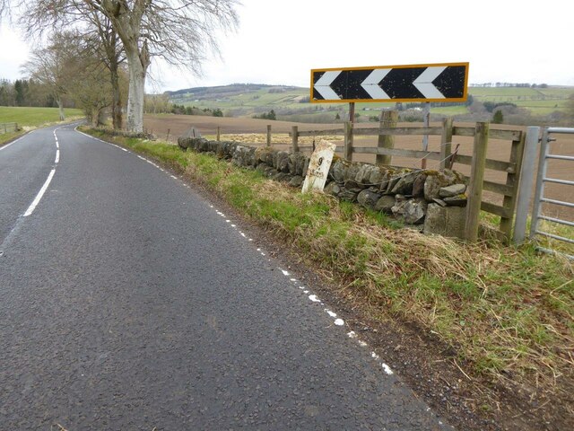
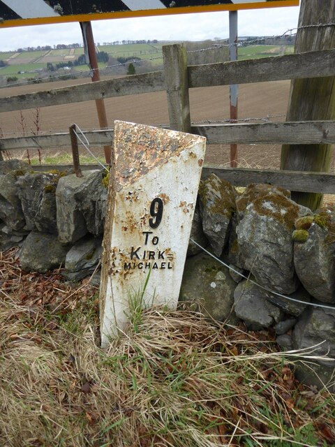
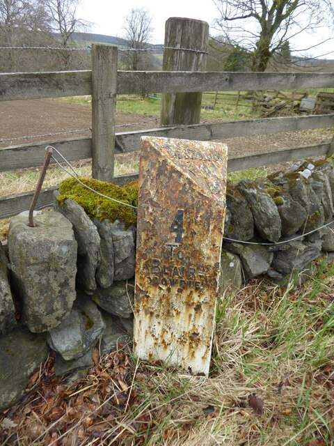
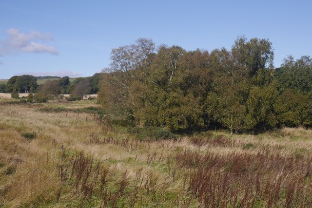
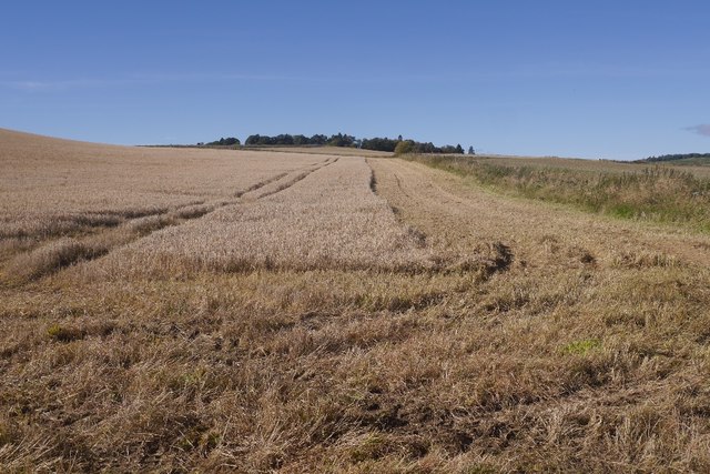
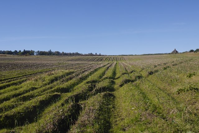
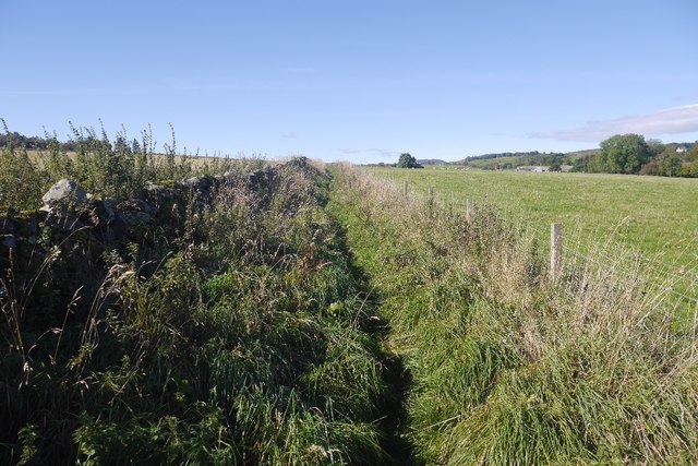
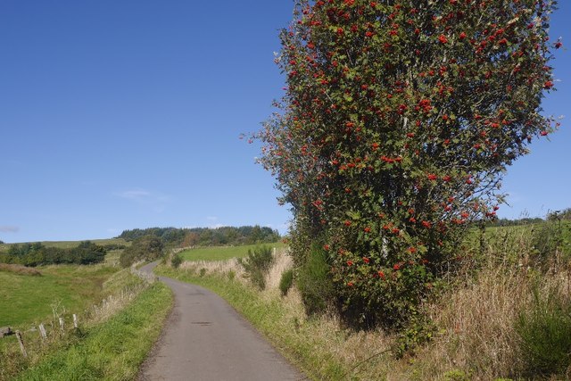
Muir of Drumlochy is a picturesque area located in Perthshire, Scotland. Situated amidst rolling hills and vast moorland, it offers visitors a unique and captivating experience of the Scottish countryside. The Muir, as it is commonly referred to, encompasses a diverse range of landscapes, including downs and moorland.

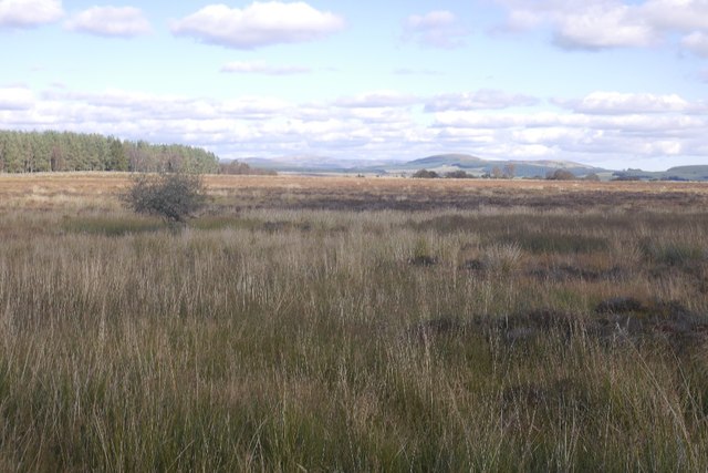
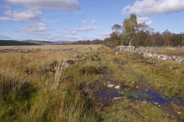
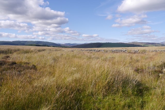
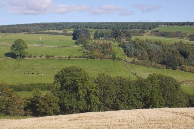
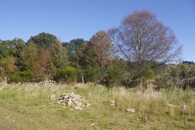
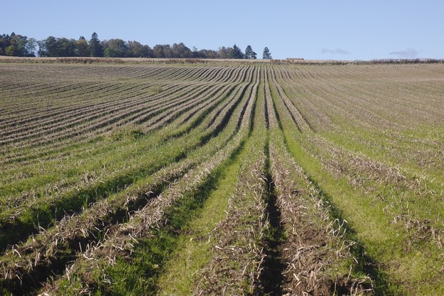
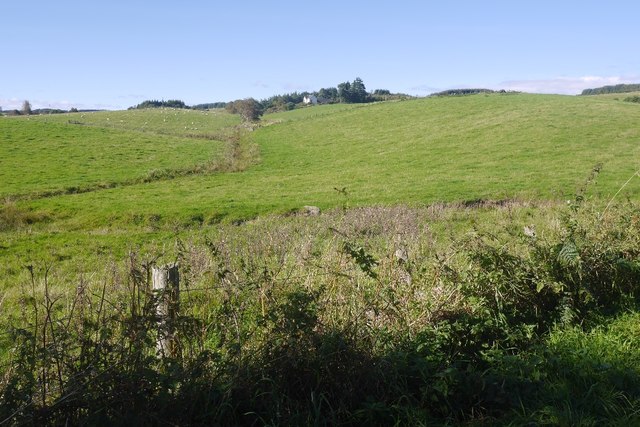
Covering an expansive area, Muir of Drumlochy is characterized by its undulating terrain and heather-clad moors. The downs, or gently sloping hills, provide breathtaking panoramic views of the surrounding countryside. Visitors can expect to see a rich tapestry of colors, with vibrant hues of purple heather mingling with the lush green grass.

The moorland, on the other hand, offers a wilder and more rugged landscape. It is covered in a thick blanket of heather and interspersed with rocky outcrops and peat bogs. This unique habitat provides a haven for a variety of wildlife, including red grouse, mountain hares, and deer. Birdwatchers will also be delighted by the presence of species such as golden eagles and merlins.

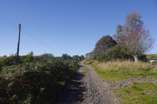
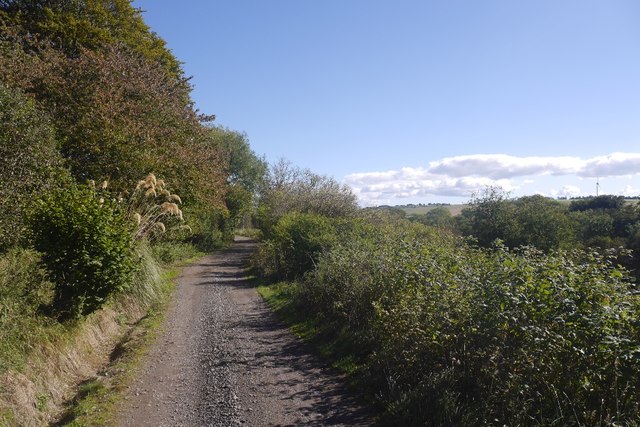
Hiking and walking enthusiasts will find an abundance of trails and paths crisscrossing the Muir. These routes cater to all levels of ability, from leisurely strolls to more challenging hikes. Exploring the Muir of Drumlochy allows visitors to immerse themselves in the tranquility and natural beauty of the Scottish countryside.

In summary, Muir of Drumlochy in Perthshire offers a captivating blend of downs and moorland. With its stunning vistas, diverse wildlife, and ample opportunities for outdoor pursuits, it is a must-visit destination for nature lovers and those seeking a peaceful retreat in the heart of Scotland.

If you have any feedback on the listing, please let us know in the comments section below.

Muir of Drumlochy Images

Images are sourced within 2km of 56.620076/-3.3829494 or Grid Reference NO1548. Thanks to Geograph Open Source API. All images are credited.

Cockrage Moss Just above the A93 and out of sight from the busy road is a big area of moorland, some of it wet. The area is a big goose roost.
Cockrage Moss
Just above the A93 and out of sight from the busy road is a big area of moorland, some of it wet. The area is a big goose roost.
Drove road above Bridge of Cally A very wet bit of the old road by Rochallie Hill Plantation.
Drove road above Bridge of Cally
A very wet bit of the old road by Rochallie Hill Plantation.
Cockrage Moss Wet moorland south of Bridge of Cally.  View towards Beinn a' Ghlo.
Cockrage Moss
Wet moorland south of Bridge of Cally. View towards Beinn a' Ghlo.
Old Milepost by the A93, north of Glenericht Gate House Perth milepost by the A93, in parish of Blairgowrie (Perth and Kinross District), South of Bridge of Cally, North of lodge for Glenericht House by field gate.

Inscription reads:-
: 4 / TO / BLAIR= / GOWRIE : : TO CALLY / 2 : : 9 / TO / KIRK= / MICHAEL :

Surveyed

Milestone Society National ID: PK_BGPL04
Old Milepost by the A93, north of Glenericht Gate House
Perth milepost by the A93, in parish of Blairgowrie (Perth and Kinross District), South of Bridge of Cally, North of lodge for Glenericht House by field gate. Inscription reads:- : 4 / TO / BLAIR= / GOWRIE : : TO CALLY / 2 : : 9 / TO / KIRK= / MICHAEL : Surveyed Milestone Society National ID: PK_BGPL04
Old milepost A view to the north towards Bridge of Cally showing the milepost on the A93 north of the lodge for Glenericht House.
Old milepost
A view to the north towards Bridge of Cally showing the milepost on the A93 north of the lodge for Glenericht House.
Old milepost by the A93 The right-hand face of the milepost on the east side of the A93 near Glenericht House.   It was repainted in 2009 but is in need of straightening up and further refurbishment. The raised legend on the bevel is TO CALLY / 2. Left face: 4 / To / Blair= / gowrie. Right face: 9 / To / Kirk= / michael.
Left face <a title="https://www.geograph.org.uk/photo/6821852" href="https://www.geograph.org.uk/photo/6821852">Link</a>.
Old milepost by the A93
The right-hand face of the milepost on the east side of the A93 near Glenericht House. It was repainted in 2009 but is in need of straightening up and further refurbishment. The raised legend on the bevel is TO CALLY / 2. Left face: 4 / To / Blair= / gowrie. Right face: 9 / To / Kirk= / michael. Left face Link.
Old milepost by the A93 The left-hand face of the milepost 2 miles south of Bridge of Cally on the A93. The raised legend on the bevel is TO CALLY / 2. Left face: 4 / To / Blair= / gowrie. Right face: 9 / To / Kirk= / michael.   This post is marked on old maps a few hundred yards to the south of its present position but it is not known when it was moved.   It is not marked on the current OS 50:000 Landranger map.
Right face <a title="https://www.geograph.org.uk/photo/6821846" href="https://www.geograph.org.uk/photo/6821846">Link</a>.
Old milepost by the A93
The left-hand face of the milepost 2 miles south of Bridge of Cally on the A93. The raised legend on the bevel is TO CALLY / 2. Left face: 4 / To / Blair= / gowrie. Right face: 9 / To / Kirk= / michael. This post is marked on old maps a few hundred yards to the south of its present position but it is not known when it was moved. It is not marked on the current OS 50:000 Landranger map. Right face Link.
View towards Glasclune Castle From East Gormack.
View towards Glasclune Castle
From East Gormack.
Grassy field by the Lornty Burn A contrast to the surrounding arable land.
Grassy field by the Lornty Burn
A contrast to the surrounding arable land.
Barley, East Gormack Taken shortly before the combining started again.
Barley, East Gormack
Taken shortly before the combining started again.
Clearance cairn Stones piled up beside a potato field. They appear to have been recently removed from the field.
Clearance cairn
Stones piled up beside a potato field. They appear to have been recently removed from the field.
Potato field, Gormack Defoliated and awaiting lifting.
Potato field, Gormack
Defoliated and awaiting lifting.
Potato field, West Gormack Awaiting lifting.
Potato field, West Gormack
Awaiting lifting.
Fenced in path, West Gormack One of two such sections of the Cateran Trail near here. A little less objectionable than the one to the east as it is wider and less overgrown.
Fenced in path, West Gormack
One of two such sections of the Cateran Trail near here. A little less objectionable than the one to the east as it is wider and less overgrown.
Road to Millhole Parting of the ways, a road turns off rightwards to Westerton.
Road to Millhole
Parting of the ways, a road turns off rightwards to Westerton.
Road from Millhole One of the outer branches of the tree of roads serving dwellings above Blairgowrie.
Road from Millhole
One of the outer branches of the tree of roads serving dwellings above Blairgowrie.
Road to Middleton Passing a heavily laden rowan.
Road to Middleton
Passing a heavily laden rowan.
Fields by Middleton (Perthshire) Looking towards Westerton.
Fields by Middleton (Perthshire)
Looking towards Westerton.
Show me another place!

Muir of Drumlochy is located at Grid Ref: NO1548 (Lat: 56.620076, Lng: -3.3829494)

Unitary Authority: Perth and Kinross

Police Authority: Tayside

What 3 Words

///amused.opera.brambles. Near Blairgowrie, Perth & Kinross

Related Wikis

River Ardle

The River Ardle (Scottish Gaelic: Abhainn Àrdail) is a tributary of the River Ericht. It runs for 10 miles (16 km) through Strathardle in Perthshire, Scotland...
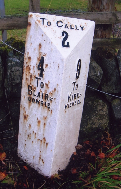
Bridge of Cally

Bridge of Cally is a small village in Kirkmichael parish, Perth and Kinross, Scotland. It sits at the junction of three glens, Glenshee, Strathardle and...

Kinloch, Blairgowrie

Kinloch is a hamlet and civil parish immediately north of the Loch of Drumellie, about two miles (three kilometres) west of Blairgowrie in Perth and Kinross...

Newton Castle

Newton Castle stands in its grounds near the town of Blairgowrie in Perth and Kinross, Scotland. It is a Category A listed building dating to the mid-16th...

Achalader

Achalader (Scottish Gaelic: Achadh Chaladair) is a settlement in the council area of Perth and Kinross, Scotland. Achalader is situated 3 miles (5 kilometres...

Rae Loch

Rae Loch is a small lowland freshwater loch that sits directly to the east of Loch of Drumellie into which it flows and is 1.5 miles (2.4 km) to the west...

Ardblair Castle

Ardblair Castle is an L-plan castle (with an added wing), dating from the 16th century, around 0.75 miles (1.21 km) west of Blairgowrie in Perth and Kinross...

Blairgowrie and Rattray

Blairgowrie and Rattray ( ) is a twin burgh in Perth and Kinross, Scotland. Locals refer to the town as "Blair". Blairgowrie is the larger of the two former...

Have you been to Muir of Drumlochy?

Leave your review of Muir of Drumlochy below (or comments, questions and feedback).