Muirton Moss

Downs, Moorland in Perthshire

Scotland

Muirton Moss

Cockrage Moss Just above the A93 and out of sight from the busy road is a big area of moorland, some of it wet. The area is a big goose roost.
Cockrage Moss Credit: Richard Webb

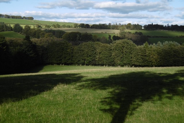
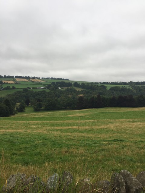
Muirton Moss is a sprawling expanse of downs and moorland located in Perthshire, Scotland. Covering a vast area of approximately 12 square kilometers, it is a diverse and stunning landscape that captivates visitors with its natural beauty and unique features.

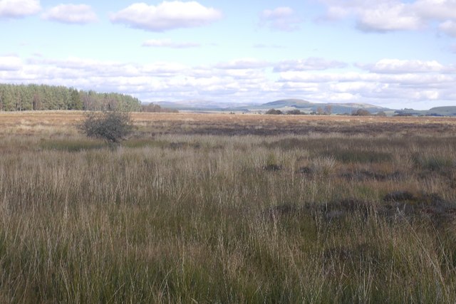
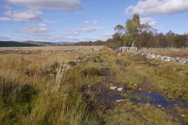
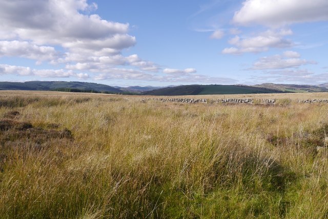
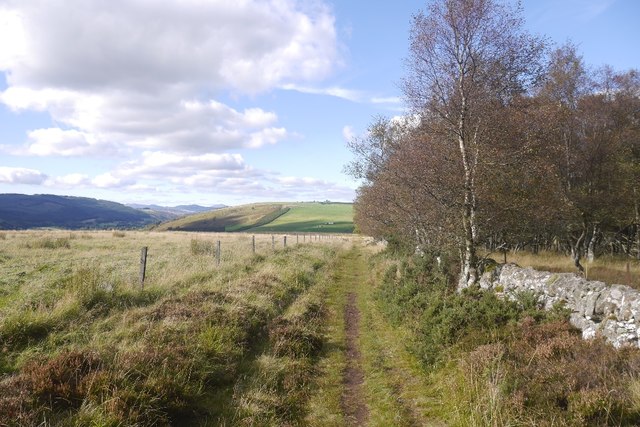
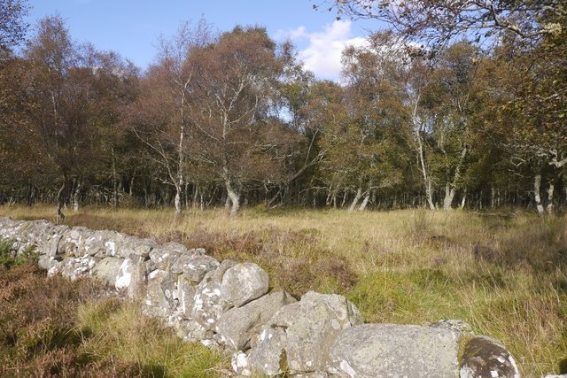
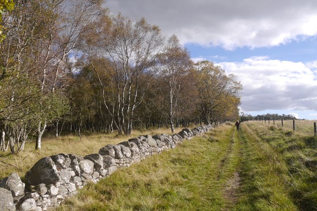
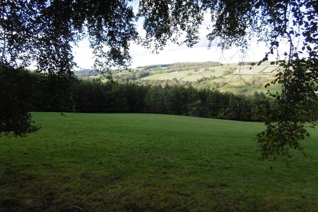
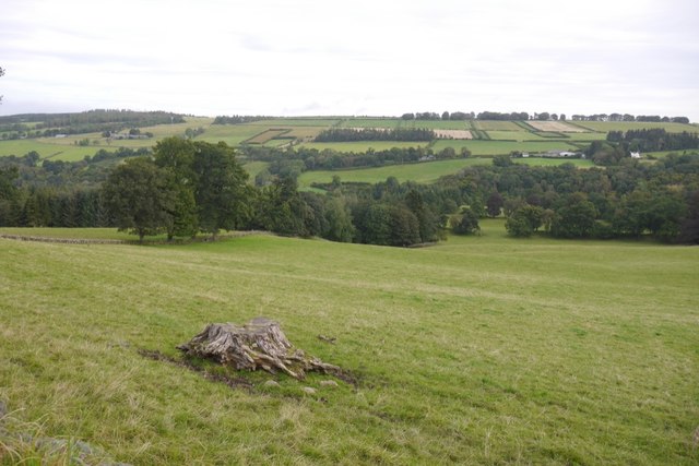
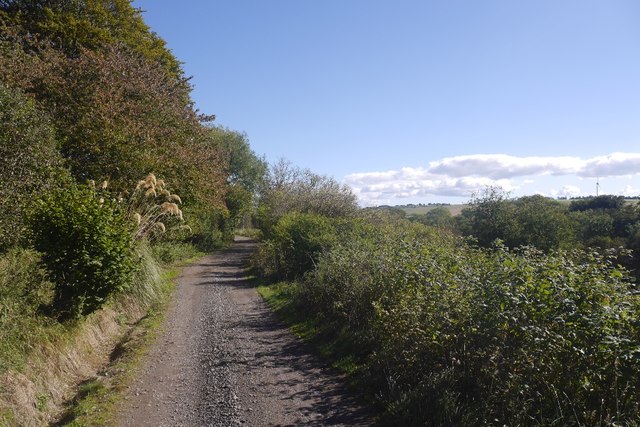
The moss is characterized by its undulating terrain, comprising of gently sloping hills and open grasslands, interspersed with patches of heather and scattered trees. The verdant greenery stretches as far as the eye can see, creating a serene and tranquil atmosphere.

The area is home to a rich array of wildlife, with various species of birds, mammals, and insects making their homes here. It is particularly renowned for its birdlife, attracting enthusiasts and ornithologists from far and wide. Rare species such as the Eurasian curlew and the golden plover can often be spotted, making it a haven for birdwatchers.

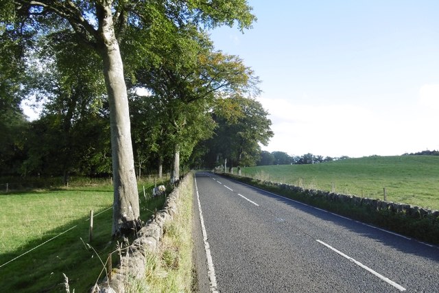
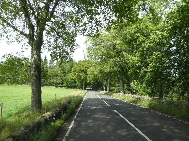
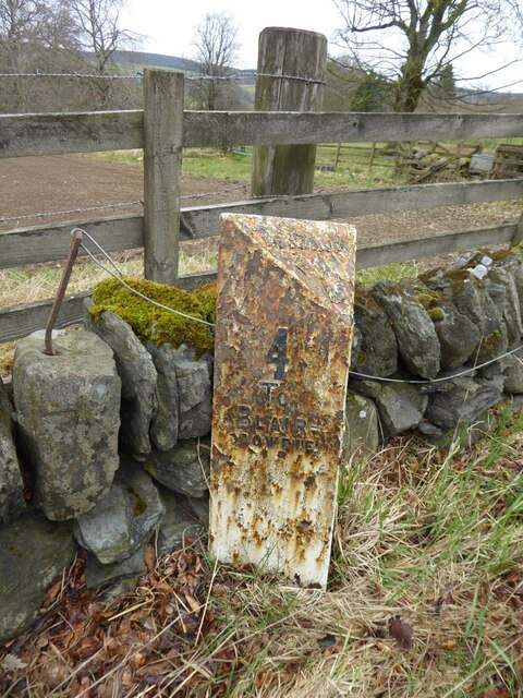
Muirton Moss also boasts a network of walking trails, allowing visitors to explore the landscape at their own pace. These paths wind their way through the moss, offering breathtaking views of the surrounding countryside and the distant hills. The trails cater to all abilities, with options for both leisurely strolls and more challenging hikes.

Overall, Muirton Moss is a natural gem within Perthshire, offering a picturesque and unspoiled environment for nature lovers and outdoor enthusiasts. Its captivating scenery, diverse wildlife, and well-maintained trails make it an ideal destination for those seeking solace in the beauty of the Scottish countryside.

If you have any feedback on the listing, please let us know in the comments section below.
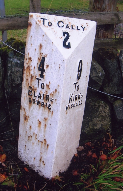
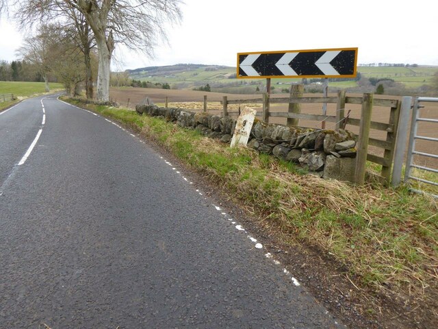
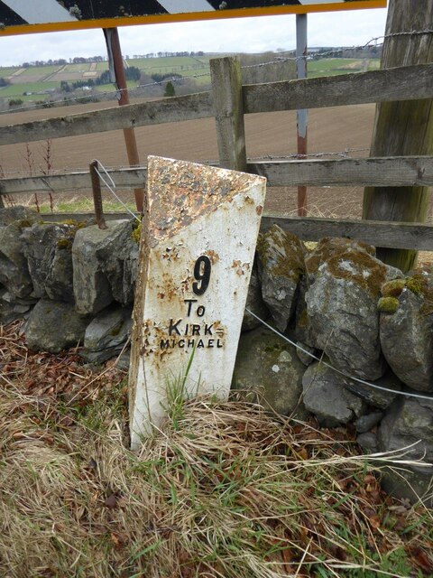
Muirton Moss Images

Images are sourced within 2km of 56.624261/-3.3831676 or Grid Reference NO1548. Thanks to Geograph Open Source API. All images are credited.

Cockrage Moss Just above the A93 and out of sight from the busy road is a big area of moorland, some of it wet. The area is a big goose roost.
Cockrage Moss
Just above the A93 and out of sight from the busy road is a big area of moorland, some of it wet. The area is a big goose roost.
Drove road above Bridge of Cally A very wet bit of the old road by Rochallie Hill Plantation.
Drove road above Bridge of Cally
A very wet bit of the old road by Rochallie Hill Plantation.
Cockrage Moss Wet moorland south of Bridge of Cally.  View towards Beinn a' Ghlo.
Cockrage Moss
Wet moorland south of Bridge of Cally. View towards Beinn a' Ghlo.
Drove road, Rochallie Hill Plantation The road starts to dry out a little as it approaches the descent to Bridge of Cally.
Drove road, Rochallie Hill Plantation
The road starts to dry out a little as it approaches the descent to Bridge of Cally.
Rochallie Wood Plantation A birch wood beside the old drove road over from Kinloch.
Rochallie Wood Plantation
A birch wood beside the old drove road over from Kinloch.
Rochallie Wood Plantation At last, a dry path.
Rochallie Wood Plantation
At last, a dry path.
Field, Rochallie Grassland sloping down towards the River Ericht.
Field, Rochallie
Grassland sloping down towards the River Ericht.
A93, Rochallie A lot of the A93 between Bridge of Cally and Rattray is tree lined.
A93, Rochallie
A lot of the A93 between Bridge of Cally and Rattray is tree lined.
Field near Mains of Mause It may have been a warm day, but the shadows are long and it's still afternoon,  Well into Autumn now.
Field near Mains of Mause
It may have been a warm day, but the shadows are long and it's still afternoon, Well into Autumn now.
A93, Mains of Mause Between Rattray and Bridge of Cally, very much the preserve of speeding motorcyclists and the boy racers this afternoon.
A93, Mains of Mause
Between Rattray and Bridge of Cally, very much the preserve of speeding motorcyclists and the boy racers this afternoon.
Road view
Road view
A93 in Glen Ericht
A93 in Glen Ericht
Old Milepost by the A93, north of Glenericht Gate House Perth milepost by the A93, in parish of Blairgowrie (Perth and Kinross District), South of Bridge of Cally, North of lodge for Glenericht House by field gate.

Inscription reads:-
: 4 / TO / BLAIR= / GOWRIE : : TO CALLY / 2 : : 9 / TO / KIRK= / MICHAEL :

Surveyed

Milestone Society National ID: PK_BGPL04
Old Milepost by the A93, north of Glenericht Gate House
Perth milepost by the A93, in parish of Blairgowrie (Perth and Kinross District), South of Bridge of Cally, North of lodge for Glenericht House by field gate. Inscription reads:- : 4 / TO / BLAIR= / GOWRIE : : TO CALLY / 2 : : 9 / TO / KIRK= / MICHAEL : Surveyed Milestone Society National ID: PK_BGPL04
Pasture and woodland, Mause View across the hidden Ericht.
Pasture and woodland, Mause
View across the hidden Ericht.
Old milepost A view to the north towards Bridge of Cally showing the milepost on the A93 north of the lodge for Glenericht House.
Old milepost
A view to the north towards Bridge of Cally showing the milepost on the A93 north of the lodge for Glenericht House.
Old milepost by the A93 The right-hand face of the milepost on the east side of the A93 near Glenericht House.   It was repainted in 2009 but is in need of straightening up and further refurbishment. The raised legend on the bevel is TO CALLY / 2. Left face: 4 / To / Blair= / gowrie. Right face: 9 / To / Kirk= / michael.
Left face <a title="https://www.geograph.org.uk/photo/6821852" href="https://www.geograph.org.uk/photo/6821852">Link</a>.
Old milepost by the A93
The right-hand face of the milepost on the east side of the A93 near Glenericht House. It was repainted in 2009 but is in need of straightening up and further refurbishment. The raised legend on the bevel is TO CALLY / 2. Left face: 4 / To / Blair= / gowrie. Right face: 9 / To / Kirk= / michael. Left face Link.
Old milepost by the A93 The left-hand face of the milepost 2 miles south of Bridge of Cally on the A93. The raised legend on the bevel is TO CALLY / 2. Left face: 4 / To / Blair= / gowrie. Right face: 9 / To / Kirk= / michael.   This post is marked on old maps a few hundred yards to the south of its present position but it is not known when it was moved.   It is not marked on the current OS 50:000 Landranger map.
Right face <a title="https://www.geograph.org.uk/photo/6821846" href="https://www.geograph.org.uk/photo/6821846">Link</a>.
Old milepost by the A93
The left-hand face of the milepost 2 miles south of Bridge of Cally on the A93. The raised legend on the bevel is TO CALLY / 2. Left face: 4 / To / Blair= / gowrie. Right face: 9 / To / Kirk= / michael. This post is marked on old maps a few hundred yards to the south of its present position but it is not known when it was moved. It is not marked on the current OS 50:000 Landranger map. Right face Link.
Road from Millhole One of the outer branches of the tree of roads serving dwellings above Blairgowrie.
Road from Millhole
One of the outer branches of the tree of roads serving dwellings above Blairgowrie.
Show me another place!

Muirton Moss is located at Grid Ref: NO1548 (Lat: 56.624261, Lng: -3.3831676)

Unitary Authority: Perth and Kinross

Police Authority: Tayside

What 3 Words

///conforms.reserve.assets. Near Blairgowrie, Perth & Kinross

Related Wikis

River Ardle

The River Ardle (Scottish Gaelic: Abhainn Àrdail) is a tributary of the River Ericht. It runs for 10 miles (16 km) through Strathardle in Perthshire, Scotland...

Bridge of Cally

Bridge of Cally is a small village in Kirkmichael parish, Perth and Kinross, Scotland. It sits at the junction of three glens, Glenshee, Strathardle and...

Newton Castle

Newton Castle stands in its grounds near the town of Blairgowrie in Perth and Kinross, Scotland. It is a Category A listed building dating to the mid-16th...

Kinloch, Blairgowrie

Kinloch is a hamlet and civil parish immediately north of the Loch of Drumellie, about two miles (three kilometres) west of Blairgowrie in Perth and Kinross...

Achalader

Achalader (Scottish Gaelic: Achadh Chaladair) is a settlement in the council area of Perth and Kinross, Scotland. Achalader is situated 3 miles (5 kilometres...

Rae Loch

Rae Loch is a small lowland freshwater loch that sits directly to the east of Loch of Drumellie into which it flows and is 1.5 miles (2.4 km) to the west...

Blairgowrie and Rattray

Blairgowrie and Rattray ( ) is a twin burgh in Perth and Kinross, Scotland. Locals refer to the town as "Blair". Blairgowrie is the larger of the two former...

Ardblair Castle

Ardblair Castle is an L-plan castle (with an added wing), dating from the 16th century, around 0.75 miles (1.21 km) west of Blairgowrie in Perth and Kinross...

Have you been to Muirton Moss?

Leave your review of Muirton Moss below (or comments, questions and feedback).