Dail Mhòr

Downs, Moorland in Caithness

Scotland

Dail Mhòr

Achnaclyth croft house The unoccupied but well maintained house with Maiden Pap in the distance.
Achnaclyth croft house Credit: John Lucas

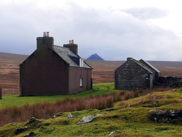
Dail Mhòr is a vast expanse of downs and moorland located in Caithness, a county in the Highland region of Scotland. It stretches across an area of approximately 1,500 hectares, making it one of the largest areas of open land in the region.

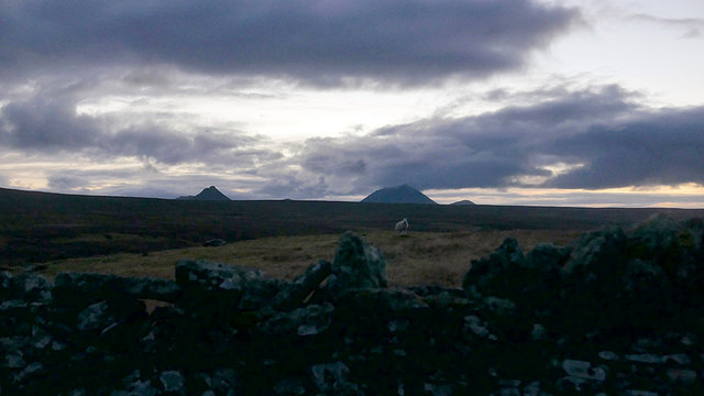
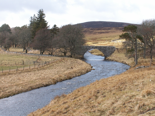
This unique landscape is characterized by its rolling hills, heather-covered moors, and sweeping panoramic views. The terrain is predominantly composed of peat, which gives the area its distinctive reddish-brown color. Dotted throughout Dail Mhòr are small lochs and boggy areas, providing habitats for various species of birds and other wildlife.

The downs of Dail Mhòr are home to a diverse range of plant species, including wildflowers, grasses, and shrubs. During the summer months, the moorland comes alive with vibrant colors, as the heather blooms in shades of purple and pink. This creates a picturesque and serene atmosphere, attracting nature enthusiasts and photographers alike.

The landscape of Dail Mhòr is not only visually stunning but also significant in terms of its cultural and historical heritage. It has been shaped by human activity for centuries, with evidence of ancient settlements and historical sites scattered across the area. The land has been used for grazing livestock and for peat cutting, which was traditionally used as a fuel source.

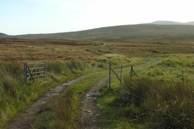
Dail Mhòr is a designated Site of Special Scientific Interest (SSSI), reflecting its importance for conservation and biodiversity. Visitors to the area can enjoy walking and hiking trails that allow them to explore the natural beauty and tranquility of this remote and captivating landscape.

If you have any feedback on the listing, please let us know in the comments section below.

Dail Mhòr Images

Images are sourced within 2km of 58.280227/-3.5262836 or Grid Reference ND1033. Thanks to Geograph Open Source API. All images are credited.

Achnaclyth croft house The unoccupied but well maintained house with Maiden Pap in the distance.
Achnaclyth croft house
The unoccupied but well maintained house with Maiden Pap in the distance.
Well formed track heading down to the croft at Achnaclyth
A twilight view towards Maiden Pap and Morven from Achnaclyth
A final afternoon view of Achnaclyth With Maiden Pap (centre) and Morven (right) in view.
A final afternoon view of Achnaclyth
With Maiden Pap (centre) and Morven (right) in view.
Track and stone wall at Achnaclyth
A well formed track north of Achnaclyth
Shed on the track to Loch Dubh From this point on, the track to the Loch deteriorates markedly to virtually nothing.
Shed on the track to Loch Dubh
From this point on, the track to the Loch deteriorates markedly to virtually nothing.
Flooded track above Achnaclyth
A view across the Flows bog in the mid-afternoon With the light fading rapidly. Maiden Pap and Morven being the most prominent hills.
A view across the Flows bog in the mid-afternoon
With the light fading rapidly. Maiden Pap and Morven being the most prominent hills.
Achnaclyth Bridge over Dunbeath water looking towards Maiden Pap
Achnaclyth
Bridge over Dunbeath water looking towards Maiden Pap
Achnaclyth old farmstead The old farm at Achnaclyth on the Dunbeath Estate
Achnaclyth old farmstead
The old farm at Achnaclyth on the Dunbeath Estate
Hill track and gate heading down towards Achnaclyth This track follows the East bank of the Raffin Burn.
Hill track and gate heading down towards Achnaclyth
This track follows the East bank of the Raffin Burn.
Croft building around Achnaclyth Achnaclyth is an abandoned croft but the buildings are kept in good condition by the estate. Morven can be seen 11km away in the far distance.
Croft building around Achnaclyth
Achnaclyth is an abandoned croft but the buildings are kept in good condition by the estate. Morven can be seen 11km away in the far distance.
Longhouse by Dunbeath Water The longhouse is part of a post medieval settlement located on the south side of Dunbeath Water.  It is about 30m long, was divided into three rooms and had a small annex on the north wall (ref <span class="nowrap"><a title="http://canmore.rcahms.gov.uk/en/site/73271/details/achnaclyth" rel="nofollow ugc noopener" href="http://canmore.rcahms.gov.uk/en/site/73271/details/achnaclyth">Link</a><img style="margin-left:2px;" alt="External link" title="External link - shift click to open in new window" src="https://s1.geograph.org.uk/img/external.png" width="10" height="10"/></span> ).
Longhouse by Dunbeath Water
The longhouse is part of a post medieval settlement located on the south side of Dunbeath Water. It is about 30m long, was divided into three rooms and had a small annex on the north wall (ref LinkExternal link ).
Four poster stone circle near Achnaclyth Only three stones remain.  They are 0.5 to 0.6m high and are aligned NW-SE. (Ref <span class="nowrap"><a title="http://canmore.rcahms.gov.uk/en/site/7571/details/achnaclyth" rel="nofollow ugc noopener" href="http://canmore.rcahms.gov.uk/en/site/7571/details/achnaclyth">Link</a><img style="margin-left:2px;" alt="External link" title="External link - shift click to open in new window" src="https://s1.geograph.org.uk/img/external.png" width="10" height="10"/></span> )

On the horizon the tip of Maiden Pap can just be seen along with Morven.
Four poster stone circle near Achnaclyth
Only three stones remain. They are 0.5 to 0.6m high and are aligned NW-SE. (Ref LinkExternal link ) On the horizon the tip of Maiden Pap can just be seen along with Morven.
Hut circle near Achnaclyth This hut is the best preserved of a group of six (ref <span class="nowrap"><a title="http://canmore.rcahms.gov.uk/en/site/7575/details/achnaclyth" rel="nofollow ugc noopener" href="http://canmore.rcahms.gov.uk/en/site/7575/details/achnaclyth">Link</a><img style="margin-left:2px;" alt="External link" title="External link - shift click to open in new window" src="https://s1.geograph.org.uk/img/external.png" width="10" height="10"/></span> ).

It lies some 120m to the northeast of <a href="https://www.geograph.org.uk/photo/1917691">ND0933 : Four poster stone circle near Achnaclyth</a>.
Hut circle near Achnaclyth
This hut is the best preserved of a group of six (ref LinkExternal link ). It lies some 120m to the northeast of ND0933 : Four poster stone circle near Achnaclyth.
Hut circle, Bouilag Hill Looking southeast towards Wag Hill.
The hut is oval and measures about 11 x 9.5m (ref <span class="nowrap"><a title="http://canmore.rcahms.gov.uk/en/site/7572/details/bouilag+hill" rel="nofollow ugc noopener" href="http://canmore.rcahms.gov.uk/en/site/7572/details/bouilag+hill">Link</a><img style="margin-left:2px;" alt="External link" title="External link - shift click to open in new window" src="https://s1.geograph.org.uk/img/external.png" width="10" height="10"/></span> ).
Hut circle, Bouilag Hill
Looking southeast towards Wag Hill. The hut is oval and measures about 11 x 9.5m (ref LinkExternal link ).
Bouilag Farmstead The farmstead comprised two buildings, a large area of enclosed infield and other stone walled enclosures (ref <span class="nowrap"><a title="http://canmore.rcahms.gov.uk/en/site/71998/details/bouilag" rel="nofollow ugc noopener" href="http://canmore.rcahms.gov.uk/en/site/71998/details/bouilag">Link</a><img style="margin-left:2px;" alt="External link" title="External link - shift click to open in new window" src="https://s1.geograph.org.uk/img/external.png" width="10" height="10"/></span> ).
Bouilag Farmstead
The farmstead comprised two buildings, a large area of enclosed infield and other stone walled enclosures (ref LinkExternal link ).
Show me another place!

Dail Mhòr is located at Grid Ref: ND1033 (Lat: 58.280227, Lng: -3.5262836)

Unitary Authority: Highland

Police Authority: Highlands and Islands

What 3 Words

///stages.lightly.motored. Near Dunbeath, Highland

Nearby Locations

Dail Mhòr

Related Wikis

Braemore

Braemore (Scottish Gaelic: Am Bràigh Mòr) is a location in Berriedale in the Highland council area of Scotland. It can be approached from the A9 road at...

Dunbeath air crash

The Dunbeath air crash involved the loss of a Short S.25 Sunderland Mk. III that crashed in the Scottish Highlands on a headland known as Eagle's Rock...

Houstry

Houstry is a scattered crofting village, in the east coast of Dunbeath, Caithness, Scottish Highlands and is in the Scottish council area of Highland.A...

Balnabruich

Balnabruich (from Scottish Gaelic Baile na Bruaich) is a small hamlet on the east coast of Scotland, close to Dunbeath, Caithness, Scottish Highlands...

Have you been to Dail Mhòr?

Leave your review of Dail Mhòr below (or comments, questions and feedback).