Bagshot

Settlement in Surrey Surrey Heath

England

Bagshot

Direction Sign – Signpost in Bagshot town centre Located on an island in Bagshot town centre, on junction of the B3029 High Street and The Square, Windlesham parish. 3 arms and lamp finial. See also <a title="https://www.geograph.org.uk/photo/1853870," href="https://www.geograph.org.uk/photo/1853870,">Link</a> <a title="https://www.geograph.org.uk/photo/4459418," href="https://www.geograph.org.uk/photo/4459418,">Link</a> <a title="https://www.geograph.org.uk/photo/4516021" href="https://www.geograph.org.uk/photo/4516021">Link</a> and <a title="https://www.geograph.org.uk/photo/4515974" href="https://www.geograph.org.uk/photo/4515974">Link</a>.

Milestone Society National ID: SY_SU9163
Direction Sign – Signpost in Bagshot town centre Credit: John V Nicholls

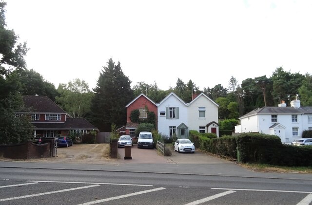
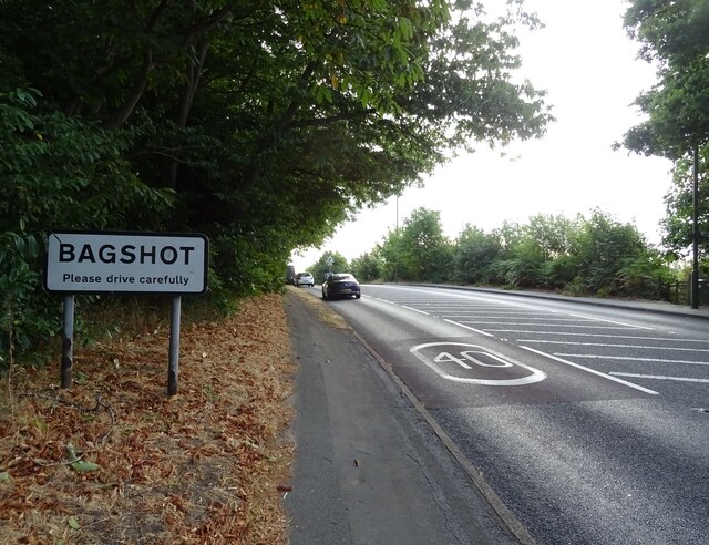
Bagshot is a small town located in the county of Surrey, England. It is situated approximately 27 miles southwest of London, making it an ideal commuter town for those working in the capital. With a population of around 5,800 residents, Bagshot maintains a close-knit community feel.

Historically, Bagshot was known for its association with the military, as it was home to the Royal Military Academy Sandhurst until it relocated in the early 19th century. Today, the town retains some military presence with the presence of the Princess Royal Barracks, which houses the Royal Logistic Corps.

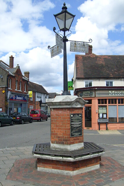
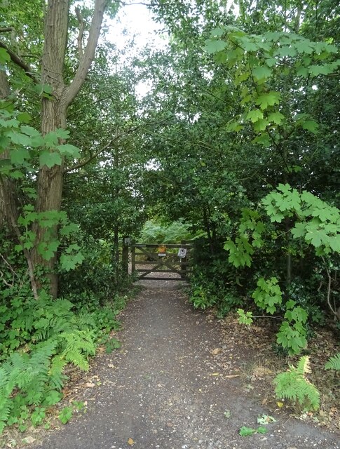
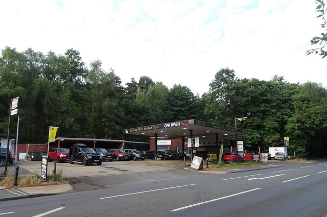
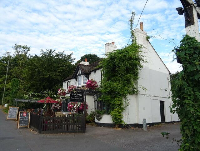
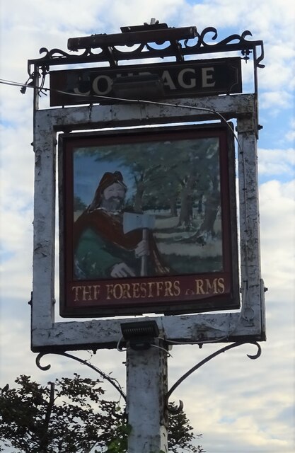
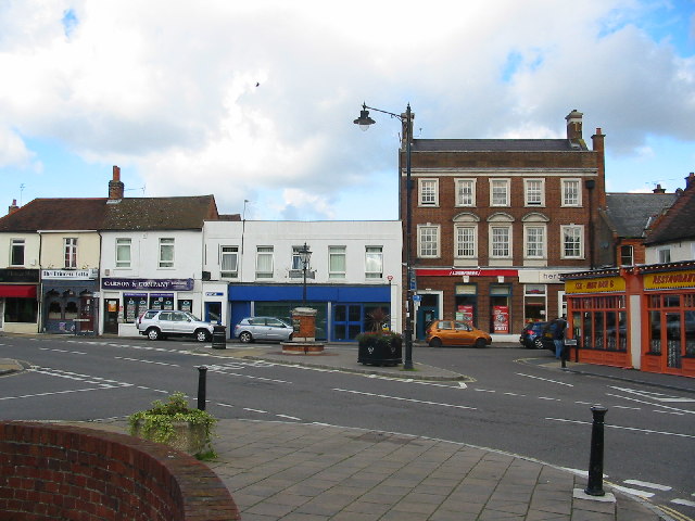
Bagshot offers a range of amenities and services for its residents. The town center features a variety of shops, restaurants, and pubs, providing plenty of options for shopping and dining. For recreational activities, Bagshot is surrounded by beautiful countryside, including the nearby Bagshot Heath, which offers opportunities for walking and outdoor pursuits.

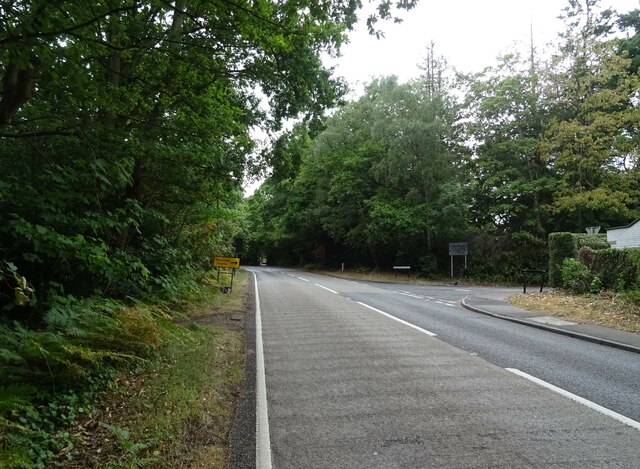
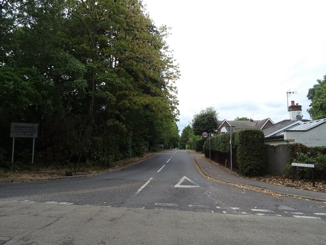
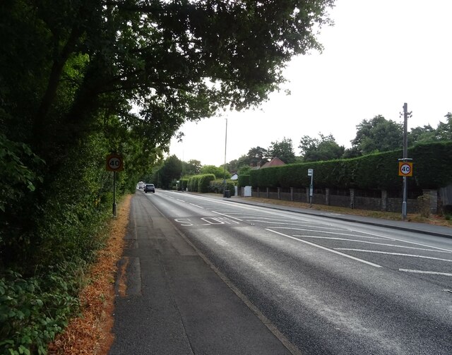
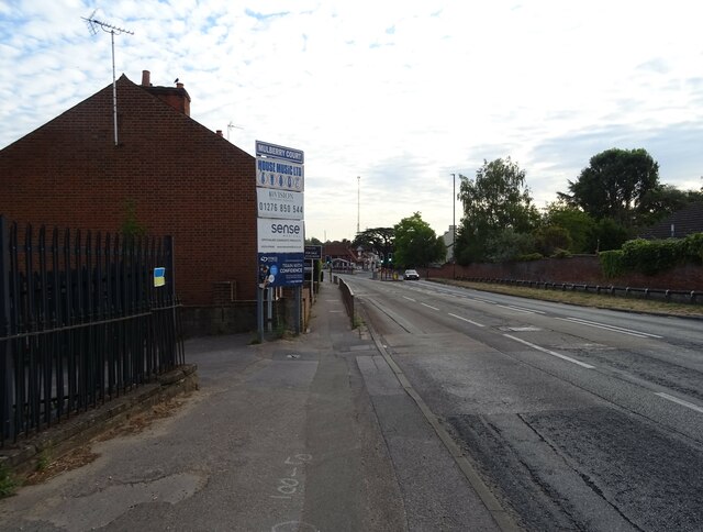
Transportation in Bagshot is convenient, with easy access to major roads such as the M3 and M4 motorways, allowing for easy travel to nearby towns and cities. The town also has its own train station, providing regular services to London Waterloo and other destinations.

In terms of education, Bagshot is home to several primary schools and is within close proximity to secondary schools in neighboring towns.

Overall, Bagshot offers a peaceful and scenic setting combined with its convenient location, making it an attractive place to live for both families and commuters alike.

If you have any feedback on the listing, please let us know in the comments section below.
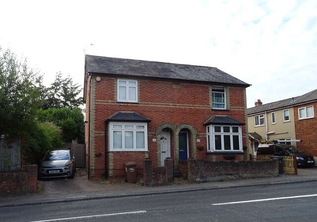
Bagshot Images

Images are sourced within 2km of 51.358986/-0.692555 or Grid Reference SU9163. Thanks to Geograph Open Source API. All images are credited.

Direction Sign – Signpost in Bagshot town centre Located on an island in Bagshot town centre, on junction of the B3029 High Street and The Square, Windlesham parish. 3 arms and lamp finial. See also <a title="https://www.geograph.org.uk/photo/1853870," href="https://www.geograph.org.uk/photo/1853870,">Link</a> <a title="https://www.geograph.org.uk/photo/4459418," href="https://www.geograph.org.uk/photo/4459418,">Link</a> <a title="https://www.geograph.org.uk/photo/4516021" href="https://www.geograph.org.uk/photo/4516021">Link</a> and <a title="https://www.geograph.org.uk/photo/4515974" href="https://www.geograph.org.uk/photo/4515974">Link</a>.

Milestone Society National ID: SY_SU9163
Direction Sign – Signpost in Bagshot town centre
Located on an island in Bagshot town centre, on junction of the B3029 High Street and The Square, Windlesham parish. 3 arms and lamp finial. See also Link Link Link and Link. Milestone Society National ID: SY_SU9163
Path onto Westend Common From Red Road.
Path onto Westend Common
From Red Road.
Red Road (B311) Towards Frimley.
Red Road (B311)
Towards Frimley.
Macdonald Road Off Red Road (B311).
Macdonald Road
Off Red Road (B311).
Car sales on London Road (A30)
London Road (A30) Towards Bagshot.
London Road (A30)
Towards Bagshot.
Houses on London Road (A30)
Entering Bagshot On London Road (A30).
Entering Bagshot
On London Road (A30).
The Foresters Arms, Bagshot On London Road.
See <a href="https://www.geograph.org.uk/photo/7256326">SU9062 : Sign for the Foresters Arms, Bagshot</a> for sign.
The Foresters Arms, Bagshot
On London Road. See SU9062 : Sign for the Foresters Arms, Bagshot for sign.
Sign for the Foresters Arms, Bagshot See <a href="https://www.geograph.org.uk/photo/7256324">SU9062 : The Foresters Arms, Bagshot</a> for public house.
Sign for the Foresters Arms, Bagshot
See SU9062 : The Foresters Arms, Bagshot for public house.
Houses on the A30, Bagshot
A30 through Bagshot
A30 through Bagshot
Miller & Carter Steakhouse, Bagshot
The Cedar Tree, Bagshot On High Street.
See <a href="https://www.geograph.org.uk/photo/7256338">SU9163 : Sign for the Cedar Tree, Bagshot</a> for sign.
The Cedar Tree, Bagshot
On High Street. See SU9163 : Sign for the Cedar Tree, Bagshot for sign.
Sign for the Cedar Tree, Bagshot See <a href="https://www.geograph.org.uk/photo/7256335">SU9163 : The Cedar Tree, Bagshot</a> for public house.
Sign for the Cedar Tree, Bagshot
See SU9163 : The Cedar Tree, Bagshot for public house.
Businesses on Guilford Road (B3029), Bagshot
The Kings Arms, Bagshot On High Street.
See <a href="https://www.geograph.org.uk/photo/7256347">SU9163 : Sign for the Kings Arms, Bagshot</a> for sign.
The Kings Arms, Bagshot
On High Street. See SU9163 : Sign for the Kings Arms, Bagshot for sign.
Sign for the Kings Arms, Bagshot See <a href="https://www.geograph.org.uk/photo/7256344">SU9163 : The Kings Arms, Bagshot</a> for context.
Sign for the Kings Arms, Bagshot
Show me another place!

Bagshot is located at Grid Ref: SU9163 (Lat: 51.358986, Lng: -0.692555)

Administrative County: Surrey

District: Surrey Heath

Police Authority: Surrey

What 3 Words

///preparing.chatters.glider. Near Bagshot, Surrey

Nearby Locations

Bagshot

Related Wikis

Bagshot

Bagshot is a large village in the Surrey Heath borough of Surrey, England, approximately 26 miles (42 km) southwest of central London. In the past, Bagshot...

Bagshot Rural District

Bashot Rural District was a rural district in the administrative county of Surrey, England from 1933 to 1974, covering an area in the north-west of the...

Bagshot railway station

Bagshot railway station serves the village of Bagshot, in the west of Surrey, England. The station, and all trains calling there, are operated by South...

Surrey Heath (UK Parliament constituency)

Surrey Heath is a constituency represented in the House of Commons of the UK Parliament since 2005 by Michael Gove, a Conservative who has also been the...

Pennyhill Park Hotel

Pennyhill Park Hotel is a 19th-century country house hotel and spa in Bagshot, Surrey in the south east of England. == History == The first historical...

Bagshot Park

Bagshot Park is a royal residence located near Bagshot, a village 11 miles (18 km) south of Windsor. It is on Bagshot Heath, a 50-square-mile (130 km2...

Windlesham Arboretum

Windlesham Arboretum is between the villages of Windlesham and Lightwater in Surrey, United Kingdom, just south of Junction 3 on the M3. The arboretum...

Jolly Farmer

The Jolly Farmer, formerly the Golden Farmer, is a former pub and roundabout on the boundary between Camberley and Bagshot in Surrey, England. The pub...

Nearby Amenities

Located within 500m of 51.358986,-0.692555
Bagshot
Is In: Surrey
Place: village
Population: 5592
Wikidata: Q4842133
Lat/Long: 51.3611644/-0.6922638
Crossing
Crossing: uncontrolled
Crossing Ref: zebra
Kerb: lowered
Sloped Curb: yes
Source: Bing
Lat/Long: 51.3603818/-0.6863336
Mini Roundabout
Lat/Long: 51.3616232/-0.6913656
Crossing
Crossing: uncontrolled
Crossing Ref: zebra
Kerb: lowered
Sloped Curb: yes
Lat/Long: 51.3611257/-0.6933417
Crossing
Crossing: uncontrolled
Crossing Island: yes
Crossing Ref: zebra
Kerb: lowered
Sloped Curb: yes
Tactile Paving: yes
Lat/Long: 51.3625557/-0.6910404
Crossing
Crossing: unmarked
Kerb: lowered
Sloped Curb: yes
Source: Bing
Lat/Long: 51.3602998/-0.6864737
Crossing
Bicycle: dismount
Crossing: unmarked
Kerb: lowered
Sloped Curb: yes
Source: Bing
Lat/Long: 51.357276/-0.688185
Barrier: bollard
Lat/Long: 51.3572311/-0.6876362
Turning Circle
Lat/Long: 51.3569514/-0.6906351
Bus Stop
Bagshot Green
Naptan AtcoCode: 40004403056A
Naptan Bearing: SE
Naptan CommonName: Bagshot Green
Naptan Indicator: Just after
Naptan Landmark: Bagshot Green
Naptan NaptanCode: surgagja
Naptan Street: Guildford Road
Naptan Verified: no
Public Transport: platform
Source: naptan_import
Lat/Long: 51.360553/-0.6866146
Bus Stop
Bagshot Green
Naptan AtcoCode: 40004403056B
Naptan Bearing: NW
Naptan CommonName: Bagshot Green
Naptan Indicator: Just Before
Naptan Landmark: Bagshot Green
Naptan NaptanCode: surgagjd
Naptan Street: Guildford Road
Naptan Verified: no
Public Transport: platform
Source: naptan_import
Lat/Long: 51.3608753/-0.687914
Bus Stop
Bagshot Square
Naptan AtcoCode: 40004403057A
Naptan Bearing: NE
Naptan CommonName: Bagshot Square
Naptan Indicator: Just Before
Naptan Landmark: Bagshot Square
Naptan NaptanCode: surgagjg
Naptan Street: High Street
Naptan Verified: no
Public Transport: platform
Source: naptan_import
Wheelchair: yes
Lat/Long: 51.3613025/-0.6932406
Bus Stop
Bagshot Square
Naptan AtcoCode: 40004403057B
Naptan Bearing: SW
Naptan CommonName: Bagshot Square
Naptan Indicator: Just after
Naptan Landmark: Bagshot Square
Naptan NaptanCode: surgagjm
Naptan Street: High Street
Naptan Verified: no
Public Transport: platform
Source: naptan_import
Wheelchair: yes
Lat/Long: 51.3614297/-0.6927318
Polling Station: 2010
Lat/Long: 51.3551924/-0.6890687
Polling Station: 2010
Lat/Long: 51.3612835/-0.6917444
Pub
The White Hart
Wheelchair: yes
Lat/Long: 51.3609486/-0.6875381
Crossing
Crossing: unmarked
Kerb: lowered
Sloped Curb: yes
Lat/Long: 51.3559655/-0.6948947
Crossing
Crossing: unmarked
Kerb: lowered
Sloped Curb: yes
Source: Surrey Air Survey
Lat/Long: 51.3575461/-0.6955777
Give Way
Lat/Long: 51.3576012/-0.6956713
Barrier: bollard
Lat/Long: 51.3577764/-0.6924647
Give Way
Lat/Long: 51.3578991/-0.696382
Crossing
Crossing Island: yes
Kerb: lowered
Sloped Curb: yes
Source: SAS
Lat/Long: 51.3601207/-0.6950091
Crossing
Crossing: unmarked
Kerb: lowered
Sloped Curb: yes
Lat/Long: 51.3578682/-0.6978968
Barrier: bollard
Lat/Long: 51.3618521/-0.6901138
Crossing
Crossing: unmarked
Kerb: lowered
Sloped Curb: yes
Source: Surrey-Air_Survey
Lat/Long: 51.3618567/-0.693851
Crossing
Crossing: unmarked
Kerb: lowered
Sloped Curb: yes
Lat/Long: 51.3623728/-0.6911175
Addr City: Bagshot
Addr Housenumber: 33
Addr Street: Waverley Road
Lat/Long: 51.3598903/-0.6912395
Removed Amenity: telephone
Lat/Long: 51.3568505/-0.6982451
Post Box
Operator: Royal Mail
Post Box Type: lamp
Ref: GU19 124D
Royal Cypher: EIIR
Royal Cypher Wikidata: Q33102113
Lat/Long: 51.3568337/-0.6982666
Crossing
Crossing Island: yes
Kerb: lowered
Sloped Curb: yes
Source: SAS
Lat/Long: 51.3609296/-0.6948109
Crossing
Crossing: uncontrolled
Crossing Island: yes
Kerb: lowered
Sloped Curb: yes
Source: Surrey-Air_Survey
Lat/Long: 51.3620294/-0.6937478
Traffic Signals
Traffic Signals Direction: forward
Lat/Long: 51.3575971/-0.6974846
Crossing
Bicycle: yes
Crossing Island: yes
Kerb: lowered
Sloped Curb: yes
Source: Bing
Lat/Long: 51.3577174/-0.6974665
Crossing
Bicycle: yes
Crossing Island: yes
Kerb: lowered
Sloped Curb: yes
Source: Bing
Lat/Long: 51.3577653/-0.6974146
Crossing
Bicycle: yes
Crossing: traffic_signals
Crossing Ref: toucan
Kerb: lowered
Sloped Curb: yes
Source: Bing
Lat/Long: 51.3577978/-0.6970353
Crossing
Bicycle: yes
Crossing: traffic_signals
Crossing Ref: toucan
Kerb: lowered
Sloped Curb: yes
Source: Bing
Lat/Long: 51.3578141/-0.6972105
Traffic Signals
Traffic Signals Direction: forward
Lat/Long: 51.3578306/-0.6969991
Crossing
Crossing: unmarked
Kerb: lowered
Source: Bing
Lat/Long: 51.3579873/-0.6965484
Crossing
Crossing: unmarked
Kerb: lowered
Sloped Curb: yes
Source: Bing
Lat/Long: 51.3580256/-0.6965035
Crossing
Crossing: unmarked
Kerb: lowered
Sloped Curb: yes
Source: SAS
Lat/Long: 51.3580969/-0.6967625
Crossing
Crossing: unmarked
Kerb: lowered
Sloped Curb: yes
Source: Bing
Lat/Long: 51.3606282/-0.6867278
Crossing
Crossing: unmarked
Kerb: lowered
Sloped Curb: yes
Source: Bing
Lat/Long: 51.3604316/-0.6866893
Crossing
Bicycle: yes
Crossing: unmarked
Kerb: lowered
Sloped Curb: yes
Source: Bing
Lat/Long: 51.3567966/-0.6982852
Traffic Signals
Traffic Signals Direction: forward
Lat/Long: 51.3577766/-0.6974447
Crossing
Crossing: unmarked
Kerb: lowered
Sloped Curb: yes
Source: SAS
Lat/Long: 51.3581239/-0.6968122
Recycling
Recycling Clothes: yes
Recycling Paper: yes
Recycling Type: container
Lat/Long: 51.3611438/-0.6914313
Post Box
Lat/Long: 51.3608231/-0.6882418
Bagshot Barbers
Shop: hairdresser
Wheelchair: no
Lat/Long: 51.3618051/-0.6922471
Chris Dean Fitness
Leisure: sports_centre
Lat/Long: 51.3593916/-0.6960107
Babolat
Building: commercial
Lat/Long: 51.3592689/-0.6961415
Eurodata Building Services
Building: commercial
Lat/Long: 51.3593007/-0.6959215
Bench
Material: wood
Lat/Long: 51.3616137/-0.6943746
Incentive Forwarding Ltd
Lat/Long: 51.3631297/-0.6930556
Continuation Networks Ltd
Lat/Long: 51.3630845/-0.6929885
Physica Health
Addr City: Bagshot
Addr Housename: Physica Health
Addr Housenumber: 7 Tanners Yard
Addr Postcode: GU19 5HD
Addr Street: London Road
Email: info@physicahealth.co.uk
Healthcare: physiotherapist
Healthcare Speciality: physiotherapy;Sports_injury;Back_Pain;physio;Neck_Pain;Knee_Pain;women's_Health;Pilates;rehabilitation;Shoulder_Pain;Knee_Replacement;Hip_Replacement;Sports_Physio
Operator: Physica Health
Payment Cash: yes
Payment Contactless: yes
Payment Credit Cards: yes
Payment Debit Cards: yes
Phone: +441276 916 346
Website: https://physicahealth.co.uk/
Lat/Long: 51.3630338/-0.6928685
Sebastian's Action Trust
Lat/Long: 51.3629786/-0.692782
Antler Homes
Office: company
Website: https://www.antlerhomes.co.uk/
Lat/Long: 51.3613453/-0.6942425
Crossing
Crossing: unmarked
Kerb: lowered
Sloped Curb: yes
Lat/Long: 51.3553414/-0.6895994
Turning Circle
Lat/Long: 51.3570491/-0.6893523
Traffic Signals
Traffic Signals Direction: forward
Lat/Long: 51.3597983/-0.6949832
Crossing
Crossing Island: yes
Kerb: lowered
Sloped Curb: yes
Source: SAS
Lat/Long: 51.3600598/-0.6950417
Barrier: bollard
Lat/Long: 51.3592802/-0.6954384
Crossing
Crossing: traffic_signals
Crossing Ref: pelican
Kerb: lowered
Sloped Curb: yes
Source: SAS
Lat/Long: 51.3597823/-0.6951263
Traffic Signals
Traffic Signals Direction: forward
Lat/Long: 51.3597521/-0.6951535
Crossing
Crossing Island: yes
Kerb: lowered
Sloped Curb: yes
Source: SAS
Lat/Long: 51.3610445/-0.6947458
Crossing
Crossing Island: yes
Kerb: lowered
Sloped Curb: yes
Source: SAS
Lat/Long: 51.360958/-0.6947659
Crossing
Crossing: traffic_signals
Crossing Ref: pelican
Kerb: lowered
Sloped Curb: yes
Source: SAS
Lat/Long: 51.3597804/-0.6949983
Crossing
Crossing: unmarked
Kerb: lowered
Sloped Curb: yes
Source: SAS
Lat/Long: 51.3605933/-0.6939941
Barrier: cycle_barrier
Lat/Long: 51.3571687/-0.6909277
Bagshot Green
Place: neighbourhood
Lat/Long: 51.3603946/-0.6888726
Bench
Backrest: yes
Lat/Long: 51.3609204/-0.6882479
Natural Baby Shower
Shop: yes
Lat/Long: 51.3609639/-0.6866756
Parking
Natural Baby Shower
Access: customers
Fee: no
Lat/Long: 51.3610636/-0.6866059
Bagshot Telephone Exchange
Addr City: Bagshot
Addr Postcode: GU19 5NG
Addr Street: Guildford Road
Operator: BT
Ref: THBA
Telecom: exchange
Lat/Long: 51.3605824/-0.685914
Bench
Lat/Long: 51.3600584/-0.6951503
Crossing
Crossing: unmarked
Kerb: lowered
Sloped Curb: yes
Lat/Long: 51.3617748/-0.6899885
Crossing
Crossing: unmarked
Kerb: lowered
Sloped Curb: yes
Lat/Long: 51.3615138/-0.6928513
Barrier: bollard
Lat/Long: 51.3572852/-0.6882816
Barrier: bollard
Lat/Long: 51.3572694/-0.6881155
Crossing
Crossing: unmarked
Kerb: lowered
Sloped Curb: yes
Source: Surrey Air Survey
Lat/Long: 51.3578067/-0.6954832
Crossing
Crossing: unmarked
Kerb: lowered
Sloped Curb: yes
Source: Surrey Air Survey
Lat/Long: 51.3578441/-0.6964706
Crossing
Crossing: unmarked
Kerb: lowered
Sloped Curb: yes
Source: Bing
Lat/Long: 51.3558484/-0.6970172
Barrier: bollard
Lat/Long: 51.3568469/-0.6975253
Barrier: bollard
Lat/Long: 51.3566743/-0.6974942
Barrier: bollard
Lat/Long: 51.358628/-0.6984402
Barrier: bollard
Lat/Long: 51.3595331/-0.6878314
Barrier: bollard
Lat/Long: 51.359922/-0.6882771
Barrier: bollard
Lat/Long: 51.359845/-0.6877697
Crossing
Crossing: uncontrolled
Crossing Ref: zebra
Kerb: lowered
Sloped Curb: yes
Source: Bing
Lat/Long: 51.36107/-0.6883409
Entrance: main
Lat/Long: 51.3630547/-0.6919386
Access: customers
Entrance: yes
Lat/Long: 51.3626439/-0.6908545
Access: customers
Entrance: yes
Lat/Long: 51.3625784/-0.6908801
Access: private
Entrance: yes
Lat/Long: 51.362511/-0.6909063
Access: customers
Entrance: yes
Lat/Long: 51.3624406/-0.6909338
Bicycle Parking
Bicycle Parking: stands
Covered: no
Lat/Long: 51.3623395/-0.6905254
Post Box
Collection Times: Mo-Fr 17:00; Sa 11:30
Drive Through: no
Mapillary: 3619905164901573
Post Box Mounting: pier
Post Box Type: lamp
Ref: GU19 229
Survey Date: 2020-09-29
Lat/Long: 51.3627604/-0.6908575
Addr Street: Guildford Road
Lat/Long: 51.3607302/-0.6878313
Addr Street: Bagshot Green
Lat/Long: 51.3605395/-0.6880224
Fast Food
Imperial Hong Kong
Addr Street: High Street
Phone: +44 1276 850436
Lat/Long: 51.3610282/-0.6937057
One Touch Services
Addr Street: High Street
Phone: +44 1276 818698
Shop: computer
Lat/Long: 51.3607873/-0.6935608
Post Office
Bagshot Post Office
Addr Postcode: GU19 5AZ
Addr Street: High Street
Branch: Bagshot
Brand: Post Office
Brand Wikidata: Q1783168
Check Date: 2020-02-20
Contact Website: https://www.postoffice.co.uk/branch-finder/1379232/bagshot
Ref Pol Id: 2475
Lat/Long: 51.3609875/-0.6933406
H&M Barbers
Addr Street: High Street
Shop: hairdresser
Lat/Long: 51.3610547/-0.6936397
Traffic Calming: choker
Lat/Long: 51.35534/-0.6896739
Entrance: yes
Lat/Long: 51.3631103/-0.6913543
Entrance: yes
Lat/Long: 51.363045/-0.6912501
Atm
Lat/Long: 51.3629425/-0.691927
Atm
Lat/Long: 51.3629251/-0.6919205
Crossing
Lat/Long: 51.3631147/-0.6910154
Crossing
Crossing: uncontrolled
Crossing Island: yes
Kerb: lowered
Sloped Curb: yes
Source: Surrey-Air_Survey
Lat/Long: 51.362064/-0.6938271
Crossing
Crossing: unmarked
Kerb: lowered
Sloped Curb: yes
Source: Surrey-Air_Survey
Lat/Long: 51.3608791/-0.688113
Barrier: bollard
Lat/Long: 51.3572045/-0.6883004
Barrier: bollard
Lat/Long: 51.3548279/-0.6910017
Crossing
Crossing: uncontrolled
Crossing Island: yes
Kerb: lowered
Sloped Curb: yes
Source: Surrey-Air_Survey
Lat/Long: 51.3548984/-0.691233
Crossing
Crossing: uncontrolled
Crossing Island: yes
Kerb: lowered
Sloped Curb: yes
Source: Surrey-Air_Survey
Lat/Long: 51.3549003/-0.6912881
Crossing
Crossing: uncontrolled
Crossing Island: yes
Kerb: lowered
Sloped Curb: yes
Source: Surrey-Air_Survey
Lat/Long: 51.3546535/-0.6915998
Crossing
Crossing: uncontrolled
Crossing Island: yes
Kerb: lowered
Sloped Curb: yes
Source: Surrey-Air_Survey
Lat/Long: 51.3546198/-0.6915676
Addr City: Bagshot
Addr Housenumber: 13
Addr Postcode: GU19 5RB
Addr Street: Horsebrass Drive
Entrance: home
Source: survey
Lat/Long: 51.3558265/-0.6915282
Addr City: Bagshot
Addr Housenumber: 11
Addr Postcode: GU19 5RB
Addr Street: Horsebrass Drive
Entrance: home
Source: survey
Lat/Long: 51.3557973/-0.6914877
Addr City: Bagshot
Addr Housenumber: 9
Addr Postcode: GU19 5RB
Addr Street: Horsebrass Drive
Entrance: home
Source: survey
Lat/Long: 51.3558273/-0.6913494
Addr City: Bagshot
Addr Housenumber: 7
Addr Postcode: GU19 5RB
Addr Street: Horsebrass Drive
Entrance: home
Source: survey
Lat/Long: 51.3558647/-0.6913528
Addr City: Bagshot
Addr Housenumber: 32
Addr Postcode: GU19 5RB
Addr Street: Horsebrass Drive
Entrance: home
Source: survey
Lat/Long: 51.3558562/-0.6906769
Addr City: Bagshot
Addr Housenumber: 30
Addr Postcode: GU19 5RB
Addr Street: Horsebrass Drive
Entrance: home
Source: survey
Lat/Long: 51.3558439/-0.6906201
Addr City: Bagshot
Addr Housenumber: 36
Addr Postcode: GU19 5RB
Addr Street: Horsebrass Drive
Entrance: home
Source: survey
Lat/Long: 51.3559612/-0.6906183
Addr City: Bagshot
Addr Housenumber: 34
Addr Postcode: GU19 5RB
Addr Street: Horsebrass Drive
Entrance: home
Source: survey
Lat/Long: 51.3559481/-0.6906755
Addr City: Bagshot
Addr Housenumber: 24
Addr Postcode: GU19 5RB
Addr Street: Horsebrass Drive
Entrance: home
Source: survey
Lat/Long: 51.3557184/-0.6906765
Addr City: Bagshot
Addr Housenumber: 22
Addr Postcode: GU19 5RB
Addr Street: Horsebrass Drive
Entrance: home
Source: survey
Lat/Long: 51.3557036/-0.6906197
Addr City: Bagshot
Addr Housenumber: 28
Addr Postcode: GU19 5RB
Addr Street: Horsebrass Drive
Entrance: home
Source: survey
Lat/Long: 51.3558208/-0.690618
Addr City: Bagshot
Addr Housenumber: 26
Addr Postcode: GU19 5RB
Addr Street: Horsebrass Drive
Entrance: home
Source: survey
Lat/Long: 51.3558088/-0.6906752
Addr City: Bagshot
Addr Housenumber: 18
Addr Postcode: GU19 5RB
Addr Street: Horsebrass Drive
Entrance: home
Source: survey
Lat/Long: 51.3557024/-0.6907935
Addr City: Bagshot
Addr Housenumber: 16
Addr Postcode: GU19 5RB
Addr Street: Horsebrass Drive
Entrance: home
Source: survey
Lat/Long: 51.3557024/-0.6909424
Addr City: Bagshot
Addr Housenumber: 14
Addr Postcode: GU19 5RB
Addr Street: Horsebrass Drive
Entrance: home
Source: survey
Lat/Long: 51.3556668/-0.6909612
Addr City: Bagshot
Addr Housenumber: 20
Addr Postcode: GU19 5RB
Addr Street: Horsebrass Drive
Entrance: home
Source: survey
Lat/Long: 51.3556668/-0.6907734
Addr City: Bagshot
Addr Housenumber: 13
Addr Postcode: GU19 5RF
Addr Street: Drayhorse Drive
Entrance: home
Source: survey
Lat/Long: 51.3555185/-0.6906569
Addr City: Bagshot
Addr Housenumber: 15
Addr Postcode: GU19 5RF
Addr Street: Drayhorse Drive
Entrance: home
Source: survey
Lat/Long: 51.3554832/-0.6906757
Addr City: Bagshot
Addr Housenumber: 9
Addr Postcode: GU19 5RF
Addr Street: Drayhorse Drive
Entrance: home
Source: survey
Lat/Long: 51.3554832/-0.6904882
Addr City: Bagshot
Addr Housenumber: 11
Addr Postcode: GU19 5RF
Addr Street: Drayhorse Drive
Entrance: home
Source: survey
Lat/Long: 51.3555189/-0.6905084
Addr City: Bagshot
Addr Housenumber: 1
Addr Postcode: GU19 5RF
Addr Street: Drayhorse Drive
Entrance: home
Source: survey
Lat/Long: 51.3554832/-0.6902602
Addr City: Bagshot
Addr Housenumber: 3
Addr Postcode: GU19 5RF
Addr Street: Drayhorse Drive
Entrance: home
Source: survey
Lat/Long: 51.3555194/-0.6902804
Addr City: Bagshot
Addr Housenumber: 5
Addr Postcode: GU19 5RF
Addr Street: Drayhorse Drive
Entrance: home
Source: survey
Lat/Long: 51.3555181/-0.6904289
Addr City: Bagshot
Addr Housenumber: 7
Addr Postcode: GU19 5RF
Addr Street: Drayhorse Drive
Entrance: home
Source: survey
Lat/Long: 51.3554832/-0.6904477
Addr City: Bagshot
Addr Housenumber: 20
Addr Postcode: GU19 5QZ
Addr Street: Hawkesworth Drive
Entrance: home
Source: survey
Lat/Long: 51.3548209/-0.6917605
Addr City: Bagshot
Addr Housenumber: 18
Addr Postcode: GU19 5QZ
Addr Street: Hawkesworth Drive
Entrance: home
Source: survey
Lat/Long: 51.3548338/-0.691743
Addr City: Bagshot
Addr Housenumber: 16
Addr Postcode: GU19 5QZ
Addr Street: Hawkesworth Drive
Entrance: home
Source: survey
Lat/Long: 51.354701/-0.6917984
Addr City: Bagshot
Addr Housenumber: 14
Addr Postcode: GU19 5QZ
Addr Street: Hawkesworth Drive
Entrance: home
Source: survey
Lat/Long: 51.3547206/-0.691835
Addr City: Bagshot
Addr Housenumber: 24
Addr Postcode: GU19 5QZ
Addr Street: Hawkesworth Drive
Building: terrace
Entrance: home
Source: survey
Lat/Long: 51.354887/-0.6916614
Addr City: Bagshot
Addr Housenumber: 22
Addr Postcode: GU19 5QZ
Addr Street: Hawkesworth Drive
Building: terrace
Entrance: home
Source: survey
Lat/Long: 51.3548672/-0.6916244
Entrance: home
Lat/Long: 51.3554353/-0.6916102
Entrance: home
Lat/Long: 51.3557085/-0.6915768
Addr City: Bagshot
Addr Housenumber: 3
Addr Postcode: GU19 5QX
Addr Street: Shepherds Chase
Entrance: home
Source: survey
Lat/Long: 51.3548286/-0.6930057
Addr City: Bagshot
Addr Housenumber: 4
Addr Postcode: GU19 5QX
Addr Street: Shepherds Chase
Entrance: home
Source: survey
Lat/Long: 51.3548108/-0.6930442
Addr City: Bagshot
Addr Housenumber: 2
Addr Postcode: GU19 5QX
Addr Street: Shepherds Chase
Entrance: home
Source: survey
Lat/Long: 51.3547225/-0.692946
Addr City: Bagshot
Addr Housenumber: 1
Addr Postcode: GU19 5QX
Addr Street: Shepherds Chase
Entrance: home
Source: survey
Lat/Long: 51.3547373/-0.6929634
Entrance: main
Lat/Long: 51.3551352/-0.6891026
Entrance: main
Lat/Long: 51.3551618/-0.6891084
Power: transformer
Lat/Long: 51.3572216/-0.6888396
Addr City: Bagshot
Addr Housenumber: 11
Addr Street: Cedar Close
Source: survey
Lat/Long: 51.3600706/-0.6929111
Addr City: Bagshot
Addr Housenumber: 1
Addr Street: Cedar Close
Lat/Long: 51.3603628/-0.6934235
Addr City: Bagshot
Addr Housenumber: 33
Addr Street: Cedar Close
Lat/Long: 51.3598612/-0.6928159
Addr City: Bagshot
Addr Housenumber: 65
Addr Street: Cedar Close
Lat/Long: 51.3591034/-0.6944481
Addr City: Bagshot
Addr Housenumber: 40
Addr Street: Cedar Close
Lat/Long: 51.3591754/-0.6945245
Addr City: Bagshot
Addr Housenumber: 14
Addr Street: Cedar Close
Lat/Long: 51.3596979/-0.6933202
Addr City: Bagshot
Addr Housenumber: 12
Addr Street: Cedar Close
Lat/Long: 51.3599458/-0.6930774
Addr City: Bagshot
Addr Housenumber: 2
Addr Street: Cedar Close
Lat/Long: 51.360249/-0.6935965
Give Way
Lat/Long: 51.3580448/-0.6966998
Addr City: Bagshot
Addr Housenumber: 9
Addr Street: Waverley Road
Lat/Long: 51.3607464/-0.6907372
Addr City: Bagshot
Addr Housenumber: 3D
Addr Street: Waverley Road
Lat/Long: 51.3610947/-0.6903885
Addr City: Bagshot
Addr Housenumber: 3C
Addr Street: Waverley Road
Lat/Long: 51.3610805/-0.6903074
Addr City: Bagshot
Addr Housenumber: 3B
Addr Street: Waverley Road
Lat/Long: 51.3611328/-0.6903275
Addr City: Bagshot
Addr Housenumber: 3A
Addr Street: Waverley Road
Lat/Long: 51.3611881/-0.6903148
Addr City: Bagshot
Addr Housenumber: 4
Addr Street: Waverley Road
Lat/Long: 51.361141/-0.6908133
Addr City: Bagshot
Addr Housenumber: 6
Addr Street: Waverley Road
Lat/Long: 51.3610263/-0.6908469
Addr City: Bagshot
Addr Housenumber: 16
Addr Street: Waverley Road
Lat/Long: 51.36047/-0.6910497
Addr City: Bagshot
Addr Housenumber: 18
Addr Street: Waverley Road
Lat/Long: 51.3603729/-0.6911181
Addr City: Bagshot
Addr Housenumber: 20
Addr Street: Waverley Road
Lat/Long: 51.3602883/-0.6911691
Addr City: Bagshot
Addr Housenumber: 22
Addr Street: Waverley Road
Lat/Long: 51.3602037/-0.6912361
Addr City: Bagshot
Addr Housenumber: 24
Addr Street: Waverley Road
Lat/Long: 51.3601183/-0.6912911
Addr City: Bagshot
Addr Housenumber: 21
Addr Street: Waverley Road
Lat/Long: 51.360151/-0.6910765
Addr City: Bagshot
Addr Housenumber: 23
Addr Street: Waverley Road
Lat/Long: 51.360063/-0.691159
Addr City: Bagshot
Addr Housenumber: 35
Addr Street: Waverley Road
Lat/Long: 51.3599381/-0.6913749
Addr City: Bagshot
Addr Housename: Viaduct View
Addr Housenumber: 39
Addr Street: Waverley Road
Lat/Long: 51.3599917/-0.6915285
Addr City: Bagshot
Addr Housenumber: 39
Addr Street: Waverley Road
Lat/Long: 51.360044/-0.6916834
Addr City: Bagshot
Addr Housenumber: 43
Addr Street: Waverley Road
Lat/Long: 51.3601566/-0.6920153
Addr City: Bagshot
Addr Housenumber: 23
Addr Street: Cedar Close
Lat/Long: 51.3603151/-0.6919885
Addr City: Bagshot
Addr Housenumber: 21
Addr Street: Cedar Close
Lat/Long: 51.360349/-0.6921219
Addr City: Bagshot
Addr Housenumber: 19
Addr Street: Cedar Close
Lat/Long: 51.3603478/-0.6922513
Addr City: Bagshot
Addr Housenumber: 17
Addr Street: Cedar Close
Lat/Long: 51.360334/-0.6923714
Addr City: Bagshot
Addr Housenumber: 15
Addr Street: Cedar Close
Lat/Long: 51.3603017/-0.6925035
Addr City: Bagshot
Addr Housenumber: 13
Addr Street: Cedar Close
Lat/Long: 51.3602644/-0.6925792
Addr City: Bagshot
Addr Housenumber: 31
Addr Street: Cedar Close
Lat/Long: 51.3599399/-0.6927053
Place Of Worship
Kingdom Hall of Jehovahs Witnesses
Denomination: jehovahs_witness
Religion: christian
Lat/Long: 51.3626807/-0.6884962
Post Box
Operator: Royal Mail
Post Box Type: pillar
Ref: GU19 143
Royal Cypher: EIIR
Royal Cypher Wikidata: Q33102113
Lat/Long: 51.361011/-0.6934322
Bench
Lat/Long: 51.3606952/-0.6867913
Charging Station
Bagshot SF Connect
Brand: BP Pulse
Capacity: 2
Motorcar: yes
Opening Hours: 24/7
Operator: BP
Socket Chademo: 2
Socket Chademo Output: 100kW
Socket Type2 Combo: 2
Socket Type2 Combo Output: 250kW
Lat/Long: 51.3633271/-0.6914006
Brand: BP Pulse
Man Made: charge_point
Motorcar: yes
Operator: BP
Ref: BPU0035
Lat/Long: 51.3633148/-0.6913917
Brand: BP Pulse
Man Made: charge_point
Motorcar: yes
Operator: BP
Ref: BPU0034
Lat/Long: 51.3633393/-0.6914094
The data included in this document is from www.openstreetmap.org. The data is made available under ODbL.

Have you been to Bagshot?

Leave your review of Bagshot below (or comments, questions and feedback).