Carthat Moor

Downs, Moorland in Dumfriesshire

Scotland

Carthat Moor

Rammerscales Sawmill
Rammerscales Sawmill Credit: Steven Brown

Carthat Moor is a vast expanse of downs and moorland located in the county of Dumfriesshire, Scotland. Stretching over a sprawling area, it is a significant natural feature of the region, encompassing diverse vegetation and captivating landscapes.

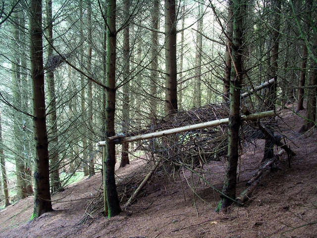
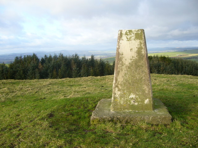
The moorland is characterized by its undulating terrain, with wide open spaces and gently rolling hills. The area is covered in heather and grasses, creating a rich tapestry of vibrant colors, particularly during the summer and autumn months. The landscape is further adorned by scattered patches of woodland, adding to the overall charm of Carthat Moor.

This area is home to a variety of wildlife, including several species of birds, such as grouse and skylarks, which can be observed soaring above the moorland. In addition, small mammals like hares and rabbits can often be spotted darting across the open spaces.

Carthat Moor offers a unique opportunity for leisure activities such as hiking and bird-watching. The well-maintained footpaths that crisscross the moor provide visitors with the chance to explore its beauty and take in the breathtaking views. The moorland also offers a serene atmosphere, ideal for those seeking a peaceful retreat away from the hustle and bustle of city life.

Overall, Carthat Moor is a picturesque and enchanting natural landscape, showcasing the beauty of Dumfriesshire's downs and moorland. It provides a haven for both nature enthusiasts and those seeking solace in the tranquility of the countryside.

If you have any feedback on the listing, please let us know in the comments section below.

Carthat Moor Images

Images are sourced within 2km of 55.084912/-3.4697775 or Grid Reference NY0677. Thanks to Geograph Open Source API. All images are credited.

Rammerscales Sawmill
Tappit-hen Wood This woodland, viewed here from close to the A709 Lockerbie to Dumfries road, is notable for the prominent letter 'R' formed (at certain times of the year) by the colours of the different species of trees. The woodland belongs, I think, to the Rammerscales estate.
Tappit-hen Wood
This woodland, viewed here from close to the A709 Lockerbie to Dumfries road, is notable for the prominent letter 'R' formed (at certain times of the year) by the colours of the different species of trees. The woodland belongs, I think, to the Rammerscales estate.
Hazelshaw Hill This is the largest of 4 different towers on the summit of Hazelshaw Hill and belongs to Cable and Wireless. Hazelshaw Hill is just to the east of Dumfries.
Hazelshaw Hill
This is the largest of 4 different towers on the summit of Hazelshaw Hill and belongs to Cable and Wireless. Hazelshaw Hill is just to the east of Dumfries.
Road to Carthat
Road to Carthat
Broad Track up Whiteside Hill
Rammerscales Wood Mixed woodland near Lochmaben. Part of the estate to which Rammerscales House belongs. See <a href="https://www.geograph.org.uk/photo/520371">NY0877 : Rammerscales House</a>.
Rammerscales Wood
Mixed woodland near Lochmaben. Part of the estate to which Rammerscales House belongs. See NY0877 : Rammerscales House.
Path, Rammerscales Wood Mixed woodland near Lochmaben.
Path, Rammerscales Wood
Mixed woodland near Lochmaben.
Rammerscales House An 18th century Georgian manor house near Lochmaben. It is built of sandstone and designed in Palladian style. It contains fine circular staircases, Jacobite relics, and a collection of 20th century paintings, tapestries and sculpture. There is a walled garden, woodland walks and wonderful views over Annandale. The house is open at certain times, which may be obtained by telephoning. See <span class="nowrap"><a title="http://www.rammerscales.co.uk/" rel="nofollow ugc noopener" href="http://www.rammerscales.co.uk/">Link</a><img style="margin-left:2px;" alt="External link" title="External link - shift click to open in new window" src="https://s1.geograph.org.uk/img/external.png" width="10" height="10"/></span> for contact details.
Rammerscales House
An 18th century Georgian manor house near Lochmaben. It is built of sandstone and designed in Palladian style. It contains fine circular staircases, Jacobite relics, and a collection of 20th century paintings, tapestries and sculpture. There is a walled garden, woodland walks and wonderful views over Annandale. The house is open at certain times, which may be obtained by telephoning. See LinkExternal link for contact details.
Trees and bracken, Rammerscales Wood Mixed woodland near Lochmaben. Part of the estate to which Rammerscales House belongs. See also <a href="https://www.geograph.org.uk/photo/520371">NY0877 : Rammerscales House</a>.
Trees and bracken, Rammerscales Wood
Mixed woodland near Lochmaben. Part of the estate to which Rammerscales House belongs. See also NY0877 : Rammerscales House.
View over the trees, Rammerscales Wood Mixed woodland on a hillside near Lochmaben. Magnificent views of Annandale may be glimpsed through the trees.
View over the trees, Rammerscales Wood
Mixed woodland on a hillside near Lochmaben. Magnificent views of Annandale may be glimpsed through the trees.
Hilltop motte & bailey site at Rockhallhead, in the distance
Tappit-hen Wood A (very) minor road through Tappit-hen Wood. The wood belongs to the Rammerscales estate, I think. From a distance, at certain times of the year, a letter "R" can be seen, formed by the contrasting colours of the leaves of the different species of trees. See <a href="https://www.geograph.org.uk/photo/17458">NY0778 : Tappit-hen Wood</a>.
Tappit-hen Wood
A (very) minor road through Tappit-hen Wood. The wood belongs to the Rammerscales estate, I think. From a distance, at certain times of the year, a letter "R" can be seen, formed by the contrasting colours of the leaves of the different species of trees. See NY0778 : Tappit-hen Wood.
Footbridge, Tappit-hen Wood Footbridge over an unnamed burn in Tappit-hen Wood. The wood belongs, I think, to the Rammerscales estate. It is notable for the prominent letter "R" formed, at certain times of the year, by the contrasting colours of the leaves of the different species of trees. See <a href="https://www.geograph.org.uk/photo/17458">NY0778 : Tappit-hen Wood</a>.
Footbridge, Tappit-hen Wood
Footbridge over an unnamed burn in Tappit-hen Wood. The wood belongs, I think, to the Rammerscales estate. It is notable for the prominent letter "R" formed, at certain times of the year, by the contrasting colours of the leaves of the different species of trees. See NY0778 : Tappit-hen Wood.
Track, Tappit-hen Wood Tappit-hen Wood belongs, I think, to the Rammerscales estate. It is notable for the prominent letter "R" formed, at certain times of the year, by the contrasting colours of the leaves of the different species of trees. See <a href="https://www.geograph.org.uk/photo/17458">NY0778 : Tappit-hen Wood</a>.
Track, Tappit-hen Wood
Tappit-hen Wood belongs, I think, to the Rammerscales estate. It is notable for the prominent letter "R" formed, at certain times of the year, by the contrasting colours of the leaves of the different species of trees. See NY0778 : Tappit-hen Wood.
Unidentified structure in Tappit-hen Wood Not sure whether this is a hide, shelter, or trap of some sort. Under a nearby tree there were signs that something must regularly roost up in the tree, possibly a buzzard, and from the tree in the foreground on the left of the picture an assortment of bones was hanging on a string.
Unidentified structure in Tappit-hen Wood
Not sure whether this is a hide, shelter, or trap of some sort. Under a nearby tree there were signs that something must regularly roost up in the tree, possibly a buzzard, and from the tree in the foreground on the left of the picture an assortment of bones was hanging on a string.
Tappit-hen Wood The wood belongs, I think, to the Rammerscales estate. It is notable for the prominent letter "R" formed, at certain times of the year, by the contrasting colours of the leaves of the different species of trees. When this picture was taken the leaves were just beginning to turn, and the lower part of the "R" can just be made out. The best view of it is from across the valley. See <a href="https://www.geograph.org.uk/photo/17458">NY0778 : Tappit-hen Wood</a>.
Tappit-hen Wood
The wood belongs, I think, to the Rammerscales estate. It is notable for the prominent letter "R" formed, at certain times of the year, by the contrasting colours of the leaves of the different species of trees. When this picture was taken the leaves were just beginning to turn, and the lower part of the "R" can just be made out. The best view of it is from across the valley. See NY0778 : Tappit-hen Wood.
Barlouth trig
Barlouth trig
North Carthat View from western slopes of Carthat Hill down to North Carthat Farm. In the distance Dumfries spreads out over Nithsdale.
North Carthat
View from western slopes of Carthat Hill down to North Carthat Farm. In the distance Dumfries spreads out over Nithsdale.
Show me another place!

Carthat Moor is located at Grid Ref: NY0677 (Lat: 55.084912, Lng: -3.4697775)

Unitary Authority: Dumfries and Galloway

Police Authority: Dumfries and Galloway

What 3 Words

///couriers.saved.shins. Near Lochmaben, Dumfries & Galloway

Related Wikis

Rockhall Tower

Rockhall Tower, also known as Rockhall House or Rockhall Tower House, is a 16th-century tower house in Collin, Dumfries and Galloway. The castle originally...

Torthorwald

Torthorwald is a village and civil parish in Dumfries and Galloway, south-west Scotland. It is located 6 kilometres (3.7 mi) east of Dumfries on the A709...

Collin, Dumfries and Galloway

Collin is a small village between Dumfries and Gretna in Dumfries and Galloway, Scotland. It is located on the Lochar Water, and the A75 road. It lies...

Heck, Dumfries and Galloway

Heck is a hamlet in the local government area of Dumfries and Galloway, Scotland. Heck is 2 miles (3.2 km) southeast of the town of Lochmaben and is 1...

Racks railway station

Racks railway station was a railway station in Dumfries and Galloway, Scotland, south of Dumfries, OS NGR NY 033 743, serving and effectively creating...

Old Lochmaben Castle

Lochmaben Castle was a 12th-century castle on the spit of land between Loch Kirk and Loch Castle, in Lochmaben, Scotland.The motte and bailey castle was...

Lochmaben Hospital

Lochmaben Hospital is a health facility in Woodlands Drive, Lochmaben, Dumfries and Galloway, Scotland. It is managed by NHS Dumfries and Galloway. �...

Lochmaben

Lochmaben (Gaelic: Loch Mhabain) is a small town and civil parish in Scotland, and site of a castle. It lies 4 miles (6 km) west of Lockerbie, in Dumfries...

Nearby Amenities

Located within 500m of 55.084912,-3.4697775
Carthat Hill
Natural: peak
Lat/Long: 55.0826646/-3.4736942
The data included in this document is from www.openstreetmap.org. The data is made available under ODbL.

Have you been to Carthat Moor?

Leave your review of Carthat Moor below (or comments, questions and feedback).