Side Downs

Downs, Moorland in Devon East Devon

England

Side Downs

Track through woodland near Beare
Track through woodland near Beare Credit: Jonathan Thacker

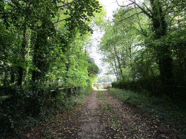
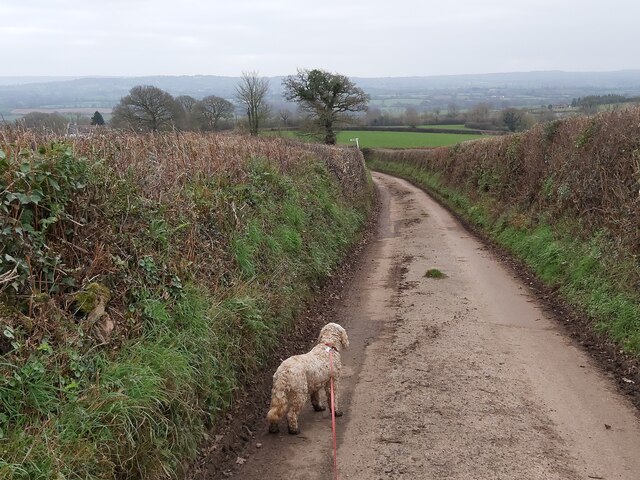
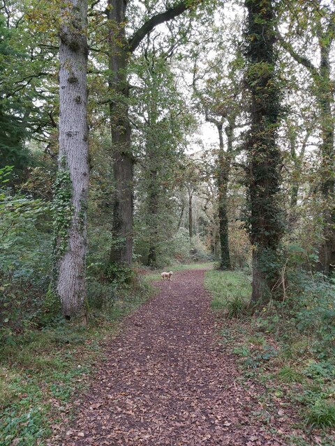
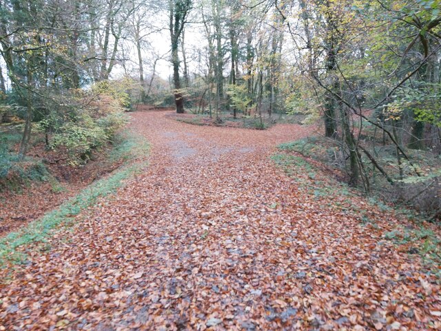
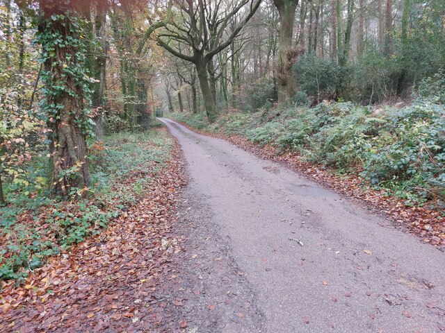
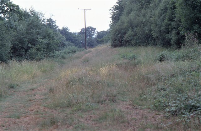
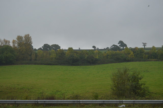
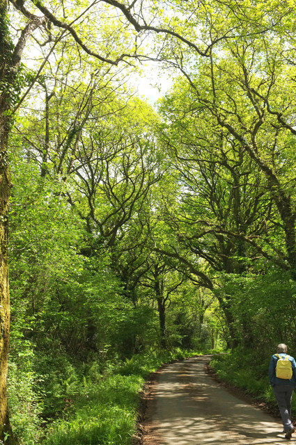
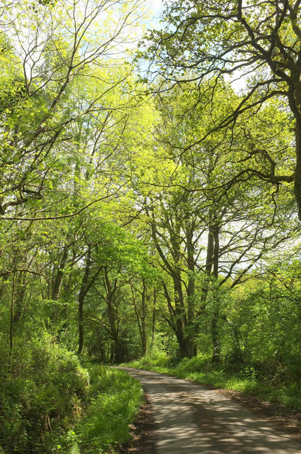
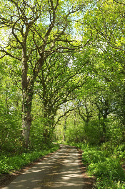
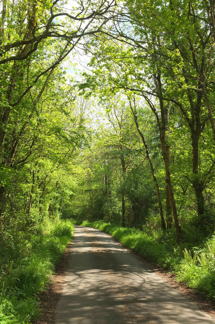
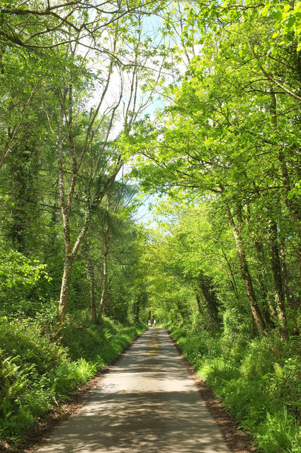
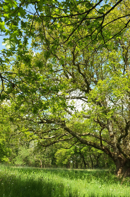
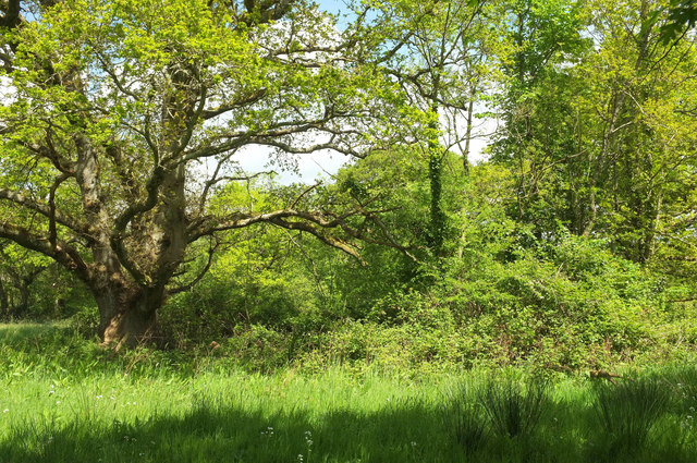
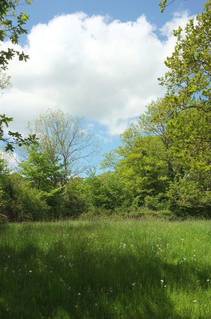
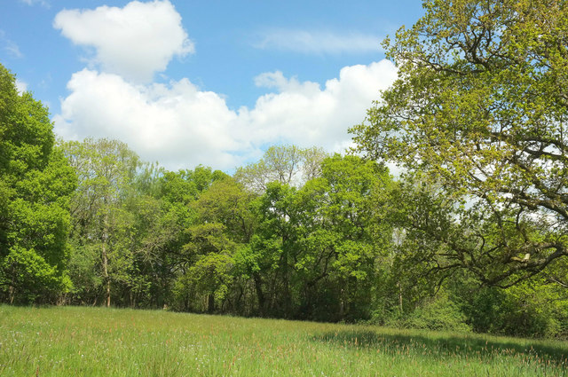
Side Downs is a picturesque area located in Devon, England. It is characterized by rolling hills and moorland, making it a popular destination for outdoor enthusiasts and nature lovers. The landscape is dotted with vibrant heather and gorse bushes, providing a stunning backdrop for hiking and birdwatching.

The Downs offer breathtaking views of the surrounding countryside and coastline, making it an ideal spot for picnics and leisurely walks. The area is also home to a variety of wildlife, including rare species of birds and butterflies.

Side Downs has a rich history, with ancient burial mounds and stone circles scattered throughout the landscape. Visitors can explore these archaeological sites and learn about the area's past inhabitants.

Overall, Side Downs is a tranquil and scenic location that offers the perfect escape from the hustle and bustle of everyday life. Whether you're looking to immerse yourself in nature or simply enjoy a peaceful stroll, this area has something to offer for everyone.

If you have any feedback on the listing, please let us know in the comments section below.

Side Downs Images

Images are sourced within 2km of 50.793134/-3.4098157 or Grid Reference ST0000. Thanks to Geograph Open Source API. All images are credited.

Track through woodland near Beare
Country Lane near Hoop-Cross A country road between Sherways Farm and Hoop-Cross in the Clyst St Lawrence Country Park in Devon.
Country Lane near Hoop-Cross
A country road between Sherways Farm and Hoop-Cross in the Clyst St Lawrence Country Park in Devon.
Woodland Path One of the many woodland paths through the National Trust Ashclyst Forest situated north of Broadclyst and east of the M5 in Devon.
Woodland Path
One of the many woodland paths through the National Trust Ashclyst Forest situated north of Broadclyst and east of the M5 in Devon.
Woodland Path A leaf covered woodland path in Paradise Copse, a National Trust Woodland just west of Clyst Hydon in Devon.
Woodland Path
A leaf covered woodland path in Paradise Copse, a National Trust Woodland just west of Clyst Hydon in Devon.
Minor Road through Woodland This minor road cuts through the National Trust woodland of Whitedown Copse and Paradise Copse just west of Clyst Hydon in Devon.
Minor Road through Woodland
This minor road cuts through the National Trust woodland of Whitedown Copse and Paradise Copse just west of Clyst Hydon in Devon.
Ashclyst Forest Somewhere on the 'Red Walk' within Ashclyst Forest. The forest ride was alive with butterflies.
Ashclyst Forest
Somewhere on the 'Red Walk' within Ashclyst Forest. The forest ride was alive with butterflies.
St Lawrence Church in Devon A view of the front of St Lawrence Church in Clyst St Lawrence in Devon as viewed from the entrance path from the country lane that runs through the village.
St Lawrence Church in Devon
A view of the front of St Lawrence Church in Clyst St Lawrence in Devon as viewed from the entrance path from the country lane that runs through the village.
St Lawrence Church in Devon A distant view of St Lawrence Church in Clyst St Lawrence in Devon as viewed from a nearby public footpath.
St Lawrence Church in Devon
A distant view of St Lawrence Church in Clyst St Lawrence in Devon as viewed from a nearby public footpath.
By the M5
By the M5
Lane from Rewes Cross Looking in the opposite direction from where <a href="https://www.geograph.org.uk/photo/5775404">SX9999 : Rewes Cross</a> was taken, down a delightful lane almost entirely free of traffic.
Lane from Rewes Cross
Looking in the opposite direction from where SX9999 : Rewes Cross was taken, down a delightful lane almost entirely free of traffic.
Lane across Merry Downs Further east from <a href="https://www.geograph.org.uk/photo/5775407">SY0099 : Lane from Rewes Cross</a> along the quiet lane through Ashclyst Forest to Caddihoe.
Lane across Merry Downs
Further east from SY0099 : Lane from Rewes Cross along the quiet lane through Ashclyst Forest to Caddihoe.
Lane to Rewes Cross Looking in the opposite direction from where <a href="https://www.geograph.org.uk/photo/5775417">SY0099 : Lane across Merry Downs</a> was taken, and therefore a reverse view of <a href="https://www.geograph.org.uk/photo/5775407">SY0099 : Lane from Rewes Cross</a>; the junction is just about visible around the bend.
Lane to Rewes Cross
Looking in the opposite direction from where SY0099 : Lane across Merry Downs was taken, and therefore a reverse view of SY0099 : Lane from Rewes Cross; the junction is just about visible around the bend.
Lane, Ashclyst Forest The quiet lane shown in <a href="https://www.geograph.org.uk/photo/5775417">SY0099 : Lane across Merry Downs</a> approaches Snaffle Park Gate.
Lane, Ashclyst Forest
The quiet lane shown in SY0099 : Lane across Merry Downs approaches Snaffle Park Gate.
Lane across Merry Downs Looking in the opposite direction from where <a href="https://www.geograph.org.uk/photo/5775438">SY0099 : Lane, Ashclyst Forest</a> was taken.
Lane across Merry Downs
Looking in the opposite direction from where SY0099 : Lane, Ashclyst Forest was taken.
Oak tree, Merry Downs In a meadow by the lane shown in <a href="https://www.geograph.org.uk/photo/5775443">SY0099 : Lane across Merry Downs</a>.
Oak tree, Merry Downs
In a meadow by the lane shown in SY0099 : Lane across Merry Downs.
Trees, Merry Downs In a meadow by the lane shown in <a href="https://www.geograph.org.uk/photo/5775443">SY0099 : Lane across Merry Downs</a>. On the left is the oak shown in <a href="https://www.geograph.org.uk/photo/5775483">SY0099 : Oak tree, Merry Downs</a>.
Trees, Merry Downs
In a meadow by the lane shown in SY0099 : Lane across Merry Downs. On the left is the oak shown in SY0099 : Oak tree, Merry Downs.
Meadow, Merry Downs A meadow by the lane shown in <a href="https://www.geograph.org.uk/photo/5775443">SY0099 : Lane across Merry Downs</a>. On the extreme right is the oak shown in <a href="https://www.geograph.org.uk/photo/5775483">SY0099 : Oak tree, Merry Downs</a>.
Meadow, Merry Downs
A meadow by the lane shown in SY0099 : Lane across Merry Downs. On the extreme right is the oak shown in SY0099 : Oak tree, Merry Downs.
Meadow, Merry Downs A meadow by the lane shown in <a href="https://www.geograph.org.uk/photo/5775443">SY0099 : Lane across Merry Downs</a>. On the right is the oak shown in <a href="https://www.geograph.org.uk/photo/5775483">SY0099 : Oak tree, Merry Downs</a>.
Meadow, Merry Downs
A meadow by the lane shown in SY0099 : Lane across Merry Downs. On the right is the oak shown in SY0099 : Oak tree, Merry Downs.
Show me another place!

Side Downs is located at Grid Ref: ST0000 (Lat: 50.793134, Lng: -3.4098157)

Administrative County: Devon

District: East Devon

Police Authority: Devon and Cornwall

What 3 Words

///hiked.grownup.painted. Near Bradninch, Devon

Nearby Locations

Side Downs Brook Hill

Related Wikis

Devon Redlands

The Devon Redlands is a natural region in southwest Britain that has been designated as National Character Area (NCA) 148 by Natural England. == Extent... ==

Beare

Beare is a village in the civil parish of Broadclyst in Devon, England. == References == == External links == Media related to Beare at Wikimedia Commons

Clyst St Lawrence

Clyst St Lawrence is a village and civil parish about 8 miles north-east of the city of Exeter in the county of Devon, England. Historically it formed...

Hele, Devon

Hele is a village in Devon, England, lying about one mile (1.6 km) SSW of Bradninch and 10 miles (16 km) NNE of Exeter, on the River Culm. The village...

Nearby Amenities

Located within 500m of 50.793134,-3.4098157
Agricultural: private
Barrier: swing_gate
Bicycle: no
Foot: yes
Horse: no
Material: wood
Swing Gate Type: single
Vehicle: private
Lat/Long: 50.7947518/-3.4100157
Side Downs
Place: locality
Lat/Long: 50.7930216/-3.4098908
Brook Hill
Ele: 90
Natural: peak
Lat/Long: 50.7932965/-3.4163127
Agricultural: private
Barrier: swing_gate
Bicycle: no
Foot: yes
Horse: no
Material: wood
Swing Gate Type: single
Vehicle: private
Lat/Long: 50.7947486/-3.4099057
The data included in this document is from www.openstreetmap.org. The data is made available under ODbL.

Have you been to Side Downs?

Leave your review of Side Downs below (or comments, questions and feedback).