Hensingham Common

Downs, Moorland in Cumberland Copeland

England

Hensingham Common

Standing Stones Trigpoint and Golf Course, Whitehaven Easy road side Trig <span class="nowrap"><a title="http://www.trigpointinguk.com/trigs/trig-details.php?t=6154" rel="nofollow ugc noopener" href="http://www.trigpointinguk.com/trigs/trig-details.php?t=6154">Link</a><img style="margin-left:2px;" alt="External link" title="External link - shift click to open in new window" src="https://s1.geograph.org.uk/img/external.png" width="10" height="10"/></span> near the golf course
Standing Stones Trigpoint and Golf Course, Whitehaven Credit: Brian Deegan

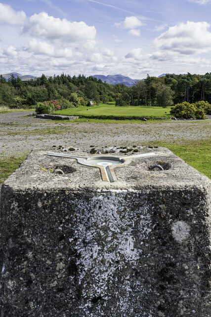
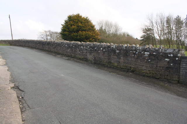
Hensingham Common, located in Cumberland, England, is a picturesque area of natural beauty. Covering a vast expanse of downs and moorland, it is a haven for outdoor enthusiasts and nature lovers alike. The common is situated in the western part of the county, bordered by the towns of Whitehaven and Hensingham.

The scenery at Hensingham Common is dominated by rolling hills and open grassland, providing breathtaking views of the surrounding countryside. The area is known for its diverse flora and fauna, with a variety of plant species thriving in the fertile soil. It is also home to several rare and endangered bird species, making it a popular spot for birdwatchers.

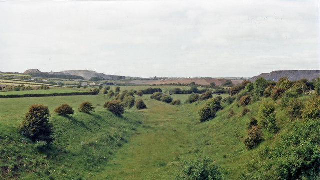
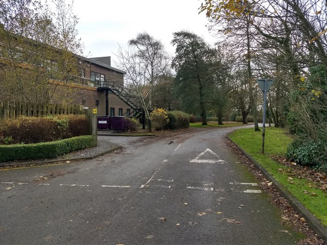
The common offers a range of recreational activities for visitors to enjoy. Walking and hiking trails crisscross the landscape, allowing visitors to explore the area at their own pace. The trails lead to hidden gems, such as tranquil ponds and ancient stone circles, adding an element of mystery to the experience.

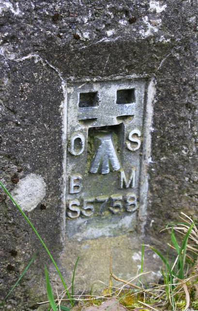
Hensingham Common holds historical significance as well. The remains of Iron Age settlements and ancient burial mounds can be found scattered throughout the area, providing a glimpse into the region's rich heritage. Archaeologists continue to unearth artifacts that shed light on the lives of the people who once inhabited the common.

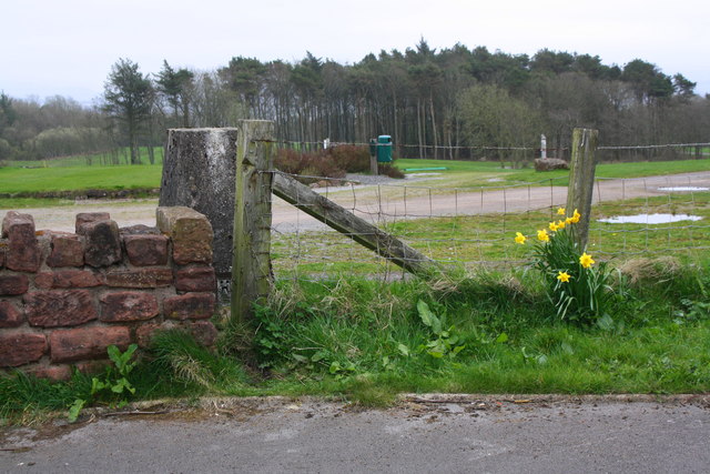
Overall, Hensingham Common is a captivating destination that offers a blend of natural beauty, outdoor activities, and historical intrigue. Whether visitors are seeking solitude amidst the stunning landscape or are eager to delve into the area's past, Hensingham Common has something to offer for everyone.

If you have any feedback on the listing, please let us know in the comments section below.

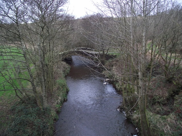
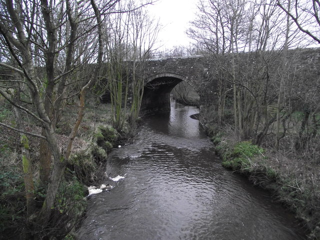
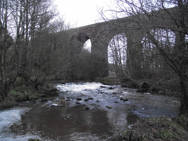
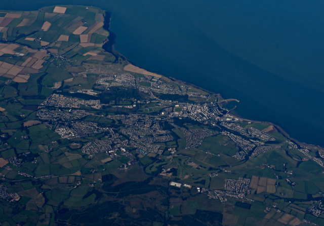
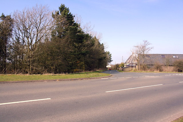
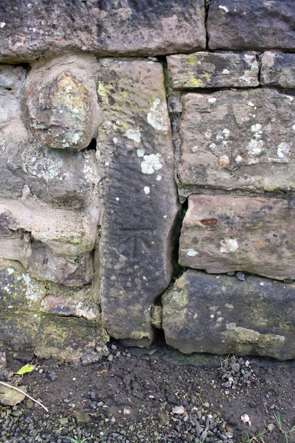
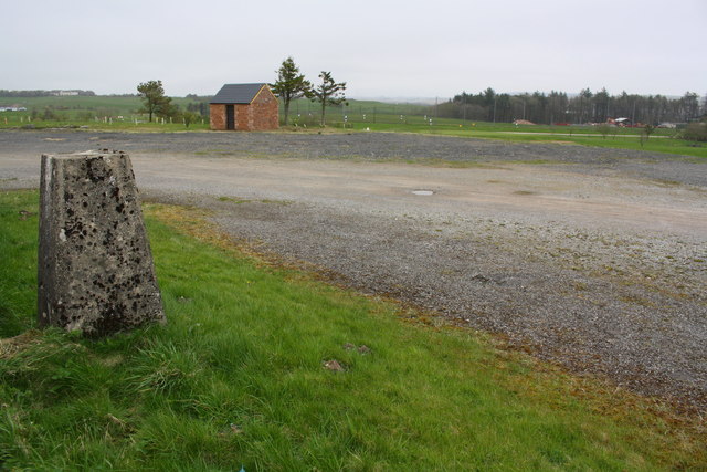
Hensingham Common Images

Images are sourced within 2km of 54.544011/-3.5484293 or Grid Reference NX9917. Thanks to Geograph Open Source API. All images are credited.

Standing Stones Trigpoint and Golf Course, Whitehaven Easy road side Trig <span class="nowrap"><a title="http://www.trigpointinguk.com/trigs/trig-details.php?t=6154" rel="nofollow ugc noopener" href="http://www.trigpointinguk.com/trigs/trig-details.php?t=6154">Link</a><img style="margin-left:2px;" alt="External link" title="External link - shift click to open in new window" src="https://s1.geograph.org.uk/img/external.png" width="10" height="10"/></span> near the golf course
Standing Stones Trigpoint and Golf Course, Whitehaven
Easy road side Trig LinkExternal link near the golf course
Near site of Cleator Moor station, 1986 A view along the course of the former Cleator & Workington Junction line, which was built, along with various other lines, for transporting haematite iron ore from the rich mines in the area to the iron and steel works in the Workington and Harrington Districts. For 100 years from the 1860s this area, nowadays almost reclaimed by nature, had been heavily industrialised and honeycombed by railways: the remnants of spoil-heaps from the iron and coal mines can be seen on the horizon. Keekle Viaduct can also be seen in the extreme left background.
Near site of Cleator Moor station, 1986
A view along the course of the former Cleator & Workington Junction line, which was built, along with various other lines, for transporting haematite iron ore from the rich mines in the area to the iron and steel works in the Workington and Harrington Districts. For 100 years from the 1860s this area, nowadays almost reclaimed by nature, had been heavily industrialised and honeycombed by railways: the remnants of spoil-heaps from the iron and coal mines can be seen on the horizon. Keekle Viaduct can also be seen in the extreme left background.
Old Keekle Bridge The Old Keekle Bridge is a packhorse bridge over the River Keekle and was restored in 1994.
Old Keekle Bridge
The Old Keekle Bridge is a packhorse bridge over the River Keekle and was restored in 1994.
Keekle Low Bridge Keekle Low Bridge carries the B5295 over the River Keekle
Keekle Low Bridge
Keekle Low Bridge carries the B5295 over the River Keekle
Keekle viaduct
Keekle viaduct
Whitehaven from the air Whitehaven Commercial park and Whitehaven Golf Club are in the foreground. North Head and St Bees Head are in the distance.
Whitehaven from the air
Whitehaven Commercial park and Whitehaven Golf Club are in the foreground. North Head and St Bees Head are in the distance.
T-junction at SE end of Victoria Road
Junction of footpath and Victoria Road
Benchmark on vertical element in stone wall Ordnance Survey cut mark benchmark levelled at 147.932m above Newlyn Datum
Benchmark on vertical element in stone wall
Ordnance Survey cut mark benchmark levelled at 147.932m above Newlyn Datum
Stone wall beside minor road at Scilly Bank There is an OS benchmark <a href="https://www.geograph.org.uk/photo/5959921">NX9919 : Benchmark on vertical element in stone wall</a> on a post in the wall at the centre of the image
Stone wall beside minor road at Scilly Bank
There is an OS benchmark NX9919 : Benchmark on vertical element in stone wall on a post in the wall at the centre of the image
Benchmark on wall on west side of road at a wall junction Ordnance Survey cut mark benchmark levelled at 160.788m above Newlyn Datum
Benchmark on wall on west side of road at a wall junction
Ordnance Survey cut mark benchmark levelled at 160.788m above Newlyn Datum
Potholes on Galemire lane
Summergrove Halls
Summergrove Halls
Road junction at Summergrove
Benchmark on 'Standing Stones' trig point Ordnance Survey flush bracket (serial identifier S5758) described on the OS Database as NX 9914 1809 FLUSH BRACKET FL BR S5758 STANDING STONES TP 143.256m ODN
Benchmark on 'Standing Stones' trig point
Ordnance Survey flush bracket (serial identifier S5758) described on the OS Database as NX 9914 1809 FLUSH BRACKET FL BR S5758 STANDING STONES TP 143.256m ODN
Triangulation pillar at entrance to Whitehaven Golf Course Detailed information about the pillar is at <span class="nowrap"><a title="http://trigpointing.uk/trig/6154" rel="nofollow ugc noopener" href="http://trigpointing.uk/trig/6154">Link</a><img style="margin-left:2px;" alt="External link" title="External link - shift click to open in new window" src="https://s1.geograph.org.uk/img/external.png" width="10" height="10"/></span> . The pillar's flush bracket benchmark <a href="https://www.geograph.org.uk/photo/5991114">NX9918 : Benchmark on 'Standing Stones' trig point</a> is visible through the gap between the stone wall and the end wooden fence post
Triangulation pillar at entrance to Whitehaven Golf Course
Detailed information about the pillar is at LinkExternal link . The pillar's flush bracket benchmark NX9918 : Benchmark on 'Standing Stones' trig point is visible through the gap between the stone wall and the end wooden fence post
Whitehaven Golf Course There is an Ordnance Survey trig point pillar <a href="https://www.geograph.org.uk/photo/5991128">NX9918 : Triangulation pillar at entrance to Whitehaven Golf Course</a> at the entrance
Whitehaven Golf Course
There is an Ordnance Survey trig point pillar NX9918 : Triangulation pillar at entrance to Whitehaven Golf Course at the entrance
Old Milestone by B5295, Hensingham Road, Whitehaven parish Whitehaven plate stone by the UC road (was A595), in parish of Whitehaven (Copeland District), Hensingham Road, built into roadside wall at pavement level,  opposite the Lowther Arms PH.

Inscription reads:-
TO
CALDER BRIDGE
8½ MILES

Surveyed

Milestone Society National ID: CU_WHCB01
Old Milestone by B5295, Hensingham Road, Whitehaven parish
Whitehaven plate stone by the UC road (was A595), in parish of Whitehaven (Copeland District), Hensingham Road, built into roadside wall at pavement level, opposite the Lowther Arms PH. Inscription reads:- TO CALDER BRIDGE 8½ MILES Surveyed Milestone Society National ID: CU_WHCB01
Show me another place!

Hensingham Common is located at Grid Ref: NX9917 (Lat: 54.544011, Lng: -3.5484293)

Administrative County: Cumbria

District: Copeland

Police Authority: Cumbria

What 3 Words

///cycle.fatherly.remotest. Near Whitehaven, Cumbria

Related Wikis

St Benedict's Catholic High School, Hensingham

St Benedict's Catholic High School is a co-educational 11–18 comprehensive school on the edge of Whitehaven, Cumbria, England. It is located between the...

The Whitehaven Academy

The Whitehaven Academy (formerly Whitehaven School) is a comprehensive co-educational secondary school with academy status, located in Whitehaven, in west...

Moresby Junction Halt railway station

Moresby Junction Halt railway station was opened by the Cleator and Workington Junction Railway (C&WJR) in 1910. Very few people lived near the halt, which...

Hensingham

Hensingham is a suburb of Whitehaven and former civil parish, now in the parish of Whitehaven, in the Cumberland district, in the ceremonial county of...

Nearby Amenities

Located within 500m of 54.544011,-3.5484293
Power: tower
Lat/Long: 54.5432719/-3.5515275
Power: tower
Lat/Long: 54.5461911/-3.5511896
Power: tower
Lat/Long: 54.5481946/-3.5501119
Power: tower
Lat/Long: 54.5412622/-3.5489225
New Monkray
Place: locality
Lat/Long: 54.5435133/-3.5523672
Power: pole
Lat/Long: 54.5478949/-3.5510771
Power: pole
Lat/Long: 54.5460583/-3.5526878
Power: pole
Lat/Long: 54.5450821/-3.5535152
Power: pole
Lat/Long: 54.5444994/-3.5543802
Power: pole
Lat/Long: 54.5441229/-3.5549636
Power: pole
Lat/Long: 54.5428579/-3.5555725
Power: pole
Lat/Long: 54.5423834/-3.5542434
Power: pole
Lat/Long: 54.5418551/-3.552779
Power: pole
Lat/Long: 54.5413751/-3.5514969
Power: pole
Lat/Long: 54.5405084/-3.5508531
Power: pole
Lat/Long: 54.5407101/-3.5444963
The data included in this document is from www.openstreetmap.org. The data is made available under ODbL.

Have you been to Hensingham Common?

Leave your review of Hensingham Common below (or comments, questions and feedback).