Darran Park
Downs, Moorland in Glamorgan
Wales
Darran Park

Darran Park, located in Glamorgan, Wales, is a picturesque natural reserve encompassing a diverse landscape of downs and moorland. Situated in the heart of the Rhymney Valley, the park spans over a vast area, offering visitors a tranquil escape from the bustling city life.
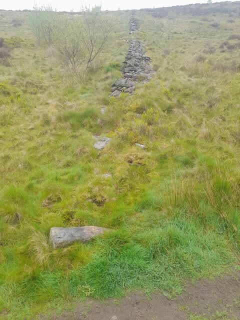
The downs in Darran Park are characterized by their rolling hills, covered in lush green grasses and scattered with vibrant wildflowers. These hills provide stunning panoramic views of the surrounding countryside, making it a popular spot for hikers and nature enthusiasts. The moorland, on the other hand, presents a more rugged terrain, with heather-covered slopes and rocky outcrops dotting the landscape.
The park is home to a wide variety of wildlife, including rare bird species, such as the red kite and peregrine falcon, which can often be spotted soaring through the skies. Additionally, the moorland is inhabited by several species of reptiles and insects, adding to the biodiversity of the area.
Visitors to Darran Park can enjoy a range of activities, including walking, cycling, and picnicking. The park boasts well-maintained trails, allowing visitors to explore the natural beauty at their own pace. There are also designated picnic areas where visitors can relax and enjoy the stunning views.
With its diverse landscape, rich wildlife, and peaceful atmosphere, Darran Park is a must-visit destination for nature lovers and those seeking a respite from the urban grind. Whether it's a leisurely stroll through the downs or an adventurous hike up the moorland, Darran Park offers a truly immersive experience in the heart of Glamorgan.
If you have any feedback on the listing, please let us know in the comments section below.
Darran Park Images
Images are sourced within 2km of 51.661918/-3.4529899 or Grid Reference SS9996. Thanks to Geograph Open Source API. All images are credited.


Darran Park is located at Grid Ref: SS9996 (Lat: 51.661918, Lng: -3.4529899)
Unitary Authority: Rhondda Cynon Taf
Police Authority: South Wales
What 3 Words
///bells.saving.noting. Near Ferndale, Rhondda Cynon Taf
Nearby Locations
Related Wikis
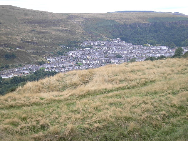
Ferndale, Rhondda Cynon Taf
Ferndale (Welsh: Glynrhedynog) is a town and community located in the Rhondda Valley in the county borough of Rhondda Cynon Taf, Wales. Neighbouring villages...

Ferndale railway station
Ferndale railway station served the Welsh mining community of Ferndale between 1876 and 1964. == History == Ferndale was a large station, comprising two...

Ferndale Colliery
Ferndale Colliery was a series of nine coal mines, located close to the village of Ferndale, Rhondda Cynon Taf in the Rhondda Valley, South Wales. ��2...

Blaenllechau
Blaenllechau is a small village located in the Rhondda Fach valley, Rhondda Cynon Taf, Wales. Neighbouring villages are Ferndale, Maerdy and Tylorstown...

Cynon Valley
Cynon Valley (Welsh: Cwm Cynon) is a former coal mining valley in Wales. It lies between Rhondda and the Merthyr Valley and takes its name from the River...

Cynon Valley (Senedd constituency)
Cynon Valley (Welsh: Cwm Cynon) is a constituency of the Senedd. It elects one Member of the Senedd by the first past the post method of election. It is...

Cynon Valley (UK Parliament constituency)
Cynon Valley (Welsh: Cwm Cynon) is a constituency in Wales represented in the House of Commons of the UK Parliament since 2019 by Beth Winter of the Labour...

Rhondda Cynon Taf
Rhondda Cynon Taf (Welsh pronunciation: [ˈr̥ɔnða ˈkənɔn ˈtaːv]; RCT; also spelt as Rhondda Cynon Taff) is a county borough in the south-east of Wales....
Nearby Amenities
Located within 500m of 51.661918,-3.4529899Have you been to Darran Park?
Leave your review of Darran Park below (or comments, questions and feedback).