Great Moor

Downs, Moorland in Somerset Somerset West and Taunton

England

Great Moor

Beach and boats at Wimbleball lake
Beach and boats at Wimbleball lake Credit: Rob Purvis

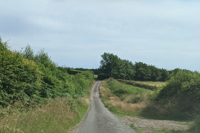
Great Moor is a picturesque area located in Somerset, England. It is characterized by its rolling hills, vast moorland, and stunning views of the surrounding countryside. The landscape is predominantly composed of open grasslands, heather, and gorse, creating a vibrant and diverse ecosystem.

The area is known for its rich history, with evidence of human habitation dating back thousands of years. There are several archaeological sites in Great Moor, including ancient burial mounds and stone circles, which provide insight into the region's past.

The flora and fauna of Great Moor are diverse and unique. The open grasslands support a variety of plant species, including wildflowers such as bluebells and orchids. The moorland is home to a range of wildlife, including birds of prey like buzzards and kestrels, as well as native mammals like rabbits and deer.

Great Moor offers a range of recreational opportunities for visitors. The vast open spaces are ideal for hiking, walking, and picnicking, with numerous footpaths and trails that allow visitors to explore the area at their own pace. The panoramic views from the hillsides are particularly breathtaking, providing a sense of tranquility and natural beauty.

Overall, Great Moor is a stunning and idyllic location that showcases the natural beauty of Somerset. Its diverse landscapes, rich history, and recreational opportunities make it a must-visit destination for nature enthusiasts and those looking to escape the hustle and bustle of everyday life.

If you have any feedback on the listing, please let us know in the comments section below.

Great Moor Images

Images are sourced within 2km of 51.058857/-3.4493951 or Grid Reference SS9829. Thanks to Geograph Open Source API. All images are credited.

Beach and boats at Wimbleball lake
Heading up Rugg's Hill
Henstown Farm house
Henstown Farm house
Brompton Regis : Wimbleball Lake Looking towards the lake which is at around 20 per cent capacity.
Brompton Regis : Wimbleball Lake
Looking towards the lake which is at around 20 per cent capacity.
Brompton Regis : Wimbleball Lake Due to low water levels sailing and activities on the lake have been suspended.
Brompton Regis : Wimbleball Lake
Due to low water levels sailing and activities on the lake have been suspended.
Entering Upton, heading south
On Post Lane, heading south
Brompton Regis : Wimbleball Lake Looking across the lake where water levels are low.
Brompton Regis : Wimbleball Lake
Looking across the lake where water levels are low.
Brompton Regis : Wimbleball Lake The reservoir is currently measuring less than a quarter of its capacity sparking fears of the effect this summer's droughts are having on the UK water supply
Brompton Regis : Wimbleball Lake
The reservoir is currently measuring less than a quarter of its capacity sparking fears of the effect this summer's droughts are having on the UK water supply
Upton farm and derelict church (only tower remains)
Wimbleball Reservoir This little valley is now underwater. The picture was taken shortly before it was flooded in the mid-70s, with all the conifers that grew in the valley, cut down ready for hauling out. It was a curious sensation standing at the planned waters edge looking into a space, the space of the photo and more, that was about to be transformed for the purpose of attracting more people to live in the West Country. Did those additional houses that were able to be built, account for all the water stored in this space?
Wimbleball Reservoir
This little valley is now underwater. The picture was taken shortly before it was flooded in the mid-70s, with all the conifers that grew in the valley, cut down ready for hauling out. It was a curious sensation standing at the planned waters edge looking into a space, the space of the photo and more, that was about to be transformed for the purpose of attracting more people to live in the West Country. Did those additional houses that were able to be built, account for all the water stored in this space?
Upton: St James’s church The tower is the only complete structure left and is now in the care of the Churches Conservation Trust. Looking north west
Upton: St James’s church
The tower is the only complete structure left and is now in the care of the Churches Conservation Trust. Looking north west
Upton: towards Haddon Hill Looking west-south-west across a hidden arm of the Wimbleball Lake to Hadborough
Upton: towards Haddon Hill
Looking west-south-west across a hidden arm of the Wimbleball Lake to Hadborough
Upton: Rainsbury House The barn conversion on the right is now ‘The Cottage’ and ‘Rainsbury House’ was recently Rainsbury Farm. On land nearby is the site of a Roman fort. Looking west-north-west
Upton: Rainsbury House
The barn conversion on the right is now ‘The Cottage’ and ‘Rainsbury House’ was recently Rainsbury Farm. On land nearby is the site of a Roman fort. Looking west-north-west
Upton: Upton Garage By the Bampton-Watchet road, looking north east
Upton: Upton Garage
By the Bampton-Watchet road, looking north east
Upton: by Post Lane Looking north west with Upton Farm and the tower of old St James’s church visible to the left
Upton: by Post Lane
Looking north west with Upton Farm and the tower of old St James’s church visible to the left
St. James's Church, Upton
Ebenezer Chapel, Upton Grade II. Non-conformist chapel, gatepiers and railings enclosing forecourt. Dated 1878.
Ebenezer Chapel, Upton
Grade II. Non-conformist chapel, gatepiers and railings enclosing forecourt. Dated 1878.
Show me another place!

Great Moor is located at Grid Ref: SS9829 (Lat: 51.058857, Lng: -3.4493951)

Administrative County: Somerset

District: Somerset West and Taunton

Police Authority: Avon and Somerset

What 3 Words

///fittingly.popping.chained. Near Dulverton, Somerset

Related Wikis

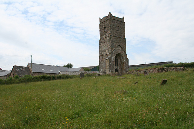
Old Church of St James, Upton

The Old St James's Church is a former church in the village of Upton, Somerset, England, of which only the tower remains, overlooking Wimbleball Lake....

Upton, Somerset

Upton is a village and civil parish north of Skilgate in Somerset, England. It is situated on a hill above the eastern end of Wimbleball Lake. == History... ==
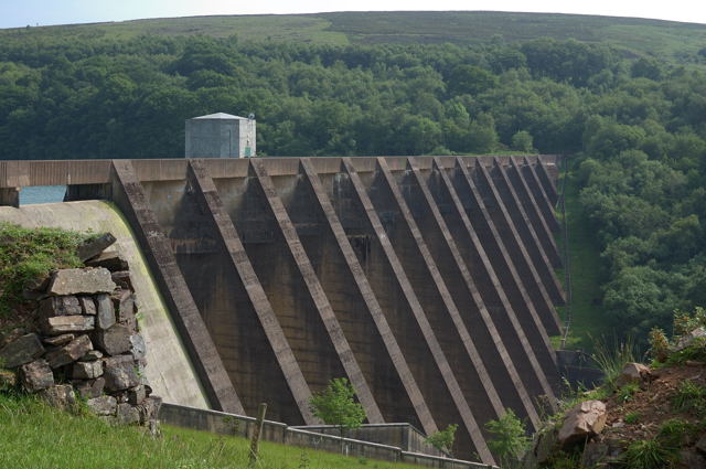
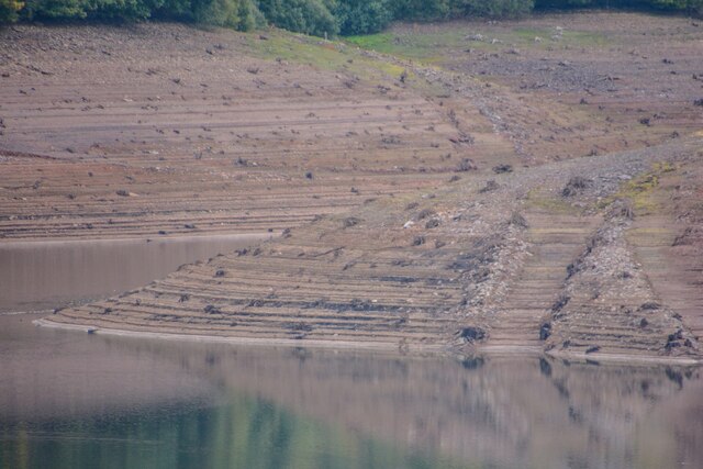
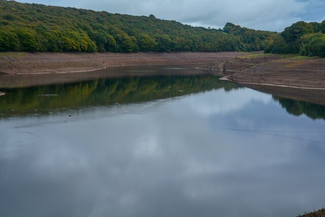
Wimbleball Lake

Wimbleball Lake on Exmoor in Somerset, England, is a water supply reservoir constructed in the 1970s and completed in 1979. The 161 feet (49 m) high dam...

Skilgate

Skilgate is a village and civil parish 5 miles (8 km) east of Dulverton and 8 miles (13 km) west of Wiveliscombe in the Somerset West and Taunton district...

Haddon Hill

Haddon Hill is a prominent east–west aligned ridge in west Somerset, England, close to Hartford within the civil parish of Brompton Regis. It lies on the...

Church of St John, Skilgate

The Anglican Church of St John in Skilgate, Somerset, England was built in the 14th century. It is a Grade II* listed building. == History == The church...

Brompton Regis

Brompton Regis (formerly known as Kingsbrompton) is a village and civil parish in the Somerset West and Taunton district of Somerset, England about 5 miles...

Church of St Mary Magdalene, Withiel Florey

The Anglican Church of St Mary Magdalene in Withiel Florey, Somerset, England was built in the 12th century. It is a Grade II* listed building. == History... ==

Nearby Amenities

Located within 500m of 51.058857,-3.4493951
East Moor
Place: locality
Lat/Long: 51.0584568/-3.4437945
Great Moor
Place: locality
Lat/Long: 51.0583143/-3.4490941
The data included in this document is from www.openstreetmap.org. The data is made available under ODbL.

Have you been to Great Moor?

Leave your review of Great Moor below (or comments, questions and feedback).