Ellicombe Common

Downs, Moorland in Somerset Somerset West and Taunton

England

Ellicombe Common

9351 leaves Dunster with a train for Bishops Lydeard During 2021, all passenger services must terminate at Watchet, Blue Anchor, or Dunster, whilst critical new infrastructure work is undertaken at Minehead.
9351 leaves Dunster with a train for Bishops Lydeard Credit: Roger Cornfoot

Ellicombe Common is a picturesque area located in Somerset, England. This stunning common is situated on the outskirts of the village of Ellicombe and offers a diverse landscape of downs and moorland. Covering an area of approximately 200 acres, it is a haven for nature enthusiasts and those seeking outdoor activities.

The common is characterized by its rolling hills and open grasslands, providing breathtaking views of the surrounding countryside. Visitors can expect to encounter a variety of flora and fauna, including heather, gorse, and wildflowers, which add vibrant pops of color to the landscape.

Ellicombe Common is also home to a rich array of wildlife. Birdwatchers will delight in the chance to spot species such as skylarks, stonechats, and meadow pipits, while small mammals like rabbits and voles can be spotted darting through the undergrowth.

For those looking to explore the common on foot, there are several walking trails that crisscross the area, offering different levels of difficulty and length. These trails allow visitors to fully immerse themselves in the natural beauty of the common, with opportunities to pause and take in the views from various vantage points.

Ellicombe Common provides a tranquil and peaceful setting for visitors to escape the hustle and bustle of everyday life. Whether it's enjoying a leisurely stroll, birdwatching, or simply soaking up the beauty of the moorland, this common offers a truly enchanting experience for all who visit.

If you have any feedback on the listing, please let us know in the comments section below.

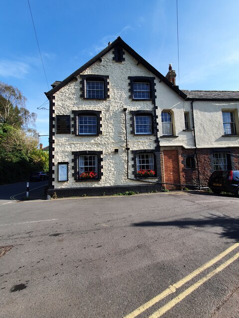
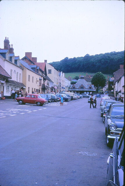
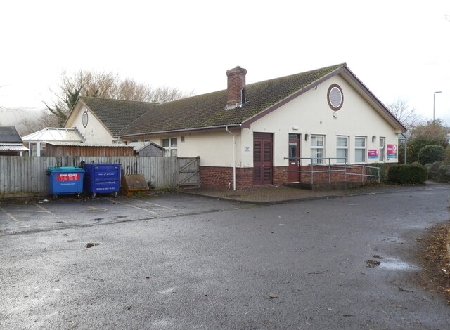
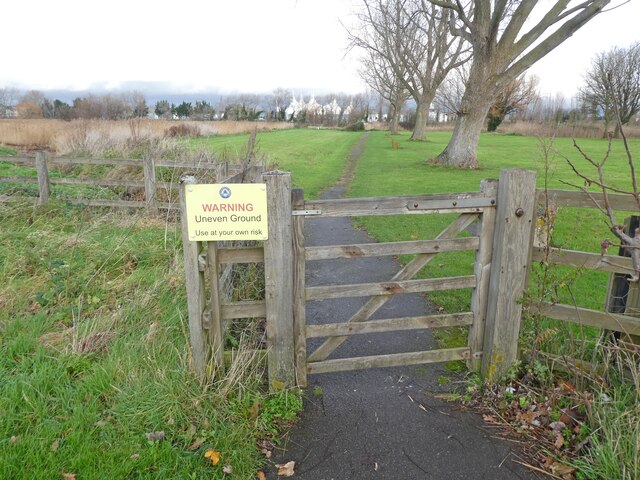
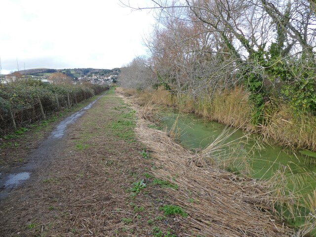
Ellicombe Common Images

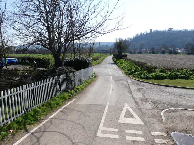
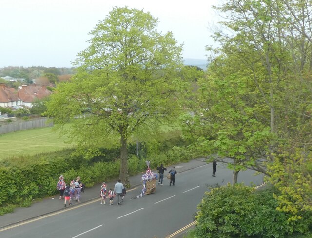
Images are sourced within 2km of 51.186133/-3.4607684 or Grid Reference SS9844. Thanks to Geograph Open Source API. All images are credited.

9351 leaves Dunster with a train for Bishops Lydeard During 2021, all passenger services must terminate at Watchet, Blue Anchor, or Dunster, whilst critical new infrastructure work is undertaken at Minehead.
9351 leaves Dunster with a train for Bishops Lydeard
During 2021, all passenger services must terminate at Watchet, Blue Anchor, or Dunster, whilst critical new infrastructure work is undertaken at Minehead.
Heritage buses await the arrival of passengers from Bishops Lydeard During 2021, all passenger services must terminate at Watchet, Blue Anchor, or Dunster, whilst critical new infrastructure work is undertaken at Minehead. These buses are used for onward conveyance.
Heritage buses await the arrival of passengers from Bishops Lydeard
During 2021, all passenger services must terminate at Watchet, Blue Anchor, or Dunster, whilst critical new infrastructure work is undertaken at Minehead. These buses are used for onward conveyance.
5199 waits at Dunster for the 'off' During 2021, all passenger services must terminate at Watchet, Blue Anchor, or Dunster, whilst critical new infrastructure work is undertaken at Minehead.
5199 waits at Dunster for the 'off'
During 2021, all passenger services must terminate at Watchet, Blue Anchor, or Dunster, whilst critical new infrastructure work is undertaken at Minehead.
Forestersv Arms Hotel, Dunster Foresters Arms Hotel, Dunster. The building also has an Ordnance Survey bench mark.
<a href="https://www.geograph.org.uk/photo/6998640">SS9843 : Ordnance Survey Bench Mark</a>
Forestersv Arms Hotel, Dunster
Foresters Arms Hotel, Dunster. The building also has an Ordnance Survey bench mark. SS9843 : Ordnance Survey Bench Mark
Ordnance Survey Bench Mark This mark is located at the Foresters Arms Hotel, Dunster. These marks were used by Ordnance Survey for mapping purposes.
<a href="https://www.geograph.org.uk/photo/6998637">SS9843 : Forestersv Arms Hotel, Dunster</a>
Ordnance Survey Bench Mark
This mark is located at the Foresters Arms Hotel, Dunster. These marks were used by Ordnance Survey for mapping purposes. SS9843 : Forestersv Arms Hotel, Dunster
Lane, at the rear of Elm Grove
The lower part of King George Road
Dunster Yarn Market View down High Street past the old Yarn Market. Even 50 years ago, parking was a problem in the town.
Dunster Yarn Market
View down High Street past the old Yarn Market. Even 50 years ago, parking was a problem in the town.
Dunster View up Dunster High St with the Yarn Market in the distance in the centre of the image.
Dunster
View up Dunster High St with the Yarn Market in the distance in the centre of the image.
Temporary Library, Minehead
Main entrance, Tesco, Minehead
'Warning - Uneven Ground' Signs are cheaper than refurbishments. This 'tarmac' path has not been resurfaced for at least 25 years.
'Warning - Uneven Ground'
Signs are cheaper than refurbishments. This 'tarmac' path has not been resurfaced for at least 25 years.
Path, running between railway line and Butlins, Minehead
Dunster station platform, West Somerset Railway
Station Road, Dunster, seen from the West Somerset Railway
Traditional 'Hobbyhorse' group heading towards Alcombe On Spring Bank Holiday in Minehead.
Traditional 'Hobbyhorse' group heading towards Alcombe
On Spring Bank Holiday in Minehead.
2857 approaches Dunster with a 'Gala' train
Water mill at Dunster
Show me another place!

Ellicombe Common is located at Grid Ref: SS9844 (Lat: 51.186133, Lng: -3.4607684)

Administrative County: Somerset

District: Somerset West and Taunton

Police Authority: Avon and Somerset

What 3 Words

///casino.hugs.breakfast. Near Minehead, Somerset

Related Wikis

Grabbist Hillfort

Grabbist Hillfort is an Iron Age oval hillfort or defended enclosure, west of Dunster in Somerset, England. The site is 885.8 feet (270.0 m) long and 219...

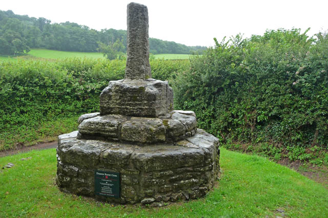
Dunster Butter Cross

The Butter Cross in Dunster within the English county of Somerset is a Grade II* listed building and scheduled monument. The cross was originally erected...
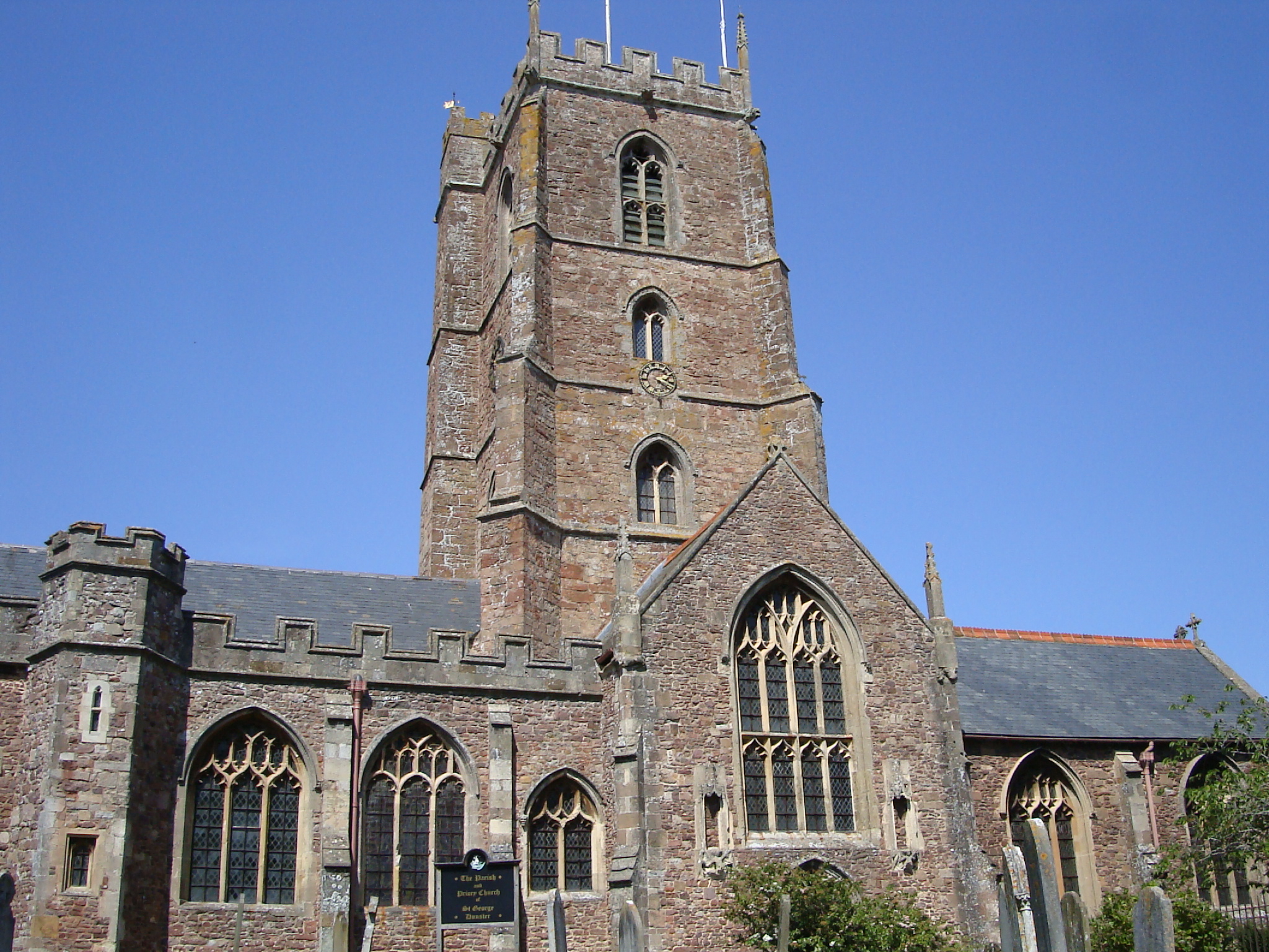
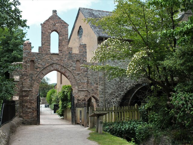
Dunster Priory

Dunster Priory was established as a Benedictine monastery around 1100 in Dunster, Somerset, England. The first church in Dunster was built by William de...
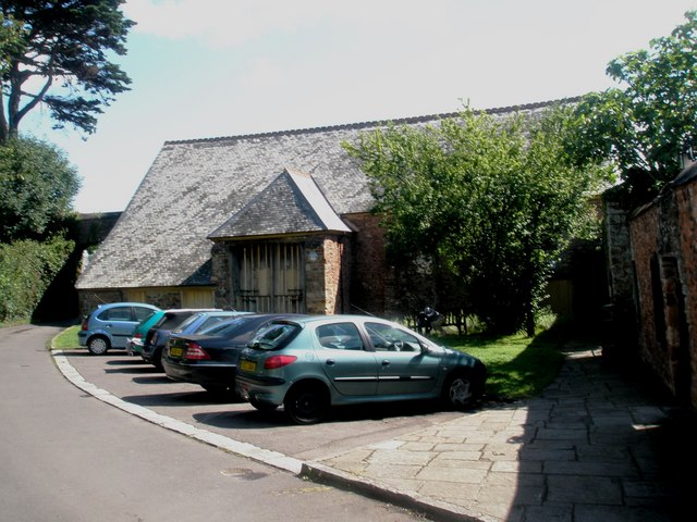
Tithe Barn, Dunster

The Tithe Barn is a 14th-century tithe barn in Dunster, Somerset, England. It has a cruciform plan. The east front has central double doors in heavy oak...

Nearby Amenities

Located within 500m of 51.186133,-3.4607684
Grabbist Hill
Place: locality
Lat/Long: 51.1843668/-3.4659505
Hiking: yes
Information: guidepost
Source: GPS survey
Tourism: information
Lat/Long: 51.1885883/-3.4629169
Hiking: yes
Information: route_marker
Source: GPS survey
Tourism: information
Lat/Long: 51.1883613/-3.4632871
Hiking: yes
Information: guidepost
Source: GPS survey
Tourism: information
Lat/Long: 51.1857732/-3.4661275
Hiking: yes
Information: route_marker
Source: GPS survey
Tourism: information
Lat/Long: 51.1848174/-3.4676202
Bench
Backrest: no
Lat/Long: 51.1834102/-3.461608
Hiking: yes
Information: guidepost
Source: GPS survey
Tourism: information
Lat/Long: 51.1834136/-3.4616603
Bench
Backrest: no
Lat/Long: 51.1838574/-3.4595588
Hiking: yes
Information: guidepost
Source: GPS survey
Tourism: information
Lat/Long: 51.1837801/-3.4595776
Hiking: yes
Information: guidepost
Source: GPS survey
Tourism: information
Lat/Long: 51.1846594/-3.4562087
The data included in this document is from www.openstreetmap.org. The data is made available under ODbL.

Have you been to Ellicombe Common?

Leave your review of Ellicombe Common below (or comments, questions and feedback).