Bad a' Channain
Downs, Moorland in Caithness
Scotland
Bad a' Channain

Bad a' Channain is a remote and rugged area located in Caithness, Scotland. Situated on the northeastern coast of the country, it is characterized by its stunning downs and moorland landscapes. The name "Bad a' Channain" translates to "the clump or thicket of the canons" in Gaelic, reflecting the area's historical ties to religious communities.
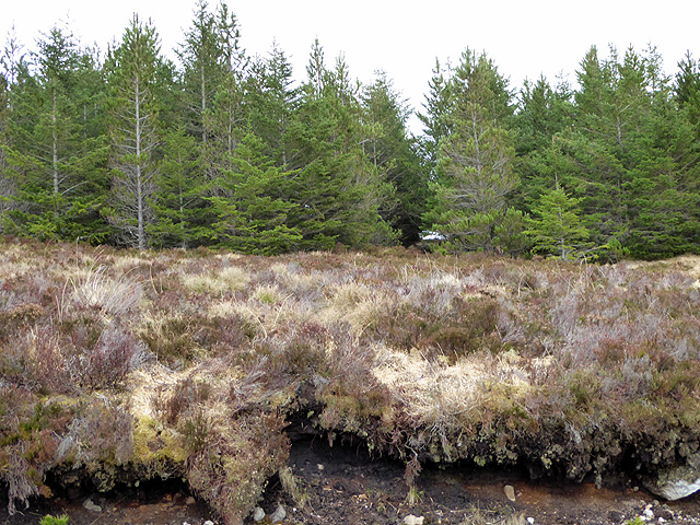
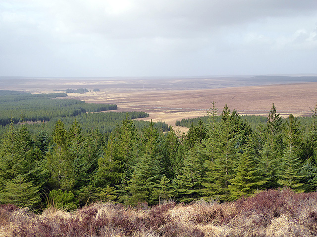
The downs of Bad a' Channain are expansive, rolling hills covered in short grasses and heather. These downs provide a picturesque backdrop, with their varying shades of green and purple, stretching as far as the eye can see. The moorland, on the other hand, is characterized by its vast open spaces, dotted with patches of heather, peat bogs, and scattered rock formations.
The area is home to a rich variety of wildlife, including many species of birds, such as the golden plover and the red-throated diver. The downs and moorland also support a diverse range of plant life, including mosses, lichens, and wildflowers.
Bad a' Channain is a popular destination for outdoor enthusiasts, offering ample opportunities for hiking, birdwatching, and photography. The landscape's rugged beauty and sense of isolation make it an ideal location for those seeking tranquility and a connection with nature.
Visitors to Bad a' Channain should come prepared for changeable weather conditions, as the area is known for its strong winds and unpredictable rainfall. Nonetheless, those who venture to this remote corner of Caithness will be rewarded with breathtaking scenery and a sense of peace and serenity.
If you have any feedback on the listing, please let us know in the comments section below.
Bad a' Channain Images
Images are sourced within 2km of 58.344365/-3.8113949 or Grid Reference NC9440. Thanks to Geograph Open Source API. All images are credited.


Bad a' Channain is located at Grid Ref: NC9440 (Lat: 58.344365, Lng: -3.8113949)
Unitary Authority: Highland
Police Authority: Highlands and Islands
What 3 Words
///numeral.fail.egging. Near Forsinard, Highland
Nearby Locations
Related Wikis
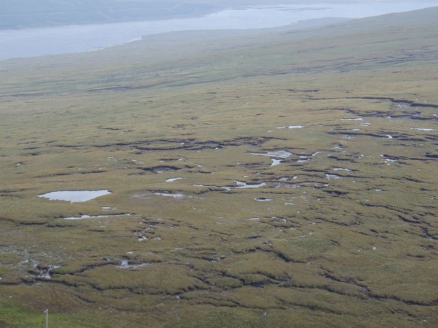
Caithness and Sutherland Peatlands
The Caithness and Sutherland Peatlands is a large area of blanket bog and peatland, covering a number of disconnected regions across the historic counties...

Forsinard Flows National Nature Reserve
Forsinard Flows is a national nature reserve (NNR) covering much of the area surrounding Forsinard in the Highland council area of Scotland. It lies at...

Forsinard railway station
Forsinard railway station () is a railway station serving the village of Forsinard in the Highland council area in the north of Scotland. It is located...

Forsinard
Forsinard ( FOR-sin-ARD) is a hamlet in the county of Sutherland in the Highland area of Scotland. It is located on the A897 road in Strath Halladale....
Have you been to Bad a' Channain?
Leave your review of Bad a' Channain below (or comments, questions and feedback).