Brae of Lude

Downs, Moorland in Perthshire

Scotland

Brae of Lude

Tomnaguie Above Blair Atholl.
Tomnaguie Credit: Richard Webb

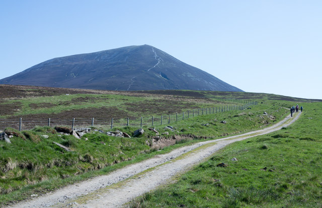
Brae of Lude is a picturesque area located in Perthshire, Scotland. Situated amidst stunning downs and moorland, this region offers a captivating blend of natural beauty and tranquility. The landscape of Brae of Lude is characterized by rolling hills, open grasslands, and heather-covered moors, creating a captivating panorama that attracts nature enthusiasts and outdoor adventurers alike.

The downs of Brae of Lude are marked by gently sloping hills that provide breathtaking views of the surrounding countryside. These downs are adorned with lush greenery, dotted with vibrant wildflowers during the summer months. The undulating terrain is ideal for hiking, allowing visitors to explore the area while immersing themselves in its natural wonders.

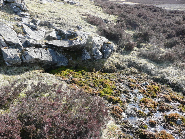
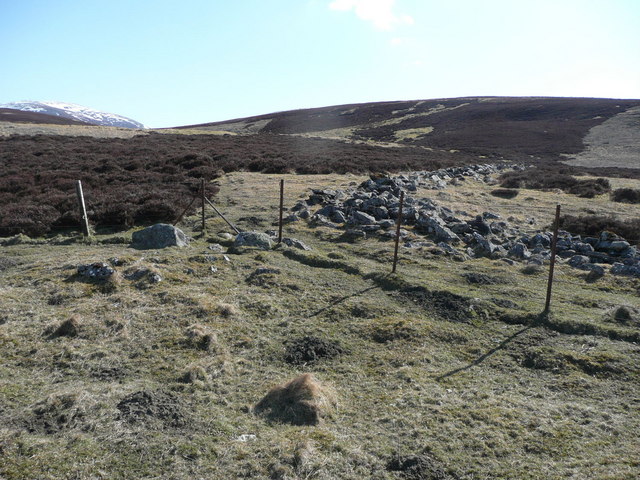
The moorland of Brae of Lude is a sight to behold, with vast stretches of heather-covered plains extending as far as the eye can see. This rugged landscape is home to a variety of flora and fauna, including birds, deer, and other wildlife. The moorland offers a unique opportunity for nature lovers to witness the untamed beauty of Scottish wilderness.

In addition to its natural splendor, Brae of Lude is also known for its historical significance. The area is dotted with ancient ruins and standing stones, serving as a reminder of its rich heritage. Visitors can explore these archaeological sites and learn about the area's fascinating past.

Overall, Brae of Lude in Perthshire is a captivating destination that promises breathtaking views, diverse wildlife, and a rich cultural heritage. Whether it's hiking across the downs or immersing oneself in the untamed beauty of the moorland, this region offers an unforgettable experience for all who venture here.

If you have any feedback on the listing, please let us know in the comments section below.

Brae of Lude Images

Images are sourced within 2km of 56.79908/-3.7997545 or Grid Reference NN9068. Thanks to Geograph Open Source API. All images are credited.

Tomnaguie Above Blair Atholl.
Tomnaguie
Above Blair Atholl.
Glen Fender
Glen Fender
Moorland below Carn Liath
Deer grazing by Loch Moraig Taken from close by the car soon after arriving at the car park.
Deer grazing by Loch Moraig
Taken from close by the car soon after arriving at the car park.
Farm road to Monzie Taken from the end of the public road above Old Bridge of Tilt, with the Munro Carn Liath in the background.
Farm road to Monzie
Taken from the end of the public road above Old Bridge of Tilt, with the Munro Carn Liath in the background.
Loch Moraig Oddly, there are two bodies of water with the name, Loch Moraig, within a few hundred metres of each other; this is by far the smaller of them. The loch in view is clearly infilling and it's possible to speculate that once the two lochs were one and have become separated by that infilling process.
Loch Moraig
Oddly, there are two bodies of water with the name, Loch Moraig, within a few hundred metres of each other; this is by far the smaller of them. The loch in view is clearly infilling and it's possible to speculate that once the two lochs were one and have become separated by that infilling process.
Road with walking party heading for Carn Liath The farm and estate road heads towards the mountain then passes on its south side; a path heads away from it to ascend Carn Liath by its south ridge. Carn Liath is of course one of three Munros of the small range of mountains known collectively as Beinn a' Ghlo.
Road with walking party heading for Carn Liath
The farm and estate road heads towards the mountain then passes on its south side; a path heads away from it to ascend Carn Liath by its south ridge. Carn Liath is of course one of three Munros of the small range of mountains known collectively as Beinn a' Ghlo.
Heather moorland Moor and heather with Carn Liath beyond.
Heather moorland
Moor and heather with Carn Liath beyond.
Monzie Farm A distant view of Monzie from the south.
Monzie Farm
A distant view of Monzie from the south.
Road to Blair Atholl Three miles from Blair Atholl. There's a car park here for walkers attempting Beinn a' Ghlo.
Road to Blair Atholl
Three miles from Blair Atholl. There's a car park here for walkers attempting Beinn a' Ghlo.
Road to Monzie Farm
Road to Monzie Farm
Burned heather moorland The heather is burned in sequence to give new heather for feeding and older heather for cover and nesting.
Burned heather moorland
The heather is burned in sequence to give new heather for feeding and older heather for cover and nesting.
Fence crosses burn This is a pretty featureless square!
Fence crosses burn
This is a pretty featureless square!
Spring Not much shortage of water up here but this spring was flowing freely anyway.
Spring
Not much shortage of water up here but this spring was flowing freely anyway.
Two walls and two fences More geometry with walls and fences going off like the Isle of Man's legs.
Two walls and two fences
More geometry with walls and fences going off like the Isle of Man's legs.
Two walls and two fences (2) Did they use a theodolite?
Two walls and two fences (2)
Did they use a theodolite?
Fender Burn Creag-choinnich Lodge with its few trees looks down on Fender Burn.
Fender Burn
Creag-choinnich Lodge with its few trees looks down on Fender Burn.
Above Glen Tilt Looking across the heather moorland, the gash of Glen Tilt is apparent in the distance.
Above Glen Tilt
Looking across the heather moorland, the gash of Glen Tilt is apparent in the distance.
Show me another place!

Brae of Lude is located at Grid Ref: NN9068 (Lat: 56.79908, Lng: -3.7997545)

Unitary Authority: Perth and Kinross

Police Authority: Tayside

What 3 Words

///plotter.commoners.gems. Near Blair Atholl, Perth & Kinross

Related Wikis

Loch Moraig

Loch Moraig is a freshwater loch, located 2 miles northeast of Blair Atholl. Loch Moraig was an artificial loch, originally a Snipe marsh, that was dammed...
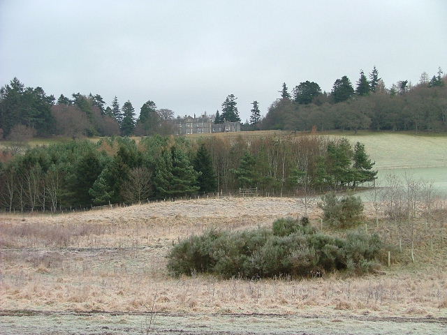
Lude House

Lude House (also known as House of Lude or Lude Estate) is a Category B listed country house and estate in Blair Atholl, Perth and Kinross, Scotland. It...

Càrn Liath (Munro)

Carn Liath (976 m) is a mountain in the Grampian Mountains of Scotland. It lies east of Blair Atholl in Perthshire, Scotland. Although belonging to the...

Bridge of Tilt

Bridge of Tilt (Scottish Gaelic: Drochaid Theilt) is a village in Perthshire, Scotland, built around the River Tilt (Scottish Gaelic: Abhainn Teilt), near...

Glen Tilt

Glen Tilt (Scottish Gaelic: Gleann Teilt) is a glen in the extreme north of Perthshire, Scotland. Beginning at the confines of Aberdeenshire, it follows...

Blair Atholl

Blair Atholl (from the Scottish Gaelic: Blàr Athall, originally Blàr Ath Fhodla) is a village in Perthshire, Scotland, built about the confluence of the...

Blair Castle

Blair Castle (in Scottish Gaelic: Caisteil Bhlàir) stands in its grounds near the village of Blair Atholl in Perthshire in Scotland. It is the ancestral...

Atholl Arms Hotel, Blair Atholl

The Atholl Arms Hotel is a hotel and restaurant in Blair Atholl, Perth and Kinross, Scotland. Standing on the B8079, it is a Category C listed building...

Nearby Amenities

Located within 500m of 56.79908,-3.7997545
Kirkton of Lude
Name Gd: Bail' na h-Eaglais'
Place: isolated_dwelling
Source Name: OS_OpenData_StreetView
Lat/Long: 56.7981524/-3.7979221
The data included in this document is from www.openstreetmap.org. The data is made available under ODbL.

Have you been to Brae of Lude?

Leave your review of Brae of Lude below (or comments, questions and feedback).