Allt y Derw

Downs, Moorland in Montgomeryshire

Wales

Allt y Derw

Eastbound A44, Penlon The A44 is a major road in the United Kingdom that runs for 155 miles from Oxford in southern England to Aberystwyth in west Wales.
<span class="nowrap"><a title="http://www.sabre-roads.org.uk/wiki/index.php?title=A44" rel="nofollow ugc noopener" href="http://www.sabre-roads.org.uk/wiki/index.php?title=A44">Link</a><img style="margin-left:2px;" alt="External link" title="External link - shift click to open in new window" src="https://s1.geograph.org.uk/img/external.png" width="10" height="10"/></span>  SABRE
<span class="nowrap"><a title="https://en.wikipedia.org/wiki/A44_road" rel="nofollow ugc noopener" href="https://en.wikipedia.org/wiki/A44_road">Link</a><img style="margin-left:2px;" alt="External link" title="External link - shift click to open in new window" src="https://s1.geograph.org.uk/img/external.png" width="10" height="10"/></span>  Wikipedia
Eastbound A44, Penlon Credit: David Dixon

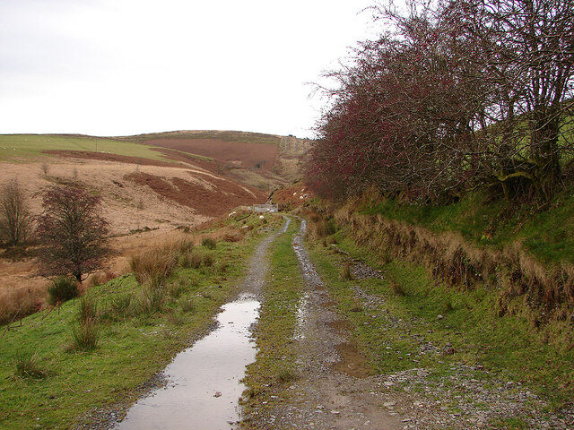
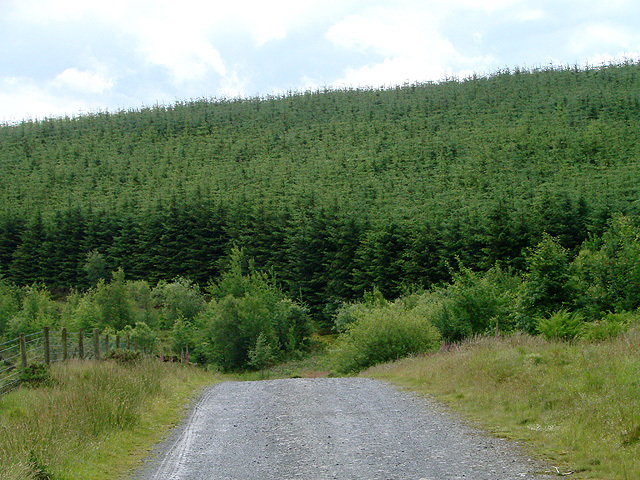
Allt y Derw is a picturesque area located in Montgomeryshire, Wales. Known for its stunning landscape and natural beauty, this region is characterized by its rolling downs and expansive moorlands. The name "Allt y Derw" translates to "hill of the oak," which is a fitting description as the area is dotted with majestic oak trees.

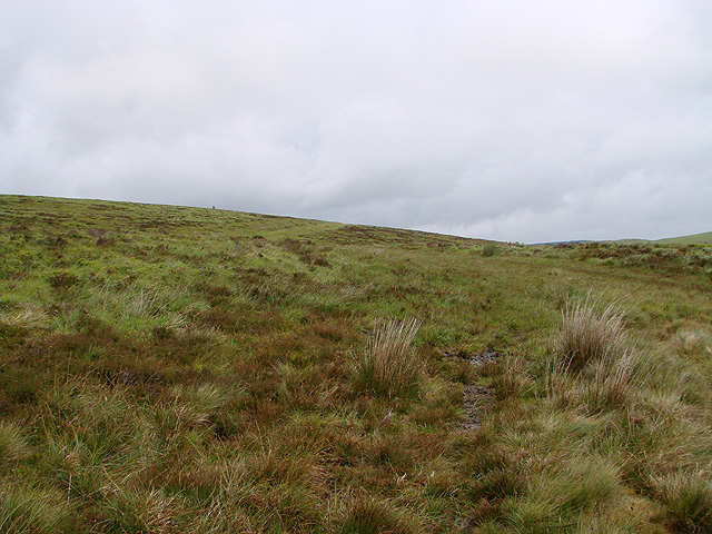
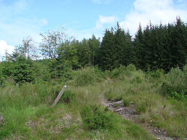
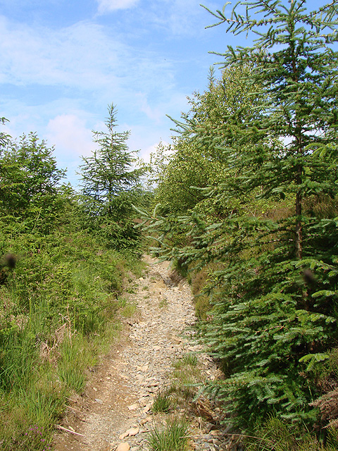
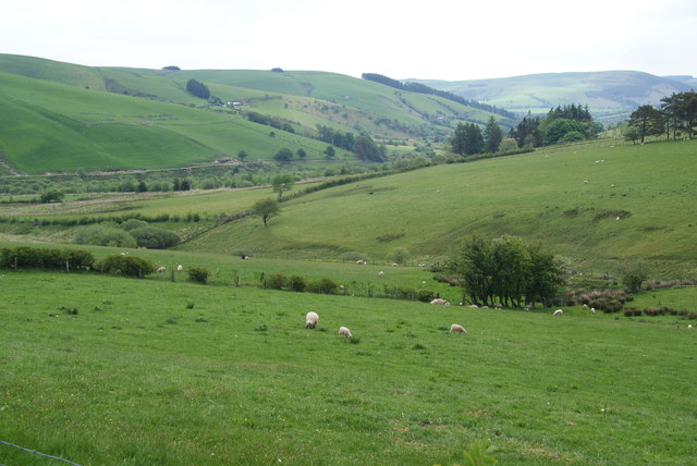
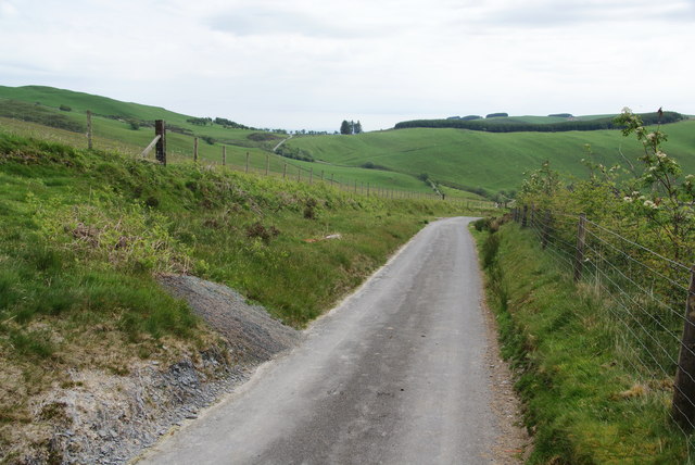
The downs of Allt y Derw offer breathtaking panoramic views, with their gentle slopes covered in lush green grass and dotted with wildflowers during the warmer months. These downs provide an ideal setting for outdoor activities such as hiking, picnicking, and nature walks. The area is home to a diverse range of wildlife, including birds, mammals, and insects, making it a haven for nature enthusiasts.

The moorlands of Allt y Derw are a spectacle to behold, with their vast expanses of heather and gorse creating a stunning purple and yellow tapestry. This unique ecosystem is home to a variety of rare plant species and provides a habitat for several bird species, including the elusive black grouse.

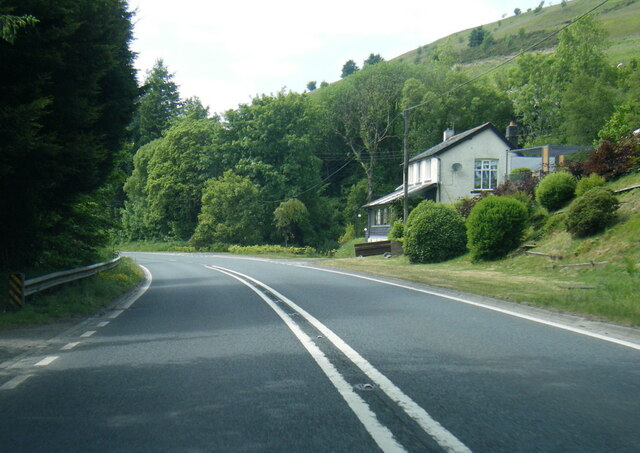
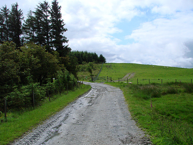
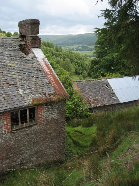
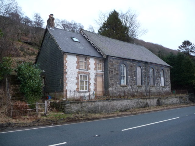
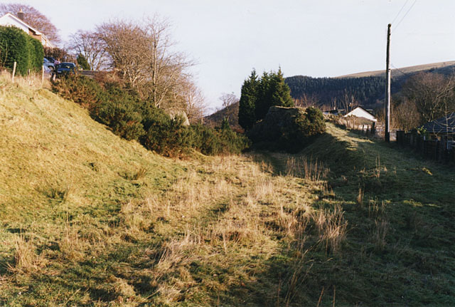
Visitors to Allt y Derw can also explore the nearby villages and towns, which offer a glimpse into the rich history and culture of the region. The area is dotted with charming cottages, traditional pubs, and historic landmarks, providing visitors with an authentic Welsh experience.

In conclusion, Allt y Derw in Montgomeryshire is a captivating destination for those seeking natural beauty and tranquility. With its rolling downs, expansive moorlands, and rich biodiversity, this area offers a truly immersive experience in the heart of Wales.

If you have any feedback on the listing, please let us know in the comments section below.
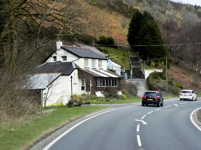
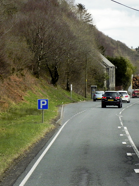
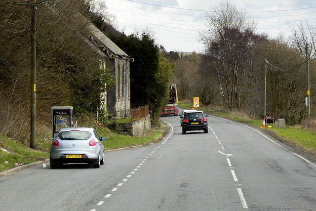
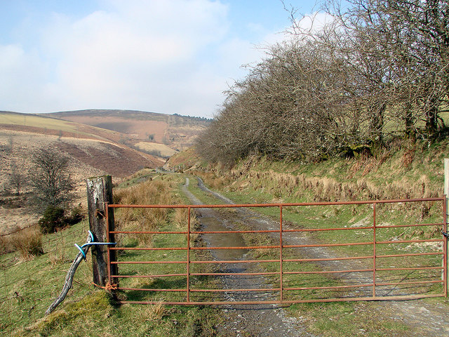
Allt y Derw Images

Images are sourced within 2km of 52.433918/-3.6582487 or Grid Reference SN8783. Thanks to Geograph Open Source API. All images are credited.

Eastbound A44, Penlon The A44 is a major road in the United Kingdom that runs for 155 miles from Oxford in southern England to Aberystwyth in west Wales.
<span class="nowrap"><a title="http://www.sabre-roads.org.uk/wiki/index.php?title=A44" rel="nofollow ugc noopener" href="http://www.sabre-roads.org.uk/wiki/index.php?title=A44">Link</a><img style="margin-left:2px;" alt="External link" title="External link - shift click to open in new window" src="https://s1.geograph.org.uk/img/external.png" width="10" height="10"/></span>  SABRE
<span class="nowrap"><a title="https://en.wikipedia.org/wiki/A44_road" rel="nofollow ugc noopener" href="https://en.wikipedia.org/wiki/A44_road">Link</a><img style="margin-left:2px;" alt="External link" title="External link - shift click to open in new window" src="https://s1.geograph.org.uk/img/external.png" width="10" height="10"/></span>  Wikipedia
Eastbound A44, Penlon
The A44 is a major road in the United Kingdom that runs for 155 miles from Oxford in southern England to Aberystwyth in west Wales. LinkExternal link SABRE LinkExternal link Wikipedia
Layby on Eastbound A44 near Tynllechwedd The A44 is a major road in the United Kingdom that runs for 155 miles from Oxford in southern England to Aberystwyth in west Wales.
<span class="nowrap"><a title="http://www.sabre-roads.org.uk/wiki/index.php?title=A44" rel="nofollow ugc noopener" href="http://www.sabre-roads.org.uk/wiki/index.php?title=A44">Link</a><img style="margin-left:2px;" alt="External link" title="External link - shift click to open in new window" src="https://s1.geograph.org.uk/img/external.png" width="10" height="10"/></span>  SABRE
<span class="nowrap"><a title="https://en.wikipedia.org/wiki/A44_road" rel="nofollow ugc noopener" href="https://en.wikipedia.org/wiki/A44_road">Link</a><img style="margin-left:2px;" alt="External link" title="External link - shift click to open in new window" src="https://s1.geograph.org.uk/img/external.png" width="10" height="10"/></span>  Wikipedia
Layby on Eastbound A44 near Tynllechwedd
The A44 is a major road in the United Kingdom that runs for 155 miles from Oxford in southern England to Aberystwyth in west Wales. LinkExternal link SABRE LinkExternal link Wikipedia
Telephone Kiosk next to the A44, Tynllechwedd The A44 is a major road in the United Kingdom that runs for 155 miles from Oxford in southern England to Aberystwyth in west Wales.
<span class="nowrap"><a title="http://www.sabre-roads.org.uk/wiki/index.php?title=A44" rel="nofollow ugc noopener" href="http://www.sabre-roads.org.uk/wiki/index.php?title=A44">Link</a><img style="margin-left:2px;" alt="External link" title="External link - shift click to open in new window" src="https://s1.geograph.org.uk/img/external.png" width="10" height="10"/></span>  SABRE
<span class="nowrap"><a title="https://en.wikipedia.org/wiki/A44_road" rel="nofollow ugc noopener" href="https://en.wikipedia.org/wiki/A44_road">Link</a><img style="margin-left:2px;" alt="External link" title="External link - shift click to open in new window" src="https://s1.geograph.org.uk/img/external.png" width="10" height="10"/></span>  Wikipedia
Telephone Kiosk next to the A44, Tynllechwedd
The A44 is a major road in the United Kingdom that runs for 155 miles from Oxford in southern England to Aberystwyth in west Wales. LinkExternal link SABRE LinkExternal link Wikipedia
This way to Hafren A right of way leading to the Hafren Forest through Cwm Bidno. Although the gate is chained shut, there is pedestrian access through a gate out of view on the right.
This way to Hafren
A right of way leading to the Hafren Forest through Cwm Bidno. Although the gate is chained shut, there is pedestrian access through a gate out of view on the right.
Right of way through Cwm Bidno Leading into the Hafren Forest.
Right of way through Cwm Bidno
Leading into the Hafren Forest.
A44 at Penlon
A44 at Penlon
A44 north of Nanty Farm
Lay-by by A44 near Penlon Screened by evergreen trees, and overlooking the Wye valley
Lay-by by A44 near Penlon
Screened by evergreen trees, and overlooking the Wye valley
Track at Comins Bwlch-y-pridd Comins = common land. The track leads to the small forestry area on Esgair Lyss, but that is hidden by the landscape in this view.
Track at Comins Bwlch-y-pridd
Comins = common land. The track leads to the small forestry area on Esgair Lyss, but that is hidden by the landscape in this view.
Track to forestry at Ffos y Ffwdan and then onto Bwlch y Groes Somewhat unusually these days, this un-mettled track, according to local signage, is still classified as a public road, in addition to being a bridleway.
Track to forestry at Ffos y Ffwdan and then onto Bwlch y Groes
Somewhat unusually these days, this un-mettled track, according to local signage, is still classified as a public road, in addition to being a bridleway.
Forestry at Ffos y Ffwdan
Disused Farm, Bwlch-y-Pridd Wye valley beyond.
Disused Farm, Bwlch-y-Pridd
Wye valley beyond.
Footpath in Hafren Forest The waymarked right of way footpath to Drum Maen and Bryn Bach leaves the main forestry road into Hafren near Panty-yr-esgair. Inspection of the map and the photo location will show that the actual path is a little way south of the marked position.
Footpath in Hafren Forest
The waymarked right of way footpath to Drum Maen and Bryn Bach leaves the main forestry road into Hafren near Panty-yr-esgair. Inspection of the map and the photo location will show that the actual path is a little way south of the marked position.
Footpath to Drum Maen This well defined footpath climbs steadily to near the summit of Drum Maen. Wet underfoot in places (what's new in Hafren?) but the main problem in walking it is deep rutting caused by some form of mechanical vehicle.
Footpath to Drum Maen
This well defined footpath climbs steadily to near the summit of Drum Maen. Wet underfoot in places (what's new in Hafren?) but the main problem in walking it is deep rutting caused by some form of mechanical vehicle.
Old chapel and manse beside the A44 at Penlon Like many old buildings in this area its use is no longer supported and it has fallen out of use and into a state of some disrepair.
Old chapel and manse beside the A44 at Penlon
Like many old buildings in this area its use is no longer supported and it has fallen out of use and into a state of some disrepair.
Gated road near Cefn-y-cownen You have to stop and get out of the car so you may as well take a picture. This is the only gate on this road between the A44 and the Severn Valley.
Gated road near Cefn-y-cownen
You have to stop and get out of the car so you may as well take a picture. This is the only gate on this road between the A44 and the Severn Valley.
Farmland above Pontbrenllwyd Afon Bidno runs along the bottom from left to right.
Farmland above Pontbrenllwyd
Afon Bidno runs along the bottom from left to right.
Road below Comins Bwlch-y-pridd It descends from here into the valley of Afon Bidno.
Road below Comins Bwlch-y-pridd
It descends from here into the valley of Afon Bidno.
Show me another place!

Allt y Derw is located at Grid Ref: SN8783 (Lat: 52.433918, Lng: -3.6582487)

Unitary Authority: Powys

Police Authority: Dyfed Powys

What 3 Words

///downs.hiker.blast. Near Llanidloes, Powys

Nearby Locations

Allt y Derw

Related Wikis

Llangurig railway station

Llangurig railway station was intended to serve the village and rural locale of Llangurig in the Welsh county of Powys. The station, which was on the Llangurig...

Blaen-y-glyn

Blaen-y-glyn is an area in the community of Llangurig, Powys, Wales, which is 67 miles (108 km) from Cardiff and 160 miles (258 km) from London. Cadw-listed...

Llangurig branch

The Llangurig branch was a part of a proposed scheme by the Manchester and Milford Railway (M&MR) to connect industrialised Northwest England with the...

Llangurig

Llangurig is both a village and a community in Montgomeryshire, Powys, Wales. The population was 723 in the 2011 UK Census. The community includes the...

Nearby Amenities

Located within 500m of 52.433918,-3.6582487
Allt Y Derw
Natural: peak
Lat/Long: 52.4327794/-3.651997
The data included in this document is from www.openstreetmap.org. The data is made available under ODbL.

Have you been to Allt y Derw?

Leave your review of Allt y Derw below (or comments, questions and feedback).