Pen yr Allt Isaf

Downs, Moorland in Merionethshire

Wales

Pen yr Allt Isaf

Derelict chapel, Cwm Cywarch
Derelict chapel, Cwm Cywarch Credit: Steven Brown

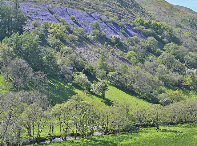
Pen yr Allt Isaf is a stunning area situated in the county of Merionethshire in Wales. Known for its breathtaking natural beauty, Pen yr Allt Isaf is characterized by its picturesque downs and moorland landscapes.

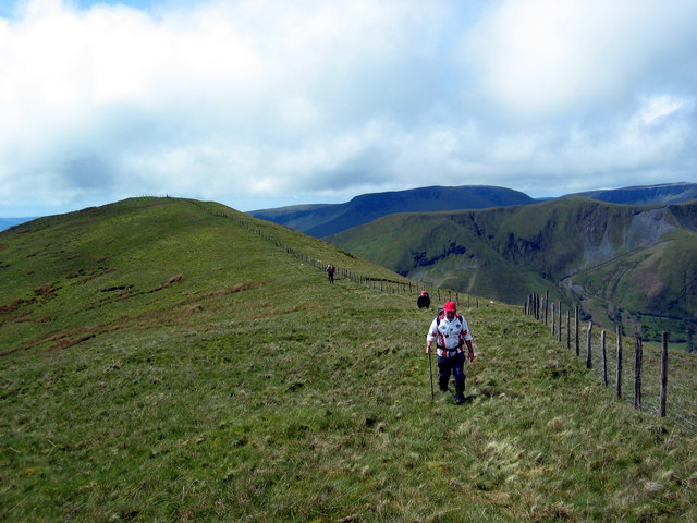
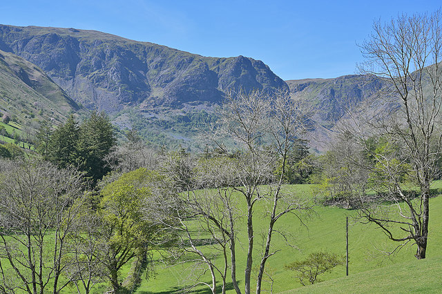
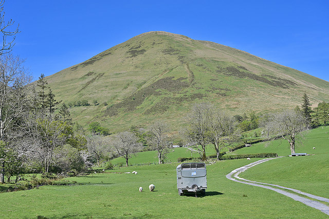
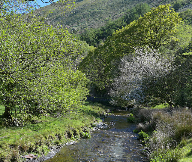
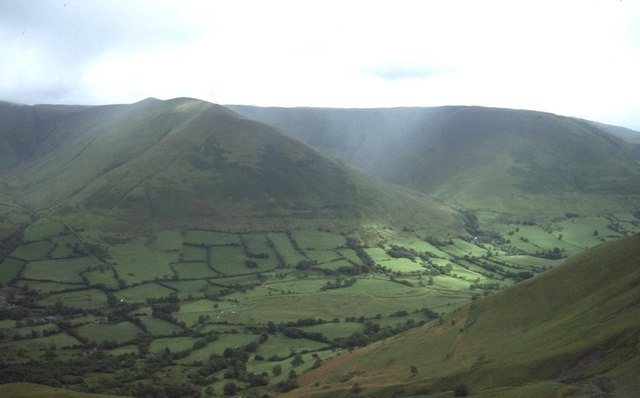
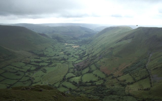
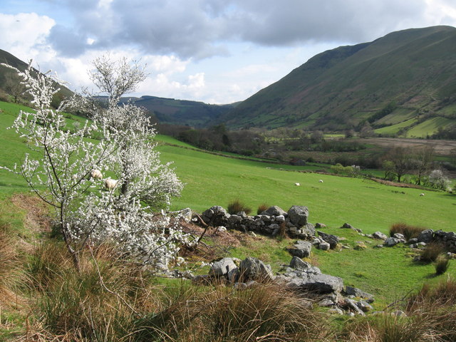
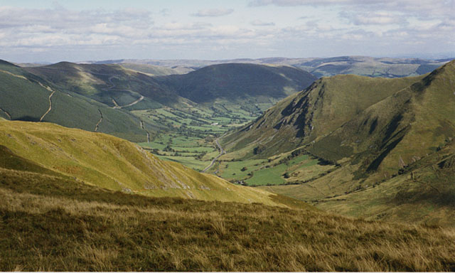
The downs in Pen yr Allt Isaf are expansive stretches of rolling hills covered in lush grass and dotted with grazing sheep. These downs offer panoramic views of the surrounding countryside and are a haven for hikers and nature enthusiasts. The gentle slopes make it an ideal location for leisurely walks, picnics, and outdoor activities.

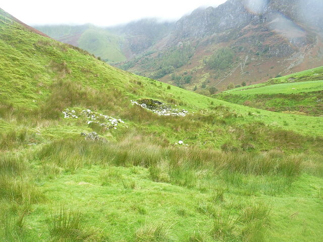
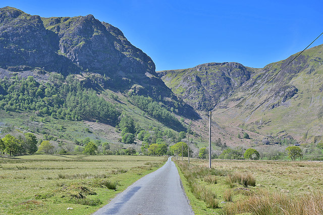
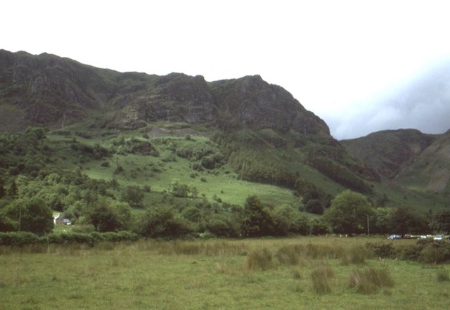
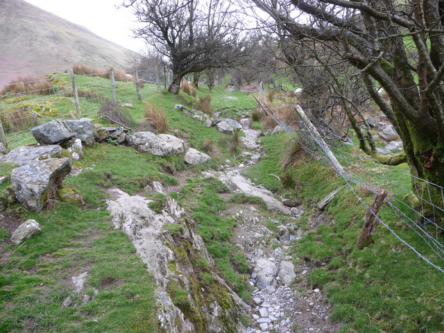
The moorland in Pen yr Allt Isaf is a rugged and wild terrain, characterized by its vast open spaces, heather-covered hills, and rocky outcrops. This untamed landscape is home to a variety of flora and fauna, including birds of prey, wild ponies, and unique plant species. The moorland provides a sense of solitude and tranquility, making it a popular destination for those seeking a remote and peaceful retreat.

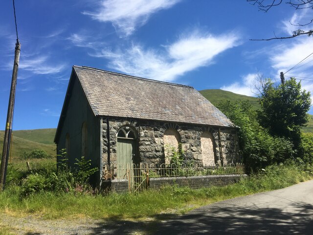
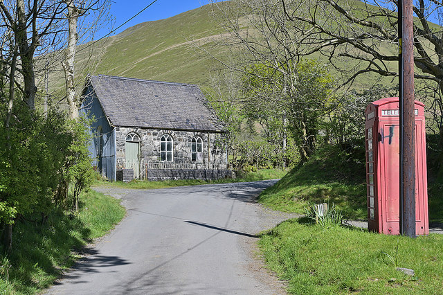
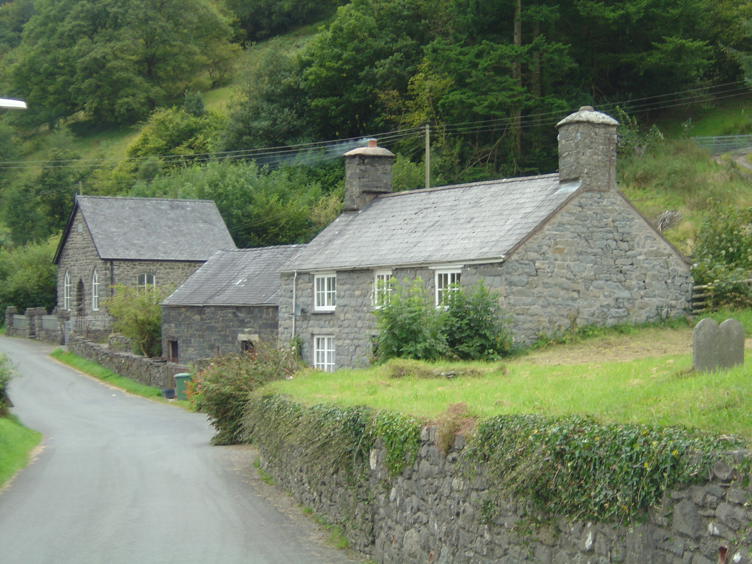
The area surrounding Pen yr Allt Isaf is rich in history and cultural heritage. Ruins of ancient settlements and burial sites can be found scattered throughout the landscape, offering a glimpse into the region's past. The nearby villages are also worth exploring, with their charming stone cottages, traditional pubs, and friendly locals.

Overall, Pen yr Allt Isaf is a must-visit destination for nature lovers and history enthusiasts alike. Its downs and moorland offer a diverse range of landscapes, providing a unique and unforgettable experience for visitors.

If you have any feedback on the listing, please let us know in the comments section below.

Pen yr Allt Isaf Images

Images are sourced within 2km of 52.747251/-3.6713684 or Grid Reference SH8717. Thanks to Geograph Open Source API. All images are credited.

Derelict chapel, Cwm Cywarch
Ruined buildings in Hengwm Not recorded, as far as I can tell, by any of the archeological investigations of the uplands over the years, so the most likely explanation is that they are former hafods of little interest or importance. There is a history of mining and quarrying in the Hengwm and Cwm Cywarch area, and possibly they may have been associated with that in some way, but that's pure speculation.
Ruined buildings in Hengwm
Not recorded, as far as I can tell, by any of the archeological investigations of the uplands over the years, so the most likely explanation is that they are former hafods of little interest or importance. There is a history of mining and quarrying in the Hengwm and Cwm Cywarch area, and possibly they may have been associated with that in some way, but that's pure speculation.
Pen yr Allt Uchaf Cerddwyr yn agosau ay gopa Pen yr Allt Uchaf.

Walkers approaching the summit of Pen yr Allt Uchaf (top of the highest slope).
Pen yr Allt Uchaf
Cerddwyr yn agosau ay gopa Pen yr Allt Uchaf. Walkers approaching the summit of Pen yr Allt Uchaf (top of the highest slope).
Hillside blues, above Ty'n-y-wern farm An intense patch of bluebells stands out on the hillside above the farm. There were numerous other patches on the sides of the cwm, but this was probably the best.

Thanks to those Geograph members who confirmed that these were bluebells.
Hillside blues, above Ty'n-y-wern farm
An intense patch of bluebells stands out on the hillside above the farm. There were numerous other patches on the sides of the cwm, but this was probably the best. Thanks to those Geograph members who confirmed that these were bluebells.
Looking up Cwm Cywarch A similar view to <a href="https://www.geograph.org.uk/photo/1521304">SH8616 : Trees in Cwm Cywarch</a>, but in a different season.
Looking up Cwm Cywarch
A similar view to SH8616 : Trees in Cwm Cywarch, but in a different season.
Pen yr Allt Uchaf, seen from Cwm Cywarch The steep sided hill seen from the start of the track to Ceunant farm.
Pen yr Allt Uchaf, seen from Cwm Cywarch
The steep sided hill seen from the start of the track to Ceunant farm.
Chapel and phonebox, Cwm Cywarch
Road over the Fawnog Fawr "Fawnog" is peat bog in English. The wide flat marshy floor of the cwm here suggests a former lake.
Road over the Fawnog Fawr
"Fawnog" is peat bog in English. The wide flat marshy floor of the cwm here suggests a former lake.
The Afon Cywarch, below the Fawnog Fawr
Cwm Cywarch A very fine example of a glacial U shaped valley.
Cwm Cywarch
A very fine example of a glacial U shaped valley.
Cwm Cywarch A very fine example of a glacial U shaped valley.
Cwm Cywarch
A very fine example of a glacial U shaped valley.
Fawnog Fawr Cwm Cywarch before the car park was built, and parking was informal on the common.
Fawnog Fawr
Cwm Cywarch before the car park was built, and parking was informal on the common.
Rough and winding path out of the cwm This old sunken, very rough and quite twisting path takes a footpath from Cwm Cywarch into Cwm Hengwm. Sheep and new born lambs are pastured each side.
Rough and winding path out of the cwm
This old sunken, very rough and quite twisting path takes a footpath from Cwm Cywarch into Cwm Hengwm. Sheep and new born lambs are pastured each side.
Track out of Blaencywarch The track runs above sheep pastures and below is Blaencywarch Farm. Some of the fields on the valley side are very small by modern standards - a rare but very welcome sight.
Track out of Blaencywarch
The track runs above sheep pastures and below is Blaencywarch Farm. Some of the fields on the valley side are very small by modern standards - a rare but very welcome sight.
Track up Cwm Hengwm This track soon becomes just a footpath climbing steadily up the valley side.
Track up Cwm Hengwm
This track soon becomes just a footpath climbing steadily up the valley side.
Footpath up Hengwm The path ascends steadily up this steep but beautiful valley side.
Footpath up Hengwm
The path ascends steadily up this steep but beautiful valley side.
Blaencywarch
Blaencywarch
Stream tumbling down Pen yr Allt Uchaf One of several steep streams dropping into Hengwm.
Stream tumbling down Pen yr Allt Uchaf
One of several steep streams dropping into Hengwm.
Show me another place!

Pen yr Allt Isaf is located at Grid Ref: SH8717 (Lat: 52.747251, Lng: -3.6713684)

Unitary Authority: Gwynedd

Police Authority: North Wales

What 3 Words

///roosters.clashes.caked. Near Cwm-Llinau, Powys

Nearby Locations

Pen yr Allt Isaf Y Ceunant

Related Wikis

Aber-Cywarch

Cywarch is a location at the head of Cwm Cywarch in the Snowdonia National Park, in Gwynedd, Wales. Several streams flow through the area, uniting to form...

Afon Cerist

The Afon Cerist is a small river that flows from underneath Craig Portas, the cliffs on the north side of Maesglase mountain, to meet the River Dyfi at...

Llanymawddwy

Llanymawddwy () is a village in the community of Mawddwy in south-east Gwynedd, Wales, which is to the north of the larger village of Dinas Mawddwy, on...

Craig Cywarch

Craig Cywarch is an extensive crag looming above Cwm Cywarch. The nearest village is Dinas Mawddwy on the A470. Climbing routes on the various buttresses...

Dinas Mawddwy

Dinas Mawddwy () is a village in the community of Mawddwy in south-east Gwynedd, north Wales. It lies within the Snowdonia National Park, but just to the...

Mawddwy

Mawddwy is a community in the county of Gwynedd, Wales, and is 88.3 miles (142.2 km) from Cardiff and 172.8 miles (278.0 km) from London. In 2011 the population...

Minllyn quarry

Minllyn quarry was a slate quarry near Dinas Mawddwy in Wales that opened before 1793 and continued working intermittently until 1925. The quarry is located...

Pont Minllyn

Pont Minllyn (also known as Pont-y-Ffinant or Pontrusk Bridge) is a bridge spanning the Afon Dyfi, north of the village of Mallwyd, in Gwynedd, Wales....

Nearby Amenities

Located within 500m of 52.747251,-3.6713684
Pen Yr Allt Isaf
Ele: 557
Natural: peak
Lat/Long: 52.7471549/-3.672048
The data included in this document is from www.openstreetmap.org. The data is made available under ODbL.

Have you been to Pen yr Allt Isaf?

Leave your review of Pen yr Allt Isaf below (or comments, questions and feedback).