East Anstey Common

Downs, Moorland in Devon North Devon

England

East Anstey Common

Castle Bridge, Dulverton, Somerset Looking north over Castle Bridge.  Just to the right of this, Danes's Brook, which flows under the bridge, joins the river Barle. Presumably the  bridge gets its name from Brewer's Castle, the site of which is out-of-shot up the hill from the top left of this image.
Castle Bridge, Dulverton, Somerset Credit: Andy Gilbert

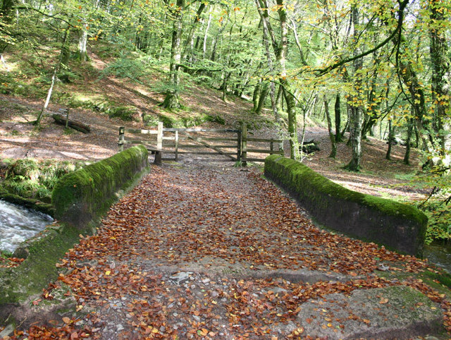
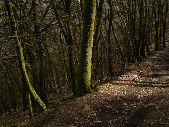
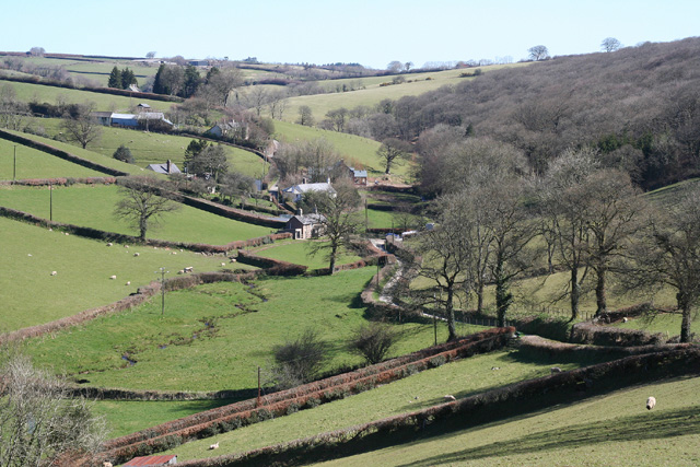
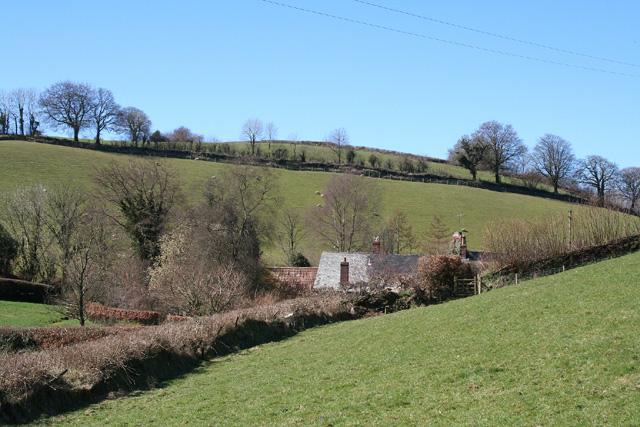
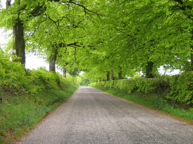
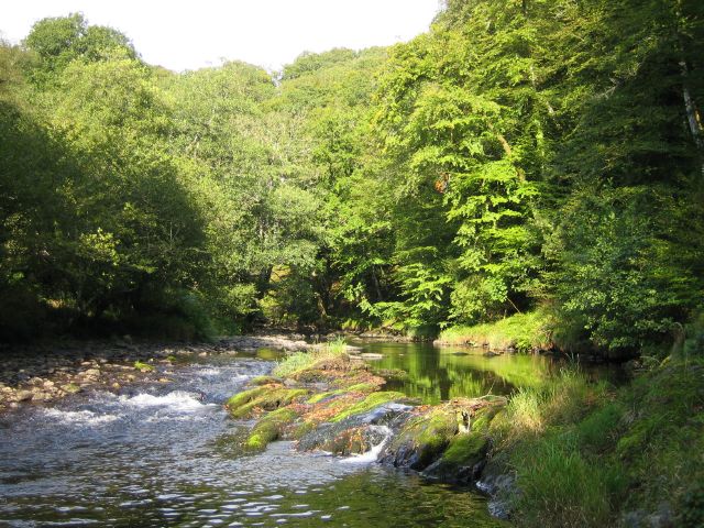
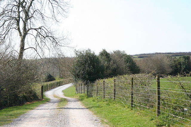
East Anstey Common is a vast area of natural beauty located in the county of Devon, England. Covering a total area of approximately 500 hectares, it is a diverse landscape comprising of downs, moorland, and woodland. The common is situated within the Exmoor National Park, offering visitors breathtaking views of rolling hills, heather-covered moorland, and ancient woodlands.

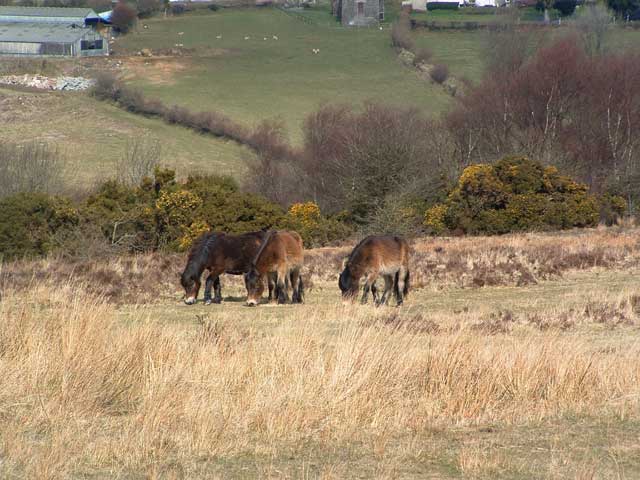
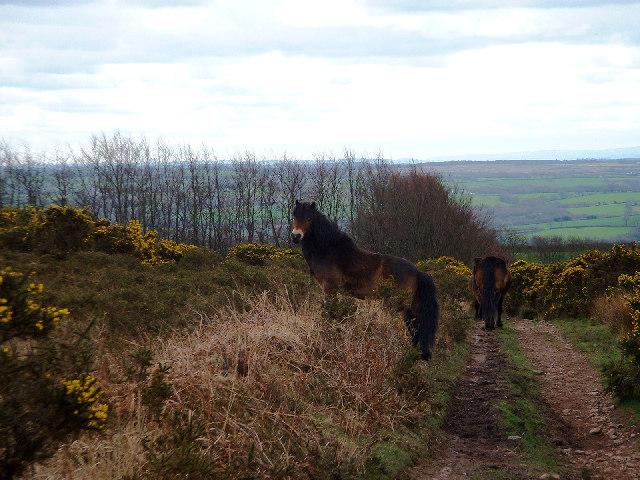
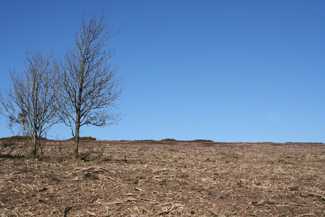
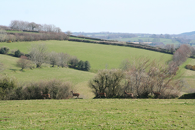
The common is home to a wide variety of flora and fauna, making it a haven for nature enthusiasts. Heathers, gorse, and bracken dominate the moorland areas, while oak and beech trees can be found scattered throughout the woodlands. The common is also rich in wildlife, with sightings of red deer, Exmoor ponies, and various bird species such as skylarks, buzzards, and kestrels being common.

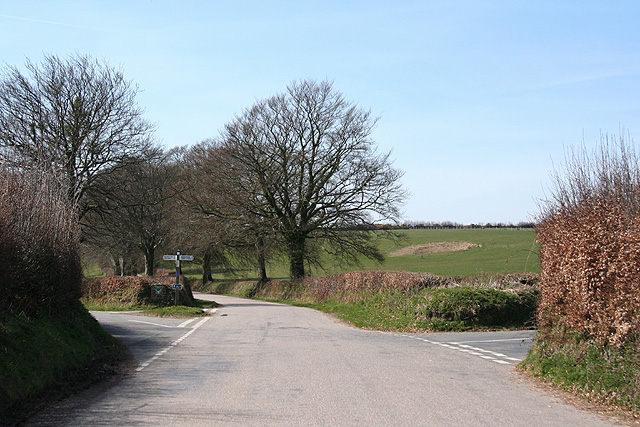
Walking trails crisscross the common, allowing visitors to explore its diverse landscapes and soak in its natural beauty. These trails range from easy strolls through the woodlands to more challenging hikes across the open moorland. The common also offers opportunities for activities such as horse riding, cycling, and picnicking, making it a popular destination for families and outdoor enthusiasts.

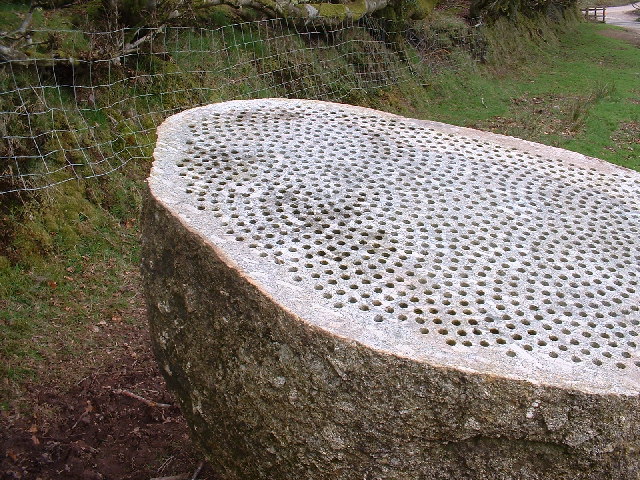
East Anstey Common is not only a place of natural beauty but also holds historical significance. It is home to several ancient archaeological sites, including stone circles and burial mounds dating back to the Bronze Age. These remnants of the past add an extra layer of intrigue and fascination to the common, attracting history buffs and archaeology enthusiasts.

Overall, East Anstey Common in Devon is a captivating landscape that offers visitors a chance to immerse themselves in the beauty of nature, explore its rich biodiversity, and experience the region's history and heritage.

If you have any feedback on the listing, please let us know in the comments section below.

East Anstey Common Images

Images are sourced within 2km of 51.046265/-3.6096373 or Grid Reference SS8728. Thanks to Geograph Open Source API. All images are credited.

Castle Bridge, Dulverton, Somerset Looking north over Castle Bridge.  Just to the right of this, Danes's Brook, which flows under the bridge, joins the river Barle. Presumably the  bridge gets its name from Brewer's Castle, the site of which is out-of-shot up the hill from the top left of this image.
Castle Bridge, Dulverton, Somerset
Looking north over Castle Bridge. Just to the right of this, Danes's Brook, which flows under the bridge, joins the river Barle. Presumably the bridge gets its name from Brewer's Castle, the site of which is out-of-shot up the hill from the top left of this image.
Exmoor Ponies on Anstey Money Common
Exe Valley Way: near Great Gate On the Exe Valley Way between Hawkridge and Brewer Castle.
Exe Valley Way: near Great Gate
On the Exe Valley Way between Hawkridge and Brewer Castle.
Exmoor ponies on Woodland Common Near Badlake Moor Cross
Exmoor ponies on Woodland Common
Near Badlake Moor Cross
IIMW sculpture by Peter Randall Page See also Granite Song in <a href="https://www.geograph.org.uk/gridref/SX7189">SX7189</a>
IIMW sculpture by Peter Randall Page
See also Granite Song in SX7189
East Anstey: Waddicombe Looking north east from the start of a bridleway to Badlake Farm. There is some evidence for a medieval watermill at Waddicombe
East Anstey: Waddicombe
Looking north east from the start of a bridleway to Badlake Farm. There is some evidence for a medieval watermill at Waddicombe
East Anstey: approaching Oak Farm Looking west-south-west on a bridleway from Waddicombe to Dunsley
East Anstey: approaching Oak Farm
Looking west-south-west on a bridleway from Waddicombe to Dunsley
West Anstey: Woodland Common The common has recently stripped of gorse. Looking north east from a point above Woodland Farm
West Anstey: Woodland Common
The common has recently stripped of gorse. Looking north east from a point above Woodland Farm
Spring Beeches Beech trees lining the road on Twitchen Common.
Spring Beeches
Beech trees lining the road on Twitchen Common.
River Barle Looking upstream, water level very low after the dry summer.
River Barle
Looking upstream, water level very low after the dry summer.
Dulverton: by Lower Chilcott A cat enjoying Easter sunshine
Dulverton: by Lower Chilcott
A cat enjoying Easter sunshine
Dulverton: Higher Chilcott Farm Home of Pine Lodge Riding Holidays. Looking north east. See <span class="nowrap"><a title="http://www.pinelodge.countryside-inter.net/introductionframe.htm" rel="nofollow ugc noopener" href="http://www.pinelodge.countryside-inter.net/introductionframe.htm">Link</a><img style="margin-left:2px;" alt="External link" title="External link - shift click to open in new window" src="https://s1.geograph.org.uk/img/external.png" width="10" height="10"/></span>
Dulverton: Higher Chilcott Farm
Home of Pine Lodge Riding Holidays. Looking north east. See LinkExternal link
Dulverton: track to Cawkett Looking south west
Dulverton: track to Cawkett
Looking south west
Dulverton: five hinds Near Chilcott Cross, looking east
Dulverton: five hinds
Near Chilcott Cross, looking east
Dulverton: by Chilcott Cross Looking north east towards a barn
Dulverton: by Chilcott Cross
Looking north east towards a barn
East Anstey: Five Cross Ways Looking west-south-west. The road ahead leads to West Anstey Common and Molland. The left turn runs to West Anstey and Yeo Mill. Right for Hawkridge and Tarr Steps. Behind the camera are roads from Oldways End and Dulverton. This is also the border between Somerset and Devon and the boundary of the Exmoor National Park - the park sign is by the signpost
East Anstey: Five Cross Ways
Looking west-south-west. The road ahead leads to West Anstey Common and Molland. The left turn runs to West Anstey and Yeo Mill. Right for Hawkridge and Tarr Steps. Behind the camera are roads from Oldways End and Dulverton. This is also the border between Somerset and Devon and the boundary of the Exmoor National Park - the park sign is by the signpost
East Anstey: East Liscombe A farmhouse with self-catering holiday cottages rated 4-star by the English Tourism Council. The barn on the right retains an old threshing machine which was powered by horses in a round house attached to the building. Looking west-north-west. See also <span class="nowrap"><a title="http://www.ansteymillscottagedevon.co.uk" rel="nofollow ugc noopener" href="http://www.ansteymillscottagedevon.co.uk">Link</a><img style="margin-left:2px;" alt="External link" title="External link - shift click to open in new window" src="https://s1.geograph.org.uk/img/external.png" width="10" height="10"/></span>
East Anstey: East Liscombe
A farmhouse with self-catering holiday cottages rated 4-star by the English Tourism Council. The barn on the right retains an old threshing machine which was powered by horses in a round house attached to the building. Looking west-north-west. See also LinkExternal link
East Anstey: West Liscombe Looking south west by the path from Dulverton to Waddicombe
East Anstey: West Liscombe
Looking south west by the path from Dulverton to Waddicombe
Show me another place!

East Anstey Common is located at Grid Ref: SS8728 (Lat: 51.046265, Lng: -3.6096373)

Administrative County: Devon

District: North Devon

Police Authority: Devon and Cornwall

What 3 Words

///engaging.retract.reception. Near Dulverton, Somerset

Related Wikis

Mounsey Castle

Mounsey Castle is an Iron Age irregular triangular earthwork of 1.75 hectares (4.3 acres) north west of Dulverton, Somerset, England. It has been scheduled...

Brewer's Castle

Brewer's Castle is a defended Iron Age settlement in the West Somerset district of Somerset, England. The hill fort is situated approximately 2 miles...

Church of St Giles, Hawkridge

The Anglican Church of St Giles in Hawkridge, Somerset, England was built in the 14th century. It is a Grade II* listed building. == History == The oldest...

West Anstey

West Anstey is a village and civil parish on the River Yeo, about 5 miles west of Dulverton, in the North Devon district, in the county of Devon, England...

Related Videos

Tarr Steps Exmoor walk with stunning autumn colours, 4K UHD

walkingtour #walk #notalking A circular autumn walk from Tarr Steps in Exmoor, Somerset, UK crossing at Hinds Pit bridge and ...

A Final Walk Of Autumn...Exmoor...TARR Steps and the River Barle and the most Beautiful RAY of LIGHT

a final walk of autumn colours around the river bare on exmoor national park, all the leaves are almost gone and lying on the ...

Have you been to East Anstey Common?

Leave your review of East Anstey Common below (or comments, questions and feedback).