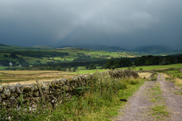
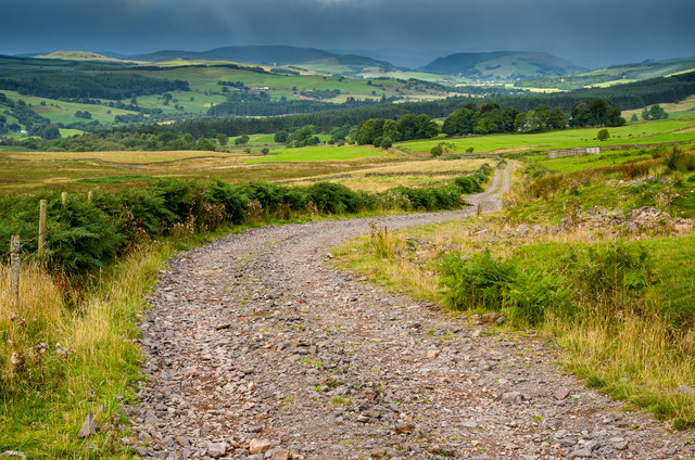
Hill Moss

Downs, Moorland in Dumfriesshire

Scotland

Hill Moss

Steil Road
Steil Road Credit: Steven Brown

The requested URL returned error: 429 Too Many Requests

If you have any feedback on the listing, please let us know in the comments section below.

Hill Moss Images

Images are sourced within 2km of 55.176349/-3.779043 or Grid Reference NX8688. Thanks to Geograph Open Source API. All images are credited.

Steil Road
Steil Road
Glenlaugh Farm
Glenlaugh Farm
A Hill Track This is a public footpath which passes Glenlaugh Farm
A Hill Track
This is a public footpath which passes Glenlaugh Farm
Stock Shelter Roofless shelter for tougher breeds
Stock Shelter
Roofless shelter for tougher breeds
House on the Hill
House on the Hill
Sheep at Glenlaugh
Sheep at Glenlaugh
The photographers friend
The stormy sky Rain advancing down the cairn valley
The stormy sky
Rain advancing down the cairn valley
Above Breconside
Above Breconside
An estate cottage An entrance and cottage at Barjarg
An estate cottage
An entrance and cottage at Barjarg
Gracefield Farm
Gracefield Farm
Kirkbride Farm
Kirkbride Farm
The Road to Kirkbride
Hill Sheep
Hill Sheep
The Kirkbride Road
The Kirkbride Road
View towards Kirkbride Hill
Low Kirkbride
Low Kirkbride
Kirkbride
Kirkbride
Show me another place!

Hill Moss is located at Grid Ref: NX8688 (Lat: 55.176349, Lng: -3.779043)

Unitary Authority: Dumfries and Galloway

Police Authority: Dumfries and Galloway

What 3 Words

///muffin.baseballs.puff. Near Thornhill, Dumfries & Galloway

Nearby Locations

Hill Moss

Related Wikis

Barjarg Tower

Barjarg Tower is an L-plan tower house probably dating from 1680, four miles south-east of Penpont, Dumfriesshire, Scotland. It is attached to a 19th...

Barburgh Mill

Barburgh Mill is a hamlet composed of an old lint mill, later extended as a woollen mill and associated buildings which lies north of Auldgirth on the...

Crossford railway station

Crossford is a closed station of the Cairn Valley Light Railway branch, from Dumfries. It served the rural area of Crossford in Dumfries and Galloway...

Dunscore

Dunscore (['dʌnskər] / 'DUN-skur', less commonly ['dunskɔ:r] / 'DUN-score') is a small village which lies 9 miles (14 km) northwest of Dumfries on the...

Nearby Amenities

Located within 500m of 55.176349,-3.779043
Power: pole
Lat/Long: 55.176908/-3.7719123
Power: pole
Lat/Long: 55.1772496/-3.7728733
Power: pole
Lat/Long: 55.1775634/-3.7738131
Power: pole
Lat/Long: 55.1779159/-3.7747996
Power: pole
Lat/Long: 55.1782708/-3.7758072
Power: pole
Lat/Long: 55.178627/-3.7768086
Power: pole
Lat/Long: 55.1789553/-3.7777271
Power: pole
Lat/Long: 55.1792836/-3.7786648
Power: pole
Lat/Long: 55.1796506/-3.7797319
Power: pole
Lat/Long: 55.1800261/-3.7807566
Power: pole
Lat/Long: 55.180352/-3.7817367
Power: pole
Lat/Long: 55.1792581/-3.7812021
Power: pole
Lat/Long: 55.178925/-3.7825046
Power: pole
Lat/Long: 55.1786234/-3.7836142
Power: pole
Lat/Long: 55.1783484/-3.7846537
The data included in this document is from www.openstreetmap.org. The data is made available under ODbL.

Have you been to Hill Moss?

Leave your review of Hill Moss below (or comments, questions and feedback).