Woodland Common

Downs, Moorland in Devon North Devon

England

Woodland Common

Exmoor Ponies on Anstey Money Common
Exmoor Ponies on Anstey Money Common Credit: Grant Sherman

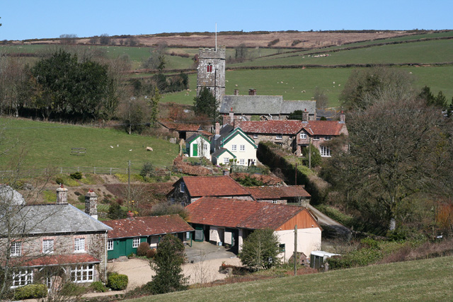
Woodland Common, Devon is a picturesque area located in the southwest of England. It is a diverse landscape that encompasses woodlands, downs, and moorland, offering a unique and varied experience for visitors.

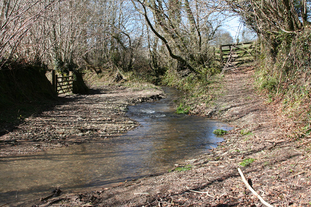
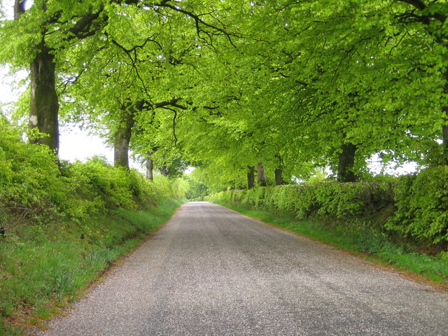
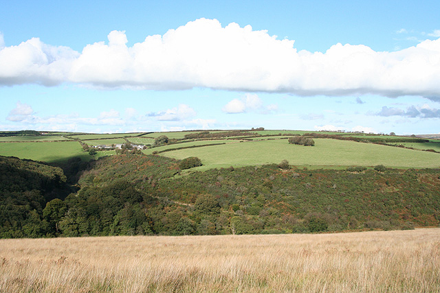
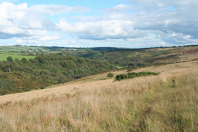
The woodlands in Woodland Common are characterized by a rich variety of trees, including oak, beech, and birch. These dense forests provide a haven for wildlife, with numerous species of birds, mammals, and insects calling this area their home. The woodlands offer a tranquil setting for nature enthusiasts, providing opportunities for walking, birdwatching, and exploring the flora and fauna.

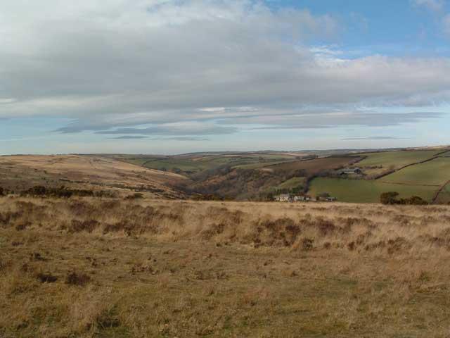
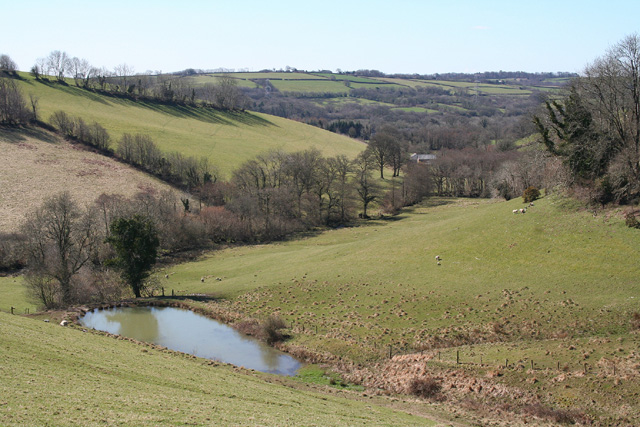
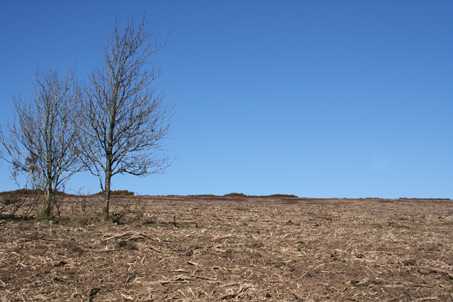
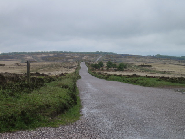
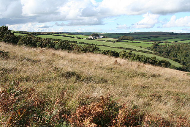
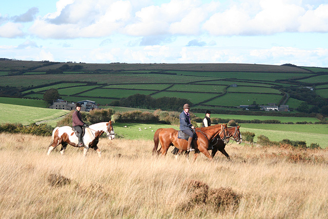
The downs in Woodland Common are rolling hills covered in lush grasslands. These open spaces offer breathtaking panoramic views of the surrounding countryside. The downs are perfect for hiking, picnicking, and even kite flying. Wildflowers dot the landscape during the warmer months, creating a colorful and vibrant scene.

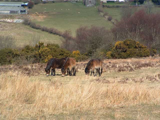
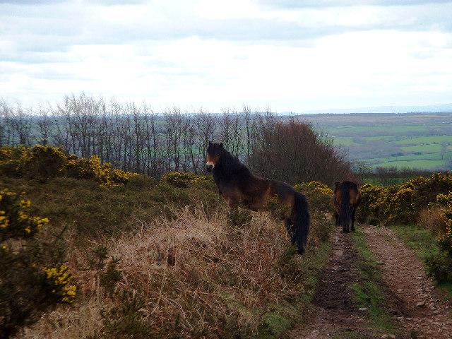
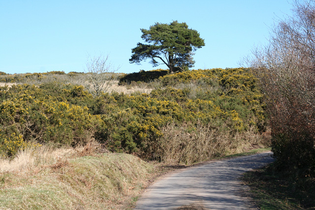
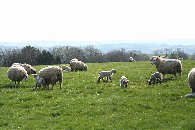
Moorland is another prominent feature of Woodland Common. It is characterized by vast expanses of heather, gorse, and bracken. The moorland is a unique and rugged environment, with its own distinct ecosystem. Visitors can observe a wide range of wildlife, including ponies, deer, and birds of prey. The moorland also boasts ancient archaeological sites, such as stone circles and burial mounds, adding a historical element to this already captivating landscape.

Woodland Common, Devon offers a diverse range of natural beauty, from the serene woodlands to the expansive downs and the rugged moorland. It is a haven for nature enthusiasts, offering a peaceful retreat and a chance to immerse oneself in the stunning scenery and abundant wildlife that this area has to offer.

If you have any feedback on the listing, please let us know in the comments section below.

Woodland Common Images

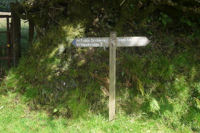
Images are sourced within 2km of 51.04711/-3.6380996 or Grid Reference SS8528. Thanks to Geograph Open Source API. All images are credited.

Exmoor Ponies on Anstey Money Common
Anstey Money Common On the Two Moors Way
Anstey Money Common
On the Two Moors Way
Exmoor ponies on Woodland Common Near Badlake Moor Cross
Exmoor ponies on Woodland Common
Near Badlake Moor Cross
IIMW sculpture by Peter Randall Page See also Granite Song in <a href="https://www.geograph.org.uk/gridref/SX7189">SX7189</a>
IIMW sculpture by Peter Randall Page
See also Granite Song in SX7189
West Anstey: village Looking north from the Two Moors Way
West Anstey: village
Looking north from the Two Moors Way
West Anstey: churchyard The present church was dedicated in November 1319 and was heavily restored in 1880. It is now St Petrock’s but may have been dedicated to the Holy Trinity in the 14th century. A Norman font survives from an earlier church
West Anstey: churchyard
The present church was dedicated in November 1319 and was heavily restored in 1880. It is now St Petrock’s but may have been dedicated to the Holy Trinity in the 14th century. A Norman font survives from an earlier church
West Anstey: towards Dunsley Mill Looking south west from the bridleway below Badlake Farm
West Anstey: towards Dunsley Mill
Looking south west from the bridleway below Badlake Farm
East Anstey: ford on bridleway Looking west-south-west on bridleway from Waddicombe to Dunsley
East Anstey: ford on bridleway
Looking west-south-west on bridleway from Waddicombe to Dunsley
West Anstey: near Woodland Common Looking east
West Anstey: near Woodland Common
Looking east
West Anstey: Woodland Common The common has recently stripped of gorse. Looking north east from a point above Woodland Farm
West Anstey: Woodland Common
The common has recently stripped of gorse. Looking north east from a point above Woodland Farm
West Anstey Common The Ridge Road over West Anstey Common.
West Anstey Common
The Ridge Road over West Anstey Common.
Spring Beeches Beech trees lining the road on Twitchen Common.
Spring Beeches
Beech trees lining the road on Twitchen Common.
West Anstey: on West Anstey Common Looking north towards Shircombe Farm. Below the farm, nearer the camera, the Dane’s Brook turns through a right angle to run south-south-west past Lyshwell Wood before resuming a more easterly course. It has a confluence with the Barle near Mounsey Castle.
West Anstey: on West Anstey Common
Looking north towards Shircombe Farm. Below the farm, nearer the camera, the Dane’s Brook turns through a right angle to run south-south-west past Lyshwell Wood before resuming a more easterly course. It has a confluence with the Barle near Mounsey Castle.
West Anstey: towards Lyshwell Farm Looking north west on the edge of the moor towards Exmoor farmland
West Anstey: towards Lyshwell Farm
Looking north west on the edge of the moor towards Exmoor farmland
West Anstey: Anstey Rhiney Moor Looking east-north-east over the Dane’s Brook valley
West Anstey: Anstey Rhiney Moor
Looking east-north-east over the Dane’s Brook valley
West Anstey: riders near Anstey Gate Looking north on West Anstey Common with Lyshwell, left, and Cloggs farms in shadow in the distance
West Anstey: riders near Anstey Gate
Looking north on West Anstey Common with Lyshwell, left, and Cloggs farms in shadow in the distance
West Anstey: ewes and lambs Near Overwell, looking south west
West Anstey: ewes and lambs
Near Overwell, looking south west
Badlake Moor Cross This finger post gives distances on the Two Moors Way.
Badlake Moor Cross
This finger post gives distances on the Two Moors Way.
Show me another place!

Woodland Common is located at Grid Ref: SS8528 (Lat: 51.04711, Lng: -3.6380996)

Administrative County: Devon

District: North Devon

Police Authority: Devon and Cornwall

What 3 Words

///retrial.lecturing.mull. Near Dulverton, Somerset

Nearby Locations

Woodland Common

Related Wikis

West Anstey

West Anstey is a village and civil parish on the River Yeo, about 5 miles west of Dulverton, in the North Devon district, in the county of Devon, England...

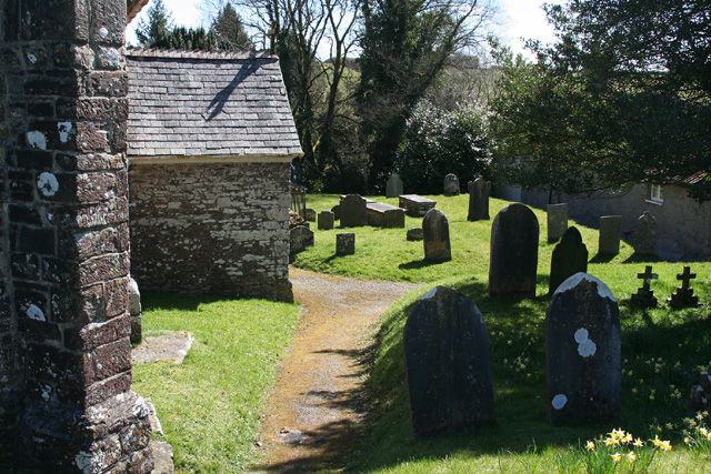
Church of St Giles, Hawkridge

The Anglican Church of St Giles in Hawkridge, Somerset, England was built in the 14th century. It is a Grade II* listed building. == History == The oldest...

Brewer's Castle

Brewer's Castle is a defended Iron Age settlement in the West Somerset district of Somerset, England. The hill fort is situated approximately 2 miles...

Mounsey Castle

Mounsey Castle is an Iron Age irregular triangular earthwork of 1.75 hectares (4.3 acres) north west of Dulverton, Somerset, England. It has been scheduled...

Nearby Amenities

Located within 500m of 51.04711,-3.6380996
Parking
Lat/Long: 51.0478766/-3.6311717
Venford Moor
Ele: 356
Natural: peak
Lat/Long: 51.0494699/-3.6321138
The data included in this document is from www.openstreetmap.org. The data is made available under ODbL.

Have you been to Woodland Common?

Leave your review of Woodland Common below (or comments, questions and feedback).