Red Brae

Downs, Moorland in Perthshire

Scotland

Red Brae

Drystane Dyke on Loss Hill Heading towards Brown Hill.
Drystane Dyke on Loss Hill Credit: wrobison

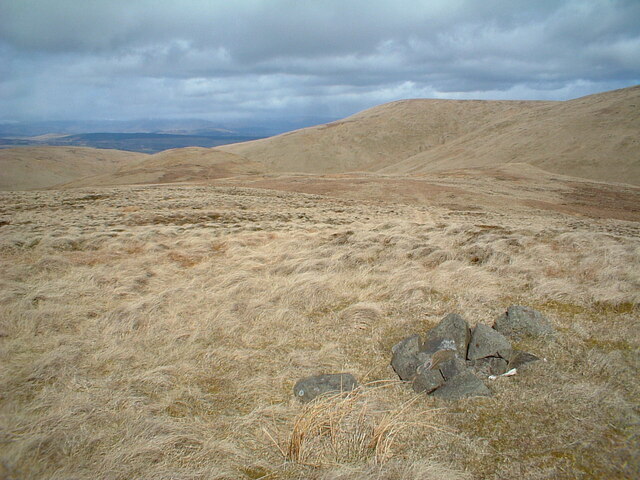
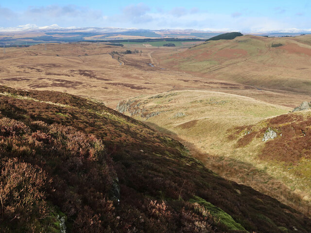
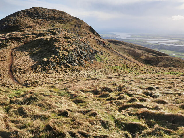
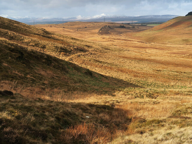
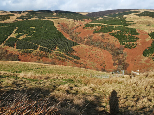
Red Brae is a picturesque region located in Perthshire, Scotland, known for its stunning downs and moorland landscapes. Situated in the heart of the Scottish Highlands, Red Brae offers visitors a tranquil and scenic escape from the hustle and bustle of city life.

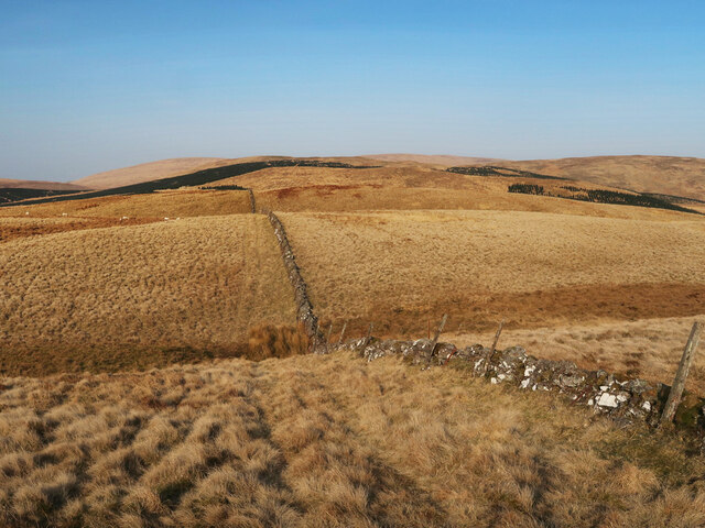
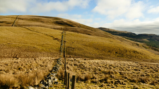
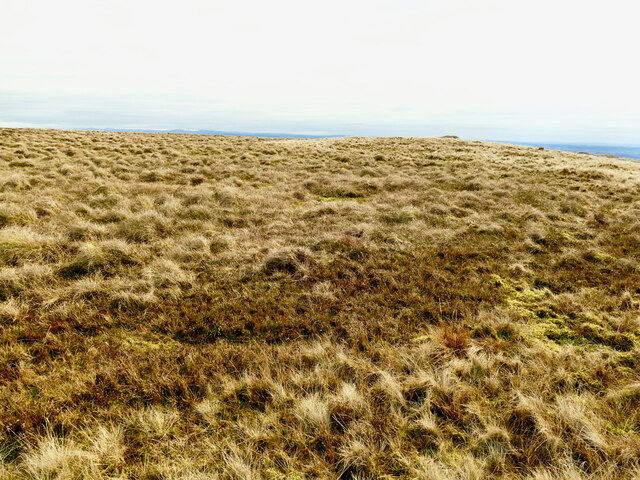
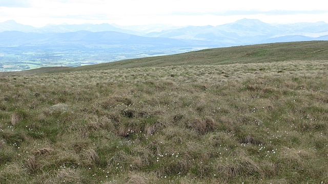
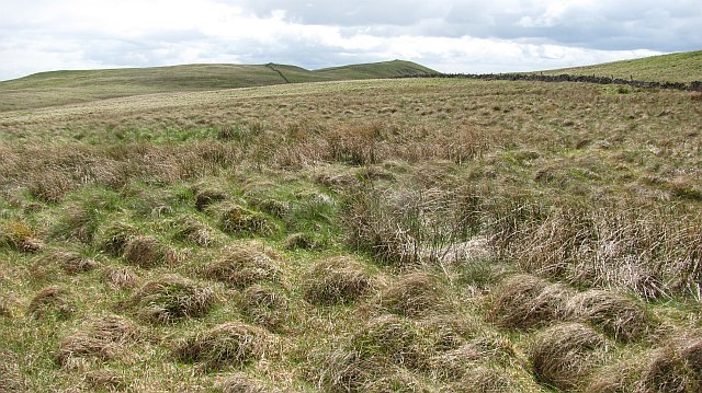
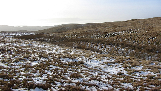
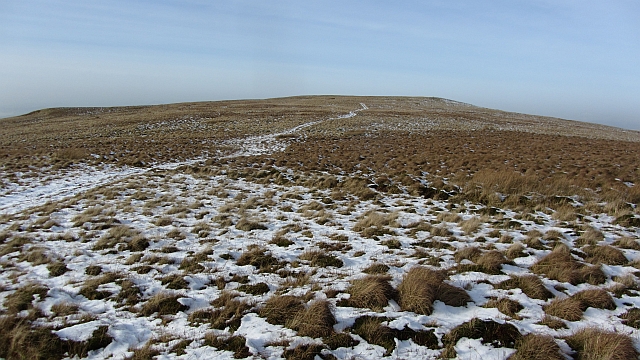
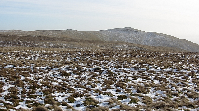
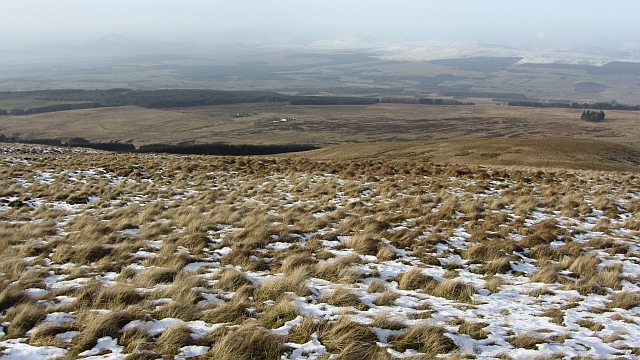
The area is characterized by its rolling downs, covered in vibrant heather and grasses that create a patchwork of colors throughout the seasons. The rich and diverse flora and fauna found here make it a haven for nature enthusiasts and wildlife lovers. Red deer, golden eagles, and red grouse are just a few of the species that call this area home.

The moorland in Red Brae is a unique and ecologically important habitat, providing a breeding ground for a variety of bird species. It also serves as a natural filter for rainwater, playing a crucial role in maintaining the water quality of nearby rivers and streams.

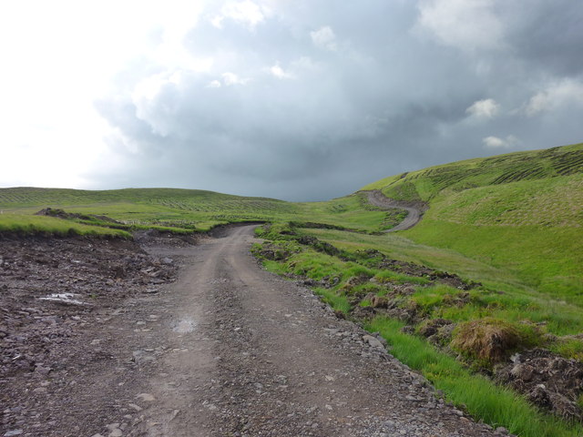
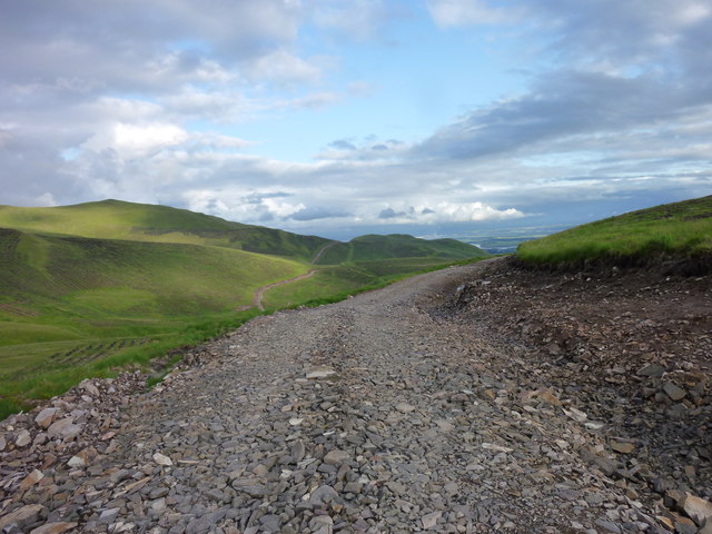
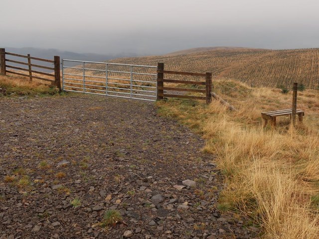
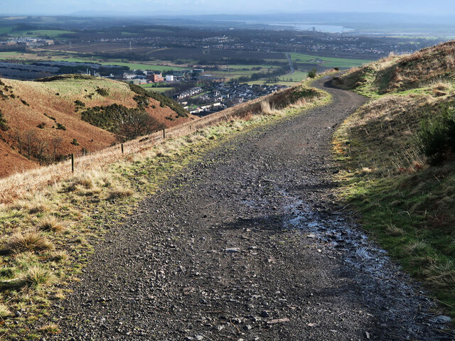
The region offers a wide range of outdoor activities for visitors to enjoy. Hiking and walking trails crisscross the downs and moorland, allowing visitors to explore the area's natural beauty at their own pace. The terrain is also ideal for mountain biking and horseback riding.

For those seeking a cultural experience, Red Brae is dotted with historical landmarks and ancient ruins. Castles and stone circles offer glimpses into the region's rich history and provide a sense of awe and wonder.

Overall, Red Brae in Perthshire is a captivating destination for nature lovers, outdoor enthusiasts, and anyone seeking a peaceful retreat in the heart of Scotland's stunning countryside.

If you have any feedback on the listing, please let us know in the comments section below.

Red Brae Images

Images are sourced within 2km of 56.170521/-3.8604667 or Grid Reference NS8499. Thanks to Geograph Open Source API. All images are credited.

Drystane Dyke on Loss Hill Heading towards Brown Hill.
Drystane Dyke on Loss Hill
Heading towards Brown Hill.
View north east from Loss Hill in the Ochils Overhead conditions were perfect for a stravaig in the hills. Conditions underfoot were less so. Despite a spell of dry weather much of the ground, including the top of Loss Hill, was very wet. A very recent deer fence has been installed along the line of the old dyke. Fresh sawdust and tractor tracks could be seen on the inside, east, of the fence. Fencing was still in progress beside the hill track to Menstrie by the Lossburn reservoir.
View north east from Loss Hill in the Ochils
Overhead conditions were perfect for a stravaig in the hills. Conditions underfoot were less so. Despite a spell of dry weather much of the ground, including the top of Loss Hill, was very wet. A very recent deer fence has been installed along the line of the old dyke. Fresh sawdust and tractor tracks could be seen on the inside, east, of the fence. Fencing was still in progress beside the hill track to Menstrie by the Lossburn reservoir.
Loss Hill top in the Ochils Taken through the deer fence, this shows the wet top of Loss Hill <a href="https://www.geograph.org.uk/photo/7424078">NN8300 : View north east from Loss Hill in the Ochils</a>. The brighter green patches in the foreground are areas of waterlogged sphagnum moss. The small dark feature on the near skyline right of centre is the summit of Dunyat.
Loss Hill top in the Ochils
Taken through the deer fence, this shows the wet top of Loss Hill NN8300 : View north east from Loss Hill in the Ochils. The brighter green patches in the foreground are areas of waterlogged sphagnum moss. The small dark feature on the near skyline right of centre is the summit of Dunyat.
Ochil mossland Rougher than usual terrain north of Colsnaur Hill. This peatland was exploited for fuel by the Hillfoot communities.  View over Strathallan towards Ben Lomond, Ben Ledi and beyond.
Ochil mossland
Rougher than usual terrain north of Colsnaur Hill. This peatland was exploited for fuel by the Hillfoot communities. View over Strathallan towards Ben Lomond, Ben Ledi and beyond.
Moorland north of Colsnaur Hill Tussocky ground on the Ochil plateau.
Moorland north of Colsnaur Hill
Tussocky ground on the Ochil plateau.
Head of the Third Inchna Burn Wet ground on Big Hunt Hill which drains into the Third Inchna Burn.
Head of the Third Inchna Burn
Wet ground on Big Hunt Hill which drains into the Third Inchna Burn.
A quadbike track The map does not name the 541m top this track leads over.
A quadbike track
The map does not name the 541m top this track leads over.
Tussocky grassland A view towards Colsnaur Hill.
Tussocky grassland
A view towards Colsnaur Hill.
Slopes of Big Hunt Hill Rough grassland slopes down towards Sheriffmuir.
Slopes of Big Hunt Hill
Rough grassland slopes down towards Sheriffmuir.
New Ochil Plantation (Part 6) The plantation track splits near this point, northwest toward Glen Tye/Sheriff muir and south toward Jerah and back toward Myreton hill.
New Ochil Plantation (Part 6)
The plantation track splits near this point, northwest toward Glen Tye/Sheriff muir and south toward Jerah and back toward Myreton hill.
New Ochil Plantation (Part 7) Looking toward Myreton hill and Colsnaur hill from a high point on the new plantation track. A large section of the new track and plantations can be seen from here.
New Ochil Plantation (Part 7)
Looking toward Myreton hill and Colsnaur hill from a high point on the new plantation track. A large section of the new track and plantations can be seen from here.
Gate and style access to Jerah Woodland On Big Hunt Hill. The new track stops here with a turning area on this side of the gate. A moorland ATV track continues into the hills.
Gate and style access to Jerah Woodland
On Big Hunt Hill. The new track stops here with a turning area on this side of the gate. A moorland ATV track continues into the hills.
Pile of stones on height 541 near Kidlaw Hill
Moorland on the north side of Dumyat The gully in the foreground is a continuation of the one between Dumyat and Castle Law on the south scarp face of the hill. Ben Vorlich and Stuc a'Chroin are the distant snow covered hills on the left.
Moorland on the north side of Dumyat
The gully in the foreground is a continuation of the one between Dumyat and Castle Law on the south scarp face of the hill. Ben Vorlich and Stuc a'Chroin are the distant snow covered hills on the left.
Summit of Dumyat Viewed from the north west with the meandering River Forth in the distance.
Summit of Dumyat
Viewed from the north west with the meandering River Forth in the distance.
Moorland north of Dumyat View towards Sheriffmuir.
Moorland north of Dumyat
View towards Sheriffmuir.
View across Menstrie Glen Looking towards the Third Inchna Burn and the Jerah Woodland.
View across Menstrie Glen
Looking towards the Third Inchna Burn and the Jerah Woodland.
Track on Dumyat An old farm track from Menstrie that goes to Lossburn Reservoir.
Track on Dumyat
An old farm track from Menstrie that goes to Lossburn Reservoir.
Show me another place!

Red Brae is located at Grid Ref: NS8499 (Lat: 56.170521, Lng: -3.8604667)

Unitary Authority: Stirling

Police Authority: Forth Valley

What 3 Words

///rental.reckoned.licks. Near Menstrie, Clackmannanshire

Nearby Locations

Red Brae

Related Wikis

Menstrie Glen

Menstrie Glen is the glen which separates Dumyat from Myreton Hill and the main body of the Ochil Hills in Scotland. Once farmed but no longer inhabited...

Myreton Hill

Myreton Hill is a peak near the village of Menstrie in the Ochil Hills of Scotland. == Location == The hill is located immediately to the north-east of...
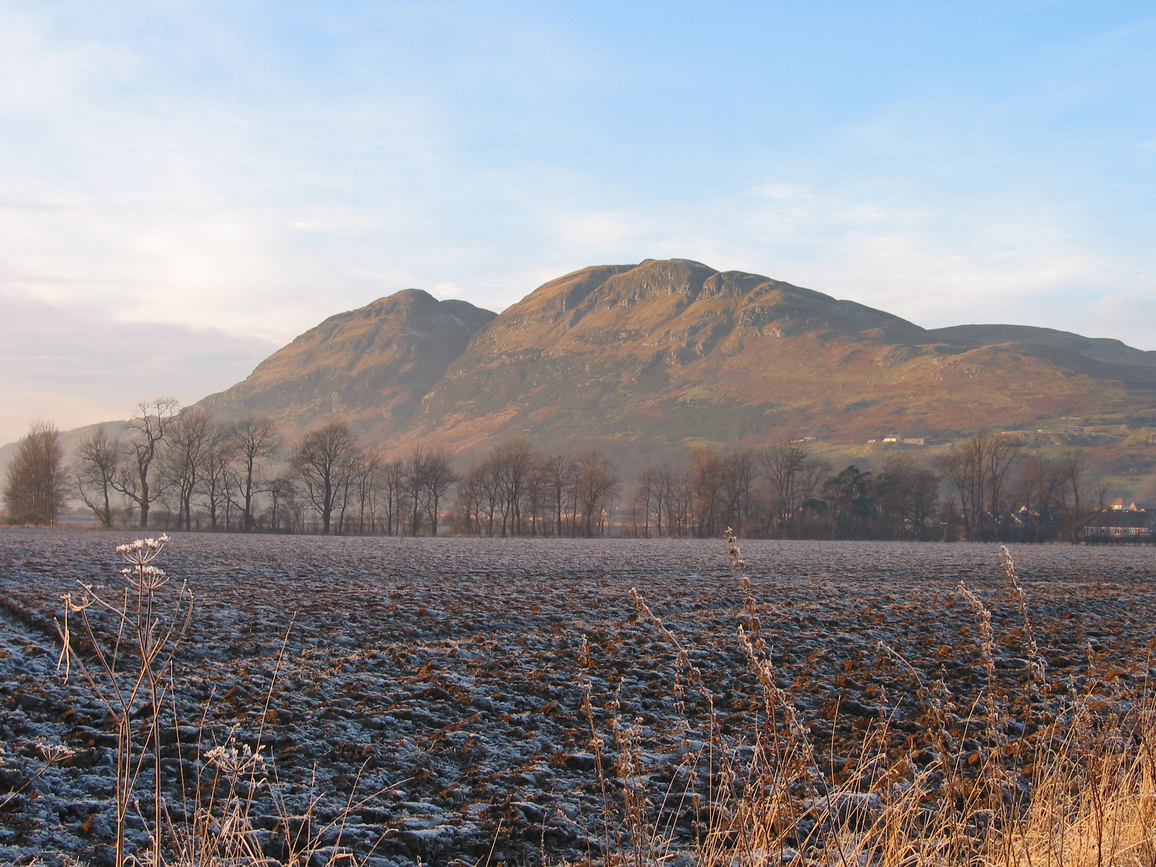
Dumyat

Dumyat or Dunmyat (Scottish Gaelic: Dùn Mhèad) is a hill at the western extremity of the Ochil Hills in central Scotland. The name is thought to originate...

Broomhall Castle

Broomhall Castle is a mansion house originally called Broom Hall and was built in 1874 by John Foukes and Frances Mackison for James Johnstone. It is situated...
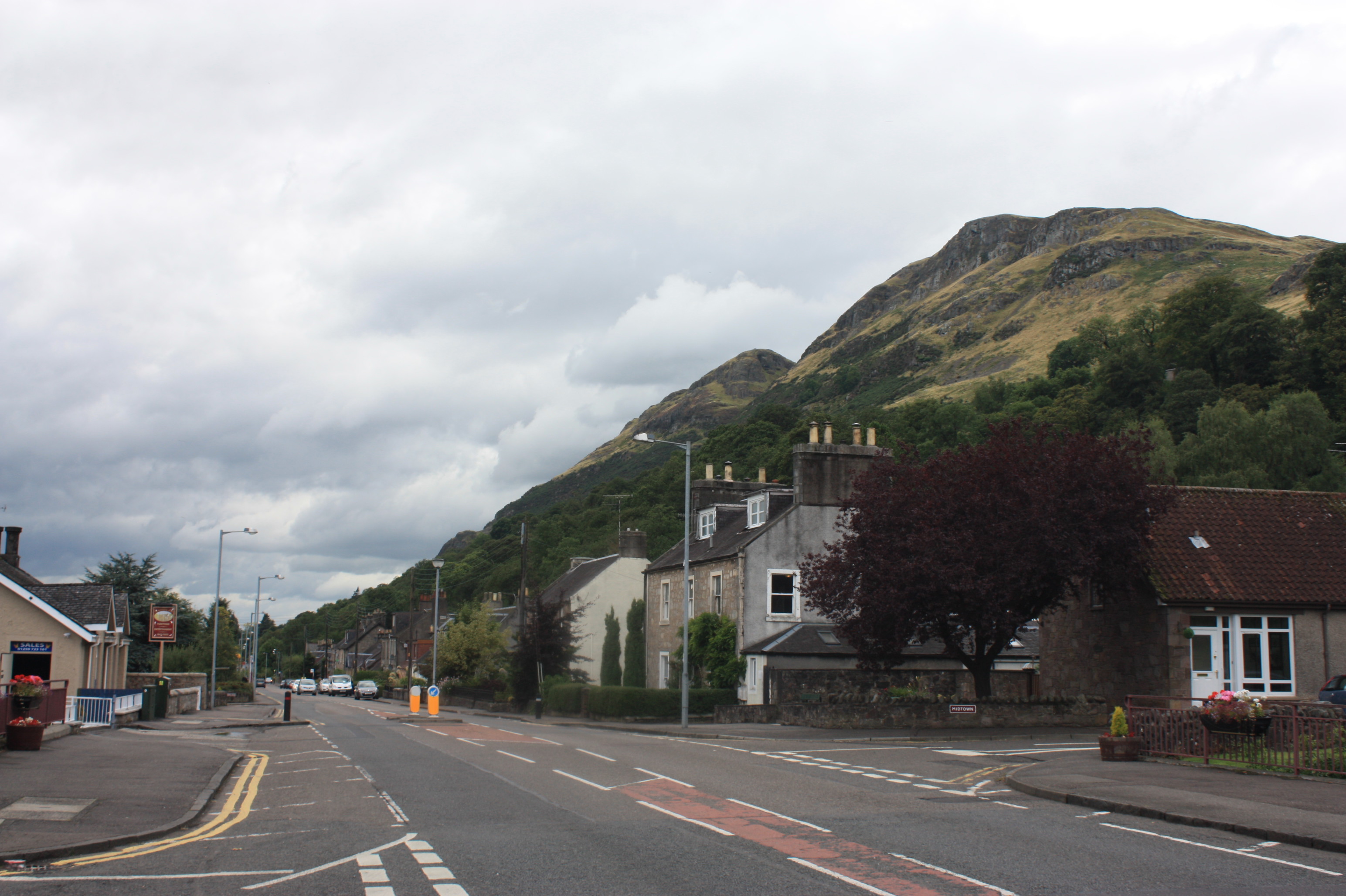
Menstrie

Menstrie (Scottish Gaelic: Meanstraidh) is a village in the county of Clackmannanshire in Scotland. It is about five miles (eight kilometres) east-northeast...

Menstrie Castle

Menstrie Castle is a three-storey manor house in the town of Menstrie, Clackmannanshire, near Stirling, central Scotland. From the early 17th century,...

Menstrie and Glenochil railway station

Menstrie and Glenochil railway station served the village of Menstrie, Clackmannanshire, Scotland, from 1863 to 1954 on the Alva Railway. == History... ==

Blairlogie

Blairlogie is a village in the Stirling council area of Scotland, situated at the base of the great southern rock-face of Dumyat between Stirling and Menstrie...

Have you been to Red Brae?

Leave your review of Red Brae below (or comments, questions and feedback).