Hurdle Down

Downs, Moorland in Somerset Somerset West and Taunton

England

Hurdle Down

Ordnance Survey Cut Mark This OS cut mark can be found on the gatepost SE side of the road. It marks a point 415.420m above mean sea level.
Ordnance Survey Cut Mark Credit: Adrian Dust

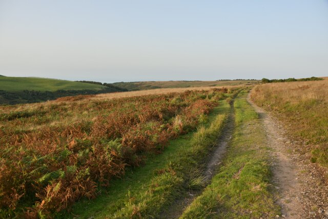
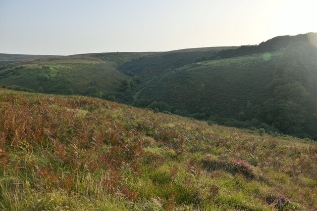
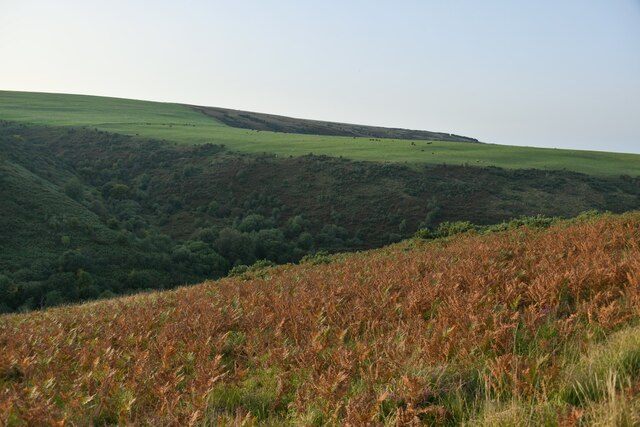
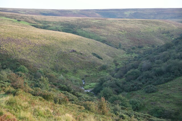
Hurdle Down is a prominent geographical feature located in the county of Somerset, England. Situated on the edge of the Mendip Hills, it is part of a larger area known as the Somerset Downs, characterized by its rolling landscape and distinct moorland vegetation.

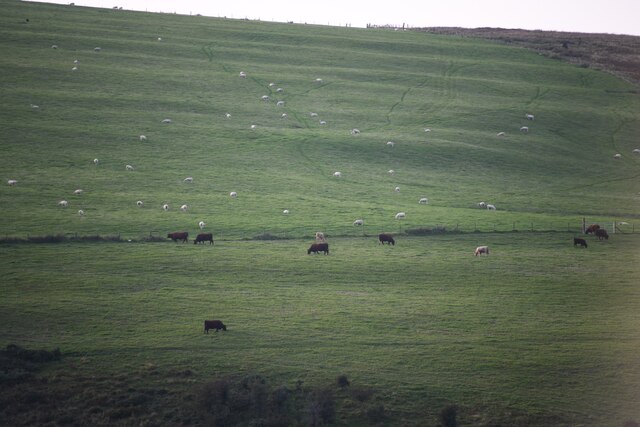
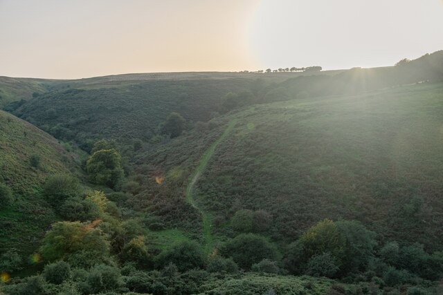
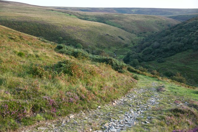
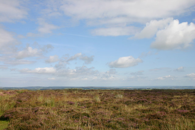
The Downs stretch across several miles, and Hurdle Down stands out as a notable high point, offering panoramic views of the surrounding countryside. It is primarily composed of limestone, a characteristic feature of the Mendip Hills, which gives it a unique appearance and contributes to its ecological importance.

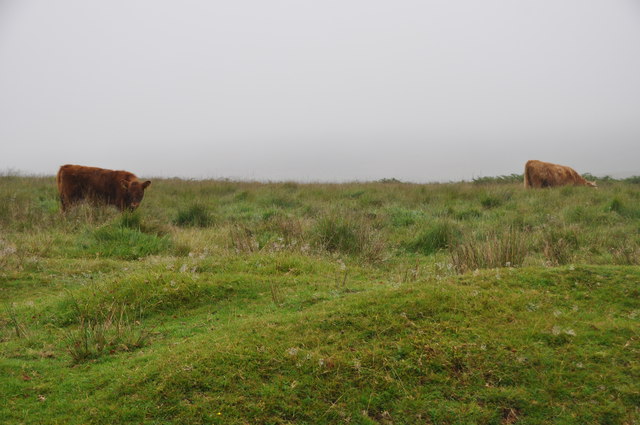
The moorland vegetation that covers Hurdle Down is a mix of grasses, heather, and shrubs, providing habitats for a diverse range of wildlife. Rare plant species can be found here, and the area is home to several bird species, including skylarks and stonechats. Local conservation efforts aim to protect and preserve this delicate ecosystem.

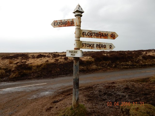
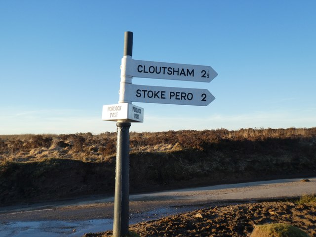
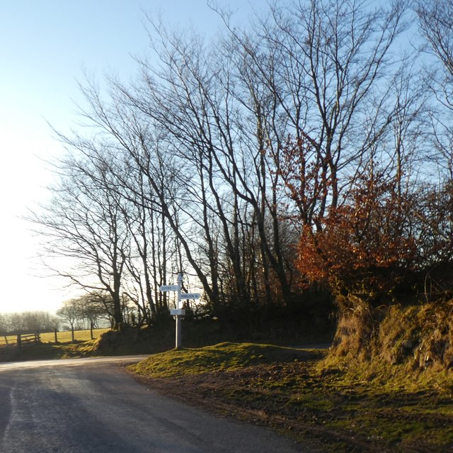
The Down is a popular destination for outdoor enthusiasts, attracting walkers, hikers, and nature lovers. There are numerous footpaths and trails that crisscross the area, providing opportunities to explore the stunning countryside. Additionally, the Down offers a tranquil setting for picnicking, birdwatching, and enjoying the natural beauty of Somerset.

Hurdle Down, Somerset, with its breathtaking views, diverse wildlife, and recreational opportunities, is a testament to the stunning natural landscapes that can be found in this region of England.

If you have any feedback on the listing, please let us know in the comments section below.
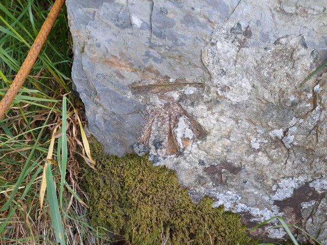
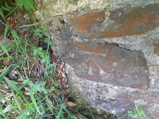
Hurdle Down Images

Images are sourced within 2km of 51.166545/-3.6553302 or Grid Reference SS8442. Thanks to Geograph Open Source API. All images are credited.

Ordnance Survey Cut Mark This OS cut mark can be found on the gatepost SE side of the road. It marks a point 415.420m above mean sea level.
Ordnance Survey Cut Mark
This OS cut mark can be found on the gatepost SE side of the road. It marks a point 415.420m above mean sea level.
Ordnance Survey Cut Mark This OS cut mark can be found on the gatepost SE side of the road. It marks a point 417.302m above mean sea level.
Ordnance Survey Cut Mark
This OS cut mark can be found on the gatepost SE side of the road. It marks a point 417.302m above mean sea level.
Ordnance Survey Rivet This OS rivet can be found on a stone NW side of the road. It marks a point 435.739m above mean sea level.
Ordnance Survey Rivet
This OS rivet can be found on a stone NW side of the road. It marks a point 435.739m above mean sea level.
Luccombe : Exmoor Scenery Looking to fields on the hillsides of Exmoor.
Luccombe : Exmoor Scenery
Looking to fields on the hillsides of Exmoor.
Luccombe : Exmoor Scenery A track heads across Exmoor above Nutscale Reservoir.
Luccombe : Exmoor Scenery
A track heads across Exmoor above Nutscale Reservoir.
Luccombe : Exmoor Scenery Looking across the moorland above the Nutscale Reservoir and stream.
Luccombe : Exmoor Scenery
Looking across the moorland above the Nutscale Reservoir and stream.
Luccombe : Exmoor Scenery Looking across the moors above Nutscale Reservoir.
Luccombe : Exmoor Scenery
Looking across the moors above Nutscale Reservoir.
Luccombe : Exmoor Scenery Looking down into the valley of Nutscale Water.
Luccombe : Exmoor Scenery
Looking down into the valley of Nutscale Water.
Luccombe : Exmoor Scenery Looking across the hillsides of Exmoor.
Luccombe : Exmoor Scenery
Looking across the hillsides of Exmoor.
Luccombe : Exmoor Scenery A track heads over the moorland.
Luccombe : Exmoor Scenery
A track heads over the moorland.
Luccombe : Exmoor Scenery A track heading over Exmoor.
Luccombe : Exmoor Scenery
A track heading over Exmoor.
Luccombe : Lucott Moor Looking across Exmoor with one of the cairns in view.
Luccombe : Lucott Moor
Looking across Exmoor with one of the cairns in view.
West Somerset : Highland Cattle A highland cattle grazing on Exmoor.
West Somerset : Highland Cattle
A highland cattle grazing on Exmoor.
West Somerset : Exmoor Scenery Looking out across the Exmoor moorland with some cattle grazing.
West Somerset : Exmoor Scenery
Looking out across the Exmoor moorland with some cattle grazing.
Heather on Exmoor Exmoor has wide open spaces covered by heather (Erica Species) and offers the best vistas in this part of the country.
Heather on Exmoor
Exmoor has wide open spaces covered by heather (Erica Species) and offers the best vistas in this part of the country.
Old Direction Sign - Signpost by Porlock Post, Exford Parish Pyramid finial - 3 arms; Somerset SCC pyramid and name by the UC road, in parish of Exford (West Somerset District), Porlock Post, on open junction.

Surveyed

Milestone Society National ID: SO_SS8641.
Old Direction Sign - Signpost by Porlock Post, Exford Parish
Pyramid finial - 3 arms; Somerset SCC pyramid and name by the UC road, in parish of Exford (West Somerset District), Porlock Post, on open junction. Surveyed Milestone Society National ID: SO_SS8641.
Signpost at Porlock Post The signpost has been decapitated and one finger removed <a href="https://www.geograph.org.uk/photo/3429762">SS8641 : Porlock Post</a>
Signpost at Porlock Post
The signpost has been decapitated and one finger removed SS8641 : Porlock Post
Hillhead Cross
Hillhead Cross
Show me another place!

Hurdle Down is located at Grid Ref: SS8442 (Lat: 51.166545, Lng: -3.6553302)

Administrative County: Somerset

District: Somerset West and Taunton

Police Authority: Avon and Somerset

What 3 Words

///dummy.measure.follow. Near Porlock, Somerset

Nearby Locations

Hurdle Down

Related Wikis

Almsworthy Common

Almsworthy Common is a small area of unenclosed land in Exmoor, south-western England. It contains a number of archaeological sites. It is about 2 miles...

Alderman's Barrow

Alderman's Barrow is a bowl barrow on Exmoor. It was created as a burial chamber in the Bronze Age and subsequently became a marker for the boundary of...

Nutscale Reservoir

Nutscale Reservoir is a reservoir located in Exmoor in north west Somerset, England. It supplies the town of Minehead and nearby Porlock and Porlock Weir...

Porlock Stone Circle

Porlock Stone Circle is a stone circle located on Exmoor, near the village of Porlock in the south-western English county of Somerset. The Porlock ring...

Berry Castle, Somerset

Berry Castle (sometimes known as Berry Camp) is an early Roman (possible Iron Age) hillslope enclosure in the West Somerset district of Somerset, England...

Exford, Somerset

Exford is a rural village at the centre of Exmoor National Park, 7 miles (11 km) north-west of Dulverton, and 10 miles (16 km) south-west of Minehead,...

Stoke Pero Church

Stoke Pero Church in Stoke Pero, Somerset, England was built in the 13th century. It is a Grade II* listed building. Standing 1,013 feet (309 meters) above...

Church of St Mary Magdelene, Exford

The Anglican Church of St Mary Magdelene in Exford, Somerset, England was built in the 15th century. It is a Grade II* listed building. == History == Nothing...

Have you been to Hurdle Down?

Leave your review of Hurdle Down below (or comments, questions and feedback).