Owlaborough Moor

Downs, Moorland in Devon North Devon

England

Owlaborough Moor

Yeo Mills looking SW across the valley
Yeo Mills looking SW across the valley Credit: Martin Southwood

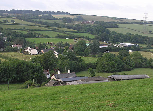
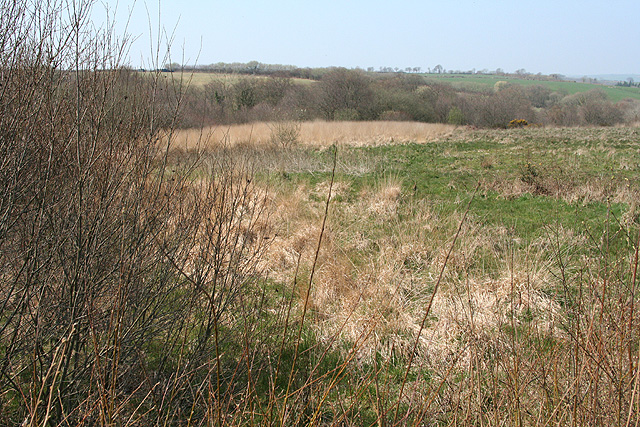
Owlaborough Moor, located in the county of Devon, England, is a picturesque expanse of downs and moorland that spans approximately 500 hectares. Situated near the village of Owlaborough, the moor is known for its natural beauty and diverse wildlife.

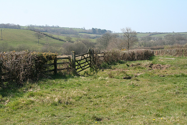
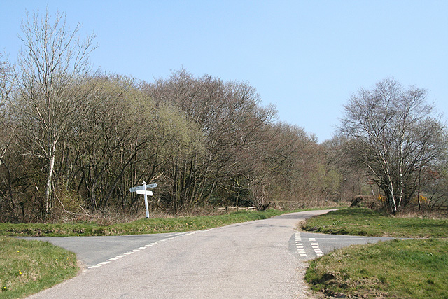
The landscape of Owlaborough Moor is characterized by rolling hills, heather-covered moorland, and scattered woodlands. The area is crisscrossed by a network of footpaths and bridleways, making it a popular destination for hikers, cyclists, and horse riders. The moor offers stunning panoramic views of the surrounding countryside, including the nearby Dartmoor National Park.

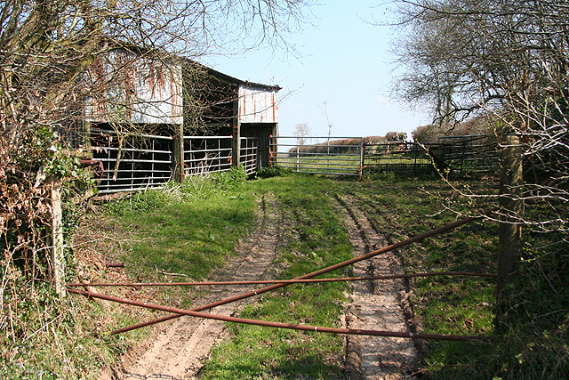
One of the unique features of Owlaborough Moor is its rich biodiversity. The area is home to a variety of plant and animal species, including rare birds like the nightjar and the Dartford warbler. Visitors may also spot grazing sheep and cattle, which help maintain the moor's delicate ecosystem.

Owlaborough Moor has a long history of human presence, with evidence of Bronze Age settlements and later farming activities. Today, the moor is managed by a local conservation trust, which works to preserve its natural heritage and promote sustainable land use practices.

Visitors to Owlaborough Moor can enjoy a range of outdoor activities, such as walking, birdwatching, and picnicking. The moor's tranquil atmosphere and unspoiled surroundings make it an ideal destination for those seeking a peaceful retreat in the heart of Devon's countryside.

If you have any feedback on the listing, please let us know in the comments section below.

Owlaborough Moor Images

Images are sourced within 2km of 51.008466/-3.6611556 or Grid Reference SS8324. Thanks to Geograph Open Source API. All images are credited.

Yeo Mills looking SW across the valley
Knowstone: St Peter’s church Looking north west
Knowstone: St Peter’s church
Looking north west
Knowstone: The Mason’s Arms Looking east-north-east. The building is reputed to date from the 13th century
Knowstone: The Mason’s Arms
Looking east-north-east. The building is reputed to date from the 13th century
Knowstone: Shapcott Barton Seen from the public footpath to East Knowstone. Looking north
Knowstone: Shapcott Barton
Seen from the public footpath to East Knowstone. Looking north
Knowstone: public footpath By the entrance to Shapcott Barton and a little overgrown. Looking west
Knowstone: public footpath
By the entrance to Shapcott Barton and a little overgrown. Looking west
East Anstey: Jubilee Inn A 20th century inn by the B3227 Taunton - Bampton - South Molton road, an early 19th century turnpike, now pleasantly quiet after much of its traffic has transferred to the North Devon Link Road. Looking east-north-east
East Anstey: Jubilee Inn
A 20th century inn by the B3227 Taunton - Bampton - South Molton road, an early 19th century turnpike, now pleasantly quiet after much of its traffic has transferred to the North Devon Link Road. Looking east-north-east
East Anstey: Smallacombe Moors Looking south east towards Blackerton
East Anstey: Smallacombe Moors
Looking south east towards Blackerton
West Anstey: saw mill By the Two Moors Way. An old tractor adapted to split logs and also to cut them, using a circular saw. Looking east-north-east on the road leading to Yeo Mill
West Anstey: saw mill
By the Two Moors Way. An old tractor adapted to split logs and also to cut them, using a circular saw. Looking east-north-east on the road leading to Yeo Mill
East Anstey: by Smallacombe Farm On the road to Oldways End, looking east-south-east. The entrance to Smallacombe Farm is on the right by the trees
East Anstey: by Smallacombe Farm
On the road to Oldways End, looking east-south-east. The entrance to Smallacombe Farm is on the right by the trees
East Anstey: woodland near Whiteford Cross Seen from a lay-by on the B3227 Bampton – South Molton road. Looking south-south-west
East Anstey: woodland near Whiteford Cross
Seen from a lay-by on the B3227 Bampton – South Molton road. Looking south-south-west
East Anstey: approaching Whiteford Cross On the B3227 Bampton – South Molton road, looking west-north-west
East Anstey: approaching Whiteford Cross
On the B3227 Bampton – South Molton road, looking west-north-west
Knowstone: by New Barn Moor On the lane from Wiston Cross to Whitefield Cross, looking north-north-west
Knowstone: by New Barn Moor
On the lane from Wiston Cross to Whitefield Cross, looking north-north-west
Molland: by Bommertown Cross Looking west-south-west
Molland: by Bommertown Cross
Looking west-south-west
Molland: Bommertown Cross Looking east-north-east on the road to Yeo Mill, Oldways End and East Anstey. Left for Bottreaux Mill and Molland; right for Knowstone
Molland: Bommertown Cross
Looking east-north-east on the road to Yeo Mill, Oldways End and East Anstey. Left for Bottreaux Mill and Molland; right for Knowstone
Knowstone: barn by West Moor Looking north east
Knowstone: barn by West Moor
Looking north east
Molland: West Moor Looking west-north-west on the lane between Wadham Cross and Wadham Bridge
Molland: West Moor
Looking west-north-west on the lane between Wadham Cross and Wadham Bridge
Knowstone: Wadham Bridge The bridge provides a crossing of the Crooked Oak. Knowstone village lies over the gorse-covered hill. Looking south east
Knowstone: Wadham Bridge
The bridge provides a crossing of the Crooked Oak. Knowstone village lies over the gorse-covered hill. Looking south east
Knowstone: the Two Moors Way Approaching Knowstone village, looking north-north-west
Knowstone: the Two Moors Way
Approaching Knowstone village, looking north-north-west
Show me another place!

Owlaborough Moor is located at Grid Ref: SS8324 (Lat: 51.008466, Lng: -3.6611556)

Administrative County: Devon

District: North Devon

Police Authority: Devon and Cornwall

What 3 Words

///lunging.acrobats.armrests. Near Dulverton, Somerset

Related Wikis

Knowstone

Knowstone is a village and civil parish situated in the North Devon district of Devon, England, halfway between the Mid Devon town of Tiverton, Devon and...

Roachill

Roachill is a hamlet in the civil parish of Knowstone in the North Devon district of Devon, England. Its nearest town is Tiverton, which lies approximately...

Oldways End

Oldways End is a hamlet in the civil parish of East Anstey in the North Devon district of Devon, England. Its nearest town is Tiverton, which lies approximately...

East Anstey

East Anstey is a village and civil parish in the North Devon district of Devon, England. The parish is located in an area which has been designated as...

Have you been to Owlaborough Moor?

Leave your review of Owlaborough Moor below (or comments, questions and feedback).