Stell Brae

Downs, Moorland in Dumfriesshire

Scotland

Stell Brae

B797 towards Wanlockhead
B797 towards Wanlockhead Credit: Steven Brown

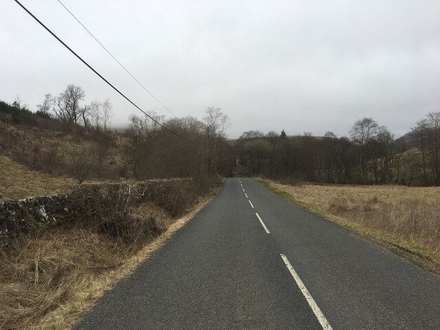
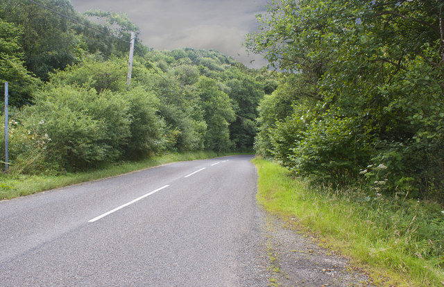
Stell Brae is a picturesque area located in Dumfriesshire, Scotland. Situated amidst the stunning landscape of Downs and Moorland, this region offers breathtaking natural beauty and a serene environment.

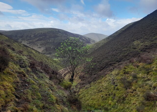
The area is characterized by its rolling hills, vast meadows, and heather-clad moorlands. The landscape is dotted with charming cottages and farmhouses, adding to the idyllic charm of Stell Brae. Visitors can enjoy the tranquility and peace offered by this remote location, making it a perfect retreat from the hustle and bustle of city life.

Stell Brae is also known for its rich wildlife and diverse flora. The moorland is home to various species of birds, including curlews, lapwings, and red grouse. It is a paradise for birdwatchers, providing ample opportunities to spot and observe these beautiful creatures in their natural habitat. The area is also abundant in wildflowers, with vibrant hues of purple heather and yellow gorse painting the landscape during the summer months.

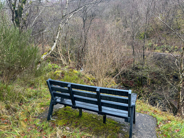
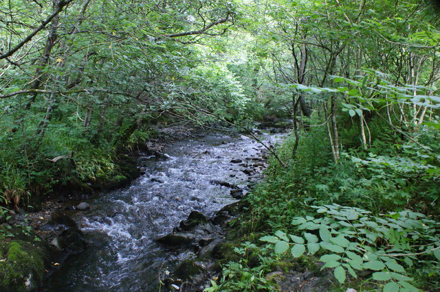
For outdoor enthusiasts, Stell Brae offers a range of activities. The hills and moorlands provide excellent opportunities for hiking and walking, with numerous trails and paths to explore. The surrounding area also offers fishing spots, with several rivers and lochs nearby.

Overall, Stell Brae in Dumfriesshire is a haven for nature lovers, offering a combination of stunning landscapes, diverse wildlife, and recreational activities. Its scenic beauty and tranquil atmosphere make it a must-visit destination for those seeking a peaceful retreat in the heart of Scotland.

If you have any feedback on the listing, please let us know in the comments section below.

Stell Brae Images

Images are sourced within 2km of 55.368536/-3.8395585 or Grid Reference NS8309. Thanks to Geograph Open Source API. All images are credited.

B797 towards Wanlockhead
Seat with not much of a view Geocaching is a type of global treasure hunt of people looking for caches, or hidden stashes of objects. Geocaching may also be described as a series of hide-and-seek games, where hiders provide online clues for seekers. Seekers use global positioning system (GPS) devices to find hidden caches
Seat with not much of a view
Geocaching is a type of global treasure hunt of people looking for caches, or hidden stashes of objects. Geocaching may also be described as a series of hide-and-seek games, where hiders provide online clues for seekers. Seekers use global positioning system (GPS) devices to find hidden caches
Lone tree on the Beer Burn. A lone tree on the Beer Burn.
Lone tree on the Beer Burn.
A lone tree on the Beer Burn.
Fence junction by the Glendyne Burn The patch of scree on the left-hand side is quite extensive by the standards of these generally grass- and heather-covered hills.
Fence junction by the Glendyne Burn
The patch of scree on the left-hand side is quite extensive by the standards of these generally grass- and heather-covered hills.
B797 through the Mennock Pass
A bridge over Mennock Water gives access to a track to Glenim
The B797 passes through woodland here
Mennock Water is never far away from the road
Mennock Water at Glenim Looking downstream.
Mennock Water at Glenim
Looking downstream.
Mennock Water at Glenim Looking upstream.
Mennock Water at Glenim
Looking upstream.
Glenim Cottage, Mennock Across a small bridge across Mennock Water and at the mouth of Glen Imshaw.
Glenim Cottage, Mennock
Across a small bridge across Mennock Water and at the mouth of Glen Imshaw.
Mennock Pass at Glenim
Auchensow Burn Difficult to see the burn with the growth of vegetation.
Auchensow Burn
Difficult to see the burn with the growth of vegetation.
Meikle Blairim Cleuch enters the Glenimshaw Burn A plank provides a way to cross the burn.
Meikle Blairim Cleuch enters the Glenimshaw Burn
A plank provides a way to cross the burn.
Waterfall on Little Blairim Cleuch This empties into Glenimshaw Burn, a tributary of the Mennock Water.
Waterfall on Little Blairim Cleuch
This empties into Glenimshaw Burn, a tributary of the Mennock Water.
Bend in the Glenim track This bulldozed track runs from Glenim to the road at the Mennock Pass.
Bend in the Glenim track
This bulldozed track runs from Glenim to the road at the Mennock Pass.
Crossing Mennock Water A mid-April view looking up the road that leads to Auchengruith Farm.
Crossing Mennock Water
A mid-April view looking up the road that leads to Auchengruith Farm.
Beside Mennock Water Mennock Water tumbles downhill in a series of rapids and small waterfalls. A mid-April view taken before the foliage opened out.
Beside Mennock Water
Mennock Water tumbles downhill in a series of rapids and small waterfalls. A mid-April view taken before the foliage opened out.
Show me another place!

Stell Brae is located at Grid Ref: NS8309 (Lat: 55.368536, Lng: -3.8395585)

Unitary Authority: Dumfries and Galloway

Police Authority: Dumfries and Galloway

What 3 Words

///ensemble.opts.focus. Near Sanquhar, Dumfries & Galloway

Nearby Locations

Stell Brae

Related Wikis

Mennock Lye Goods Depot

Mennock Lye Goods Depot or Mennock Siding was a railway freight facility located off the A76 in the hamlet of Mennock that lies circa two miles (three...

Mennock

Mennock is a small village or hamlet which lies 2 miles (3.2 km) south-east of Sanquhar on the A76, in Dumfriesshire, in the District Council Region of...

Kirkbride, Durisdeer

Kirkbride, previously Kilbride was an ancient parish close to the village of Enterkinfoot, the lands of which lay on both sides of the River Nith in the...

Wanlockhead railway station

Wanlockhead railway station was opened on 1 October 1902 as the terminus on the Leadhills and Wanlockhead Light Railway and served the lead mining area...

Nearby Amenities

Located within 500m of 55.368536,-3.8395585
Power: pole
Lat/Long: 55.3648881/-3.8420649
Power: pole
Lat/Long: 55.3654817/-3.840712
Power: pole
Lat/Long: 55.3658707/-3.8398382
Power: pole
Lat/Long: 55.3662665/-3.8389339
Power: pole
Lat/Long: 55.366702/-3.8379479
Power: pole
Lat/Long: 55.367103/-3.8370274
Power: pole
Lat/Long: 55.3675226/-3.836053
Power: pole
Lat/Long: 55.367767/-3.8354969
Power: pole
Lat/Long: 55.3646311/-3.8426468
Power: pole
Lat/Long: 55.365196/-3.8413631
The data included in this document is from www.openstreetmap.org. The data is made available under ODbL.

Have you been to Stell Brae?

Leave your review of Stell Brae below (or comments, questions and feedback).