Castle Moor

Downs, Moorland in Devon North Devon

England

Castle Moor

Beaple's Hill Trig Point A view of the Trig Point on Beaple's Hill next to the A361 in Devon.
Beaple's Hill Trig Point Credit: John P Reeves

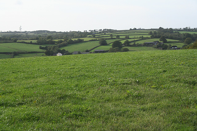
Castle Moor is a picturesque area located in Devon, England, known for its stunning downs and moorland landscapes. Situated in the southern part of the county, Castle Moor offers visitors a unique and immersive experience in nature.

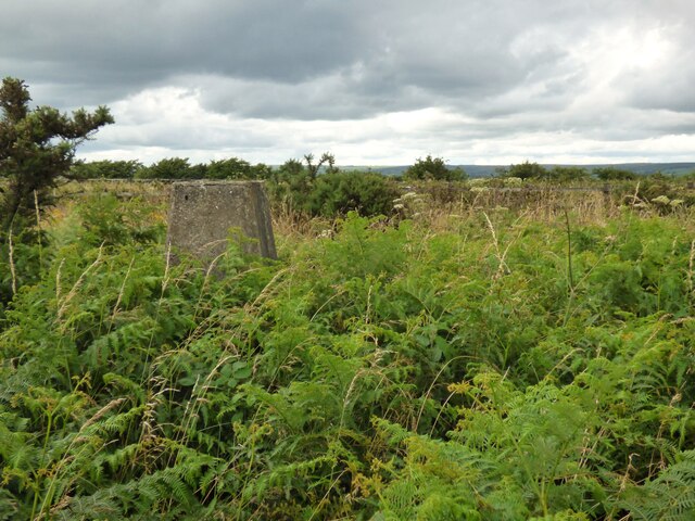
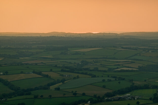
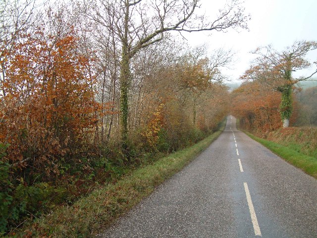
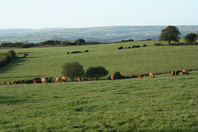
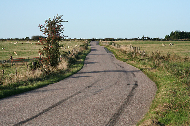
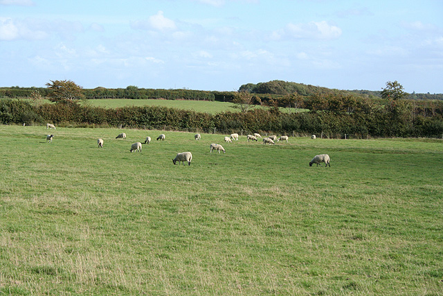
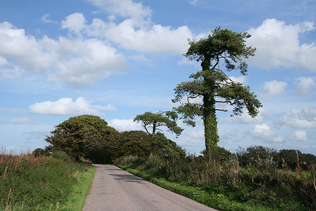
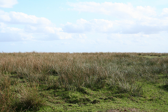
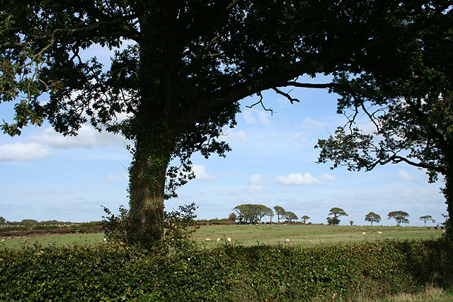
The area is characterized by its rolling hills and wide expanses of open grassland, making it a haven for nature enthusiasts and hikers. The downs of Castle Moor are adorned with a variety of wildflowers, creating a vibrant and colorful display during the spring and summer months. The moorlands, on the other hand, are rich in biodiversity, with heather, gorse, and ferns covering the rugged terrain.

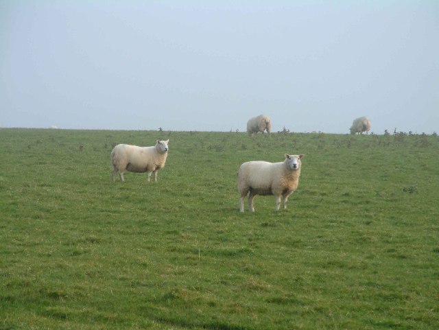
Castle Moor is also home to a diverse array of wildlife. Visitors may spot birds of prey soaring through the skies, including buzzards and kestrels. In addition, the moorland provides a habitat for rare species such as the Dartford warbler and the cuckoo. The meandering streams and ponds attract an abundance of aquatic life, including frogs, newts, and dragonflies.

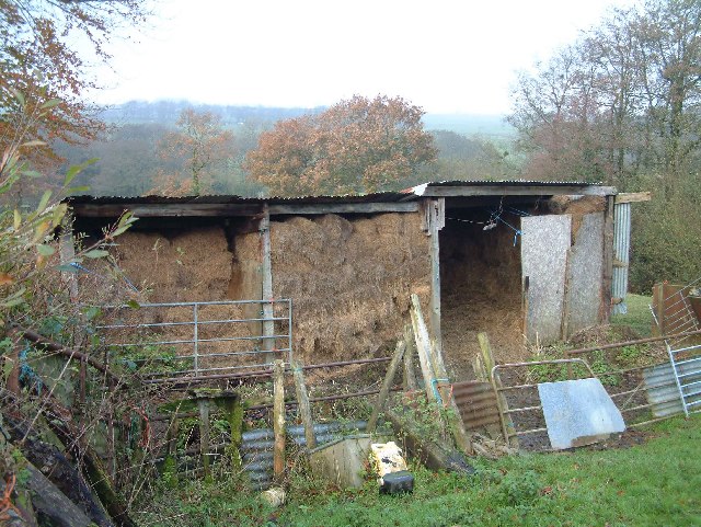
For those interested in history, Castle Moor has its own fascinating stories to tell. The area is dotted with ancient ruins and archaeological sites, including the remnants of an old castle, giving visitors a glimpse into its rich past.

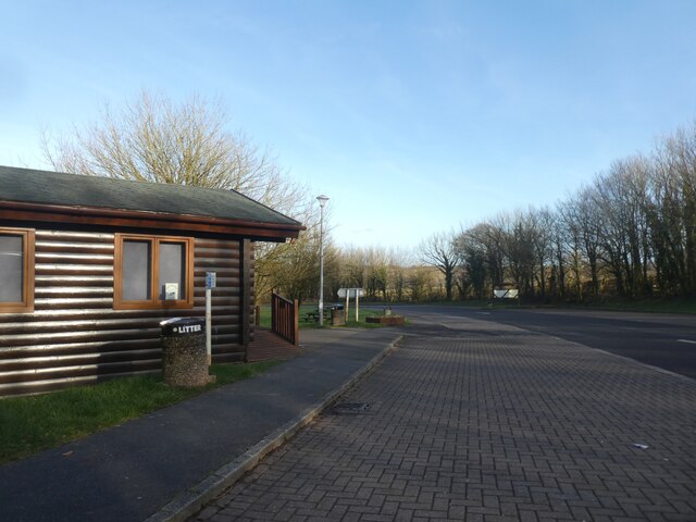
Visitors to Castle Moor can enjoy a range of outdoor activities. The vast network of trails and paths invites hikers and walkers to explore the stunning landscapes, while cyclists can traverse the challenging terrain. The area also offers opportunities for picnicking, wildlife spotting, and photography.

In conclusion, Castle Moor in Devon offers a captivating blend of natural beauty, wildlife, and historic charm. It is a must-visit destination for nature enthusiasts and those seeking a tranquil escape amidst breathtaking scenery.

If you have any feedback on the listing, please let us know in the comments section below.
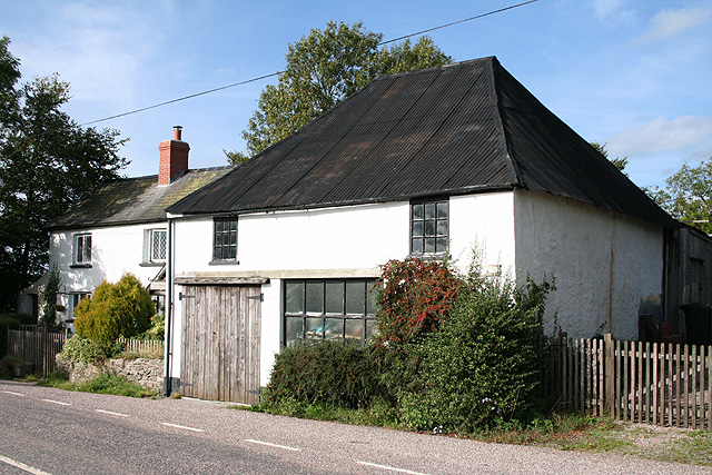
Castle Moor Images

Images are sourced within 2km of 50.972358/-3.6832118 or Grid Reference SS8120. Thanks to Geograph Open Source API. All images are credited.

Beaple's Hill Trig Point A view of the Trig Point on Beaple's Hill next to the A361 in Devon.
Beaple's Hill Trig Point
A view of the Trig Point on Beaple's Hill next to the A361 in Devon.
Cabin and car park off the A361 westbound, Moortown Cross
Batsworthy Windfarm and the North Devon coast The wind farm is in the shadows just above the centre of the image. The setting sun is reflecting off the sea near Saunton. This photo was taken from a hot air balloon as it passed near to Knightshayes Court.
Batsworthy Windfarm and the North Devon coast
The wind farm is in the shadows just above the centre of the image. The setting sun is reflecting off the sea near Saunton. This photo was taken from a hot air balloon as it passed near to Knightshayes Court.
Sheep near Poole Farm
Wooded lane near Nutcombe Farm
Hay store near Nutcombe Farm
Knowstone: towards Beaple’s Moor Looking north-north-west. The North Devon Link Road runs beyond the third field from the camera. Exmoor is on the horizon
Knowstone: towards Beaple’s Moor
Looking north-north-west. The North Devon Link Road runs beyond the third field from the camera. Exmoor is on the horizon
Knowstone: nearing Beaple's Hill Cross Looking north-north-east on the road from Chulmleigh.
Knowstone: nearing Beaple's Hill Cross
Looking north-north-east on the road from Chulmleigh.
Knowstone: Beaple’s Moor Looking south east: sheep country
Knowstone: Beaple’s Moor
Looking south east: sheep country
Rose Ash: The Old Smithy On Little Ash Moor, looking north-north-west. The smithy stands by one of the old roads from Tiverton to Barnstaple, opposite the entrance to Nutcombe Farm
Rose Ash: The Old Smithy
On Little Ash Moor, looking north-north-west. The smithy stands by one of the old roads from Tiverton to Barnstaple, opposite the entrance to Nutcombe Farm
Rose Ash: on Nutcombe Ridge Looking east-north-east in the direction of Batsworthy Cross
Rose Ash: on Nutcombe Ridge
Looking east-north-east in the direction of Batsworthy Cross
Rose Ash: The Ridge Farm near Fanny’s Cross. Looking north east
Rose Ash: The Ridge
Farm near Fanny’s Cross. Looking north east
Creacombe: Lower Moor Close to Batsworthy Cross where it is proposed that a large wind turbine be erected. Local residents are far from best pleased
Creacombe: Lower Moor
Close to Batsworthy Cross where it is proposed that a large wind turbine be erected. Local residents are far from best pleased
Creacombe: by Batsworthy Cross Roadside view with oak tree. Looking east-north-east
Creacombe: by Batsworthy Cross
Roadside view with oak tree. Looking east-north-east
Creacombe: East Batsworthy Farm Banner at farm entrance proclaiming opposition to a proposed wind turbine – on a large scale – to be located at nearby Batsworthy Cross. Looking south to farmland
Creacombe: East Batsworthy Farm
Banner at farm entrance proclaiming opposition to a proposed wind turbine – on a large scale – to be located at nearby Batsworthy Cross. Looking south to farmland
Rackenford: Waterloo Farm By the old road from Tiverton. Looking north east
Rackenford: Waterloo Farm
By the old road from Tiverton. Looking north east
Creacombe: near Creacombemoor Cross Looking west-north-west over the valley of the Sturcombe River. The communications mast at Venhay Cross can be seen on the skyline, left. The Two Moors Way passes by Creacombemoor Cross
Creacombe: near Creacombemoor Cross
Looking west-north-west over the valley of the Sturcombe River. The communications mast at Venhay Cross can be seen on the skyline, left. The Two Moors Way passes by Creacombemoor Cross
Creacombe: footpath to West Backstone Looking south-south-east. Beyond the bend the public path diverges to the left from the private drive
Creacombe: footpath to West Backstone
Looking south-south-east. Beyond the bend the public path diverges to the left from the private drive
Show me another place!

Castle Moor is located at Grid Ref: SS8120 (Lat: 50.972358, Lng: -3.6832118)

Administrative County: Devon

District: North Devon

Police Authority: Devon and Cornwall

What 3 Words

///eyelid.owns.distracts. Near Witheridge, Devon

Related Wikis

Creacombe

Creacombe is a small village and former civil parish, now in the parish of Rackenford, in the North Devon district of Devon, England. Its nearest town...

Batsworthy

Batsworthy is a village in Devon, England. == References ==

Rackenford and Knowstone Moors

Rackenford and Knowstone Moors is a nature reserve of the Devon Wildlife Trust, situated about 8 miles (13 km) north-west of Tiverton, in Devon, England...

Rose Ash

Rose Ash, formerly Ralph-Esse, is a village and civil parish in North Devon district, Devon, England. In the 2011 census it was recorded as having a population...

Knowstone

Knowstone is a village and civil parish situated in the North Devon district of Devon, England, halfway between the Mid Devon town of Tiverton, Devon and...

Roachill

Roachill is a hamlet in the civil parish of Knowstone in the North Devon district of Devon, England. Its nearest town is Tiverton, which lies approximately...

Ash Mill

Ash Mill is a village in Devon, England.Ashmill was the site of Ashwater station on the former L.S.W.R. North Cornwall line which closed in the 1960s....

Rackenford

Rackenford is a village and civil parish in North Devon, England. It is roughly located 7.31 miles North West of Tiverton and 20 miles South East of Barnstaple...

Nearby Amenities

Located within 500m of 50.972358,-3.6832118
Generator Method: wind_turbine
Generator Source: wind
Generator Type: horizontal_axis
Power: generator
Lat/Long: 50.9728456/-3.68356
Generator Method: wind_turbine
Generator Source: wind
Generator Type: horizontal_axis
Power: generator
Lat/Long: 50.9737968/-3.6766945
Generator Method: wind_turbine
Generator Source: wind
Generator Type: horizontal_axis
Power: generator
Lat/Long: 50.9752241/-3.6854735
The data included in this document is from www.openstreetmap.org. The data is made available under ODbL.

Have you been to Castle Moor?

Leave your review of Castle Moor below (or comments, questions and feedback).